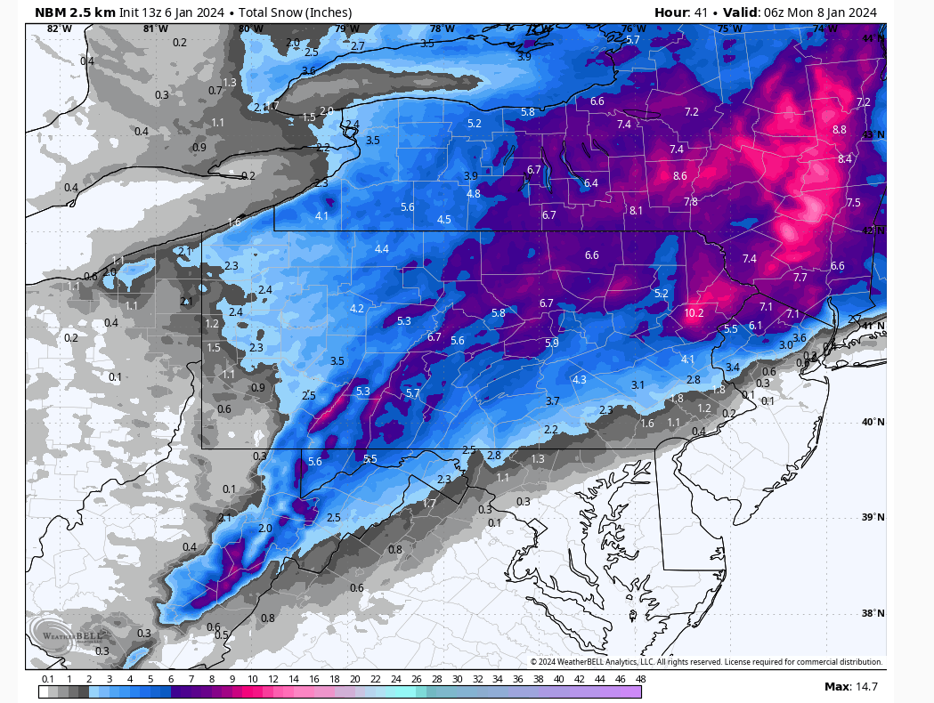
A rapidly-intensifying storm system will track through Delaware this evening, along the New Jersey coast overnight, and east of Cape Cod midday tomorrow. Heavy snow will soon overtake the region, quickly advancing from SW to NE early this afternoon, with rates over 1” per hour. The heaviest precipitation will subside around midnight as the storm pulls away toward Cape Cod. Sleet could mix into the precipitation along the southern part of the area after 7pm, increasing the snow density and reducing totals. Also, there are indications that the low-level wind driven westward over the Pocono Plateau will downslope into the Wyoming Valley, inducing a slight warm level a few thousand feet aloft that could cause sleet to interfere with their totals later this afternoon and tonight. This will be exciting to watch!
There will be a period of light snow wrapping around the back side of the system tomorrow morning through midday that could also deposit 1-3” of low-density snow.
These rapidly intensifying events often harbor surprises and are always a source of inspiration, so hopefully everyone enjoys this exciting event, and good luck to everyone’s final snow totals!