
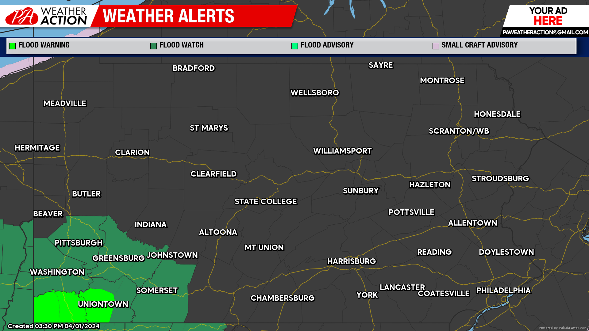
The threat for heavy rainfall and severe weather is possible Tuesday ahead of a passing cold front. Flood Watches and Warnings have been issued for southern portions of the region as rain will continue to stick around for the majority of the week.
Tuesday
Rain and thunderstorms are expected for the majority of the day on Tuesday. According to the Storm Prediction Center, the region will be in the areas with a slight to moderate chance for severe weather. Primary hazards will be high winds, hail, and an isolated tornado. Chances for stronger thunderstorms will be in the late afternoon and evening hours. Highs will be range in the 50s. Winds will be out of the southeast at 9 to 16 mph. High wind gusts will be possible in any thunderstorm that occurs. Lows will range in the 40s.
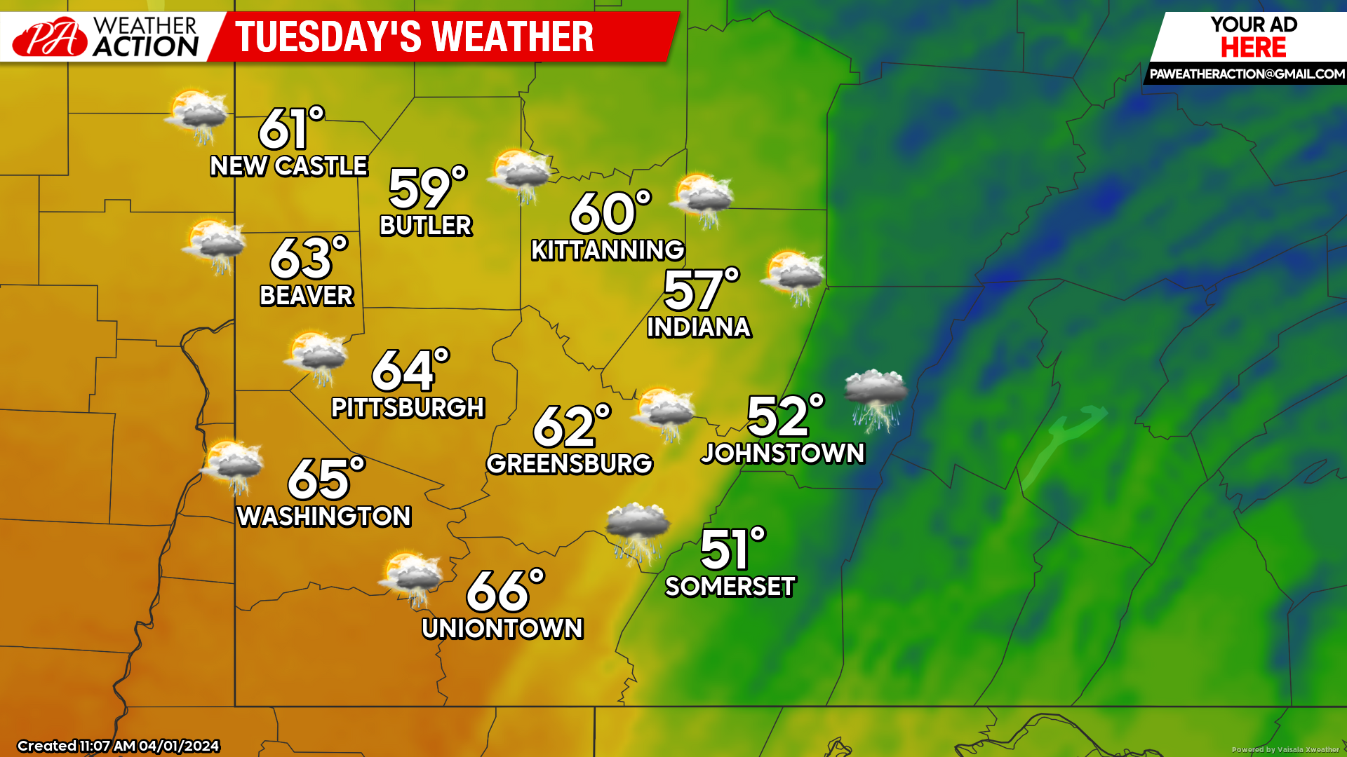
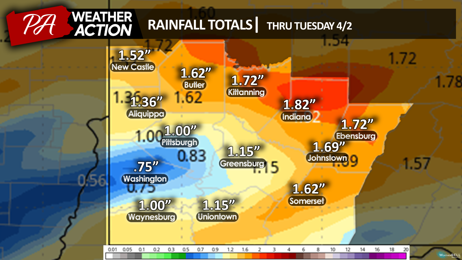
Rainfall totals may approach 2 inches of total precipitation.
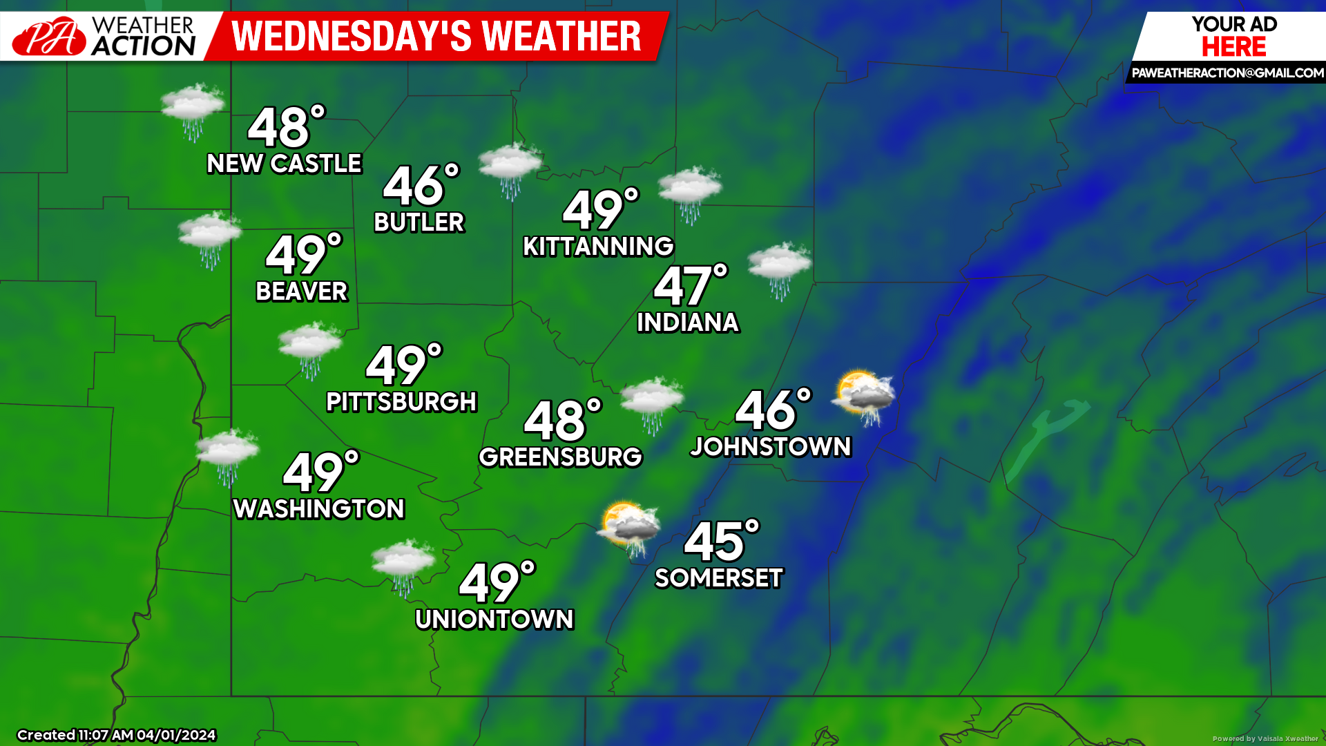
Wednesday
Rain showers and possibly a thunderstorm is expected for the entire region on Wednesday. There is the possibility for snowflakes to mix with rain showers in the higher elevations in the evening and overnight hours. Highs will be high to mid 40s. Winds will be out of the southwest at 10 to 14 mph. Lows will be in the low 30s.
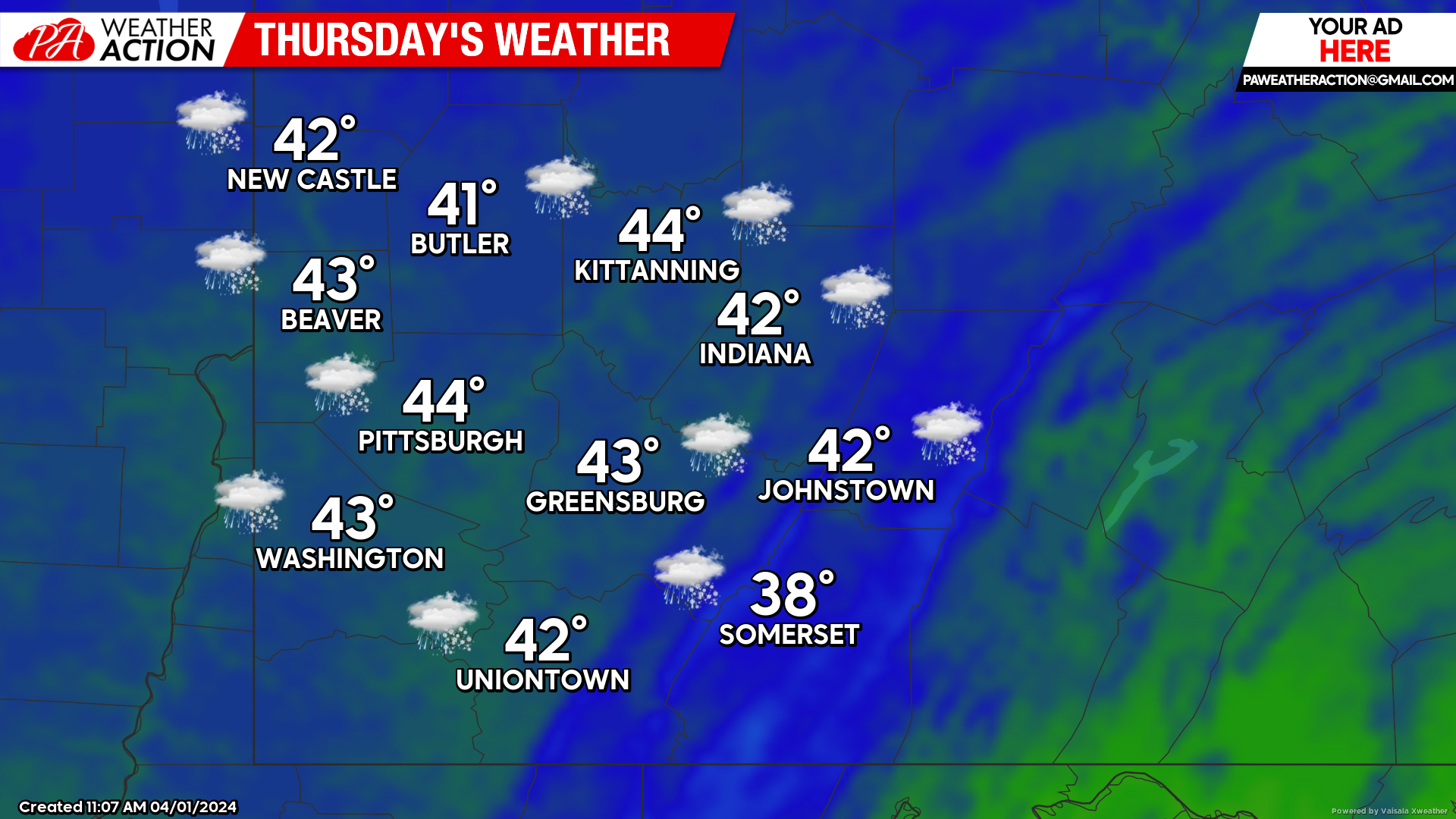
Thursday
A rain/snow mix will transition to all rain in the late morning hours. Rain will continue throughout the day, rain and snow showers are possible in the higher elevations in the evening and overnight hours. Highs will be in the mid 40s to upper 30s. Winds will be out of the west-southwest at 7 to 15 mph, wind gusts approaching 25 mph is possible.
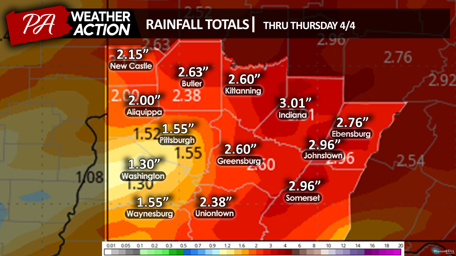
Rainfall totals thru Thursday could range between 1.5 to 3 inches throughout the region.
Be weather aware and do not drive over water covered roadways. Adhere to any and all-weather alerts and warnings.
Follow PA Weather Action for forecast updates.
You must be logged in to post a comment.