
Totals are on the increase for this rare April snow event. Due to this primarily being a night event, the sun angle will not have much of an impact. Also, this will be very heavy snow. And as we learned last event, heavy snow can accumulate despite the warm temperatures in the previous days.
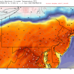
This will be a quick-hitting event. Snow will move into Southwest PA between 1-3 AM, with temperatures around freezing. Here is the NAM model for 2 AM Monday.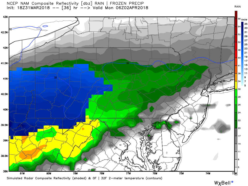
As depicted by the model, there may be a rain/snow mix in Southcentral and Southeast PA at the onset of the storm.
Snow will move east through the night, becoming heavy in the Lower Susquehanna Valley region by the pre-dawn hours. Here is the NAM model for 5 AM Monday.
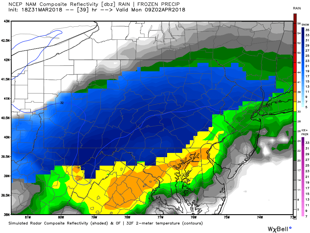
By this time, snow will be falling around the entire state, heaviest from the Laurel Highlands to Southcentral PA.
Areas in the Laurel Highlands up into the Central Mountains around State College will see the most accumulations on roads due to temperatures below freezing.
Snow will begin to wrap up in Western and Central PA as the sun comes up Monday Morning. Here is the NAM model for 8 AM Monday.
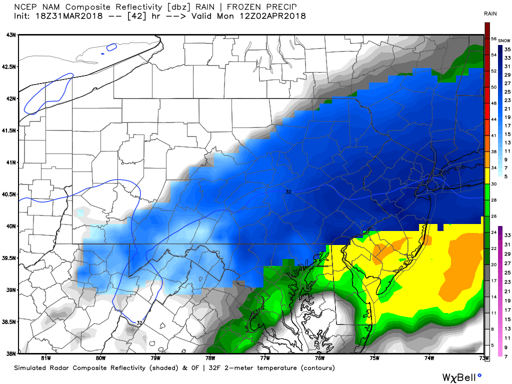
The Monday Morning Commute will be difficult for many areas, especially around the Lehigh Valley because heavy snow will still be falling.
SECOND CALL SNOW FORECAST SUNDAY NIGHT INTO MONDAY MORNING
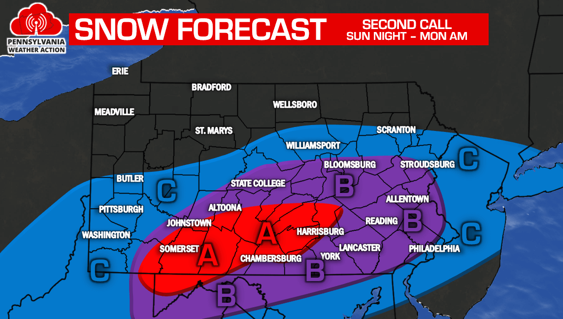
Area A: 4 to 6 inches of snowfall is expected. Slushy roads are likely during the Monday Morning Commute.
Area B: 2 to 4 inches of snowfall is expected. Slushy roads are likely during the Monday Morning Commute, especially above the turnpike.
Area C: 1-2 inches snowfall is expected.
Make sure you have our Facebook liked to stay updated with the latest updates, click here>>>Pennsylvania Weather Action’s Facebook Page
Share this snowy forecast update with your family and friends using our icon below!

You must be logged in to post a comment.