
We have managed to escape impacts from tropical systems so far this hurricane season, but that will end momentarily as a low end tropical storm, Ophelia, has developed and will be making landfall near Wilmington, NC early Saturday morning before moving in our direction.
STORM TIMING
Initial rainfall bands will move into Southern and Eastern PA around sunrise Saturday as they quickly push north. The Penn State White Out game will be dreary but only light rain is expected there. A bit of a lull in the rain is expected Saturday afternoon and early evening before more rainfall bands arrive late Saturday evening, continuing into Sunday morning. These bands may produce wind gusts of 25-40mph. Rain will exit Eastern & Central PA from south to north late Sunday morning into the afternoon. Meanwhile out in Western PA, both Saturday and Sunday will feature spotty showers but certainly times of no precipitation as well. Below is Hi-Res NAM future radar.
OPHELIA RAINFALL FORECAST THRU MON AM
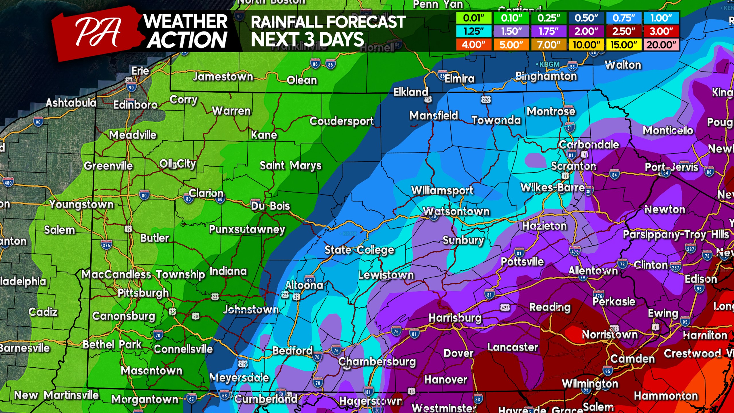
Rainfall totals of 1-3″ are expected generally east of I-81 in Central and Eastern PA. Totals will quickly fall off as you head west of the I-81 corridor. West of the Appalachians, only a tenth to a quarter inch of rain is expected.
Have a great weekend and stay dry, it’ll be a chilly first weekend of fall as well!
Be sure to share this article with friends and family who may be interested!
[social_warfare]
Download our app for a clean design and spectacular radar, along with our handwritten updates for each region. Tap the banner below.
You must be logged in to post a comment.