
Good afternoon! I hope everyone has had an enjoyable week so far. It has been majorly on the dry side with temperatures holding above average much of the recent days, making it feel like more late September than early November. However, changes will be coming to the pattern as a cold front sweeps through the region this evening and into tomorrow morning, ushering in much cooler conditions. The upside is that we will remain mostly dry. Let’s jump in!
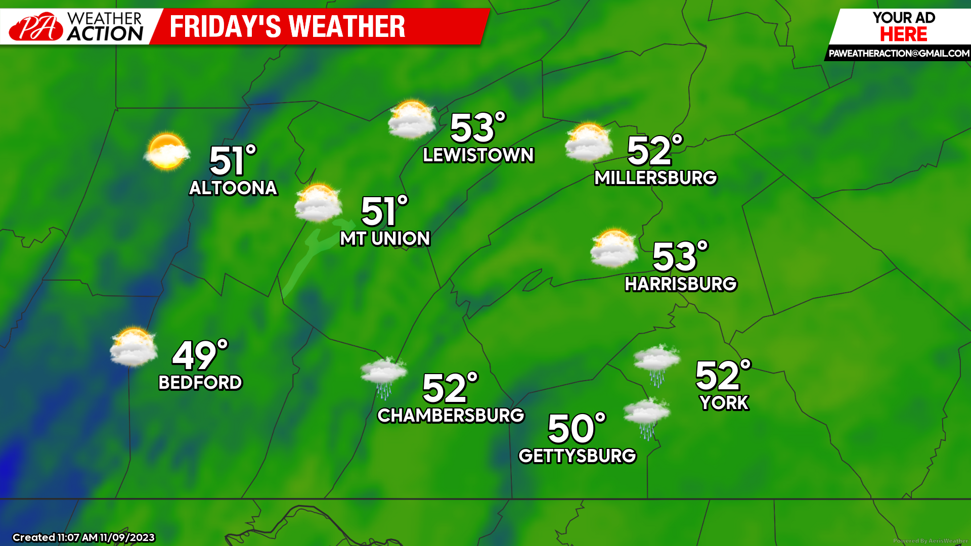
FRIDAY:
Expect mostly cloudy to completely cloudy skies as a weak low pressure systems approaches the area during the afternoon hours. High temperatures are expected to range from the upper-40s to lower-50s, so overall a lot cooler than the rest of the week. A few showers will be possible across the far southern counties during the early afternoon hours, but overall shower activity should remain very scattered and short-lived. Additionally, expect a southerly wind of 5-10 MPH during the afternoon and evening hours.
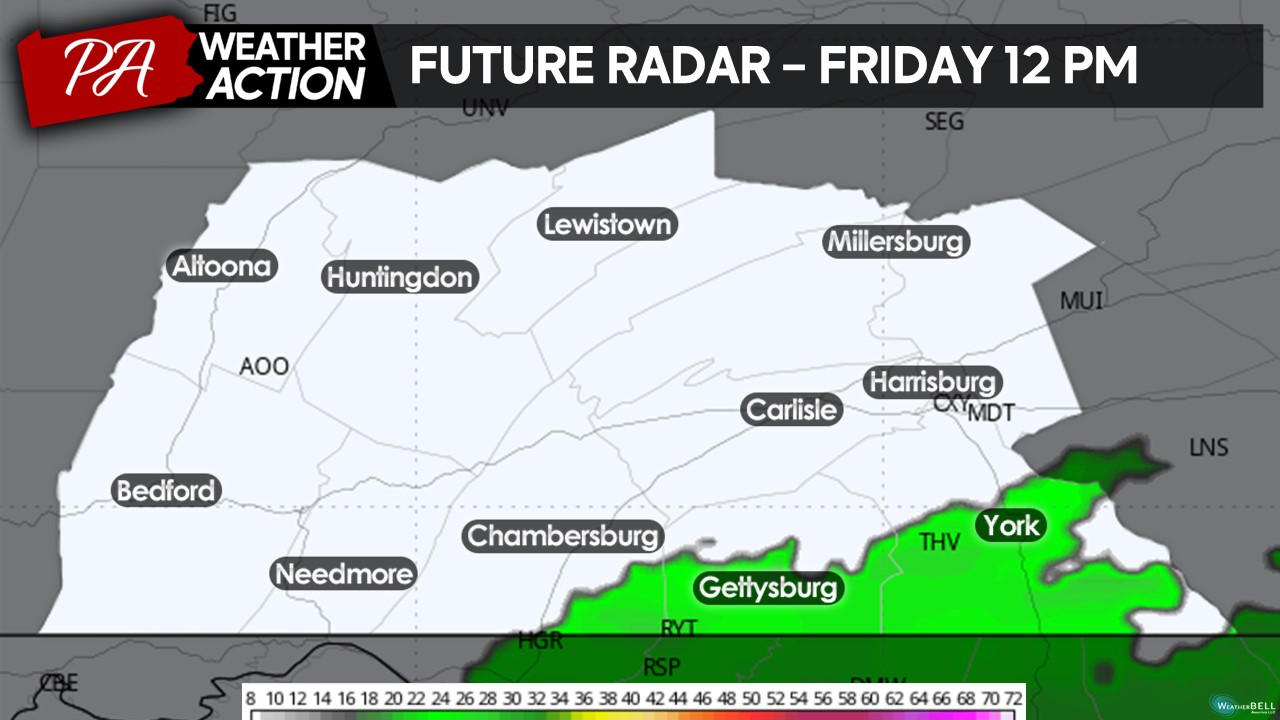
Taking a look at the future radar, a few showers may impact the far southern counties during the early afternoon hours, but as mentioned, these showers will be rather scattered, short-lived, and light in intensity.
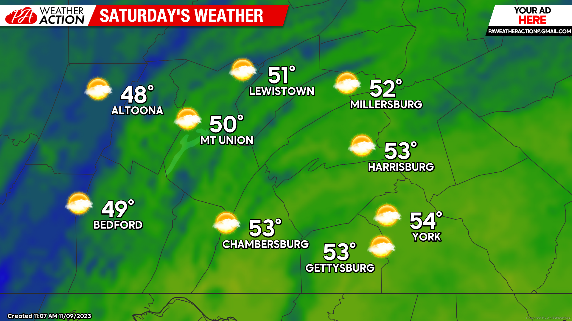
SATURDAY:
High pressure will build into the region on Saturday, allowing for partly cloudy skies across the entire region. However, with a northerly flow, our high temperatures will not be warming up much during the afternoon hour with high temperatures expected to range from the upper-40s to mid-50s. Expect a northerly wind of 5-10 MPH with gusts occasionally up to 20-25 MPH. It will not be awful for outdoor plans but dress accordingly!
SUNDAY:
Sunday will bring the coldest day of the weekend as the high pressure system will help to push in a much colder air mass from Canada. Expect high temperatures to generally fall in the mid-to-upper 40s with generally mostly sunny skies. Expect winds to be generally calm as well. Not too bad of a day although you may need to dress slightly warm for any outdoor activities!

That is all for the weekend forecast! Overall the pattern has been rather dry and stagnant with no major precipitation chances and it is looking that will hold as we head into early next week as well. Enjoy the calmness because we all know once winter strikes we will be busy with tracking winter weather events. If you have any questions and/or concerns, feel free to reach out. For more updates, follow PA Weather Action on Facebook and download the social media app!
Denys


You must be logged in to post a comment.