

A storm system currently over the Great Lakes will travel well to our north tonight, dragging some showers across the area. Rainfall amounts will be light, generally a tenth of an inch or less. It will also be a breezy and mild night, with temperatures climbing into the mid-upper 40s after midnight!
TUESDAY
Any showers should clear out around sunrise, after which the system will draw warmer air into our region tomorrow morning, featuring widespread 60s by midday! Breezy conditions will continue, with gusts up to 30 mph at times to blow the autumn leaves around. However, as the aforementioned storm system moves into Maine later in the day, our wind direction will shift from the southwest during the morning to a northwest wind by evening, circulating cooler air into our region during the afternoon. There could also be a few isolated showers during the afternoon.

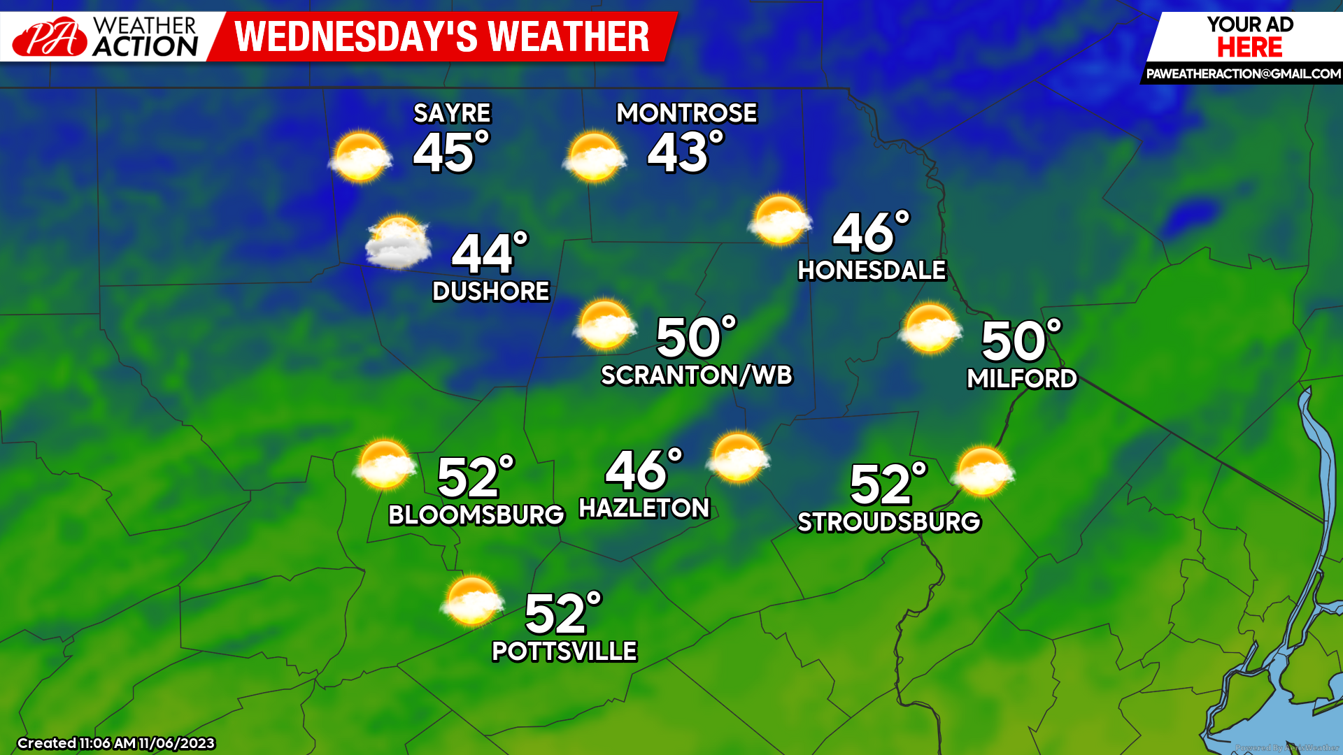
WEDNESDAY
Wednesday will dawn with widespread temperatures near freezing. Yet another storm system will move into the Great Lakes, attempting to circulate warmer air into our region. That air will overrun the cooler air already in place over our area, resulting in areas of clouds along with chilly surface temperatures. Showers will develop Wednesday night. For most locations, it will be just a chilly light rain, but some places could experience a period of light mixed precipitation.
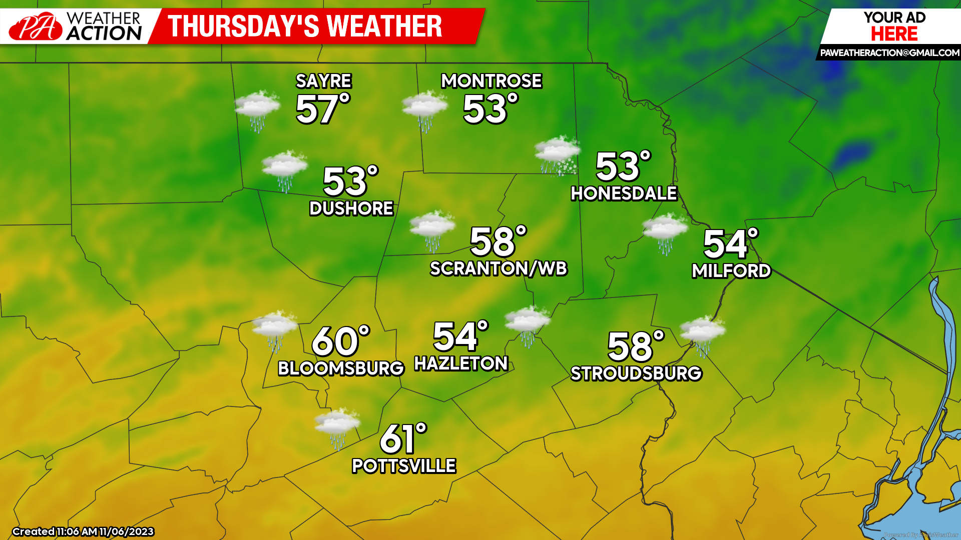
THURSDAY
Residual showers will be possible on Thursday, with temperatures slightly above normal for this time of year. Enjoy!
You must be logged in to post a comment.