
A long-awaited snow event is likely to take shape this weekend from the Midwest, through the Ohio Valley, and into our region. While the ingredients are not there for a big storm, some of us may still receive several inches of snow from this system.
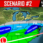
Yesterday we released three scenario maps, and as of now scenario #2 looks most likely (Click Here to View Scenario Maps). Models now generally agree that we will receive a round of light to moderate snow late Saturday afternoon, lasting through sunrise on Sunday. Due to temperatures being well below freezing in all levels of the atmosphere, this will be 15:1 ratio snow. That means for every tenth-inch of precipitation, about 1.5″ of snow will fall.
What still remains somewhat unclear is how far north snow may reach on Sunday. The low pressure will travel over Cape Hatteras Sunday, and at the same time we will have a relatively strong high pressure to our north. Areas south of route 30 in Southcentral and Southeast PA have the highest chance of receiving additional snowfall Sunday Afternoon and evening. As of now, our impact forecast was made with the expectation that precipitation will stay primarily south of the PA/MD line Sunday Afternoon.
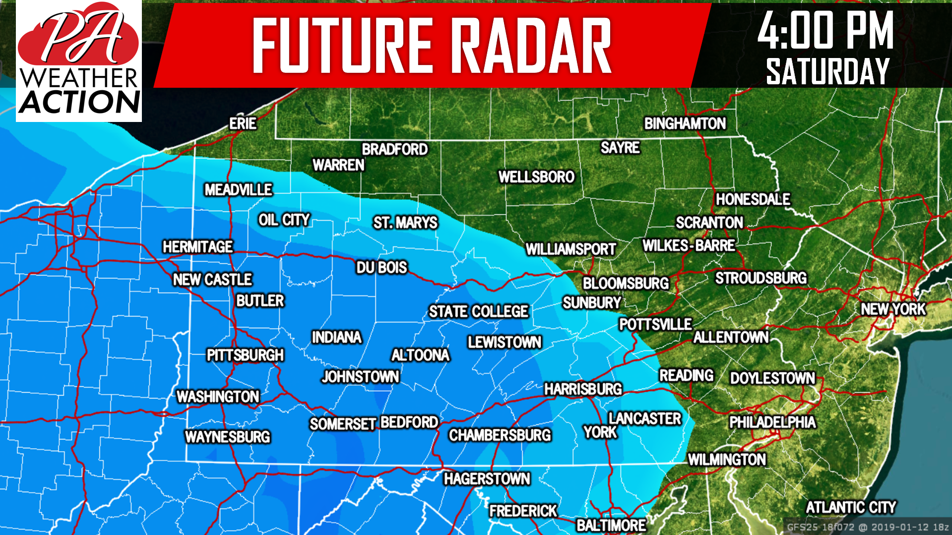
Let’s get into timing for this storm. As mentioned, snow will move into the state Saturday Afternoon from west to east. By 4:00 PM Saturday, we expect much of the western half of PA to be under light to moderate snow. Here is future radar for 4:00 PM Saturday Afternoon:
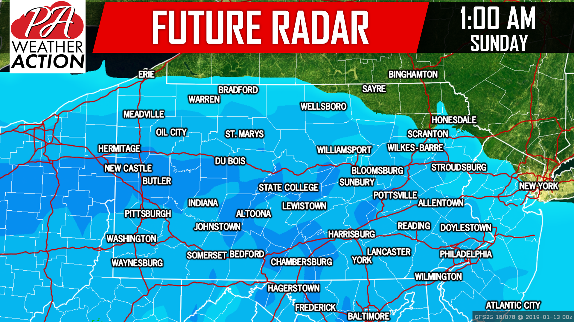
 Snow will continue to move east as Saturday Evening progresses. By 1:00 AM Sunday, nearly all of the state will likely be seeing light snow. Below is future radar for 1:00 AM Sunday Morning:
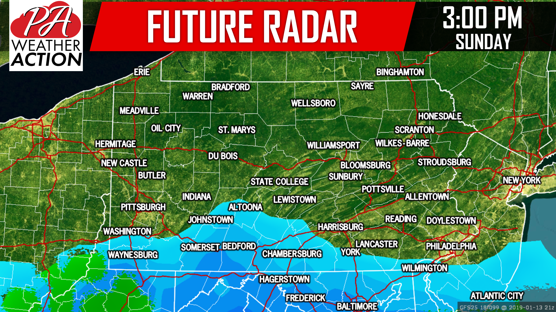
 By sunrise on Sunday, snow is expected to be out of the state. But the event may not be over in Southern PA, as some light snow could move back in by Sunday Afternoon. Recent model runs today have suggested a slight north trend with this snow Sunday Afternoon. If this trend continues into tomorrow, expect some changes in forecasted snow amounts in Southern PA. Here is future radar for 3:00 PM Sunday:
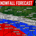
STORM IMPACTS FORECAST MAP
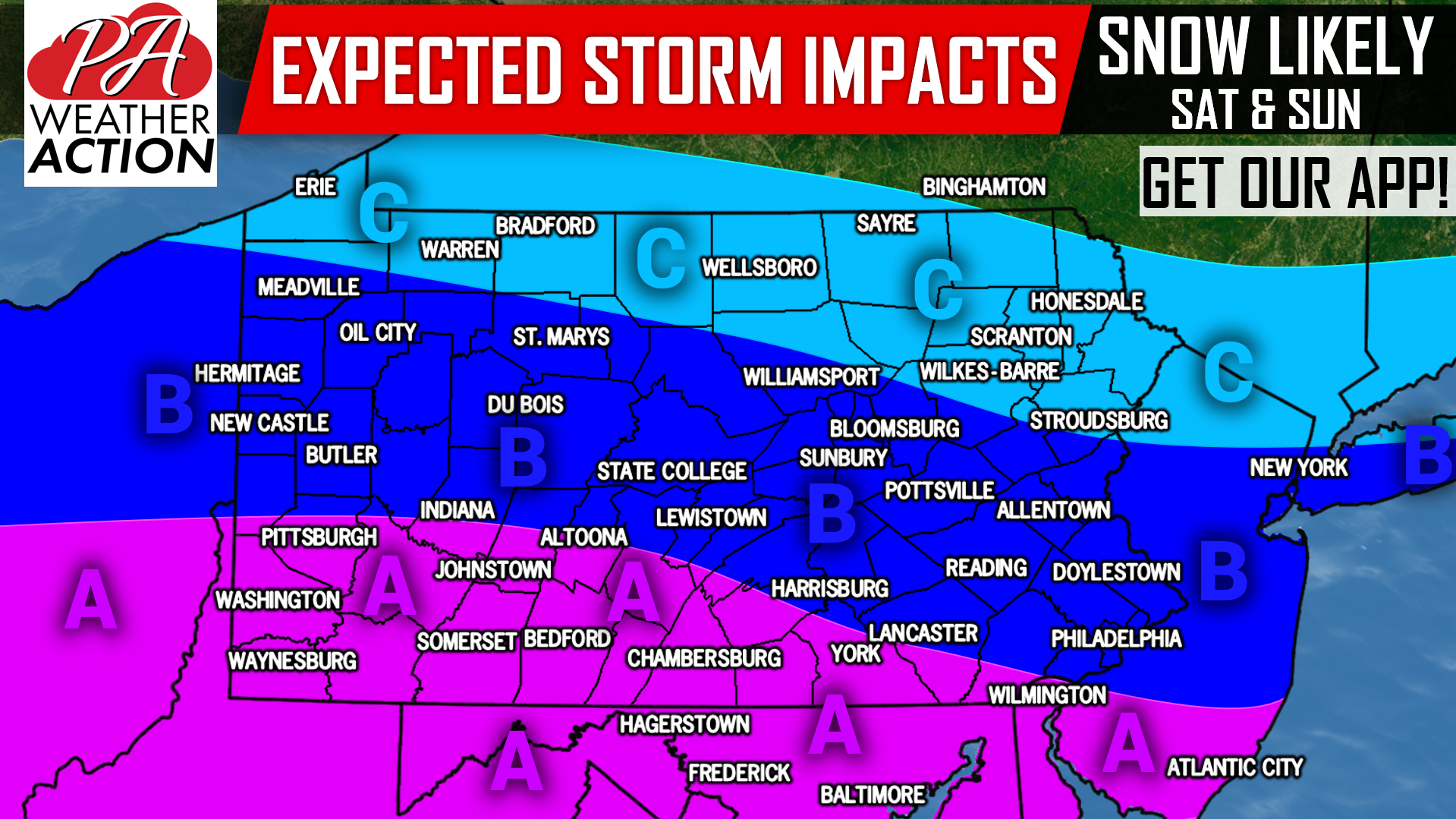
Area A: Moderate impacts are currently expected from this storm. Areas closest to the MD line are likely to see highest snowfall amounts. This region has the best chance to receive 3″ or more of snowfall. Expect hazardous travel conditions Saturday Evening into Sunday Morning, potentially lasting longer depending.
Area B: Light impacts from this storm are currently anticipated. This section can expect to receive 1″ or more from the event. Locations closest to Area A will see highest snowfall amounts. Slippery travel is possible Saturday Night, especially on untreated surfaces.
Area C: Minimal impacts are likely in this region, as only very light snow is expected. This area has a 50/50 chance of seeing 1″ or more from this event.
We will have actual snowfall accumulation ranges in Thursday Evening’s Forecast. For now, make plans to limit travel if possible in Southern PA Saturday Evening, and on into Sunday Morning.
Download our app to receive updates on this storm, as well as hourly and daily forecasts, as well as alerts >>> PA Weather App Link
Share the forecast with your friends and family using the share button below. Stay tuned!
You must be logged in to post a comment.