

Good afternoon! I hope you are enjoying the warmth and sunshine this afternoon and continue to do so because major changes are coming to the pattern as we round off the weekend and head into early next week. This cold front will usher in the coldest air of the season yet- and may threaten the area with potential first snowflakes of the season, especially in the highest elevations! If you are planning to view the fall foliage across the region make sure to get out over the next few days because next week’s pattern will usher in much colder temperatures and gusty winds which will accelerate the leaf fall out.
FRIDAY:
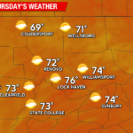
Friday will bring the most widespread warmth of the entire week with high temperatures ranging from the mid-70s to lower-80s across the region under a mix of sun and clouds. Expect a westerly wind to develop during the afternoon hours of 5-10 MPH. It will be a very warm afternoon, so make sure to get outdoors and make plans because changes will be coming as we head later in the weekend.

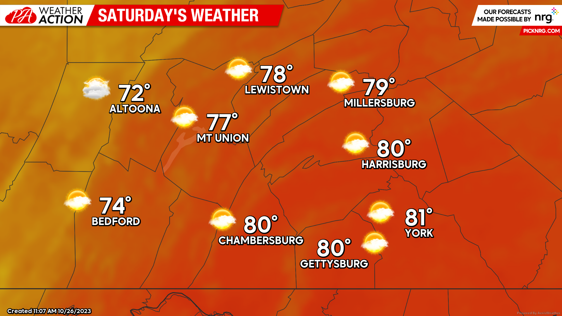
SATURDAY:
Some changes will be coming Saturday as the cold front to the north begins to slowly sag south into our region. Although, expect another very warm day with high temperatures ranging from the lower-70s to lower-80s north-to-south with cloud cover increasing throughout the afternoon. During the evening hours, a few of the northern counties of the region may see a few showers. Expect a northwesterly wind of 5-10 MPH during the afternoon and evening hours as well.
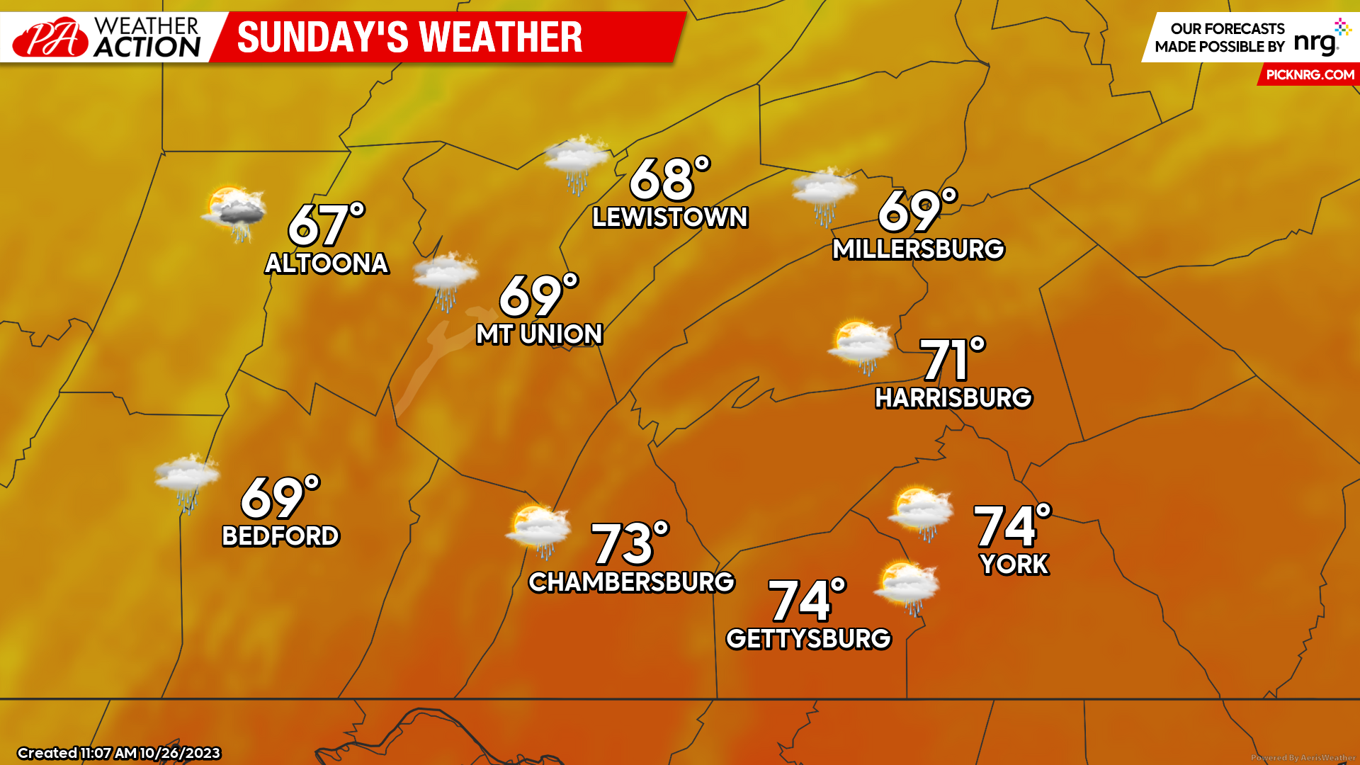
SUNDAY:
As we head into Sunday, the cold front will begin to move through the area allowing for much lower temperatures and the threat for widespread showers and isolated thunderstorms. Expect high temperatures to range from the mid-60s to lower-70s. Expect a westerly wind of 5-10 MPH during the afternoon and evening hours as well. Expect showers to move through the region throughout much of the daylight hours, so make sure to bring your rain gear and umbrellas if you are planning to head out!
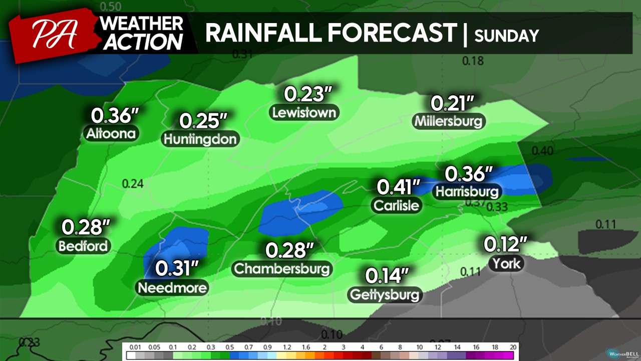
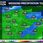
Expect rainfall amounts between 0.15 – 0.50″ across the region with localized areas of lower and/or higher amounts. Overall, Sunday is not expected to be a complete washout but it will still be raining generally on-and-off throughout the day with much cooler temperatures overall.
PATTERN CHANGE:
As you can see by the 500MB pattern next week, the eastern United States ridge will be replaced with a trough, which will allow for much cooler temperatures to settle into the region with cold air flowing in from Canada. This will allow for the coldest air of the season yet (potentially highs in the upper-30 to mid-40s) and the first flakes of the season (especially in the highest elevations & lake effect snow). If you enjoy sunny and warm conditions, make sure to enjoy the next few days as this may be the last warm pattern in quite awhile!
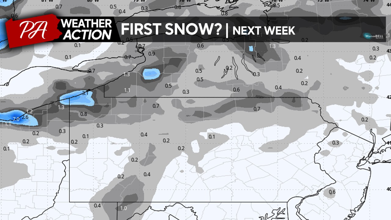
 As you can see, the some of the model guidance is hinting at some snow across the lake effect zones and the highest elevations of central Pennsylvania. Depending on the amount of moisture available when the coldest air moves in, a few areas within our region may see the potential to see a first flakes of snow, especially the further north and west you are located. However, this remains very up-in-the-air so make sure to stay tuned for any updates on this potential!
 If you have any questions or concerns, feel free to reach out at anytime! For more weather updates, make sure to join the group on Facebook and download the PA Weather Action app.
Denys
You must be logged in to post a comment.