
Continuing dry and seasonably warm conditions on Friday will transition into multiple days of periodic rain and falling temperatures throughout the weekend. Extreme temperature change expected the beginning of next week.
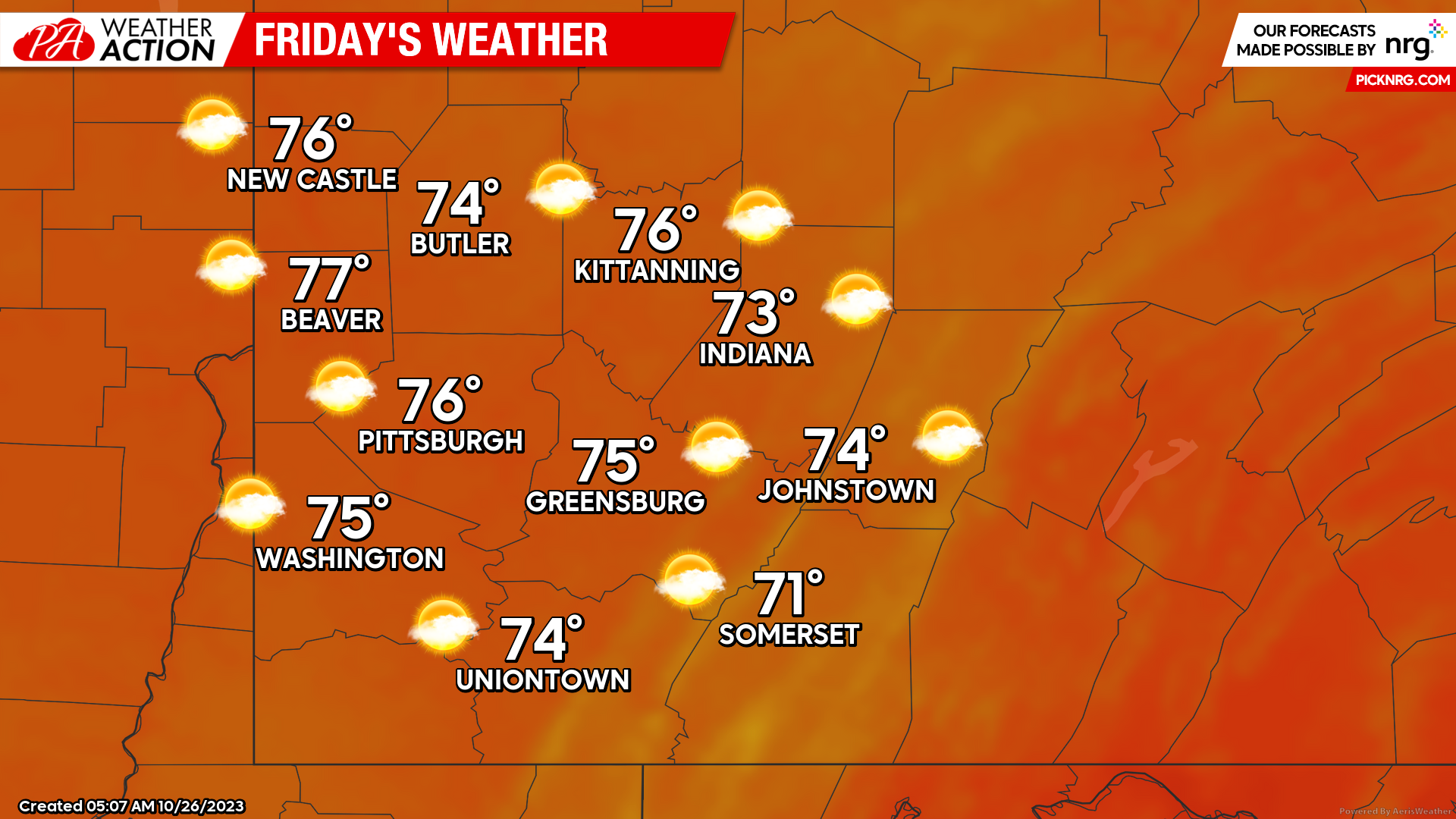
Friday
Mostly sunny skies with high temperatures in the mid to upper 70s for most of the region. Winds will be out of the south-southwest between 7 to 12 mph. Evening lows will be in the low to mid 60s. There is a slight chance for rain late Friday night into the early morning hours on Saturday.
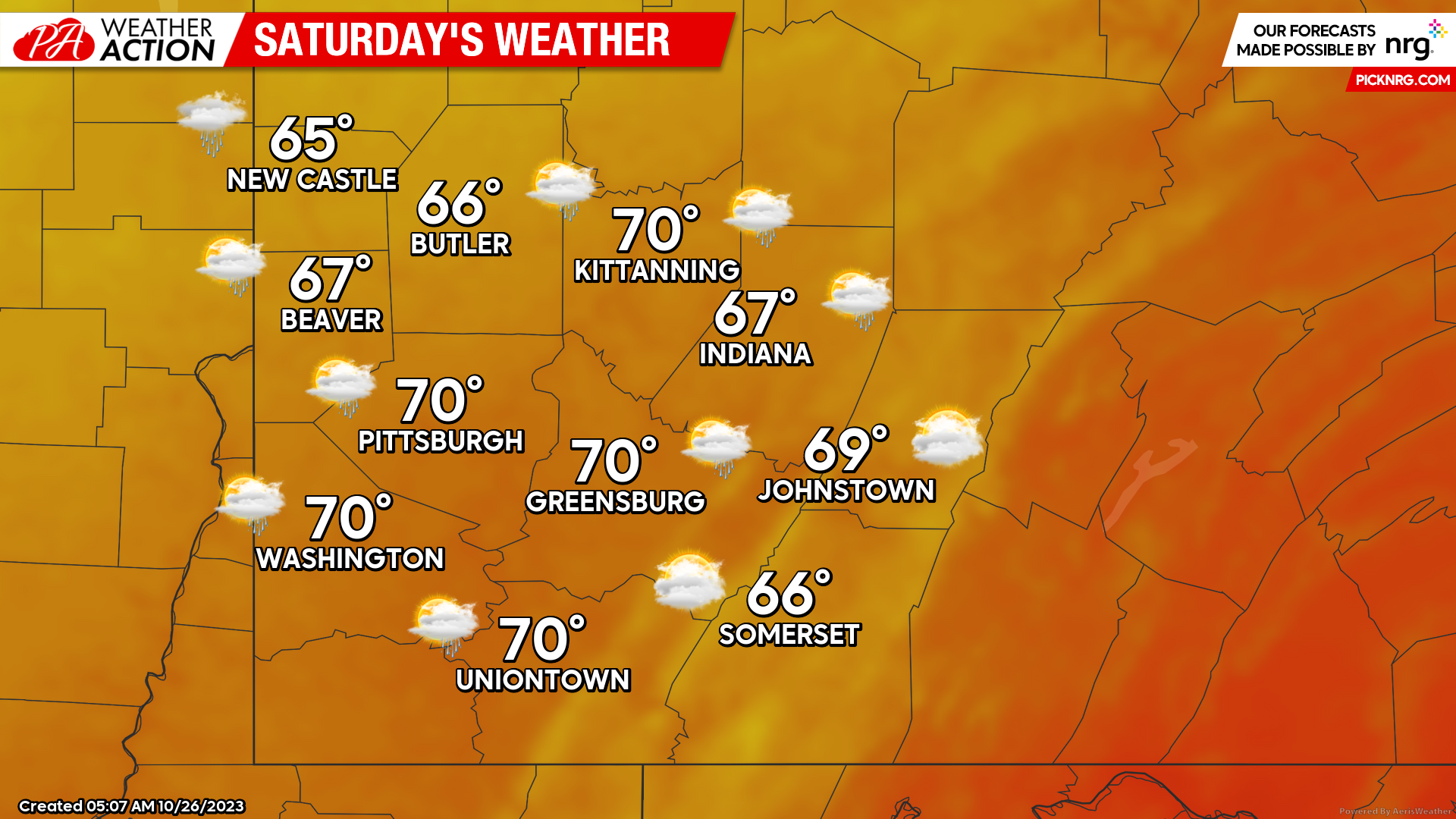
Saturday
Mostly cloudy conditions with a slight chance for rain throughout the day. Highs will be in the mid to high 60s, with some areas reaching 70 degrees. Winds will be out of the Southwest at 7-9 mph becoming Northwest in the afternoon. Lows will be in the mid to upper 50s.
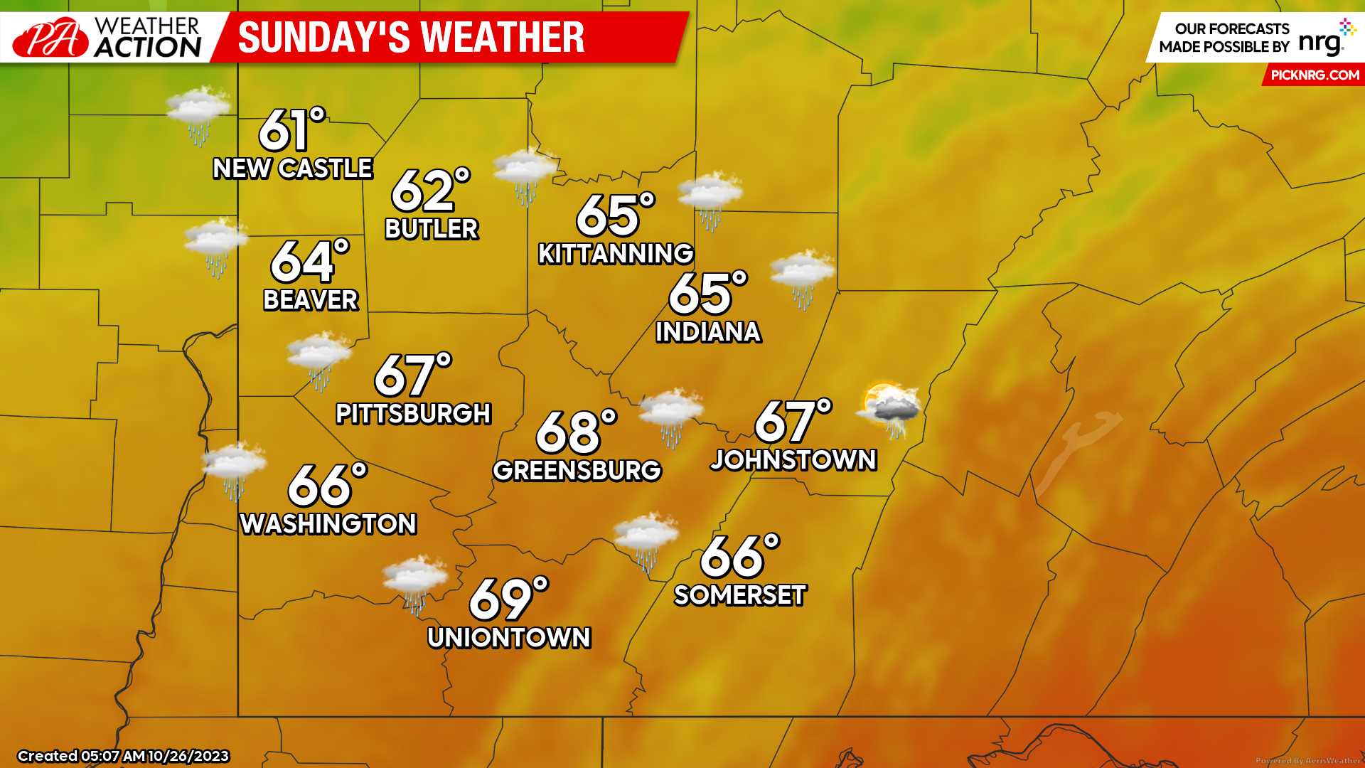
Sunday
Rain and cooler temperatures can be expected throughout the region. Highs will range from the Low 60s to upper 60s. Lows will be in the Low 50s to mid 40s.
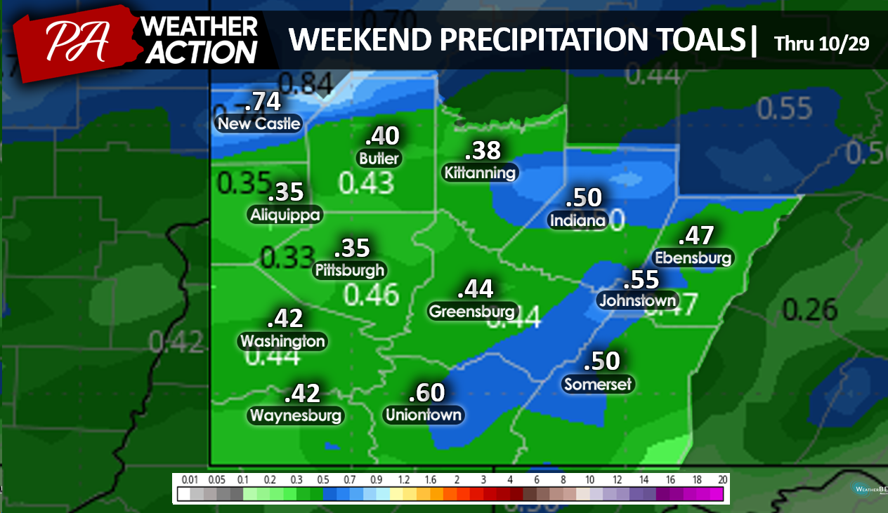
Weekend precipitation totals will be between 1/4 to 3/4 inches.
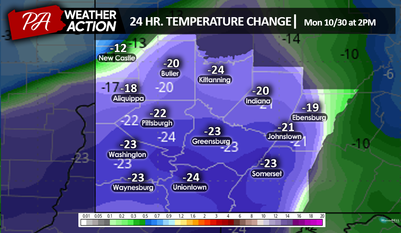
Temperatures will begin to drastically change from the conditions we experienced earlier this week, around mid-day on Monday. There is increasing probability for snow by Tuesday for portions of Northwestern Pennsylvania. Be sure to follow PA Weather Action to stay informed on the changing weather conditions.


You must be logged in to post a comment.