
It seems like just days ago the month of January had a rather poor look in terms of snowfall, as temperatures looked to be above average for the month. While we can’t say for sure what the remainder of January will bring, we can say that the chances of a significant winter storm around January 6-7 are increasing rapidly.
There has been growing consistency on the models over the last two to three days regarding this significant winter storm threat. Regardless, we are still 5-6 days out and are seeing the usual deviations as different models have different high pressure placements and strengths.
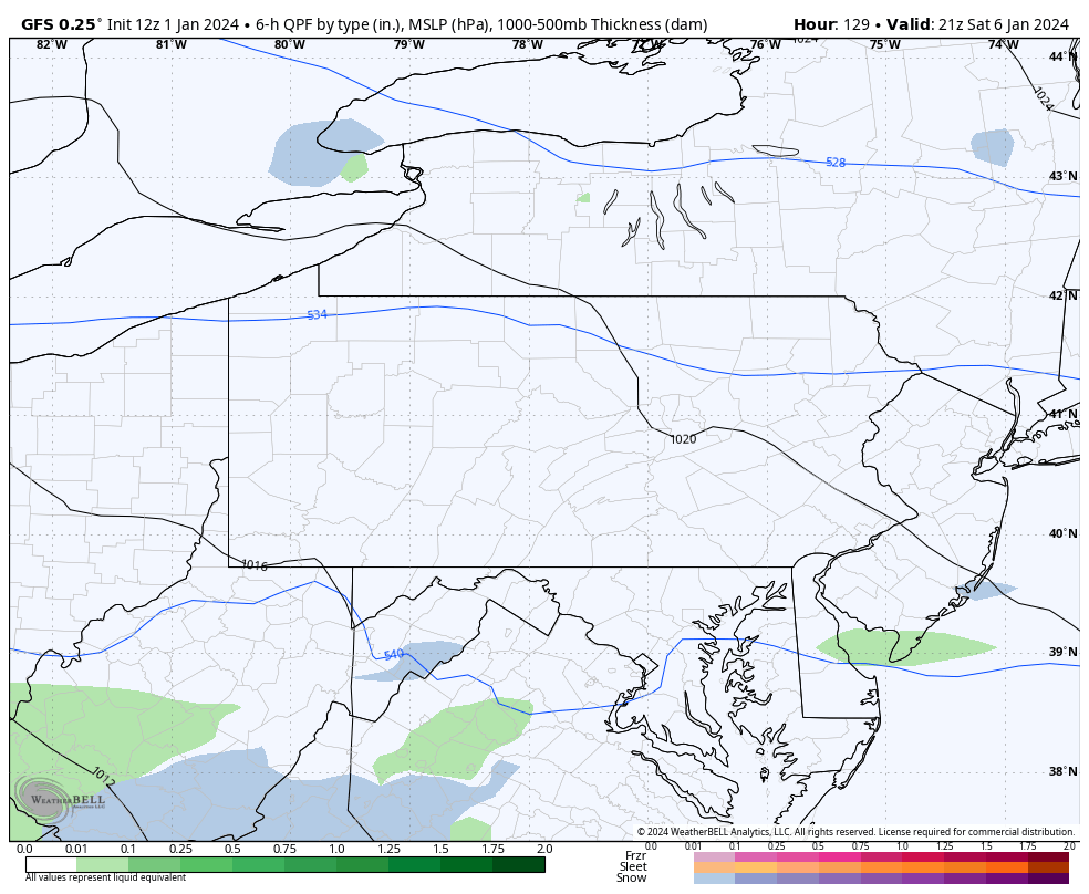
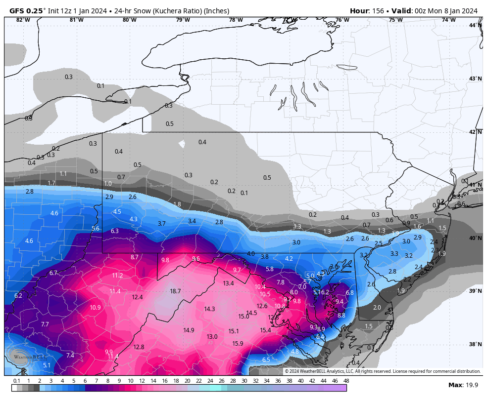
Beginning with the American model, the GFS. It has by far the strongest high pressure in Quebec which keeps the low pressure off the coast farther south and as a result, heaviest snowfall is in Virginia with Southern PA seeing light to moderate impacts. This solution is certainly possible but remains least probable at the moment.
Below is the associated snowfall output from the GFS.
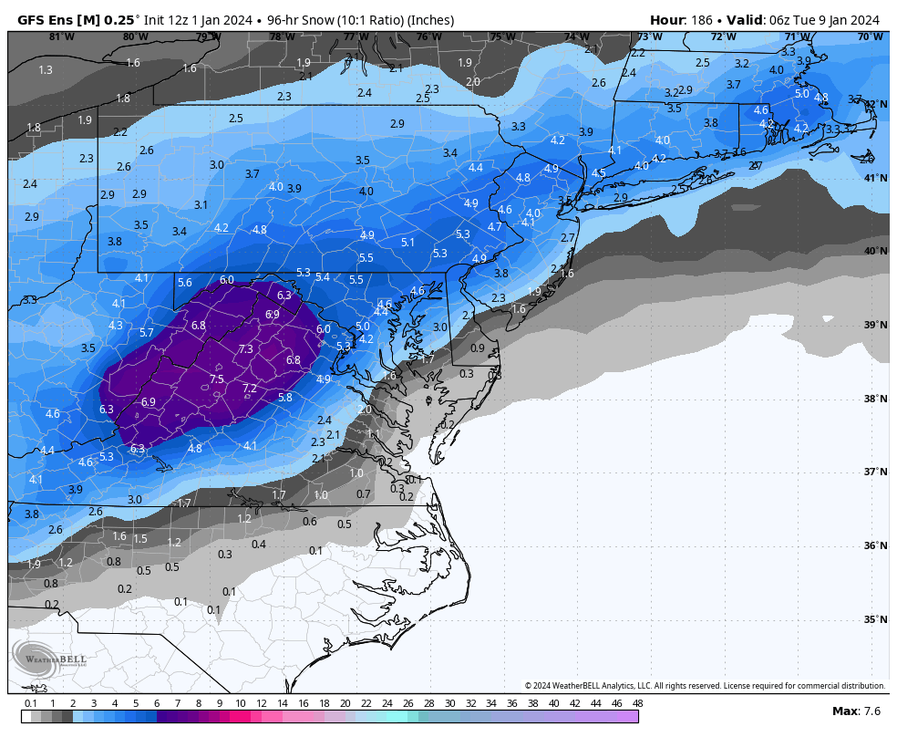
 The GFS Ensembles (GEFS) are a bit farther north on average but are the farthest south of any ensemble package. Note – ensembles are not as accurate and often indicate lower than reality snowfall totals until the onset of the event.
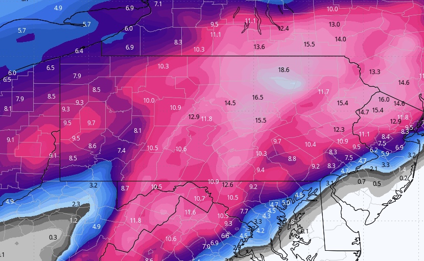
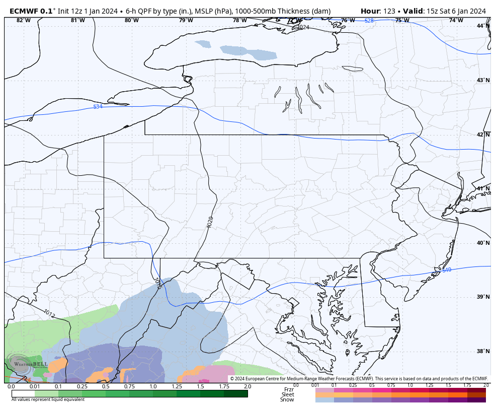
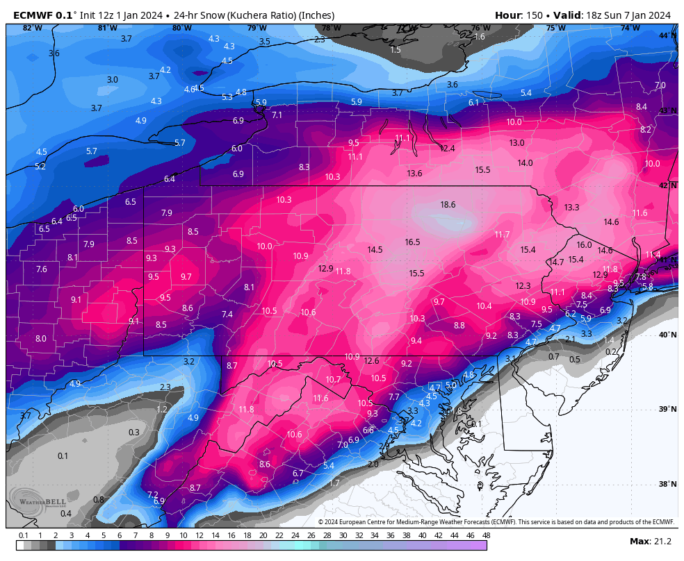
 Now onto the European Model, the ECMWF, which is statistically the most accurate model but does have a bias of over amplifying systems. As you’d expect, it’s much more amplified (stronger system), but the big difference is the weakened high pressure over Quebec which allows the storm to travel farther north and along the coast. We discuss the high pressure because high pressure will always win out against low pressure and in this situation, the placement of the low pressure will be almost entire dictated by the high pressure. Here is the Euro’s progression of the storm followed by its snowfall output.
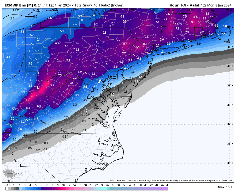
The European Ensemble package is very much on board for a significant snowstorm as well, with widespread 6” means which will only be on the increase. View that below:
Finally, the Canadian is the most amplified and warmest for Southeast PA. It’s also not a very probable solution but at this stage anything is possible. Below is the snowfall map from the Canadian.
As usual, the I-81 corridor seems to have the safest bet for significant snowfall at this point.
Once you head south of Reading and Allentown, the threat of mixing with sleet, freezing rain, and or rain is elevated.
In my opinion, I think we will see a solution between the Euro and the GFS. It’s very rare we would see an area with a foot plus as expansive as the Euro indicates. I think areas on the northern edge will probably see less in future runs, with areas that stay all snow just above the rain/snow line seeing highest accumulation.
As for timing, this looks like late Saturday into Sunday morning and afternoon. It’ll come in from southwest to northeast.
Thank you for reading, we will have another update tomorrow on all the latest information.

You must be logged in to post a comment.