
The passage of a cold front will bring a chance for snow showers to impact the region late Wednesday into Thursday.
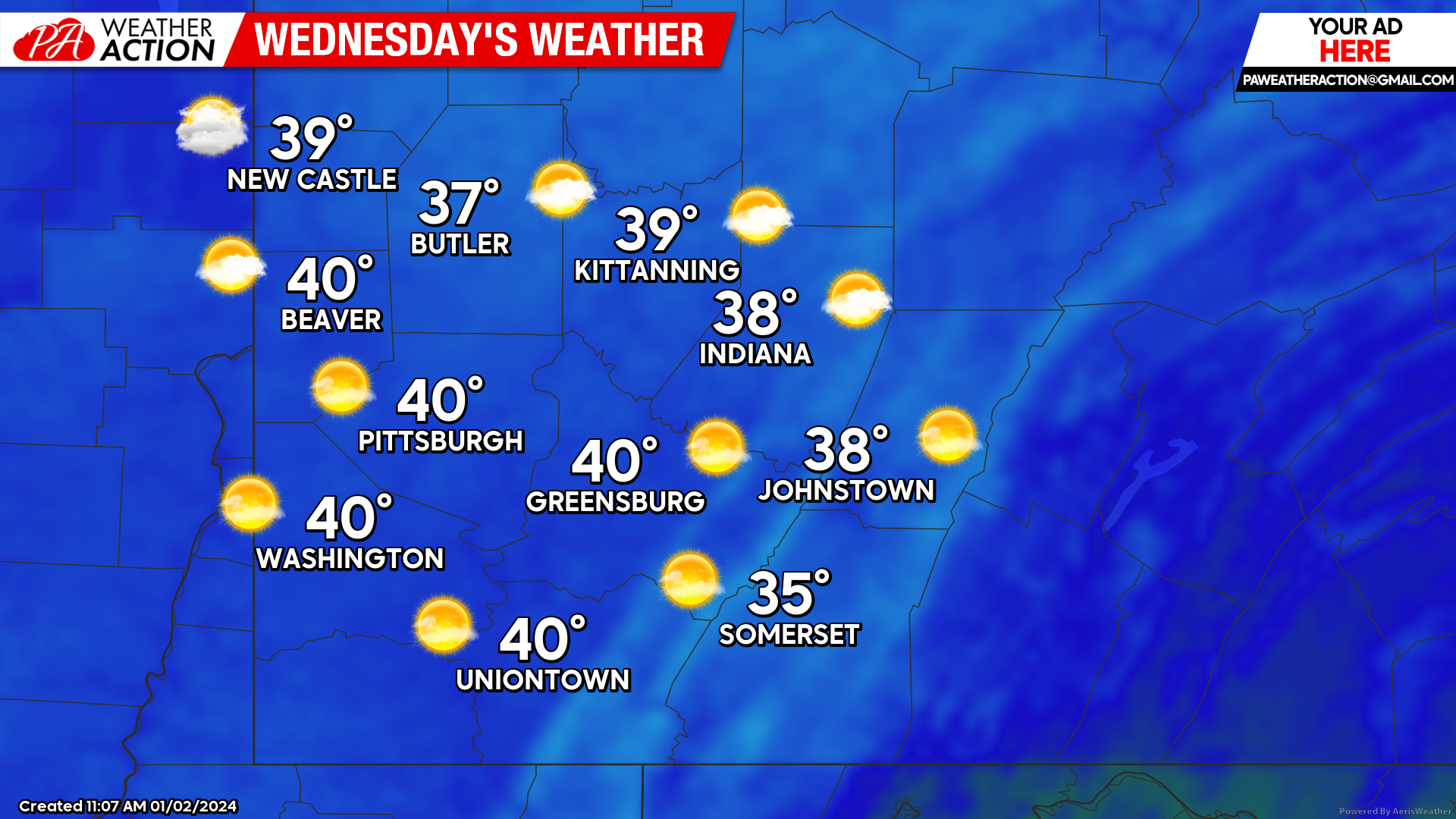
Wednesday
Partly sunny skies will begin to transition to mostly cloudy conditions around sunset. The chance for snow showers will be possible in the evening and overnight hours. Highs will be in the mid to low 30s. Winds will be out of the west-southwest at 10 mph. Lows will be in the mid 20s to low 30s. Total snow accumulations will be less than an inch, and possibly restricted only to higher elevations.
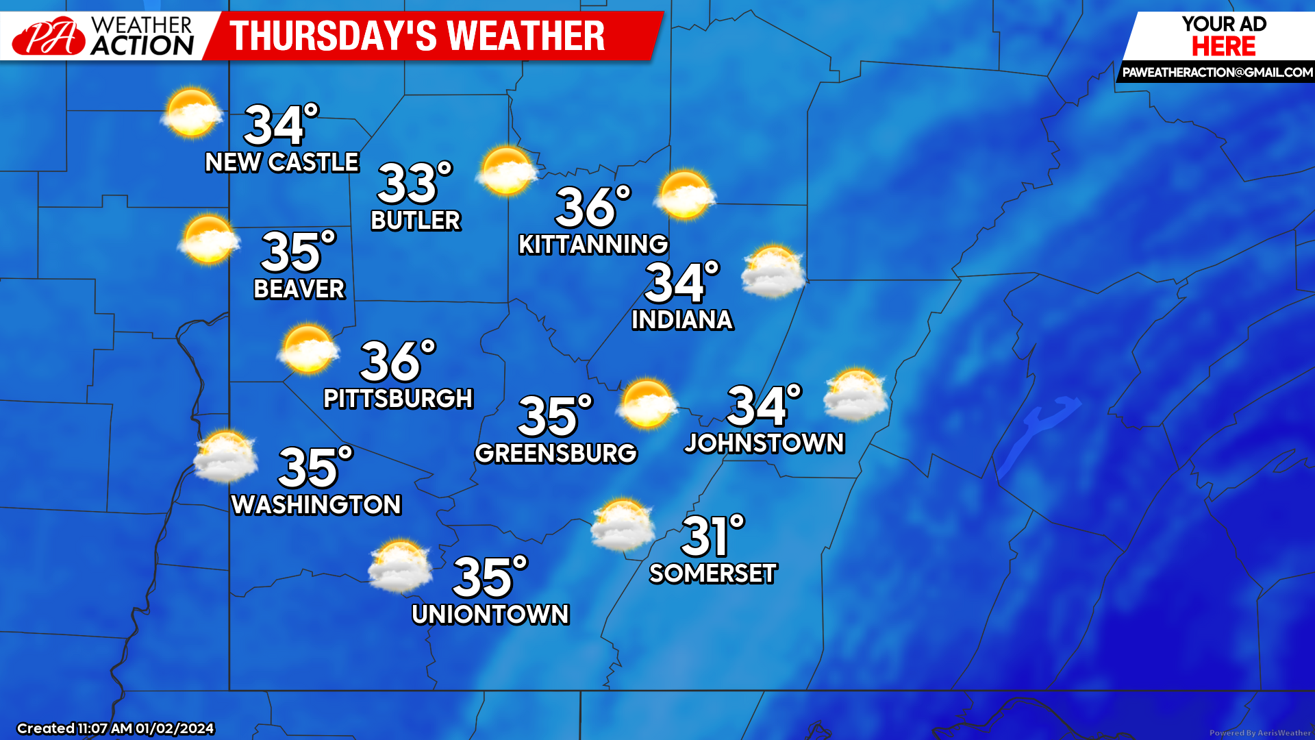
Thursday
Colder temperatures with a lingering chance for snow showers in the morning hours. Partly sunny conditions will follow. Highs will be in the mid to low 30s. Winds will be out of the northwest at 8-18 mph, wind gusts could be as high as 30 mph in the higher elevations. Lows will be low 20s to mid-teens.
Friday
Mostly sunny conditions will expand throughout the region. Highs will range in the 30s. Lows will be in the mid to low 20s.

The chance for a potential winter storm to impact the region over the weekend currently sits between 40-50%, with the higher elevations having a greater chance compared to the rest of the region. PA Weather Action will continue to monitor the situation and updates will be provided through our social media pages and website. More specific information on potential impacts for Southwest PA will be provided in this week’s weekend forecast.
You must be logged in to post a comment.