
Good afternoon folks! I hope you had an enjoyable week – it went by so quickly yet again! I have been so busy with school work and club activities, which is why I believe it went by so quickly. It has been a pretty pleasant week with a mix of sun and clouds and seasonable conditions. The cooler nights and mornings have made it feel a lot more like fall, which made it enjoyable to sip on hot tea and coffee! Unfortunately, right in time for the weekend, changes will be coming to the forecast as a robust low pressure system moves into the region, allowing for widespread precipitation and much lower temperatures. Lets dig into the forecast:
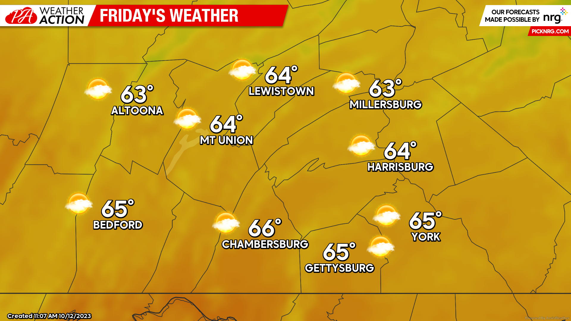
FRIDAY:
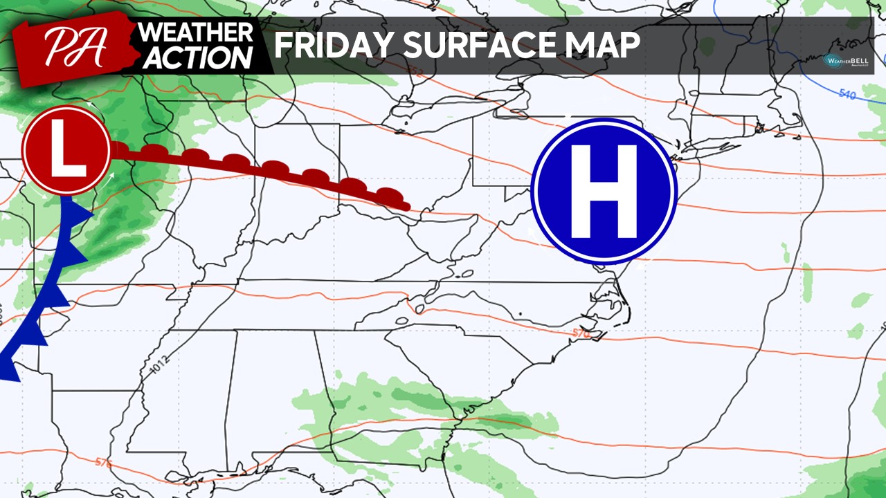
Friday will bring a pleasant end to the week with mostly sunny to partly cloudy skies across the region as the high pressure system begins to depart the region. Expect high temperatures in the mid-60s for many locations, which will be right around, if not- slightly above average for this time of the year. It will be good to get outdoors and soak it all in because major changes are coming as we head into the weekend!
SATURDAY:
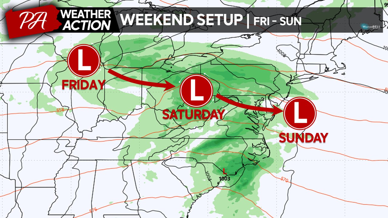
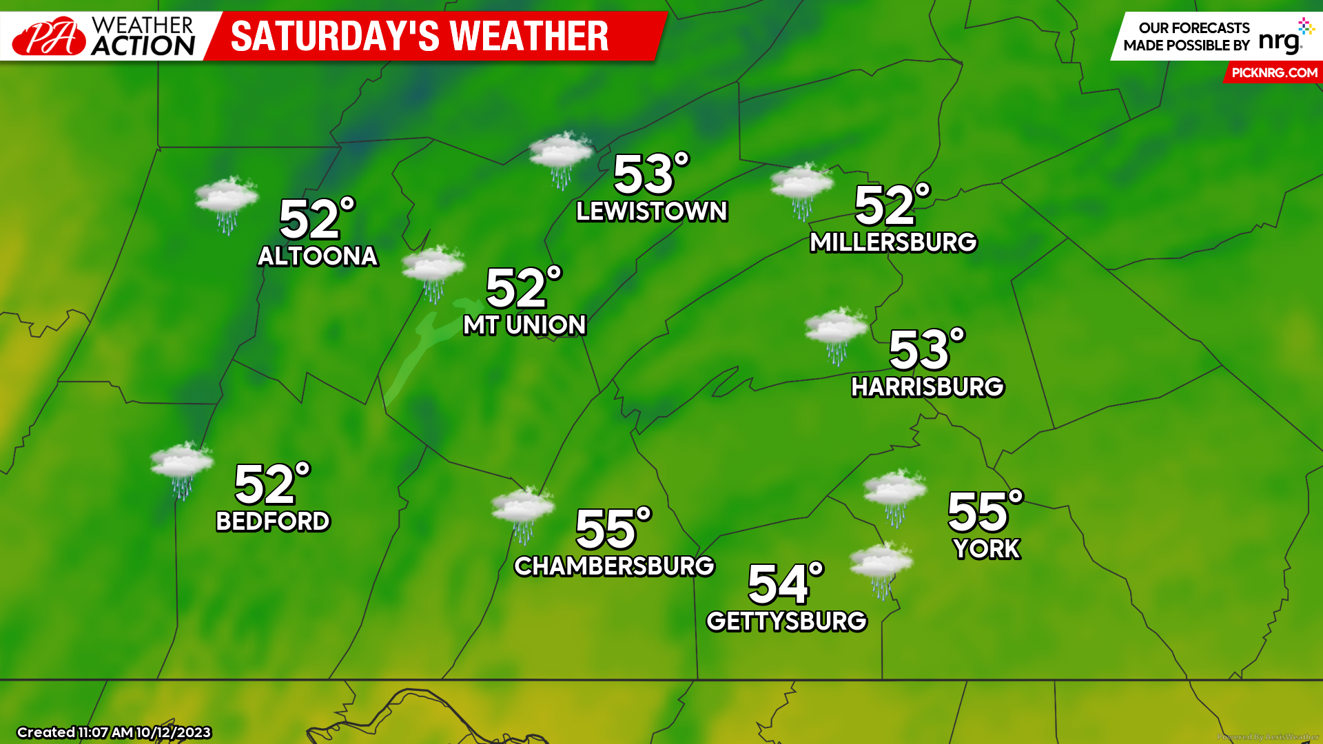
As the low pressure system moves into the region on Saturday, expect widespread rain showers with much cooler conditions across the region. These high temperatures of the low-50s may occur earlier in the afternoon, with temperatures falling into the mid-40s during the heaviest precipitation rates during the mid-afternoon and evening hours. Expect an easterly wind of 5-10 MPH with occasional higher wind gusts. Overall, if you have outdoors plan on Saturday, it may be a good idea to move those plans indoors! If you are planning to be outdoors during the duration of the day, dress properly for the rain and colder conditions – especially if you may viewing fall foliage or even heading up north to the Penn State game!
FUTURE RADAR:
Expect the early morning hours (4-8AM) to be rather dry, however, precipitation will quickly spread into the area west-to-east after 8-9 AM. Expect a steady rainfall throughout much of the afternoon and evening, although a few breaks time-from-time will be expected. These breaks should be rather short-lived, so overall, most of Saturday will be wet. The heaviest rain will occur during the mid-afternoon through early evening hours, before beginning to taper off north-to-south into the overnight hours.
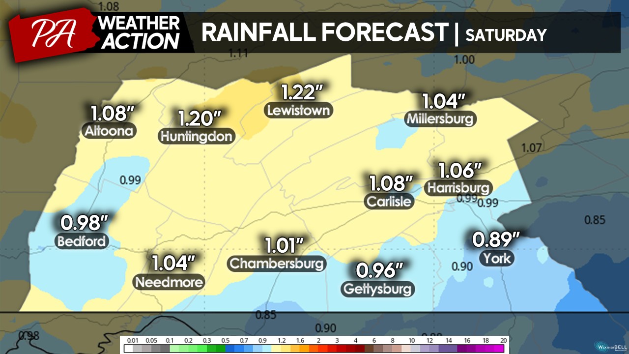
EXPECTED PRECIPITATION:
Overall, much of the region to receive around an inch of rainfall throughout the day on Saturday. A few areas may pick up slightly more and/or less, which will be dependent on where the heaviest bands of rain setup during the afternoon hours. Flooding is not expected to become an issue, however, a few flood-prone areas may experienced ponding of water and areas of poor drainage (especially with potential leaves clogging up drains).
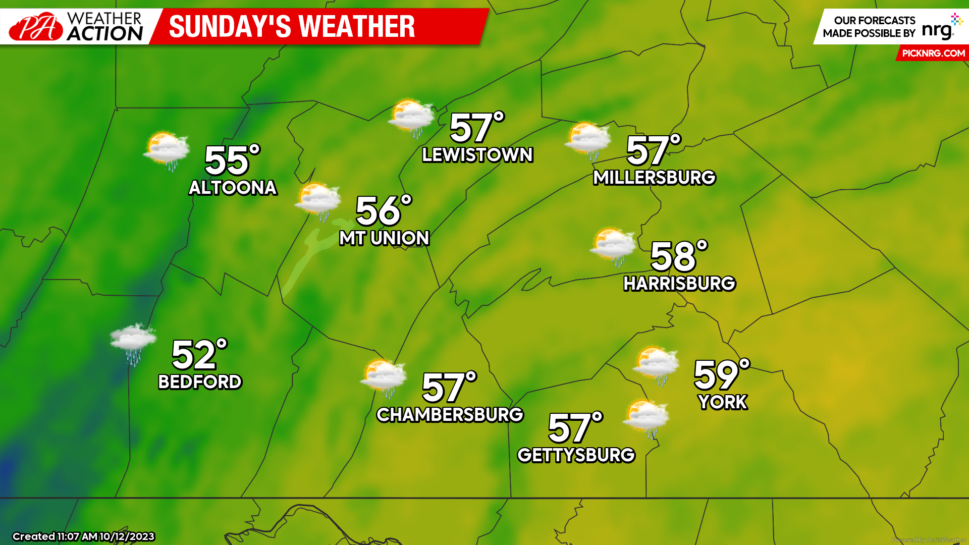
SUNDAY:
While Sunday will still be rather cool and cloudy, it will be significantly drier compared to Saturday. Expect high temperatures to climb into the mid-50s for many locations with winds of around 10 MPH from the north. Sunday afternoon may be a bit windy, with gusts potentially up to 25-30 MPH at times. Expect isolated-to-scattered showers, although total precipitation amounts should be less than 0.10″ for those who see precipitation.
While the weekend forecast is not looking the best, I hope your plans and activities still go smoothly! I am planning to attend the Penn State vs UMass football game, but I know I will be really looking forward to the hot chocolate and Halloweens movies indoors afterwards. If you have any questions regarding the forecast, please do not hesitate to reach out!
Denys

You must be logged in to post a comment.