The Winter Solstice occurs at 10:27 PM and marks the start of astronomical winter season. However, we will have to wait a while before it feels like winter in our area.
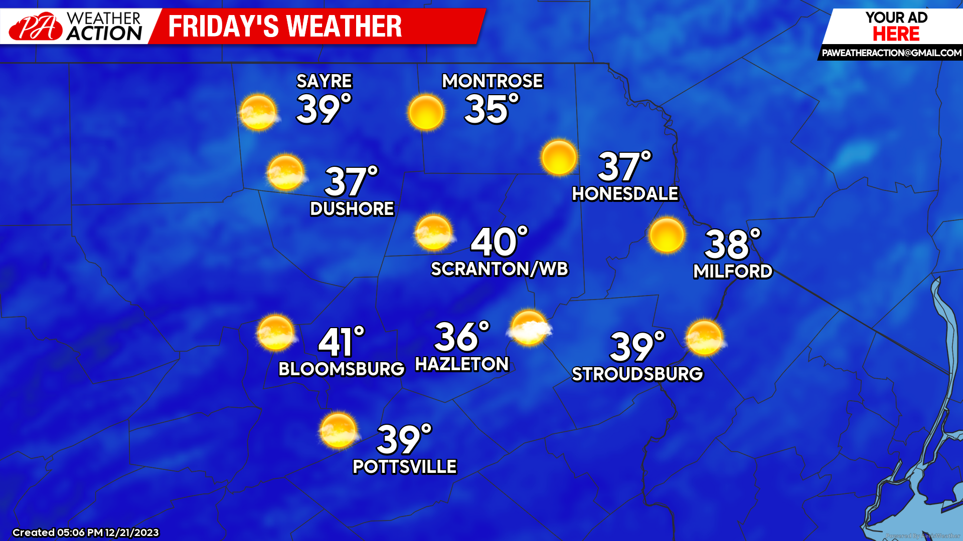
FRIDAY
A Canadian surface high will deliver slightly cooler, more-normal temperatures for tomorrow. An approaching disturbance will induce clouds over our area very late in the day or Friday night.
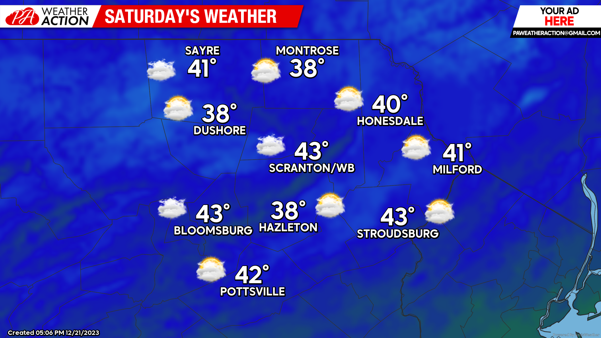
SATURDAY
The approaching disturbance will result in a cloudy day with slightly above-normal temperatures across the area.
That disturbance will pass over our area Saturday evening, delivering a few light rain showers Saturday night after sunset, with freezing rain possible in the higher elevations. Total amounts should be under a tenth of an inch.
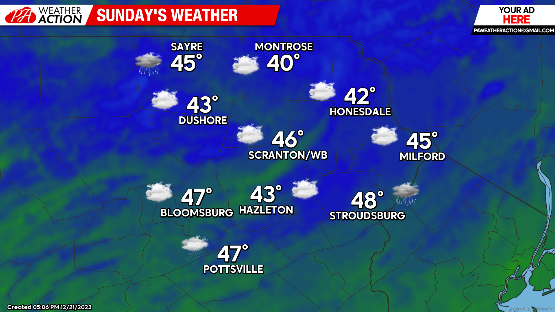
SUNDAY
Christmas Eve will be a mostly cloudy and mild day after perhaps a few leftover morning showers in the eastern part of the area.
HOLIDAY WEEK
CHRISTMAS DAY will feature variable clouds with much-above-normal temperatures. Max temps will soar well into the 40s for everyone, and even into the 50s in the valleys of the southern part of our area!
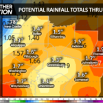
A strong storm system will develop over the central US this weekend into early next week, drawing a soaking rain into our area late Tuesday through Wednesday, along with a continuation of much-above-normal temperatures. The system will move into Canada by Thursday, subsiding the soaking rain into lingering snow showers for Thursday and circulating more-normal temperatures into our area to finish the week.