


A period of light snow is expected late Monday night into Tuesday morning for the area. Although snow amounts will be on the light side, it is a very tricky forecast to pinpoint where the greatest snow amounts will fall. So please note this is a first call forecast and that we will have a final call posted tomorrow evening.
Snow will overspread Western Pennsylvania first likely after 9:00 PM Monday night. Below is the NAM model valid for 1:00 Tuesday morning: 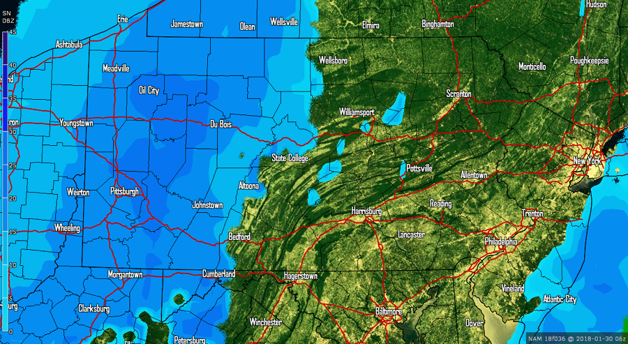 The snow will push west to east initially, then will push more southeast as we head later into Tuesday morning. This will result in Eastern Pennsylvania receiving less snow than many areas in Western and Central Pennsylvania. Below is valid for 7:00 AM Tuesday Morning:
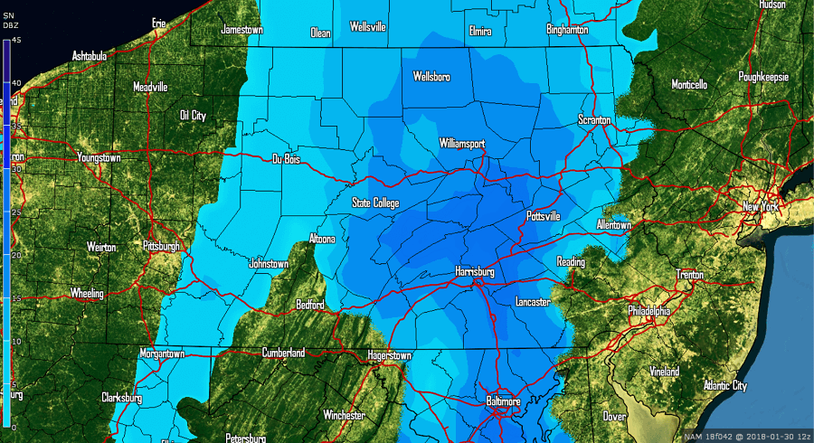
We stress that this system will be a quick hitter. Most areas will see about a 6 hour period of light snow. However, because of the timing, the Tuesday morning commute to work and school will be impacted especially for areas in Central Pennsylvania.
Taking the same model out to 1:00 PM Tuesday afternoon, the only snow remaining is across far Eastern Pennsylvania and exiting the region: 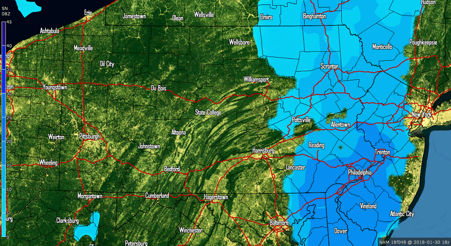
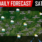
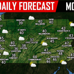
FIRST CALL SNOW FORECAST MONDAY NIGHT 1/29 INTO TUESDAY MORNING 1/30:
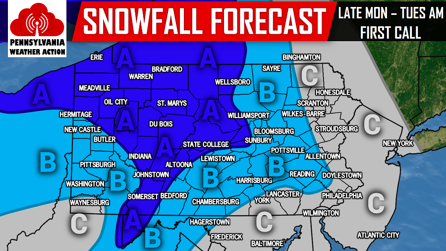
Area A: These areas will see the heaviest of the snow that does fall. 2 to 3 inches of snowfall is expected. Tuesday morning commute will likely be impacted.
Area B: 1 to 2 inches of snowfall is expected. Tuesday morning commute will likely be impacted especially for Central Pennsylvania areas because of timing.
Area C: A coating to 1 inch of snowfall is expected.
This is a challenging forecast, so please stay tuned to our final call tomorrow evening. Also, this is not our only chance of snow this week. There will be another opportunity by Friday and potentially another opportunity next Sunday into Monday. Be sure to have our Facebook page liked to stay updated, click here>>>Pennsylvania Weather Action’s Facebook Page
Do not forget to share this forecast with your family and friends using our icon below!
You must be logged in to post a comment.