Posted inArticle Flash Flooding Heavy Rain Tropics
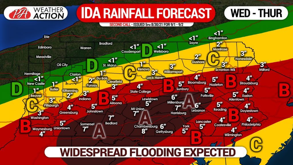
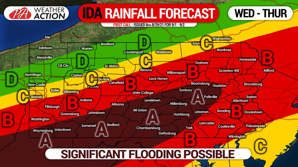
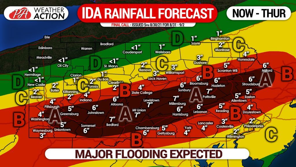
FINAL CALL RAINFALL FORECAST: Major Flooding Imminent as Remnants of Ida Likely to Dump 5-8″ of Rain for Many
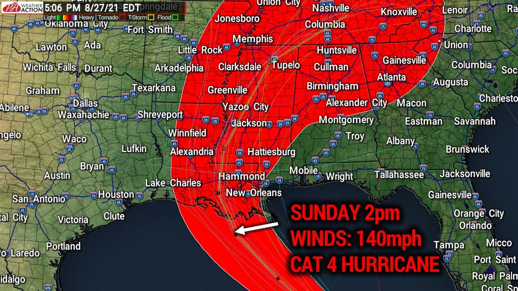
Scattered heavy rain has already begun in parts of the state as this 24-36 hour deluge is just about to get going. Moderate to major…