

A cold Canadian surface high settled into the region today and was responsible for the sunny sky and light wind we experienced. It will also be partially responsible for a period of mixed precipitation we will enjoy Tuesday afternoon.
Tonight will feature cloudy conditions as warm air ahead of advancing storm system streams northward high above our heads. Down here at the surface, we will experience varying degrees of temperatures in the 20s overnight.
TUESDAY
As that strong storm system moves into the Great Lakes region, precipitation will arrive in our area during the afternoon and begin as a wintry mix. Some of the higher elevations could see a coating of snow, perhaps even some measurable amounts near the NY border. However, the wind a few thousand feet above our heads will be screaming from the south and will drive enough warm air into our region to quickly change everyone to rain. The colder surface air will help shield us from that strong wind, but gusts of 35mph will eventually work downward toward the surface late in the afternoon, especially across the higher elevations. Temperatures will slowly climb into the upper 30s and low 40s by evening.
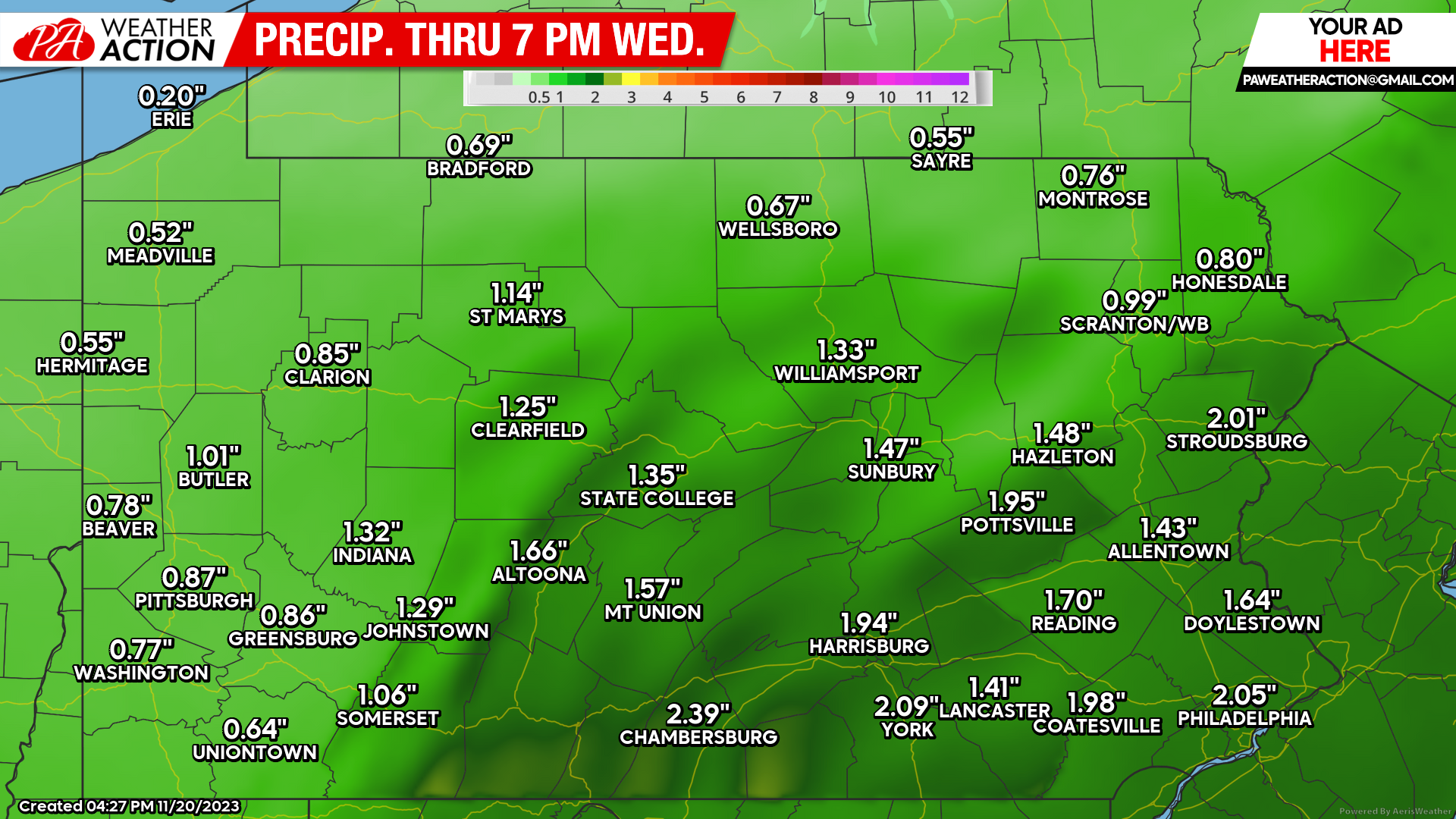
Tuesday night will feature windblown rain with temperatures continuing to climb well into the 40s. Wind gusts will be in the 30-40 mph range, especially across the higher elevations. The valley locations will be more protected and thus experience lower wind gusts. Total rainfall amounts will be close to an inch for most of the area, although the southern counties could receive as much as 2″ from this storm.

WEDNESDAY
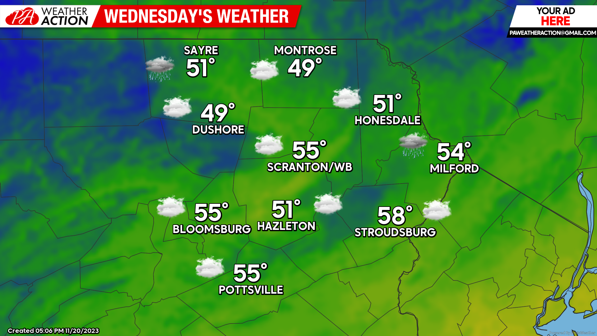
The system will exit our area, with rain ending during the morning followed by decreasing wind, and temperatures reaching into the 50s. However, clouds will cover the area most of the day and there could be isolated sprinkles. Clouds will continue through Wednesday night, with wind increasing and gusts 30-40 mph from the west after midnight. Temperatures will only fall into the 30s.
THANKSGIVING
A surface high will move into our area, providing dry and windy conditions. Wind gusts will be around 30 mph, subsiding in the evening. Enjoy!

FRIDAY-SUNDAY
At this time the rest of the holiday weekend looks dry with slightly below-normal temperatures. Max temperatures will generally range from the mid-upper 30s in the higher elevations and the low-mid 40s for the valleys. Overnight lows will be in the 20s.
You must be logged in to post a comment.