
Winter is beginning to show up in Pennsylvania and we are starting with an appetizer in the form of a somewhat surprise light snow event in Northern and Eastern PA. A few festive flakes were around the area, today but a round of snow Thursday will cause some travel headaches, and of course some joy for those who were cheering for snow during the holidays.
A clipper system will dive southeast from Ontario in Western New York, and then into our neck of the woods. Not everyone in Pennsylvania will receive snow, but those who miss out may have another chance Sunday night into Monday. Although there’s still a lot to work out with that tricky system so let’s take it one day at a time.
SNOW TIMING
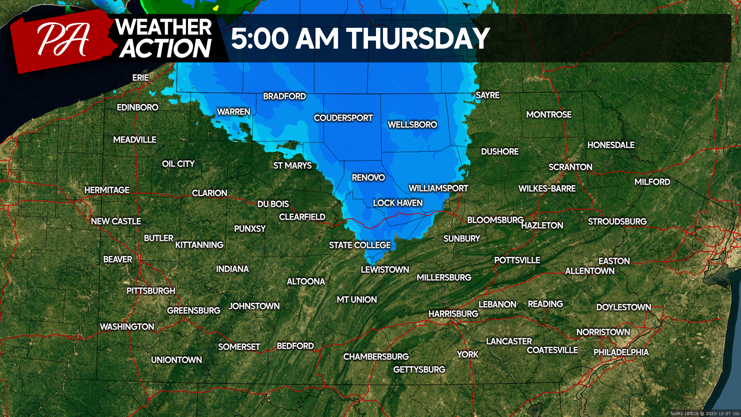
Light to moderate snow will push into North Central PA by the pre-dawn hours of Thursday morning. Temperatures there will be in the mid to upper 20s, so snow will have no problem accumulating on all surfaces. Take it slow and steady Thursday morning. Below is Hi-Res NAM Future Radar for 5:00 AM Thursday.
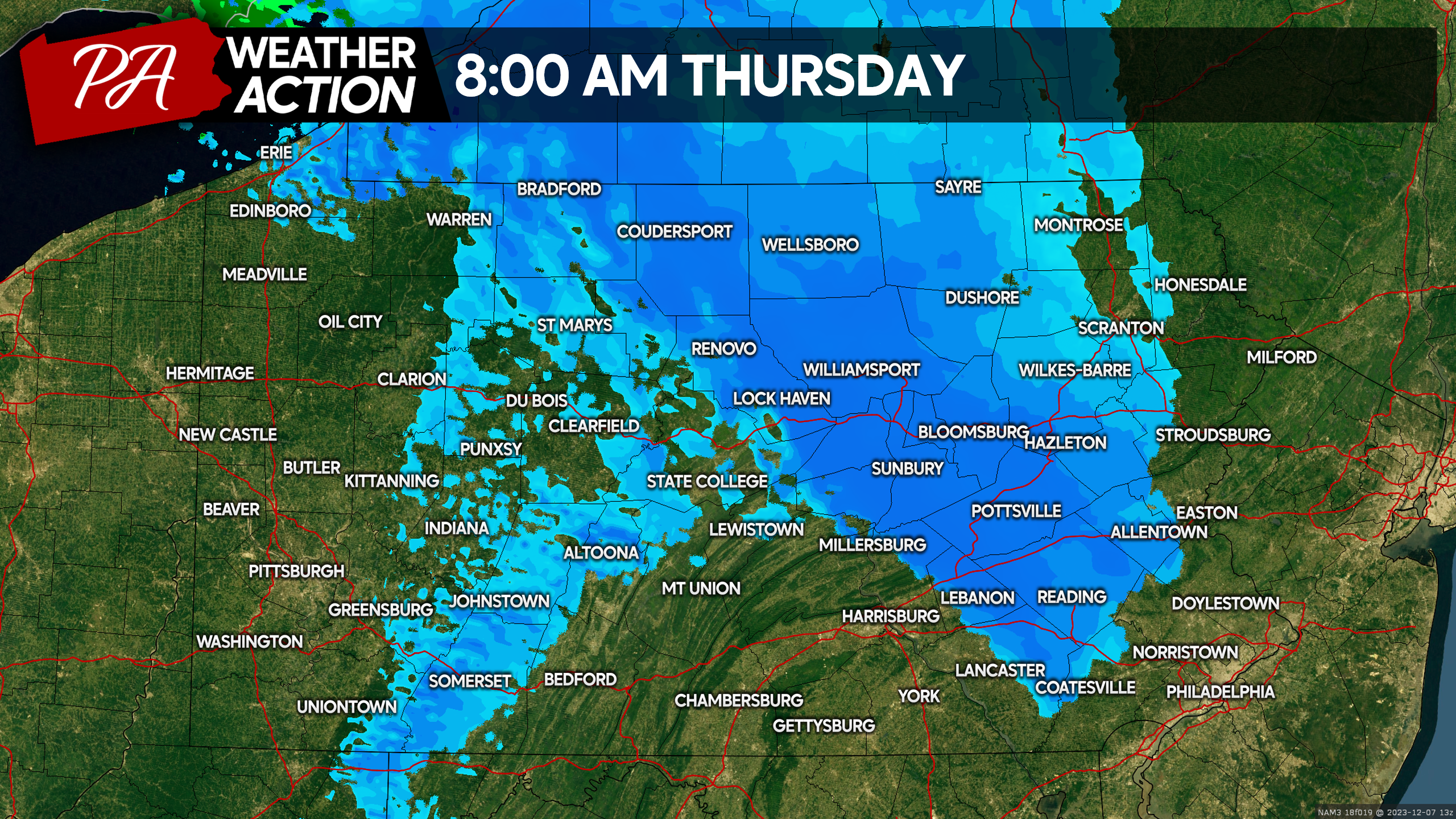
Light to moderate snow will quickly overspread the Central Susquehanna Valley, Coal Region, and I-78 corridor in PA by 8:00 AM Thursday. With temperatures still below freezing even in the valleys, accumulation on roadways is a concern. It may be smart to head into work a little earlier than normal in these areas, before the snow causes any issues. Here is Hi-Res NAM Future Radar for 8:00 AM Thursday.
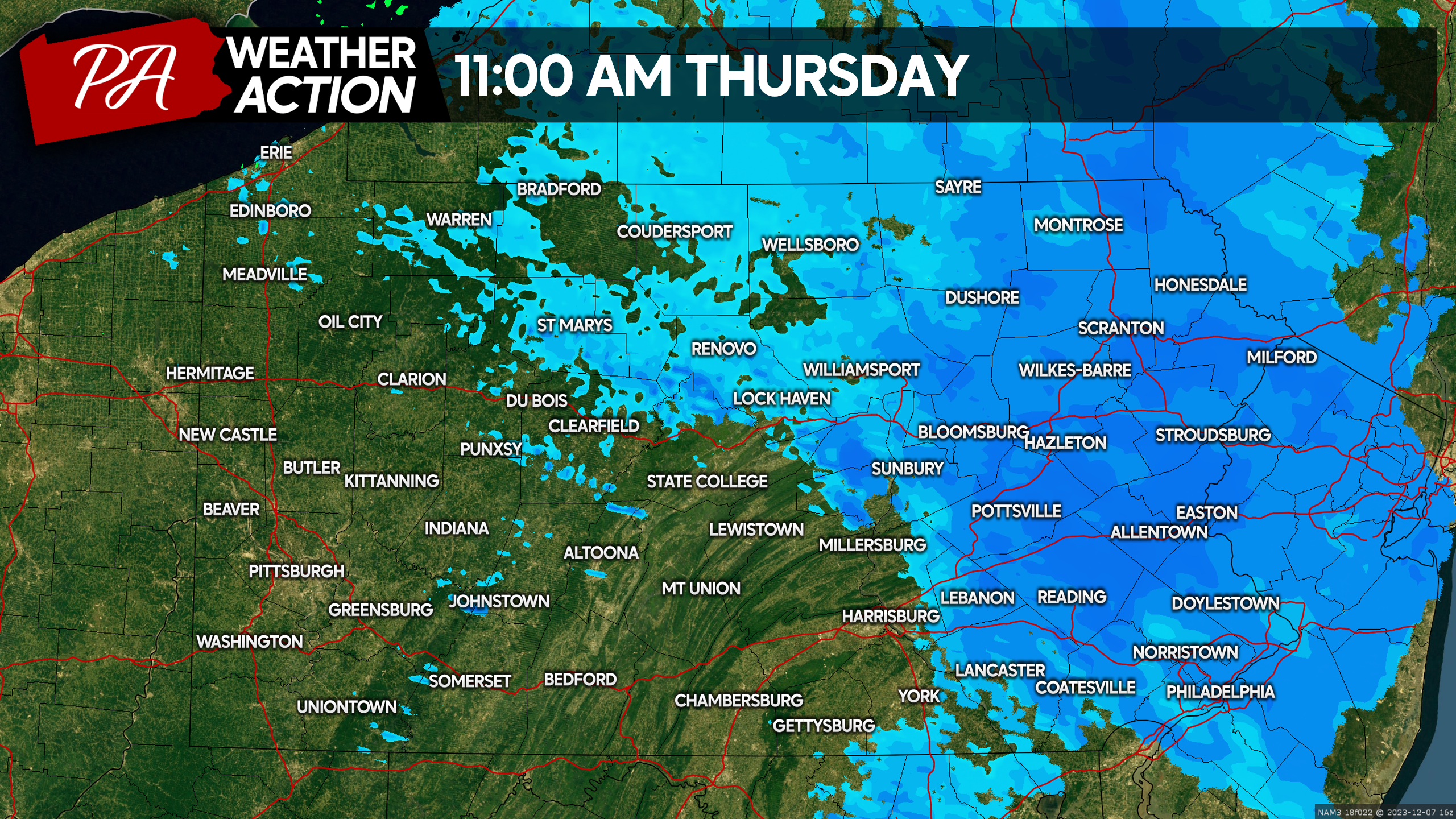
By lunchtime Thursday, snow will be exclusive to Eastern PA, having nearly entirely wrapped up in Central PA. Temperatures around lunchtime will be right around 32-33° in the valleys and 30-31° in the mountains, meaning roadway impacts are still expected everywhere. Crews shouldn’t have a problem keeping primary roadways clear, but the local streets may be slippery. Below is Hi-Res NAM Future Radar for 11:00 AM Thursday.
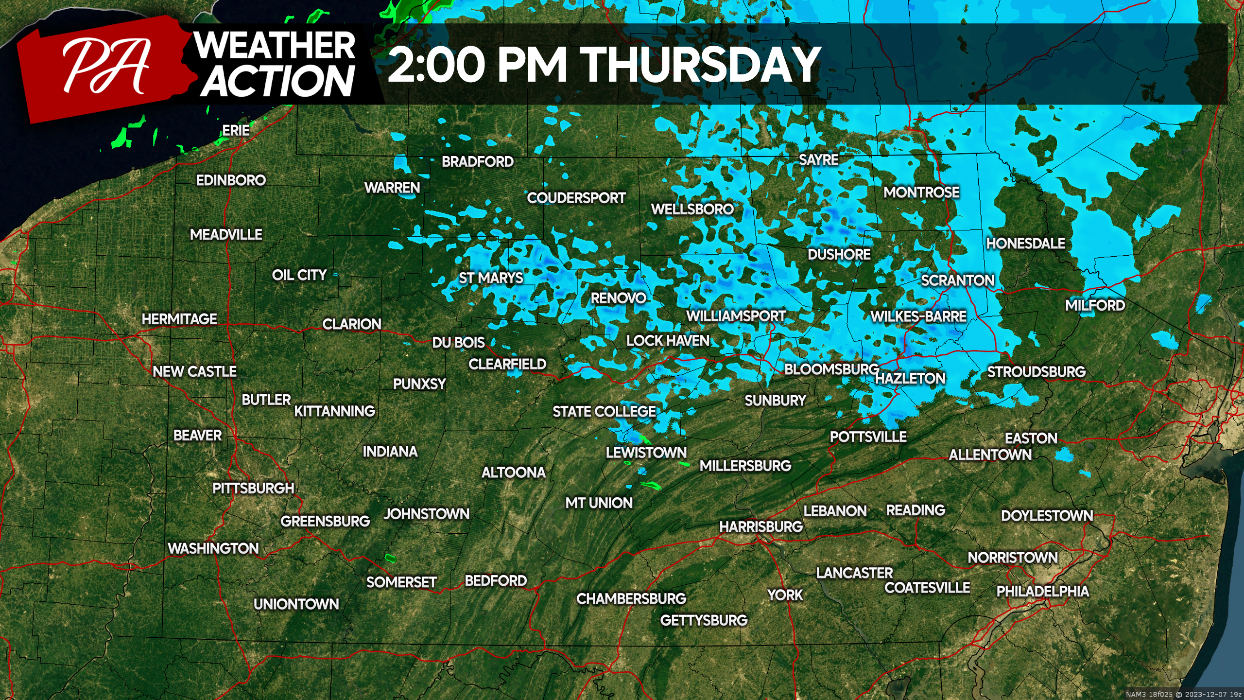
Snow bands will rapidly weaken after noontime Thursday, and by 2:00 PM we should just be left with some lake effect flurries and cloudy skies. This means the PM commute should be clear, but if you travel over mountaintops, take it slow up there. Here is Hi-Res NAM Future Radar for 2:00 PM Thursday.
FINAL CALL SNOWFALL FORECAST FOR THURSDAY 12/7/23
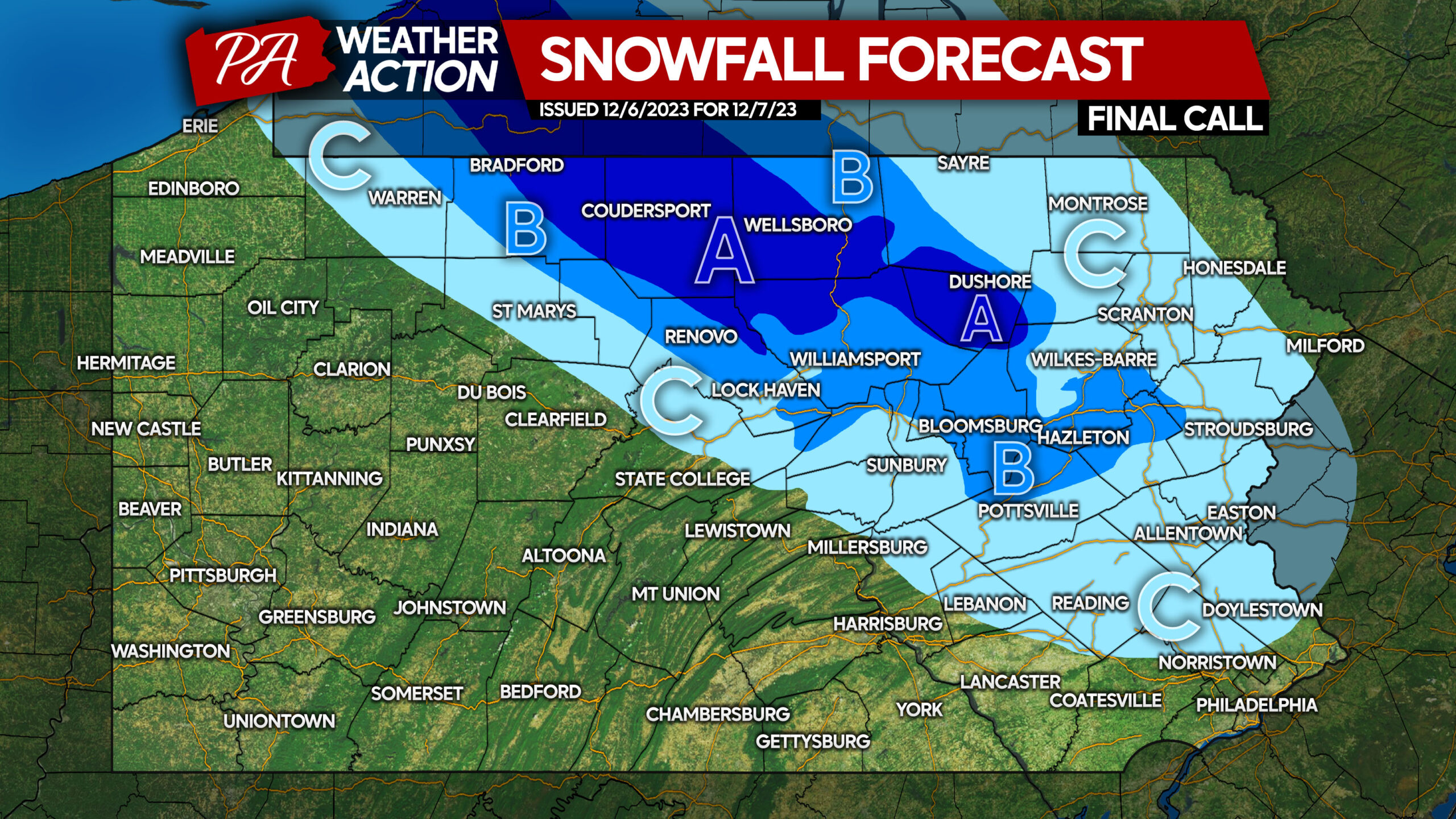
Area A: Snow accumulation of 2 – 3″ expected. Snow-covered roads are expected Thursday morning and early afternoon.
Area B: Snow accumulation of 1 – 2″ expected. Slippery travel is expected Thursday morning and early afternoon.
Area C: Snow accumulation of less than 1″ expected. Slippery travel mainly on side streets expected Thursday morning and early afternoon.
Don’t forget to share this forecast with family and friends, as it is a surprise event that hasn’t been covered much!
Stay ahead of the snow all winter long and really get into the fun of winter storm tracking with PA Weather Action Pro! All our First Call Snowfall Forecasts will be exclusive to subscribers, and it’s just 99 cents the first month! It’s a great idea for those in a line of work affected by weather, or if you’re simply enthusiastic about weather! You will be emailed when we update, and you will be invited to ask questions on a live stream with us before storms! Subscribe below!
[dt_divider style=”thick” /]

You must be logged in to post a comment.