
Good afternoon! I hope everyone has had an enjoyable week so far. The weather conditions have been pretty seasonable this week with highs on either side of the 40-degree mark with periods of snow showers and flurries. Some areas picked up a decent an inch or two of snow this morning as the warm front lifted through the region. With that said, much warmer air will flood the region as we head into the weekend, allowing for unseasonably warm temperatures and the potential for more rain.
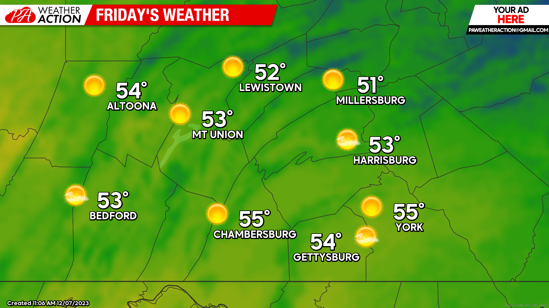
FRIDAY:
Friday will bring pleasant conditions as we wrap up the work week. Expect high temperatures to climb into the low-to-mid 50s with generally sunny conditions, although there may be periods of cloud cover during the afternoon hours. There will also be a southerly wind of 4 – 7 mph. It will be great day to get outdoors and to soak in some of the sunshine!
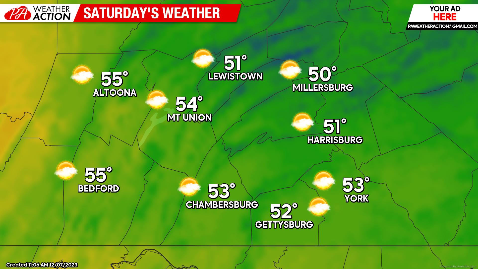
SATURDAY:
Saturday will bring very similar conditions to Friday as high temperatures will climb into the low-to-mid 50s. Expect slightly more cloud cover than Friday, with overcall cloud cover increasing throughout the day. Saturday will also be the last fully dry day of the weekend- so make sure to get outdoors before the rain moves in on Sunday!
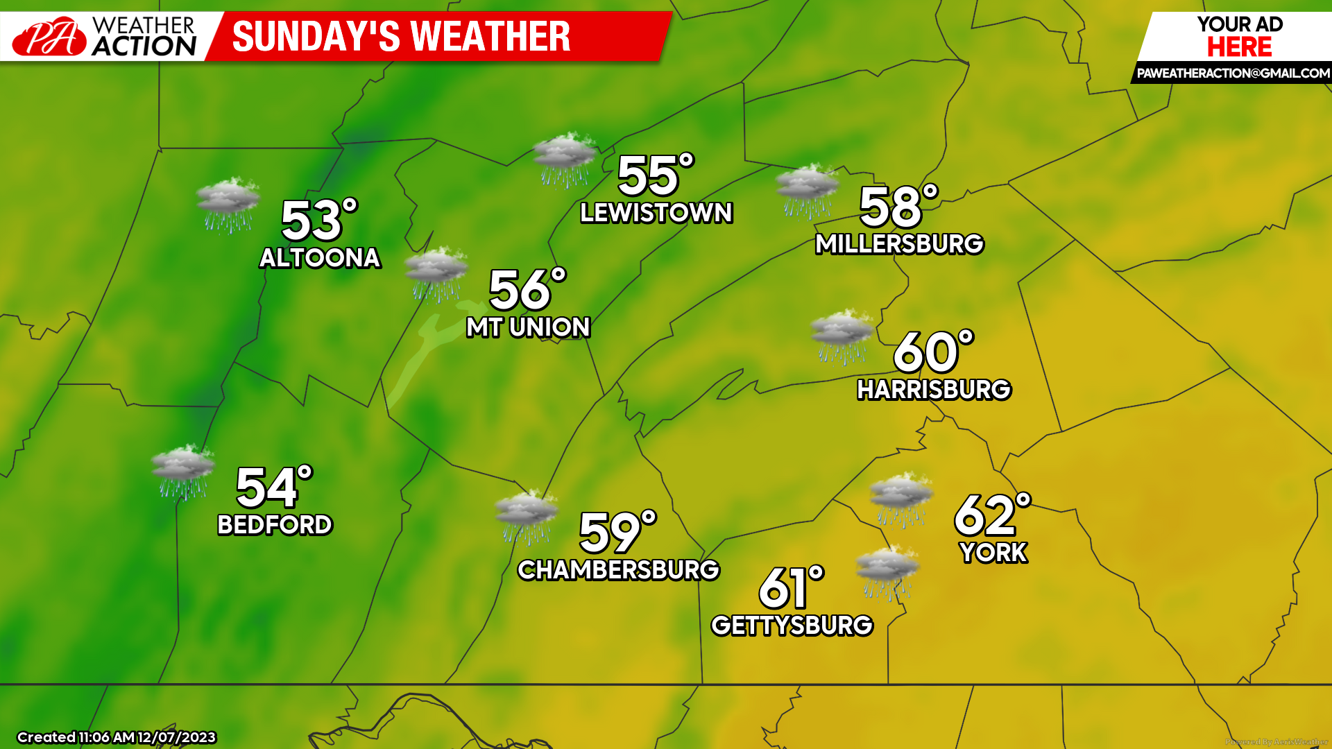
SUNDAY:
Sunday will bring changes to the entire region as a low pressure system moves into the region. Showers will overspread the area in the afternoon and evening hours, becoming more steady and widespread over time. Temperatures will climb into the mid-50s to low-60s as well, especially after sunset. We will also see a southerly wind of 5 – 10 mph with gusts occasionally up to 20 mph.
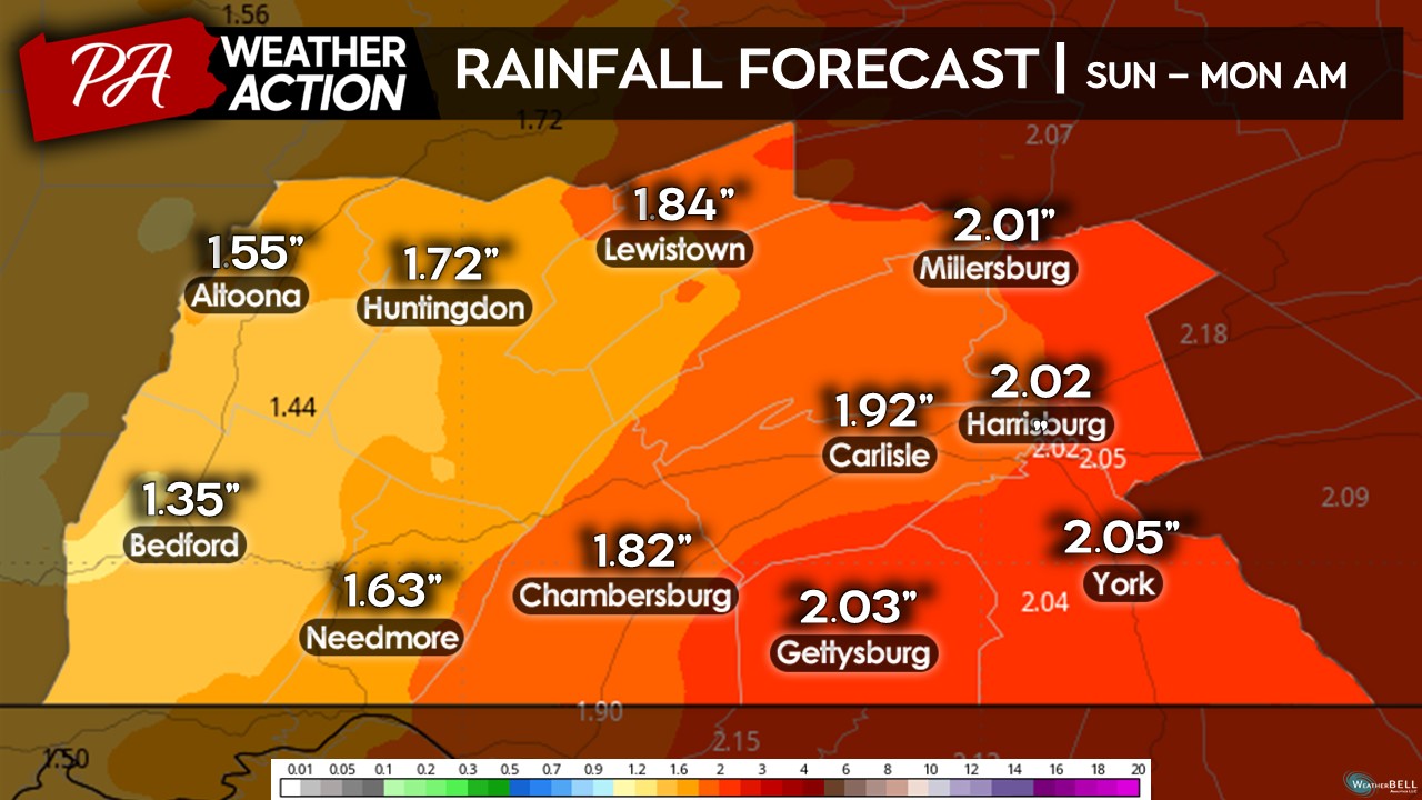
 Expect total rainfall amounts to range between 1.50-2.00″ across the area. These rainfall amounts will be very beneficial as we climbing out of a drier-than-normal pattern that persisted through much of November.
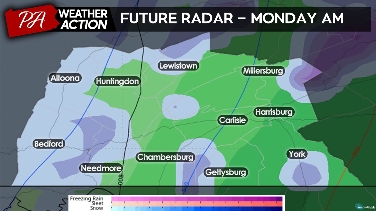
 A few areas may see some wet flakes mix in early Monday morning, especially across the western counties and higher elevations. Little to no snowfall accumulation is expected at this time.
 That is it for the weekend forecast! Enjoy the warmer-than-average conditions over the next 48 hours before the rain arrives on Sunday. Otherwise, for the majority of next week it looks to remain mostly dry with seasonable conditions. Our next storm system may not be coming until late next weekend. Stay tuned for updates by following PA Weather Action on Facebook and downloading the app.
You must be logged in to post a comment.