
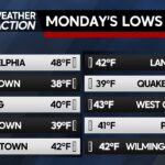
A quiet and clear start to the week with a gradual temperature increase is expected. Patchy frost cannot be ruled out for some portions of the region.
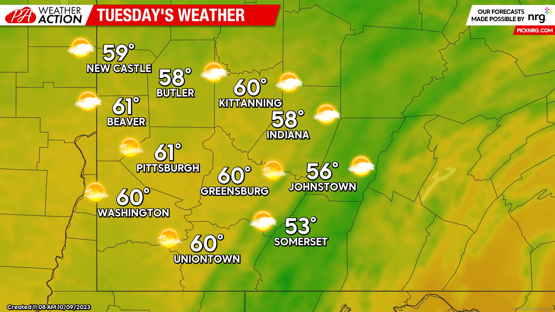
Tuesday
Patchy frost is a possibility in the valleys early Tuesday morning, especially where skies are partly cloudy, and winds are lighter. Higher elevations should see enough southwesterly breezes to prevent frost formation. During the daytime hours, mostly sunny skies can be expected throughout the region. High temperatures will range from the low 60s to the mid 50s with lows near 40 degrees, higher elevations may see low temperatures dip into the 30s. Winds will be out of the Southwest between 7 and 14 mph.
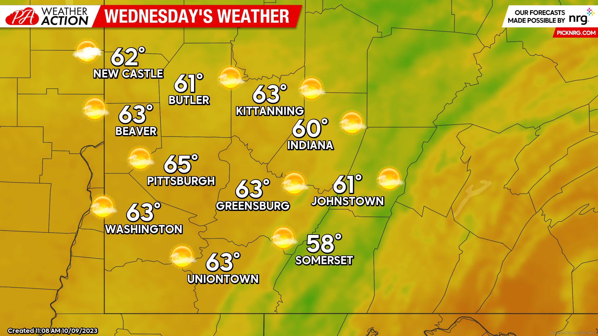
Wednesday
Another day of mostly sunny skies during the daytime hours. Highs will be slightly warmer with temperatures ranging from the low to mid 60s. Evening and overnight lows will be in the mid to low 40s. Winds will be out of the west-southwest at 7-11 mph. A slight chance for rain is expected late Wednesday into Thursday morning.
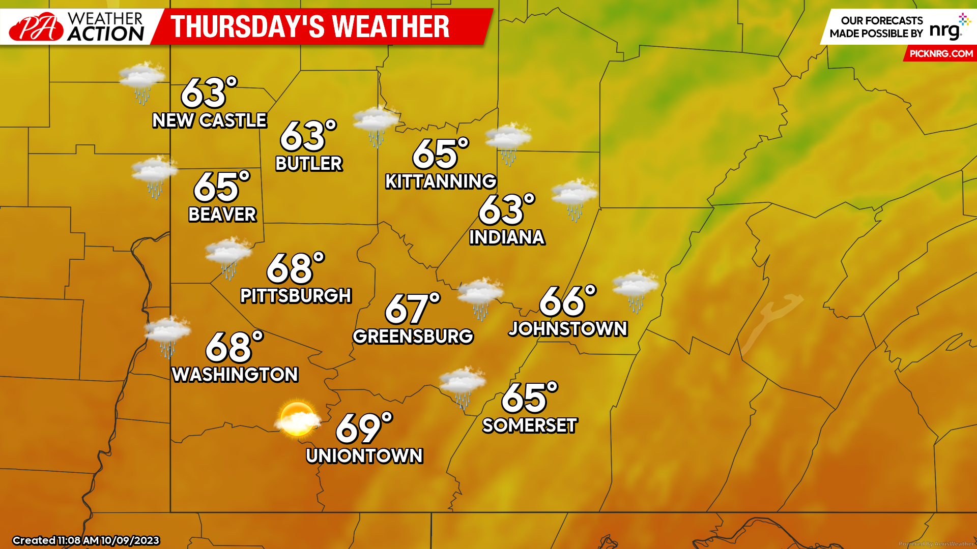
Thursday
A chance of rain will persist for much of the day. High temperatures will again be slightly warmer with highs in the mid to upper 60s and lows ranging from the low 50s to mid 40s.
A more active weekend is ahead of us. Be sure to follow PA Weather Action on social media and download the app to stay informed on all updates and forecasts.
You must be logged in to post a comment.