
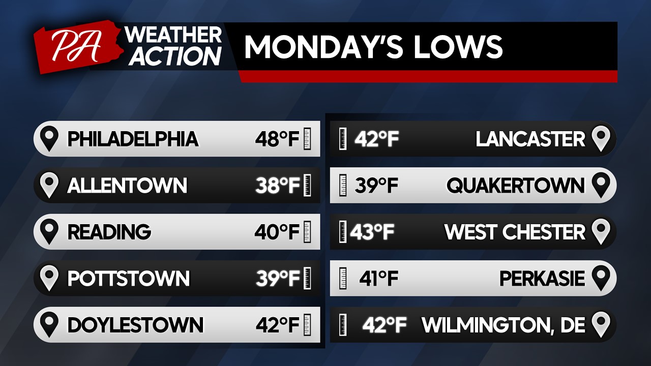
Good Afternoon Everyone! It’s sure feeling like fall out there after a strong cold front moved through over the weekend, dropping temperatures significantly off of their anomalous warmth last week. Some northern parts of our region started in the 30s this morning, making it the chilliest morning since mid-May, a sure sign of the seasonal transition underway.
Over the weekend, we saw a strong closed low develop over Quebec which has ushered in the chilly air mass. This low is expected to stay in place through mid-week keeping our temperatures cool and scattered cloud cover in place.
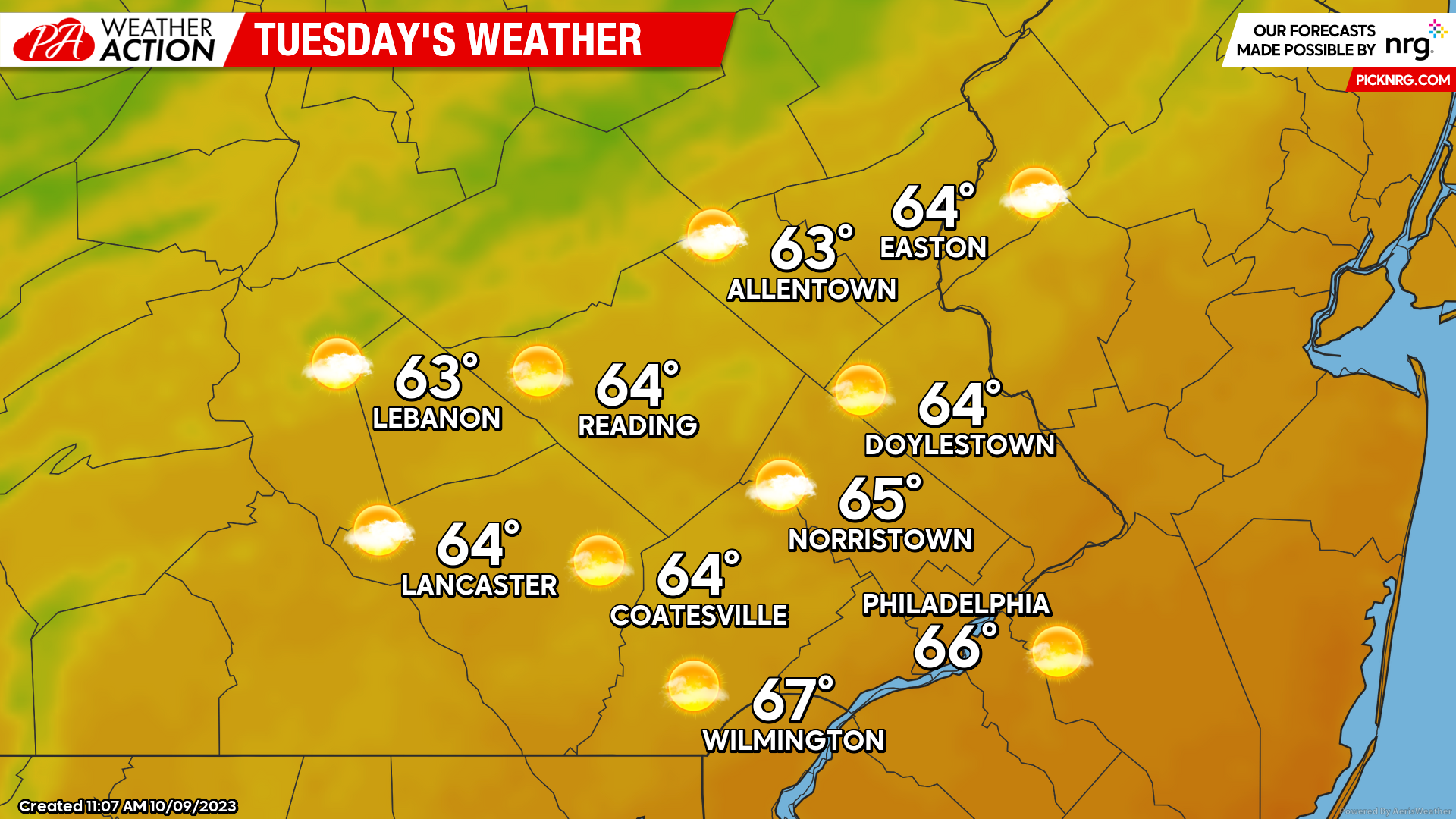
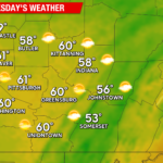
Tuesday
A shortwave trough rotating around the Canadian low may bring some scattered showers before sunrise on Tuesday. By daybreak, expect scattered cloud cover and chilly temperatures to start your morning. Lows should begin in the low-mid 40s. Broken cloud cover is expected to continue throughout the day with gusty winds at times. Temperatures Tuesday afternoon should peak in the mid-60s. Expect winds out of the SW at 5-10mph with gusts to 25mph.
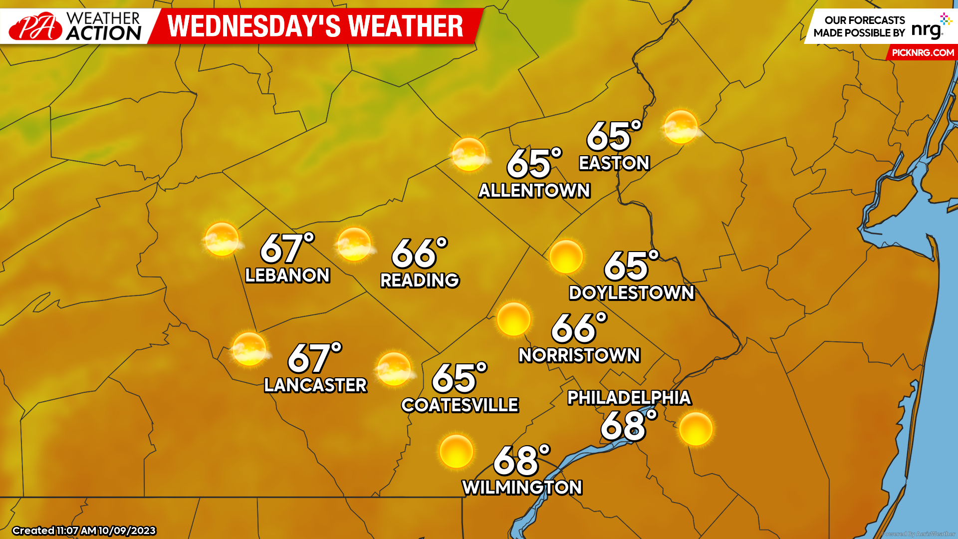
Wednesday
Quiet weather conditions are expected to continue through Wednesday as high-pressure skims the region to the Southeast. This will result in less cloud cover for Wednesday and a slight moderation in temperatures. Expect lows Wednesday morning to start off chilly once again dipping into the low-mid 40s. Highs Wednesday afternoon should peak into the mid-upper 60s under mostly sunny skies making for a pleasant October afternoon. Expect winds out of the W at 5-10mph with gusts to 20mph.
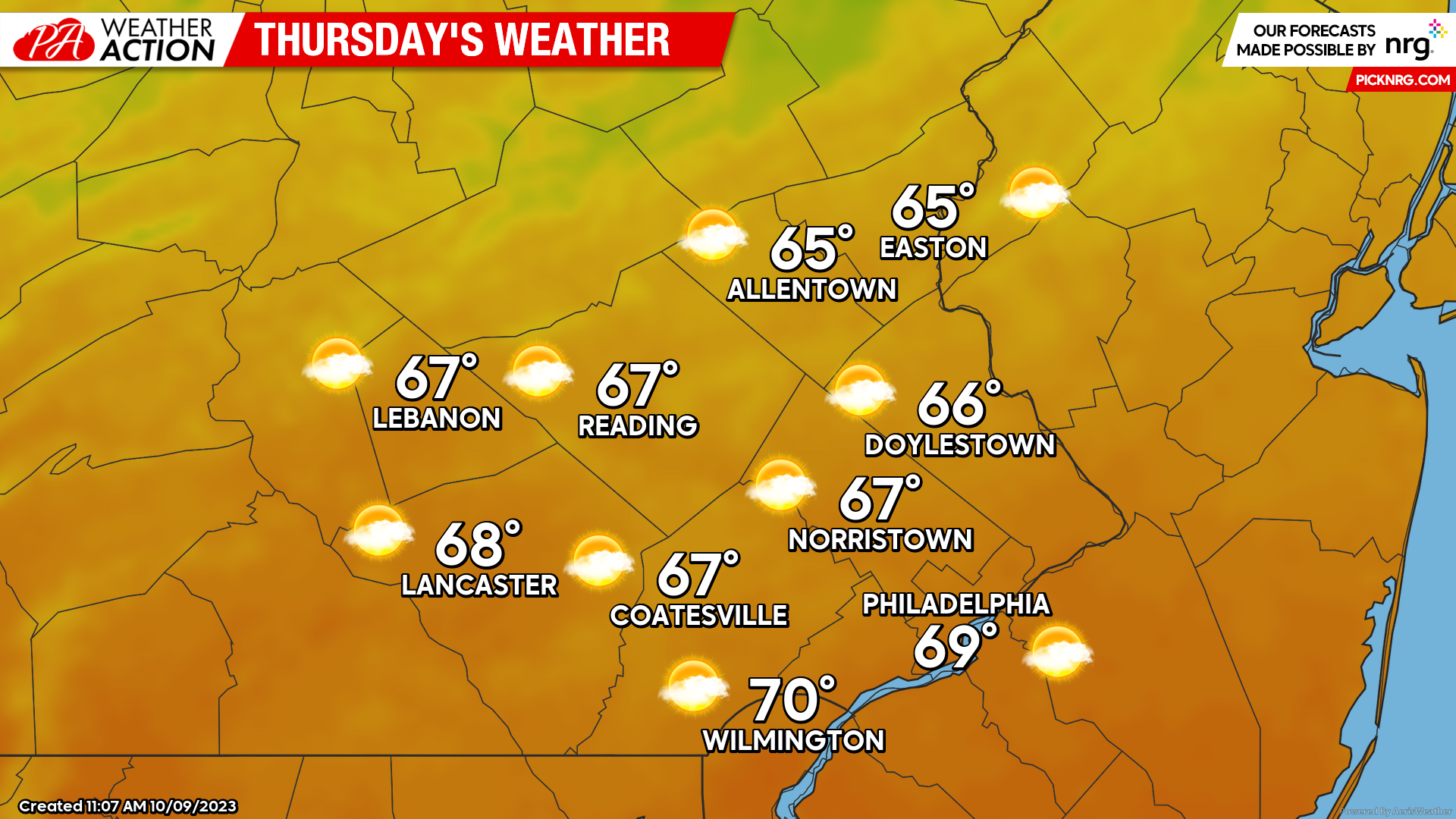
Thursday
For Thursday, a surface trough is expected to pass through the region. This will increase cloud cover for the region throughout the day, however, precipitation is not expected at this time. Expect morning lows to start in the mid-upper 40s under partly cloudy skies. Partly cloudy to mostly cloudy skies will remain in place across the region throughout the day. Highs should peak near average in the mid-upper 60s. Winds should lighten up for Thursday as well.
Looking ahead towards this weekend, a coastal low is set to develop offshore of the Delmarva peninsula, moving northeastward throughout the weekend. While uncertainty still lies in the track of this coastal low, confidence is increasing that this low will set the stage for a messy weekend. The potential for heavy rains, gusty winds, and coastal flooding are present, however, time is still needed to fine-tune the details of impacts. Expect more updates on this storm in Thursday’s blog post. For now, I hope you all enjoy the fall weather this week! If you have any questions regarding the forecast feel free to let me know!
-Michael Woytowiez

You must be logged in to post a comment.