
The passage of a low pressure center will bring cooler, drier air to the region to start the weekend.
Friday
Lingering rain showers are possible to begin the day on Friday, followed by mostly cloudy conditions. There is a slight chance for late night rain/snow showers in the higher elevations Friday night into Saturday morning. Highs will be in the high to mid 40s. A light northwest wind will shift to winds out of the west at 6 to 10 mph, higher elevations could see wind gusts approaching 20 mph. Lows will be in the mid 20s. 
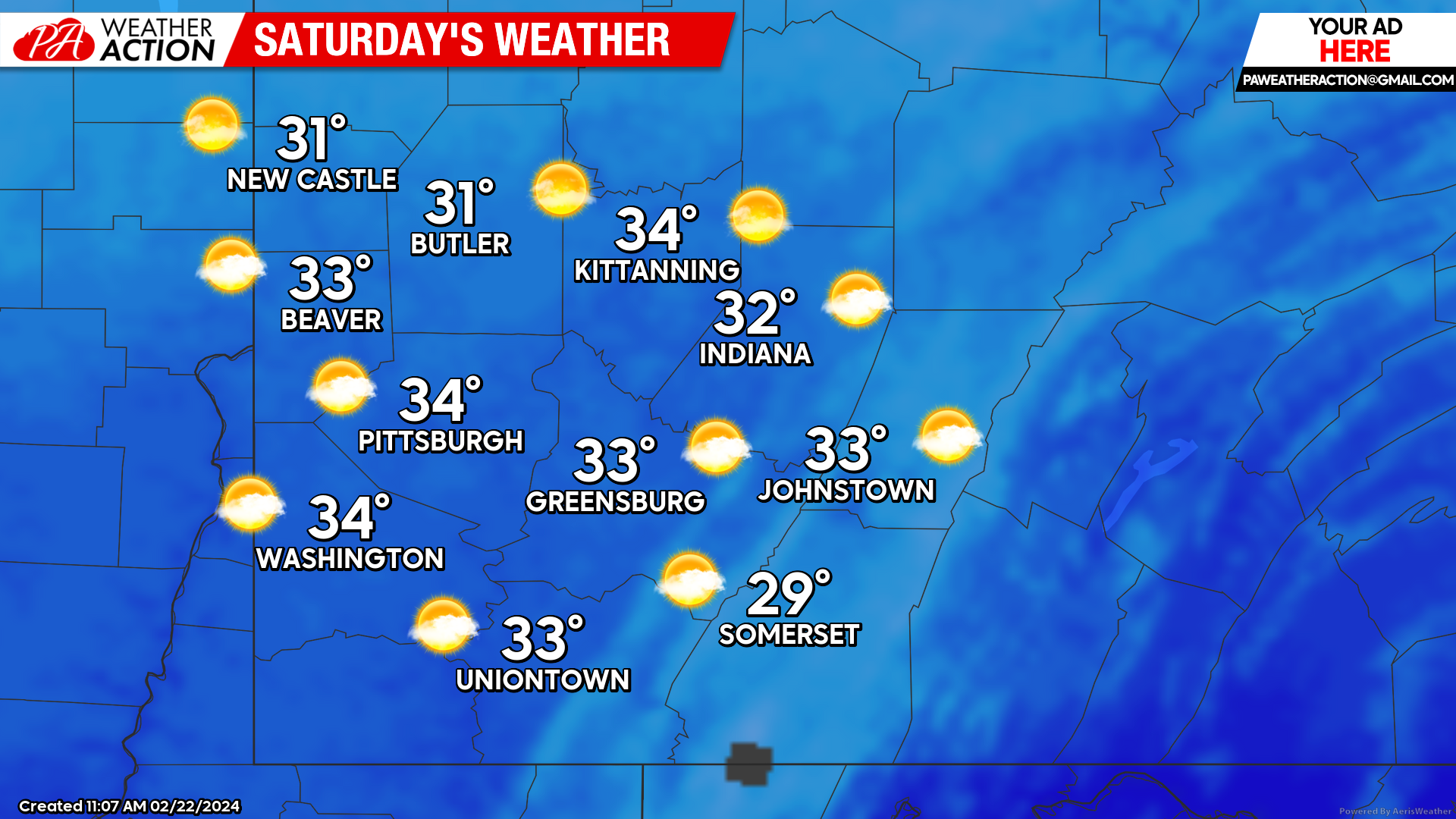
Saturday
Clear and cooler conditions can be expected throughout the region on Saturday. Highs will be in the low 30s. Winds will be out of the north-northwest at 10 to 15 mph. Lows will be low 20s to mid-teens.
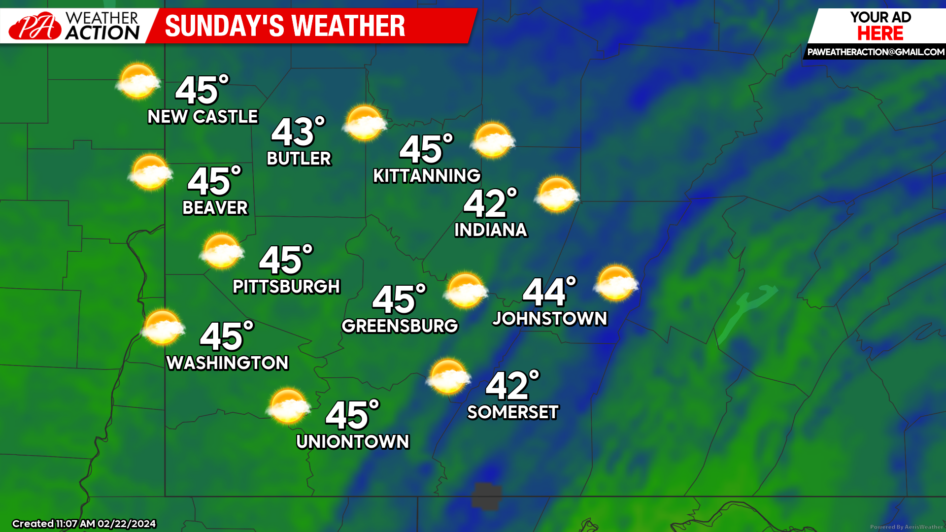
Sunday
Mostly sunny conditions will continue for the majority of the day on Sunday. There is a slight chance for rain late Sunday night into the early morning hours on Monday. Highs will be mid to low 40s. Winds will increase throughout of the day, winds will be out of the south at 10 to 15 mph, wind gusts will range between 20 to 30 mph. Lows will be in the mid to low 30s.
Warmer temperatures look to return early next week. Be sure to follow PA Weather Action for more weather updates.

You must be logged in to post a comment.