
All time high heat records dating back 60 to over 100 years will be challenged in a few days as temperatures reach the triple digits in many Pennsylvania valleys with heat indexes up to 112°. Extreme heat kills about 50 people in PA annually, more than any other weather phenomenon. Take it very seriously, especially because a heat wave of this intensity doesn’t happen every year. It’s not dramatic, there isn’t a sudden warning, it just happens.
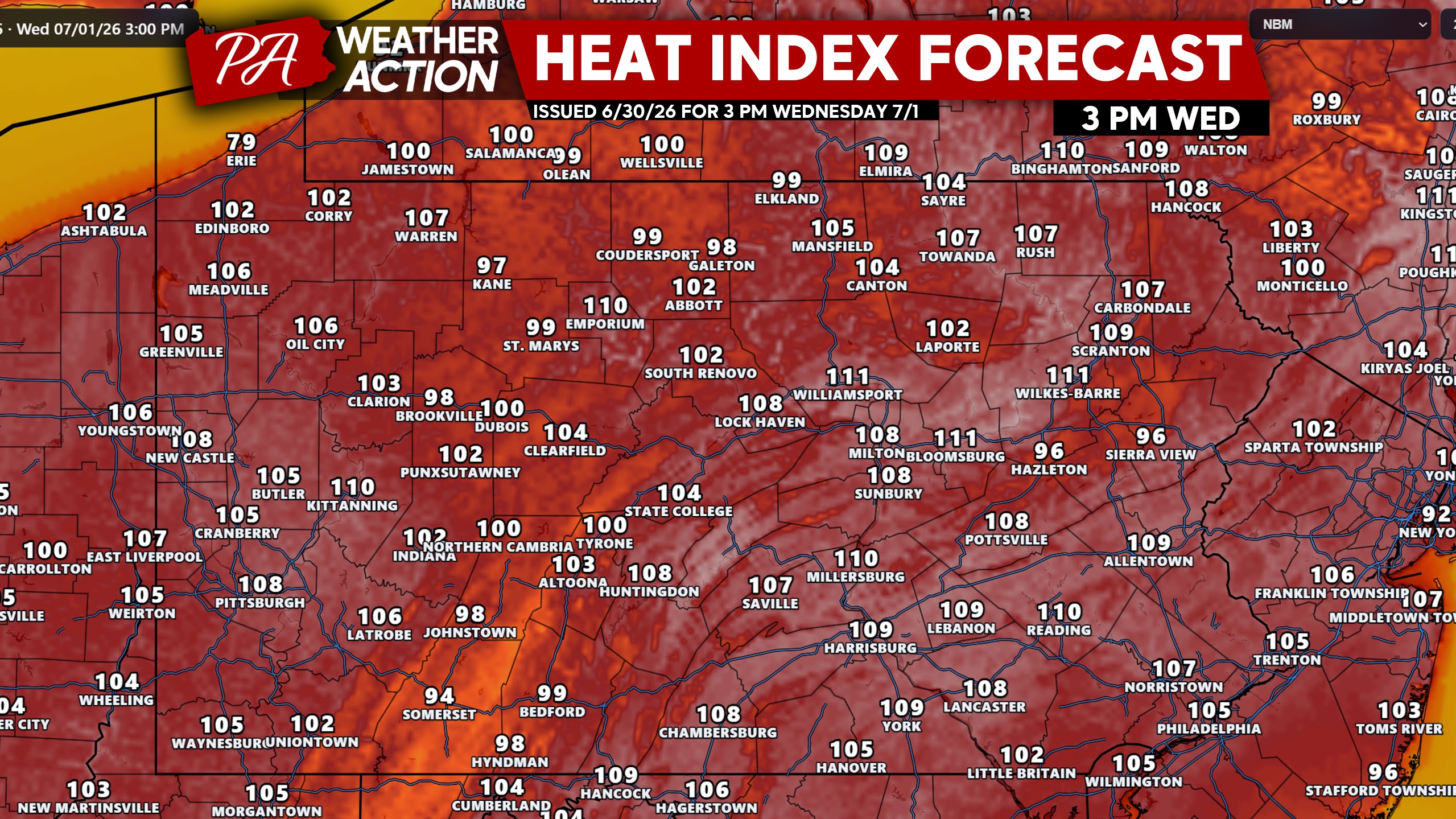
Wednesday: Heat Spreads East
Heat will intensify on Wednesday as the ridge sets up directly overhead. High temperatures in the 90s are expected with dew points in the low to mid 70s, making it feel like above 100° in most locations around PA. In addition, a few strong thunderstorms are possible in Northeast PA later in the day.
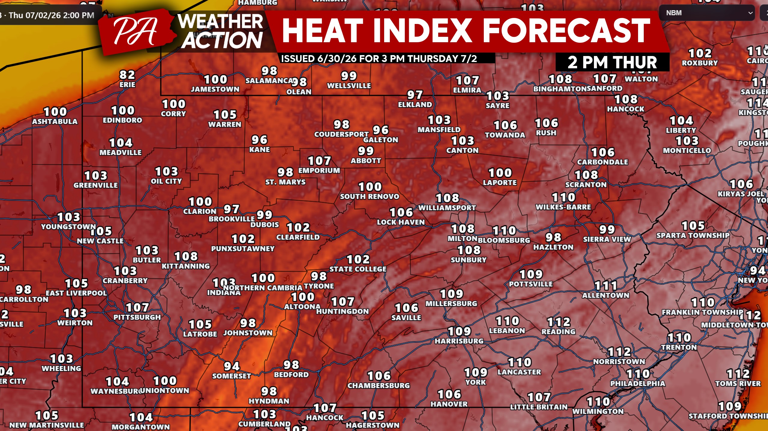
Thursday: The Worst of It
The final workday before the holiday weekend will be one of the hottest July 2nds in recorded history with high temperatures reaching and exceeding 100° in most highly-populated areas of PA with heat indexes about 10 degrees hotter. No chance of rain to cool us off either, just oppressive heat!
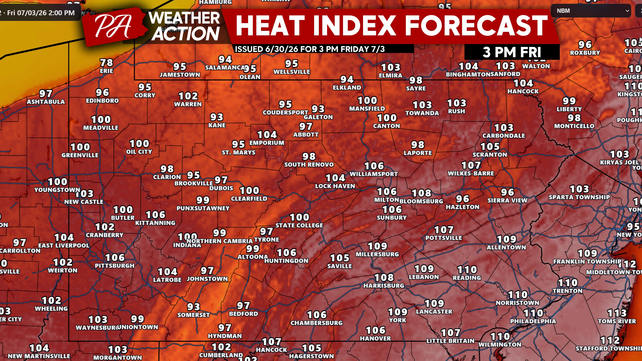
Friday: Heat Persists, Some Storms?
As the ridge begins to lose its grip, mesoscale convective systems, or cluster of thunderstorms, will work their way southeast around the ridge. Currently the thunderstorm threat is to our north, but by Friday it will drop south. We don’t think the severe threat will be exceptionally high on Friday, with most guidance showing isolated to scattered storms in the evening.
Let’s not forget about the heat, because while heat indexes will begin to lower in Northern and Western PA, they will be as stifling as ever for many of us. High temperatures will be well into the 90s to around 104° in the hottest areas, tying or beating records for a second consecutive day.
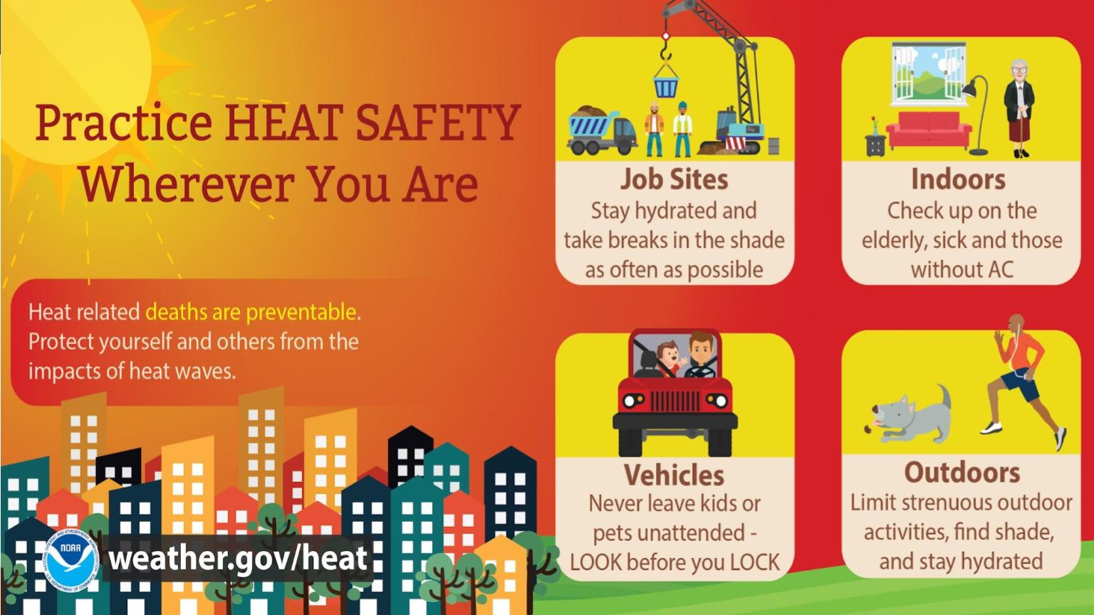
We strongly advise following these heat safety tips out of consideration for you, your family and friends, and pets!
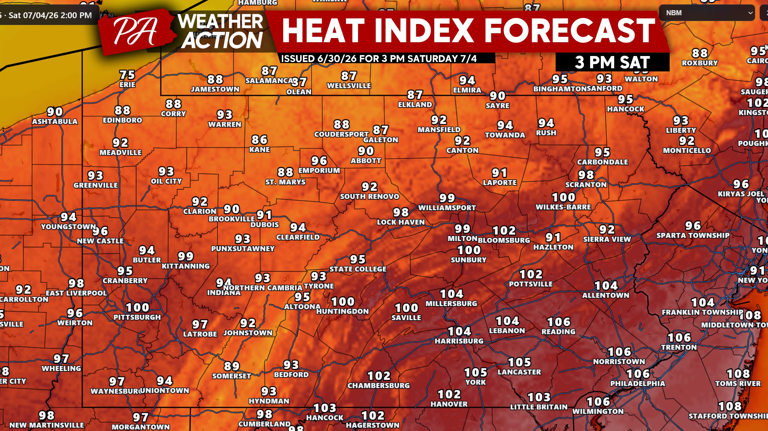
Saturday (July 4th): Severe Storm Threat
As the ridge loses its grip, the heat will very slowly begin to go down. This will not be a drastic decrease, with feels-like temperatures still in the triple digits in many of the densely-populated valleys of PA.
The bigger story will be the scattered strong to severe thunderstorms that will be a concern for the many people spending time outdoors. Along with Independence Day firework shows! It will be a day to watch the radar and alerts, because some areas will be clear for fireworks or activities like boating, while others will not be.
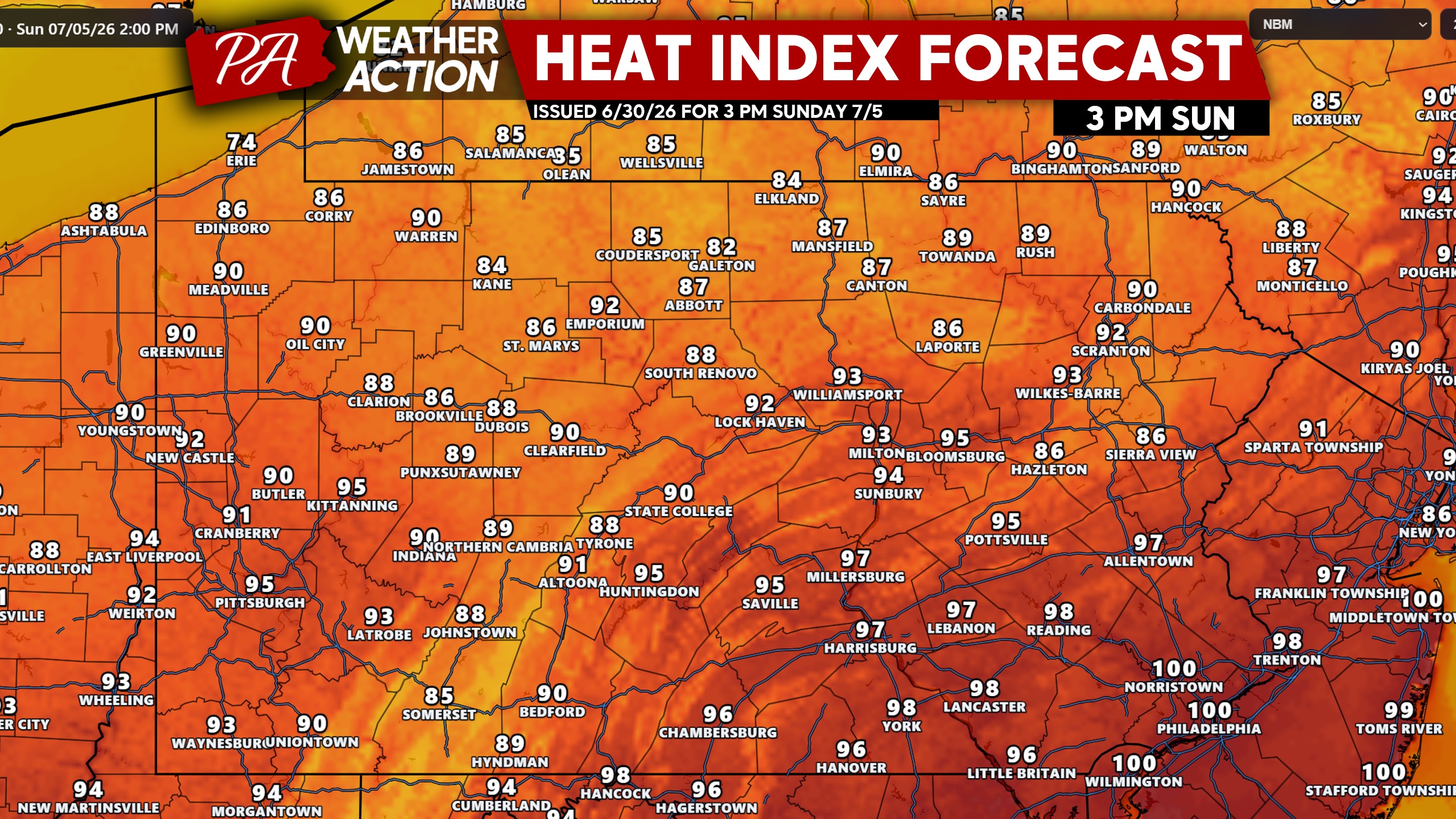
Sunday: Ridge Crushed, More Storms?
Finally by Sunday, the ridge will be crushed and heat indexes will top out in the 80s and 90s. More thunderstorms are possible, but again we are not talking about a washout by any means. More so isolated to scattered storms later in the day.
Don’t forget to share this forecast with family and friends! Heat is a silent killer, and especially dangerous on a holiday weekend when many will be outside and possibly dehydrated.

You must be logged in to post a comment.