
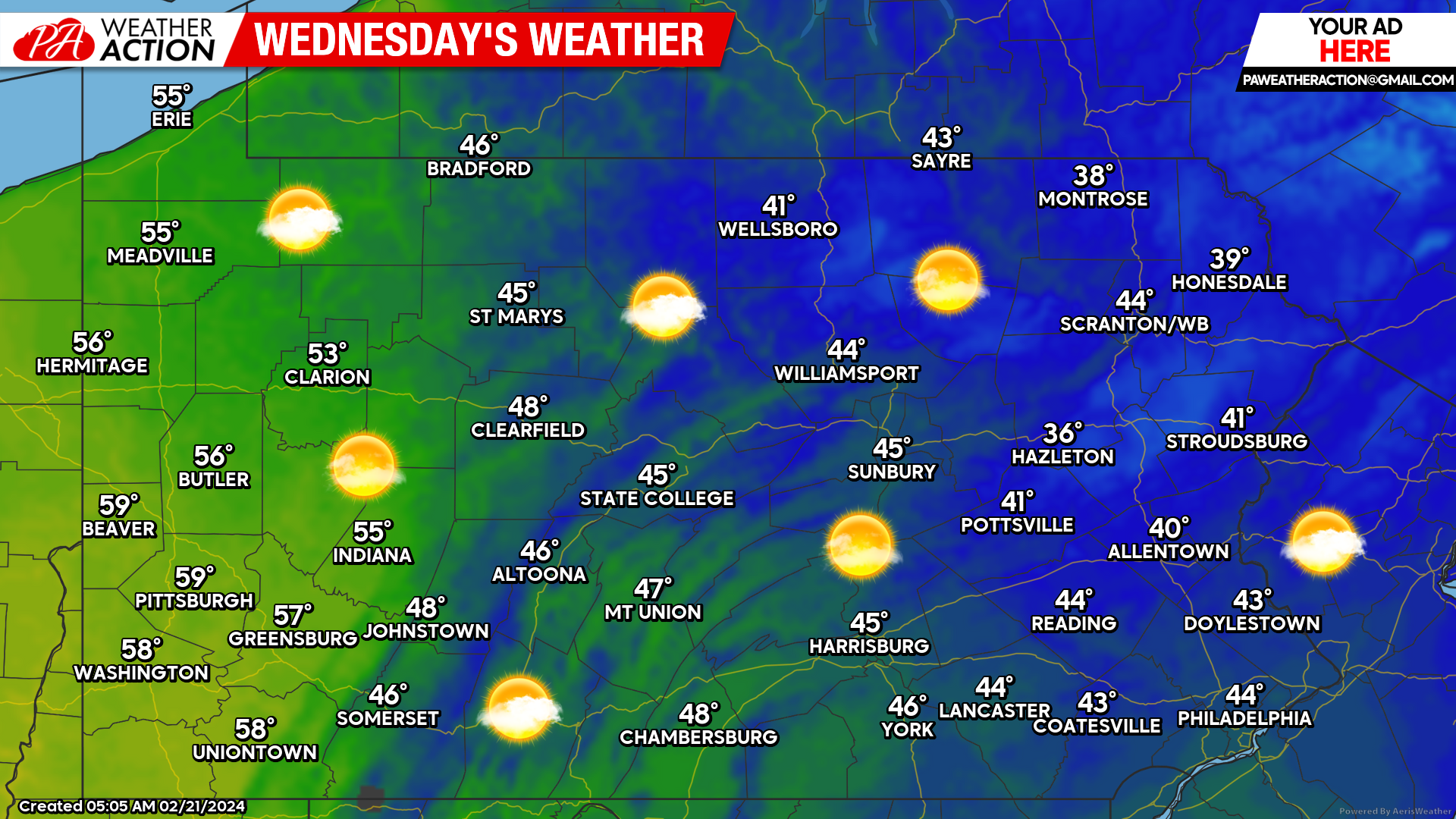
We have been on another string of sunny days recently, that that will come to a brief late this workweek, but not before one last sunny day today.
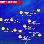
Today will remain chilly in the eastern half of Pennsylvania, but approach 60 degrees along the Ohio border! A light south breeze of 5-10mph, nothing too impactful!
And then comes the cloudy skies and rain on Thursday. Latest modeling has rain pushing into Western PA late Thursday morning, and Northern PA early Thursday afternoon. The latest Hi-Res NAM shows some risk of freezing rain, however most other guidance has just some wet snowflakes before changing to rain over the higher mountain terrain. Below is future radar from the Hi-Res NAM.
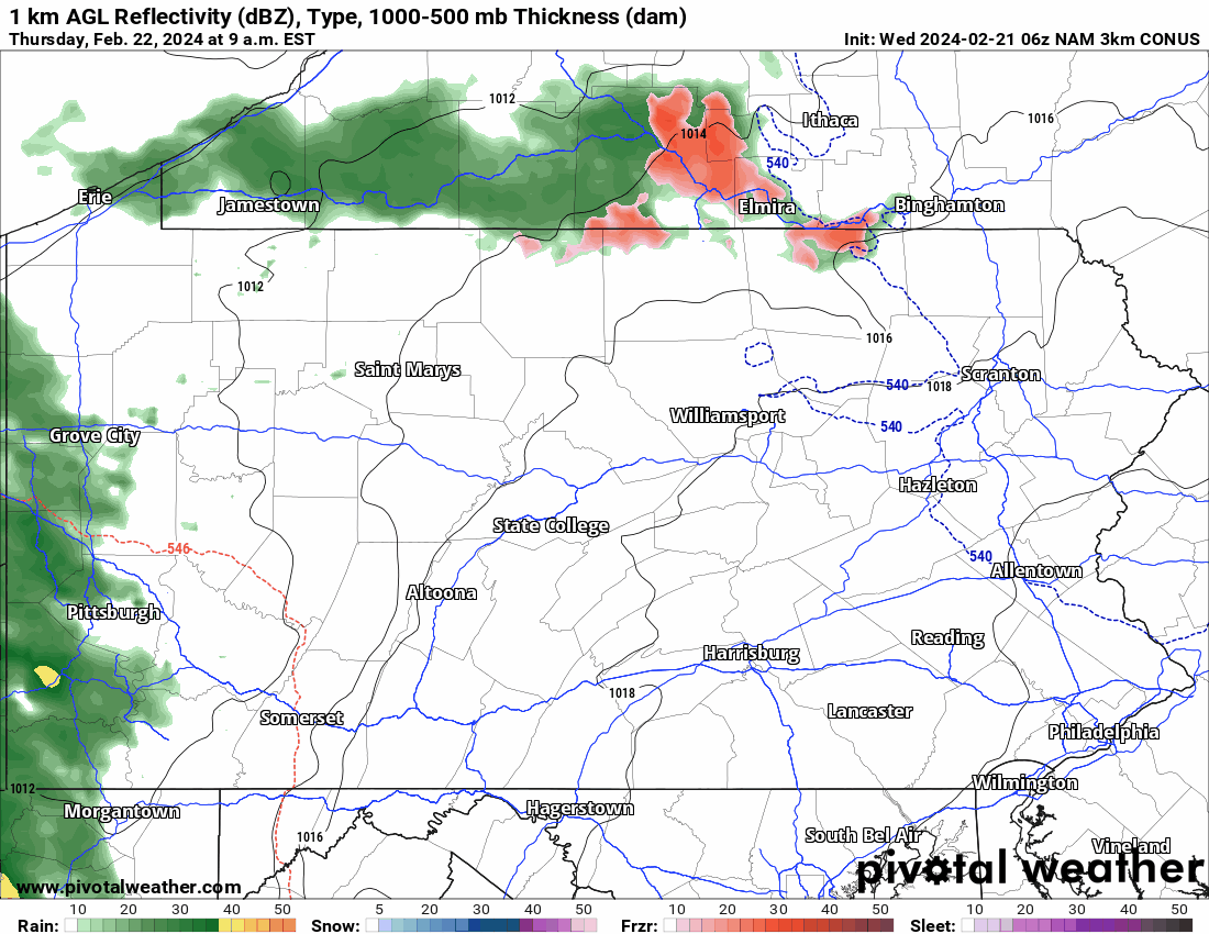
Cold air damming will result in high temperatures in the 40s Thursday across the Appalachians and 50s in Southwest PA. We are not concerned with any freezing rain, and think the wet snowflake idea over highest terrain above 2000′ elevation is more accurate.
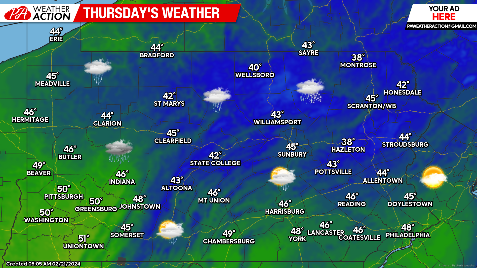
Rain will push into Central and Eastern PA Friday morning. You can view regional forecast maps for Friday and Saturday here.
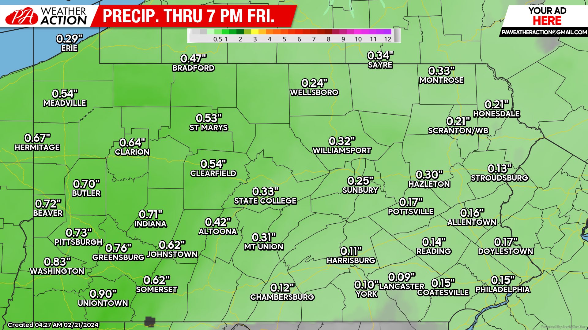
Total rainfall amounts are expected to max out between a half-inch and an inch in much of Western PA, with totals quickly falling as you head east. Below is the latest rainfall forecast map!
Our next forecast article will be Friday morning, where we will talk about the weekend! Thank you for reading!
You must be logged in to post a comment.