
After the past couple days of dry and mostly sunny weather, we have our eyes turned to the weekend as a low pressure system will track just south of Pennsylvania during the day Friday and will transfer its energy to the coast Friday night. This coastal low will enhance precipitation across the state overnight Friday into Saturday morning.
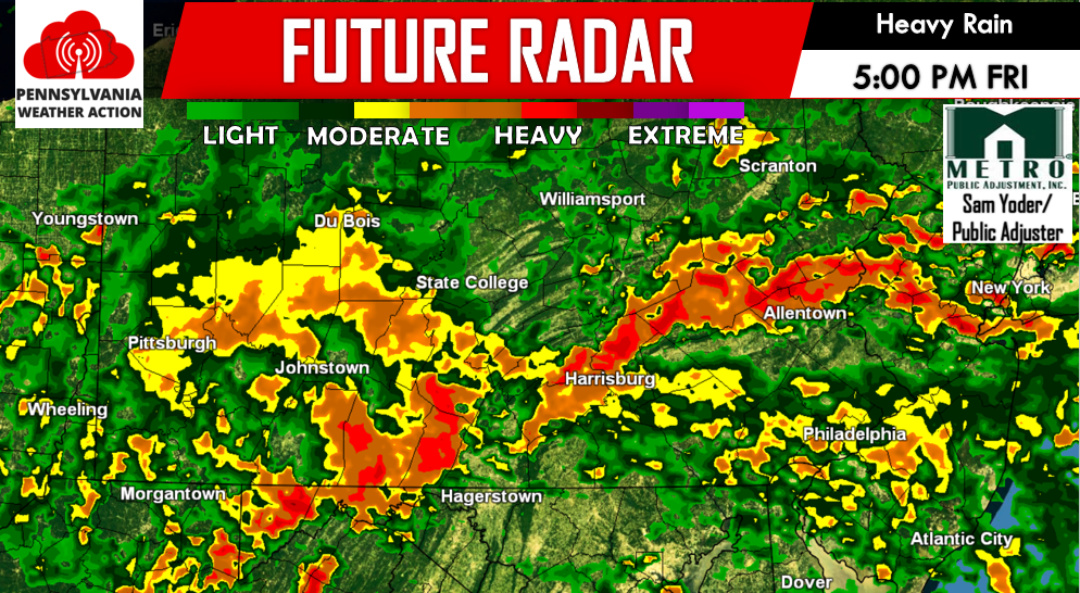
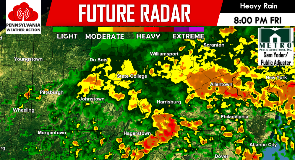
Below is our futurecast radar valid for 5:00 PM Friday and 8:00 PM Friday evening:
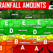
PREDICTED RAINFALL TOTALS FRIDAY PM THROUGH SATURDAY PM:
Timeline: Rainfall will begin from west to east beginning lunchtime Friday, lasting through the early morning hours of Saturday. It will be possible for rain to linger over our eastern counties into lunchtime Saturday.
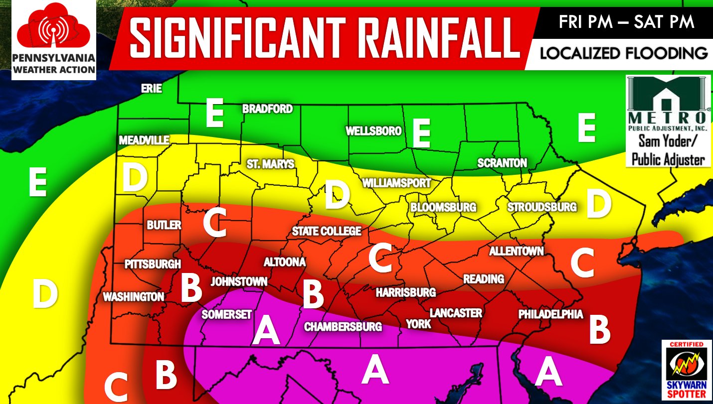
Area A – 2 to 3 inches of rainfall is expected Friday afternoon through lunchtime Saturday. The potential does exist for localized locations to receive over 4 inches of rainfall. In these localized locations that do receive over a third of a foot of rain, major flash flooding would be a concern.
Area B – 2 to 2.5 inches of rainfall is expected Friday afternoon through lunchtime Saturday. Localized locations may receive up to 3 inches of rainfall. Significant flash flooding is possible in these areas, especially in locations that experienced flash flooding just a few days ago.
Area C – 1 to 2 inches of rainfall is expected Friday afternoon through lunchtime Saturday. Localized locations may receive up to 2.5 inches of rainfall. Moderate flash flooding is possible, especially in flood prone areas.
Area D – 0.5 to 1 inch of rainfall is expected Friday afternoon through lunchtime Saturday. Localized locations may receive up to 2 inches of rainfall.
Area E – Less than a half inch of rainfall is expected Friday afternoon through lunchtime Saturday.
Make sure you have our Facebook page liked for the latest updates regarding this coastal storm and more. We will have another update Tomorrow evening>>>PA Weather Action on Facebook! You can also stay updated by downloading our app. Just search “PA Weather” in your phone’s app store.
Do not forget to warn your family and friends of the upcoming flash flood threat using our icons below!
You must be logged in to post a comment.