
Over the last 24 hours since our last update, models have had some shifts as expected. Most notably, the axis of heaviest snowfall accumulation has shifted northwest. Also, there has been a uniform trend towards a somewhat weaker system with a lower maximum snowfall potential.
This time on Monday, it appeared maximum accumulations may be 10-15”, however now that’s been reduced to 6-10”. Nonetheless, still a significant storm. We remain 100 hours out, so plenty of time for further trends which may not be good news for those looking for a heavy snowfall in Southeast PA.
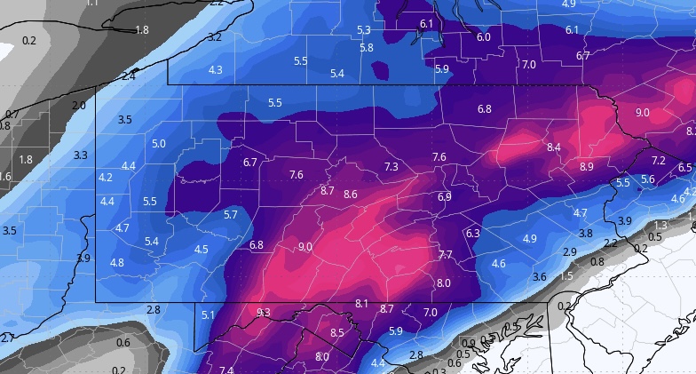
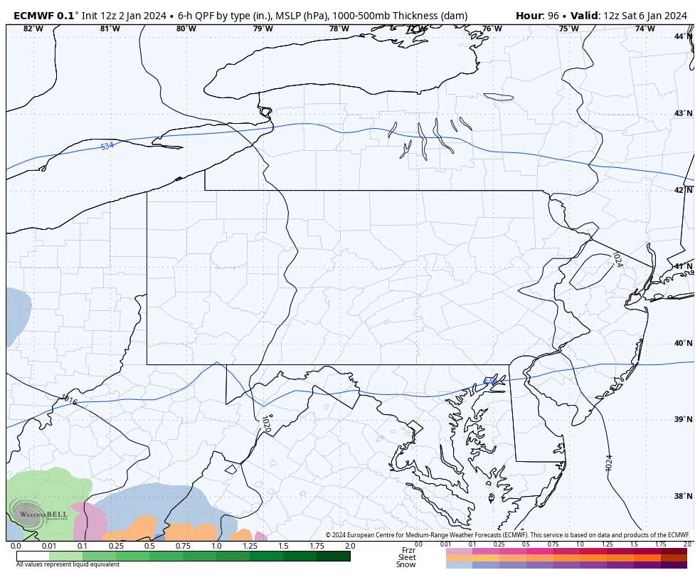
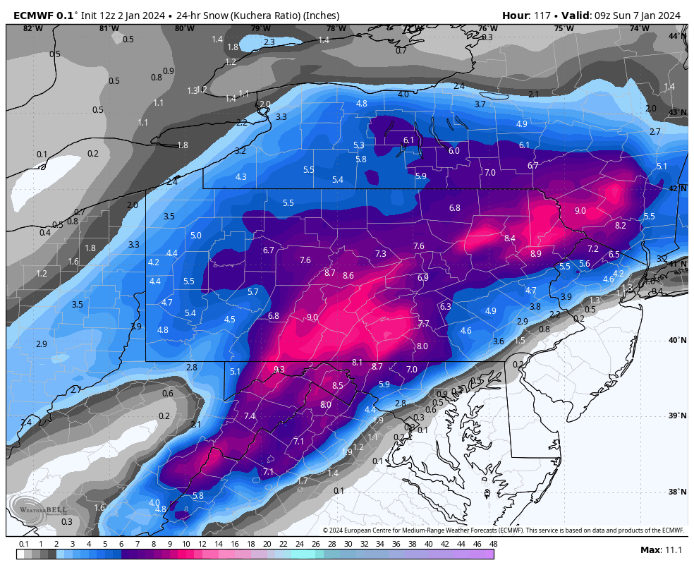
Starting with the European model, which has most significantly reduced accumulations the last few runs due to weaker precipitation rates, albeit still projecting a long period of moderate snow. Places near the MD line and I-95 mix with rain on the latest run. Note that for timing on these models, 00z is 7pm the previous day, 06z is 1am, 12z is 7am, and 18z is 1pm.
Highest accumulations are across South Central PA up to the Poconos, on the order of 6-10”.
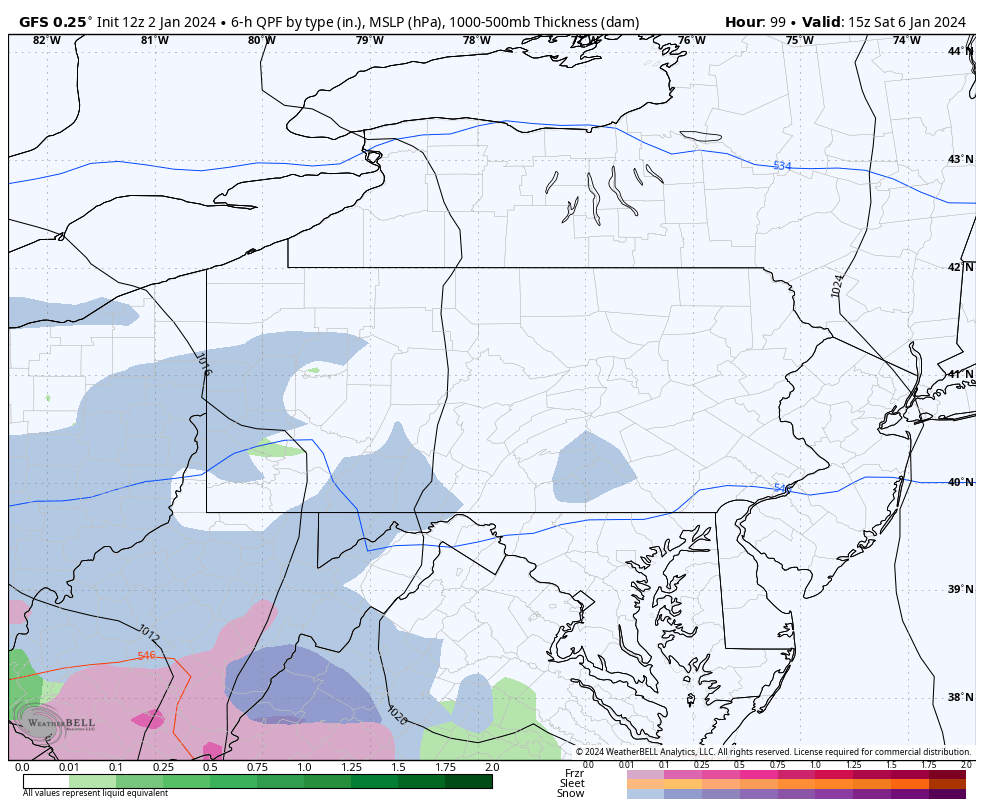
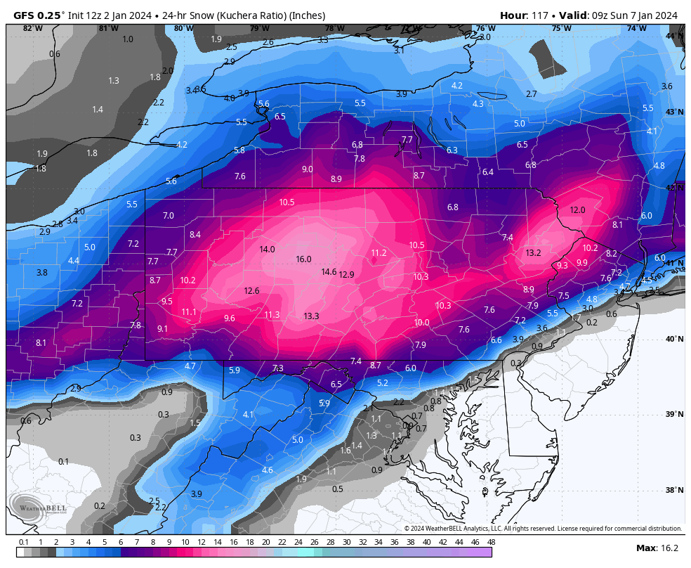
Then comes the GFS, which has most notably shifted heaviest accumulations north into the mountains.
 This solution at this point seems most probable, and it’s not a pretty one for cities along I-95.
Next we have the Canadian, which keeps banding heavier and the rain/snow line in the north Philadelphia suburbs. I’d venture to say we are unfortunately headed away from this solution and expect snowfall output from this model to decrease in coming runs. Here is future radar, followed by snowfall from the Canadian.
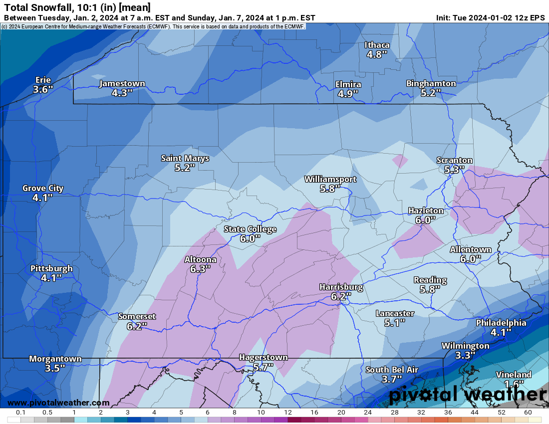
 Now let’s get into the ensemble packages. They’re lower because there’s always a few members with no storm which eventually catch the hint that there will indeed by a storm. Below is the snowfall mean from the Euro Ensemble, which are 50 individual models that each have a slightly different algorithm.
The NBM, or NWS Blend of Models, is often a great tool to use and currently presents an output I would say would be most on par with what our forecast would be at this range if we had to have one, but it remains a bit too early to have a snowfall forecast.
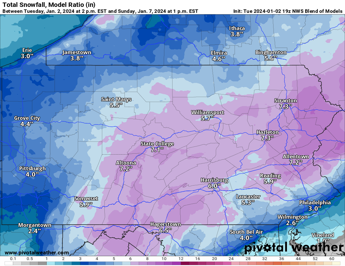
At this point, it’s very possible we will trend to an outcome with just moderate accumulations of 4-7”. We will of course continue to keep you all updated on the latest trends!
You must be logged in to post a comment.