
Summary
A weak system moving across the Southern Great Lakes will bring a period of snow to mainly Northern Pennsylvania Sunday. Temperatures will be near freezing in the valleys and in the upper 20s in higher elevations, so it’s a given that this will be somewhat of an elevation-dependent event. Generally highest totals will be in the Northern Poconos, with as much as 4″, and lowest totals for those who see snow will be in the deep valleys where about in inch is expected.
Road Impacts
Road impacts will be very minimal on Sunday in the valleys, but slick travel is expected about 1000′ elevation in Northern PA.
Timing
Light to localized moderate snow will push in to Central PA by 6-9am Sunday and Eastern PA by 7am-10am. The snow will end in North Central PA by 11am – 2pm, and Northeast PA by 4-8pm.
Below is latest future radar this Saturday evening from the High Resolution NAM model.
Final Call Snowfall Forecast for Sunday (12/11)
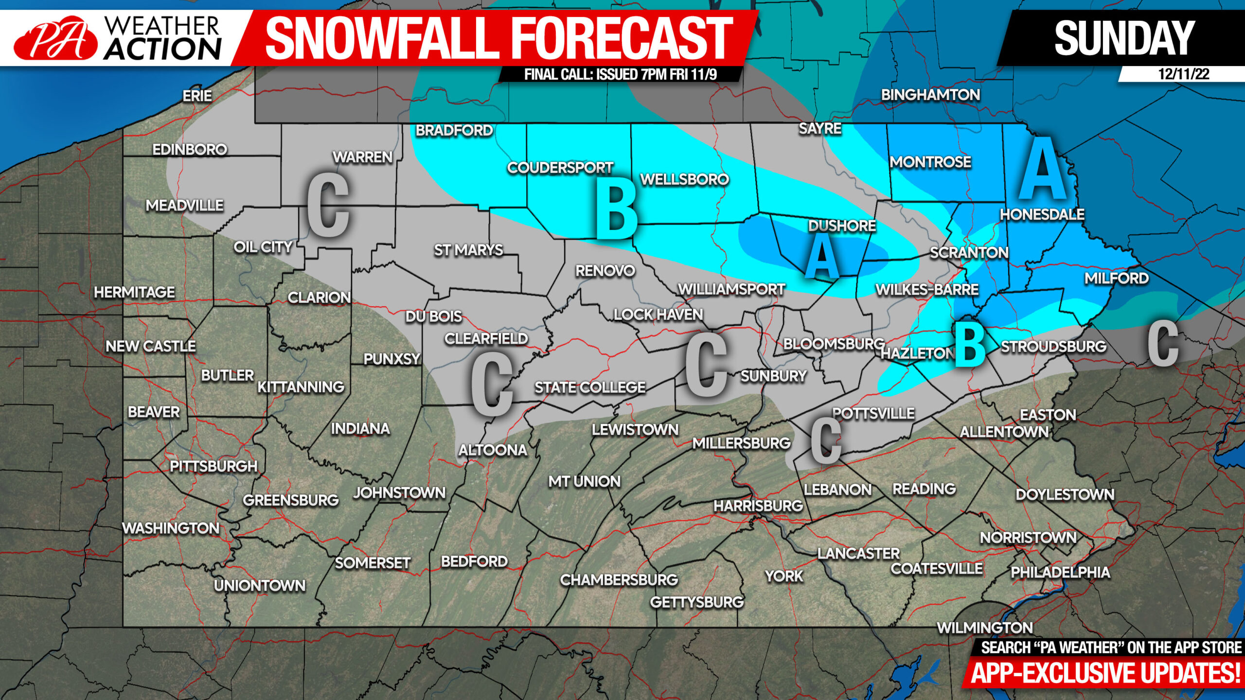
Area A: Snowfall accumulation of 2 – 4″ expected. Roads will be slushy especially on ridge-tops. Take it slow and steady!
Area B: Snowfall accumulation of 1 – 2″ expected. Roads may be slick especially in rural high elevations.
Area C: Snowfall accumulation of less than 1″ expected.
We continue to watch the growing potential for a large winter storm Thursday – Friday. Lots of things to work out, but you can track the model runs and my analysis for who may get what on our app! Download app here:

[social_warfare]


You must be logged in to post a comment.