
December 10, 2022 Morning Update
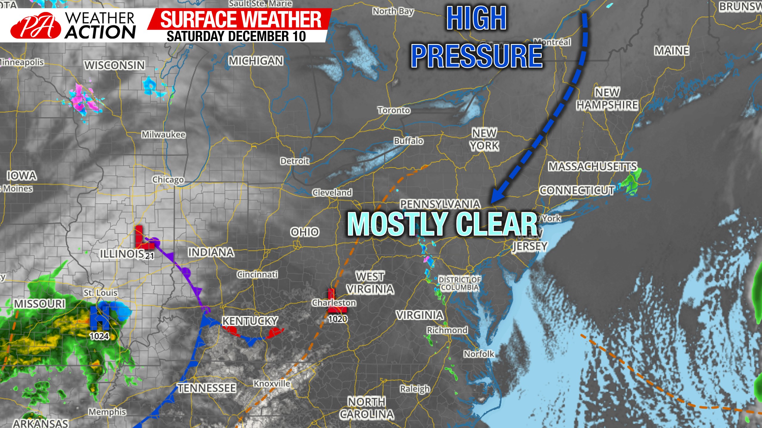
Morning Surface Weather Map
We are starting off the day mostly sunny besides patchy freezing drizzle over the Laurel Highlands which will quickly weaken as hits the high pressure.
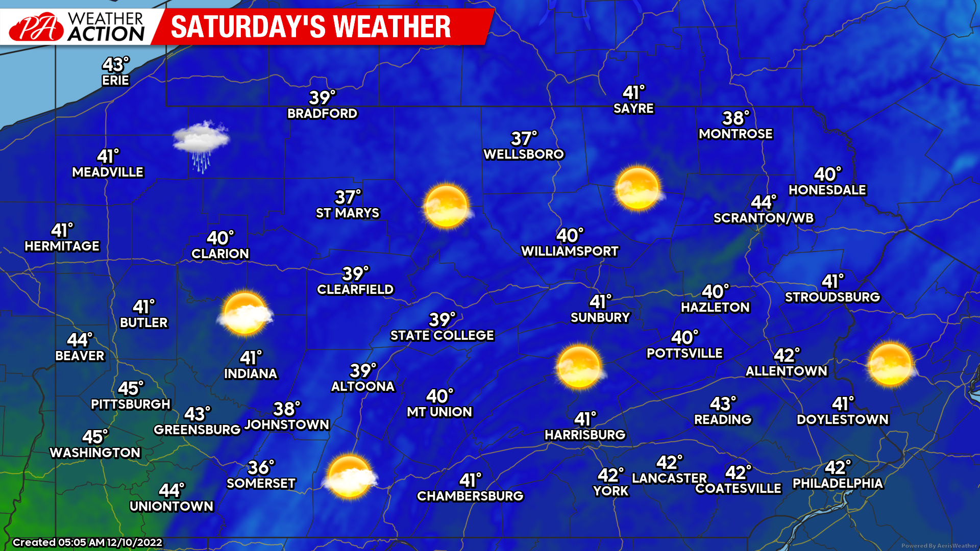
Saturday’s Weather Map
More blue skies today, which is always welcome on a big holiday shopping weekend! Temperatures will be a few degrees below normal in most areas, so certainly be sure to bundle up adequately if you’ll be spending much time outside.
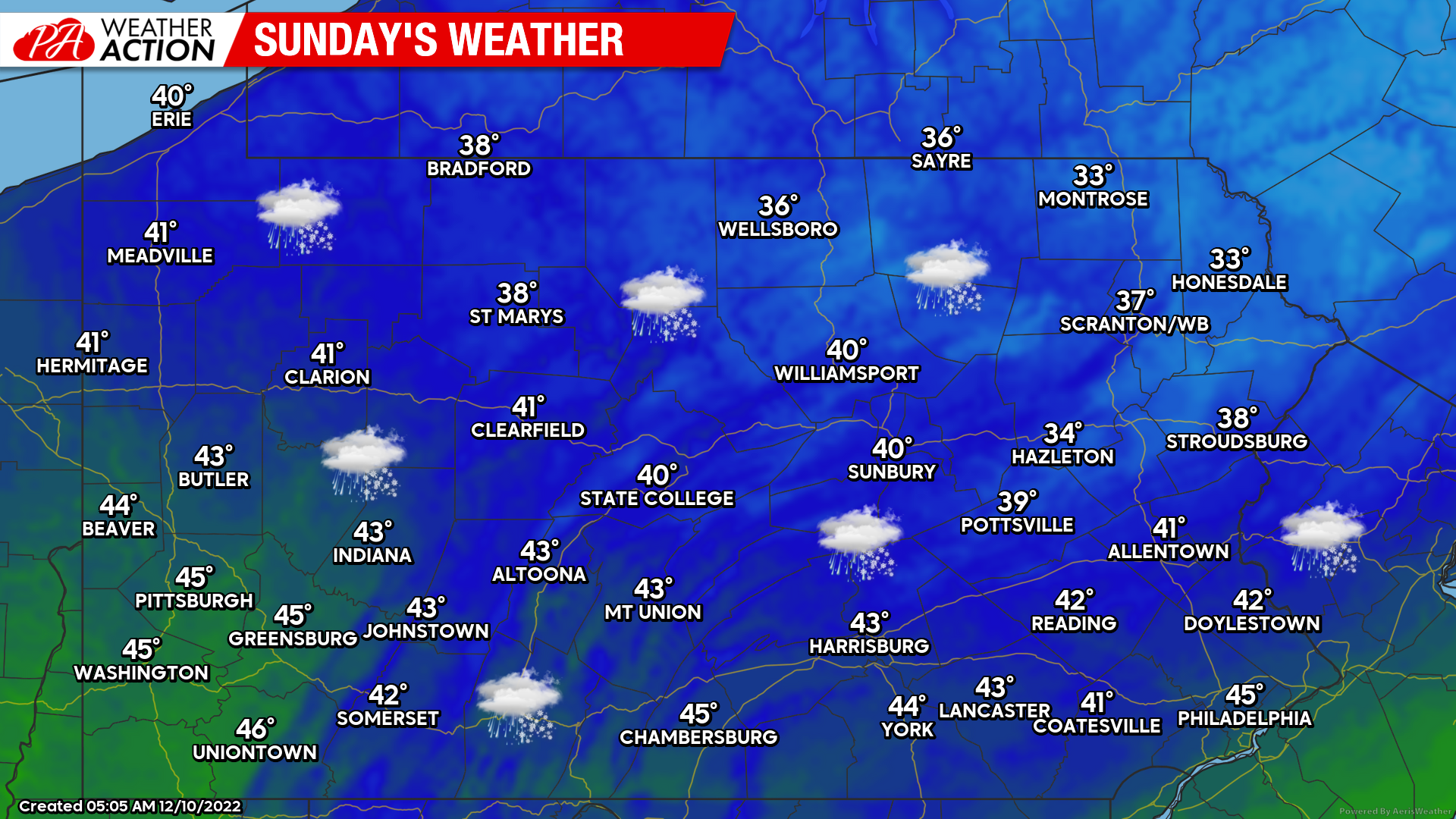
Sunday’s Weather Map
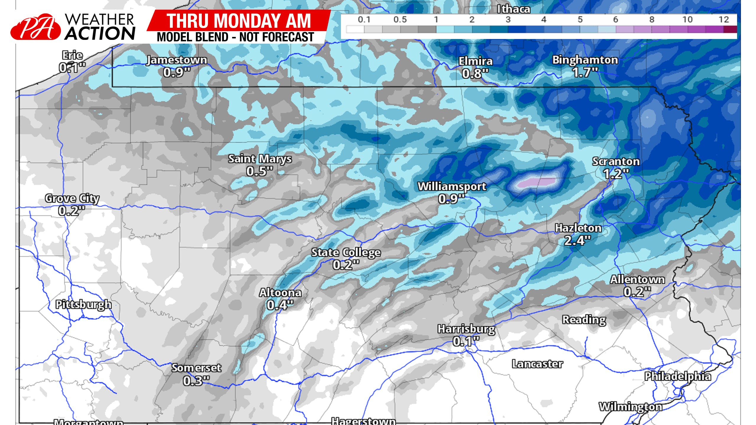
Some light snow is coming tomorrow generally north of Harrisburg and Allentown. A few rain showers are likely in Southern PA. Accumulations will be very elevation-dependent. While valleys will see an inch, perhaps 2″, ridges and mountain ranges will see more like 2 – 4″. Read our First Call Snowfall Forecast here.
Below is the latest model blend for snowfall amounts, which really shows the importance of elevation.
Thursday – Friday’s Storm Potential
I have to admit, it’s hard not to get excited about this potential. It’s still 5-6 days out, so proceed with great caution if you see a model, because chances are it’s already changed somewhat. However, we are beginning to see a bit of consistency. At the same time, I feel like 5-6 days out is always when models are consistent and then it goes down the tubes until 2-3 days out.
This threat checks many of the boxes for what we look for when diagnosing a big storm potential. But there are still a few issues including where the coastal develops, where it tracks, and where it stalls. If it tracks over the DelMarVa, chances are SEPA will see mostly rain. If the trough takes longer to tilt negative, and the storm takes longer to really bomb out and tuck in to the coast, then it wouldn’t tuck until it’s too far north. It would then be more of an I-80 and north snowstorm. However, if it tucks in towards the coast around Ocean City, MD or Cape May, NJ, we may be talking about some serious snowfall amounts.
The biggest question of course is where. Like I said in Friday morning’s update, the closer you are to I-81, the more wintry impacts you’ll likely see. The southern end of the state could still see a period of ice as well. But this looks like a classic December interior snowstorm. I don’t know about the Philadelphia area yet and won’t for a while. On the western edge, there won’t be a sharp cutoff because the high pressure is to our north, not west. So even Western PA may get in on some good snow. Here is a comparison of the ensemble low pressure placements.
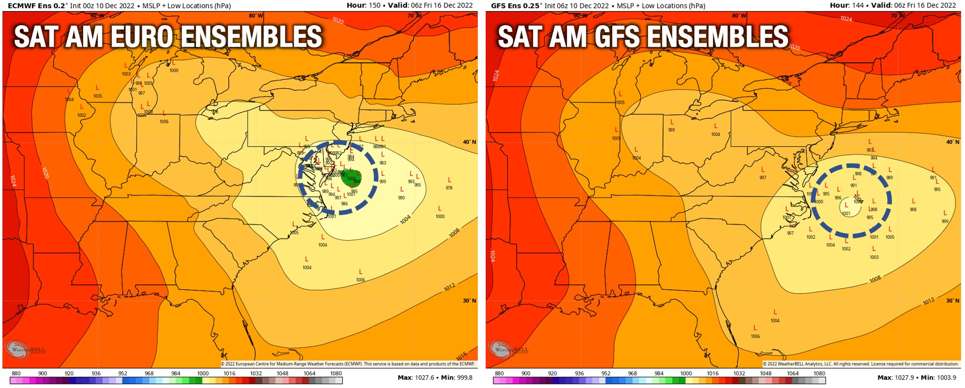
The Euro Ensembles are closer to the coast near Ocean City, MD, while the American Ensembles are farther off the Virginia Capes. The Euro low pressure placement would yield a much more impactful storm.
I don’t want to get ahead of myself, as maybe I’ve already done. I will be sharing my thoughts on the models and the potentials for different parts of the state in the Updates section of our app. It costs around $1 a month, and there’s a free trial too. Tap the imagine below to join me over there!

You must be logged in to post a comment.