
December 12, 2022 Morning Update
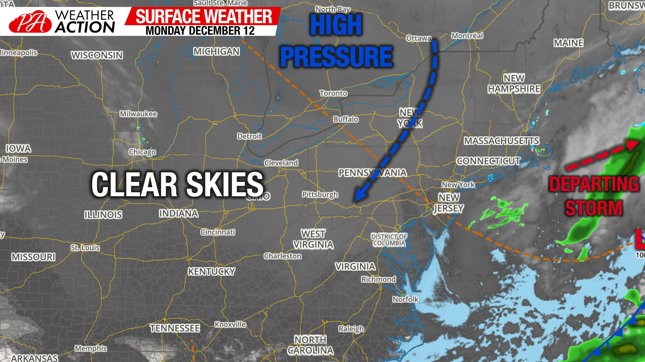
Morning Surface Weather Map
There is not much going on around the Eastern US today. Sky conditions vary this morning as yesterday’s disturbance is now well off the Atlantic Coast. A high pressure centered to our north will be responsible for chilly temperatures this week.
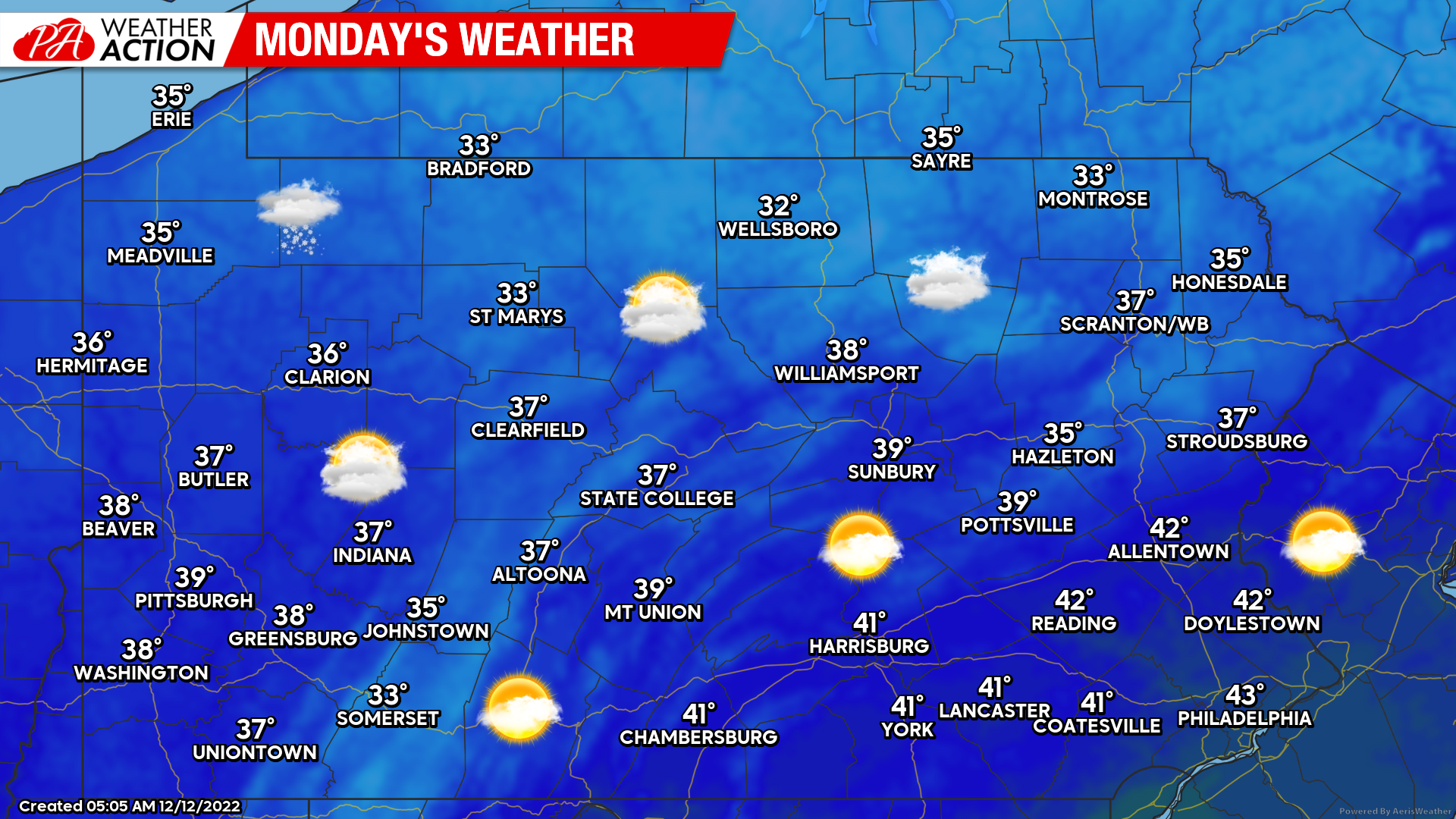
Monday’s Weather Map
More in the way of clouds today in Northern and Western PA, with partly to mostly sunny skies in Southern and Eastern PA. A few flurries are possible in Northwest PA, which is basically every winter day in that part of the state. Highs will be cold as mentioned, in the low mid 30s to mid 40s.
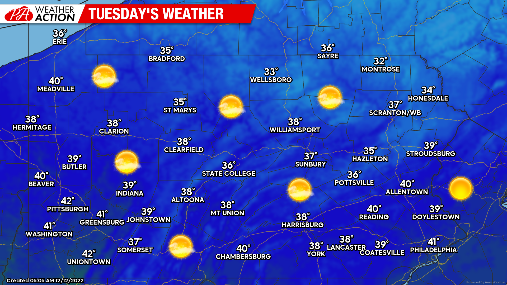
Tuesday’s Weather Map
Mostly sunny skies across the board Tuesday with highs in the mid 30s to low 40s.
Thursday – Friday’s Winter Storm
This storm was always supposed to be the pattern change storm and was initially expected to bring us nothing but rain followed by a strong cold front. Then it quickly shifted to a big storm potential as Canadian high pressure was modeled to be much stronger, initiating a transfer to the coast. I admit, even I was excited for a bit on Friday and Saturday. Well now, we have settled in the middle of those two solutions.
The initial low is modeled to transfer to a Midwest low, which moves into Wisconsin as another low forms in the Carolinas. The issue is the Wisconsin low stays dominant (lower pressure) all the way until the coastal low is off Long Island. Ideally if you want to see snow, you don’t want a low pressure to your west, and definitely not one that is higher latitude than your location. It will quickly erode your cold air source, as this one will do.
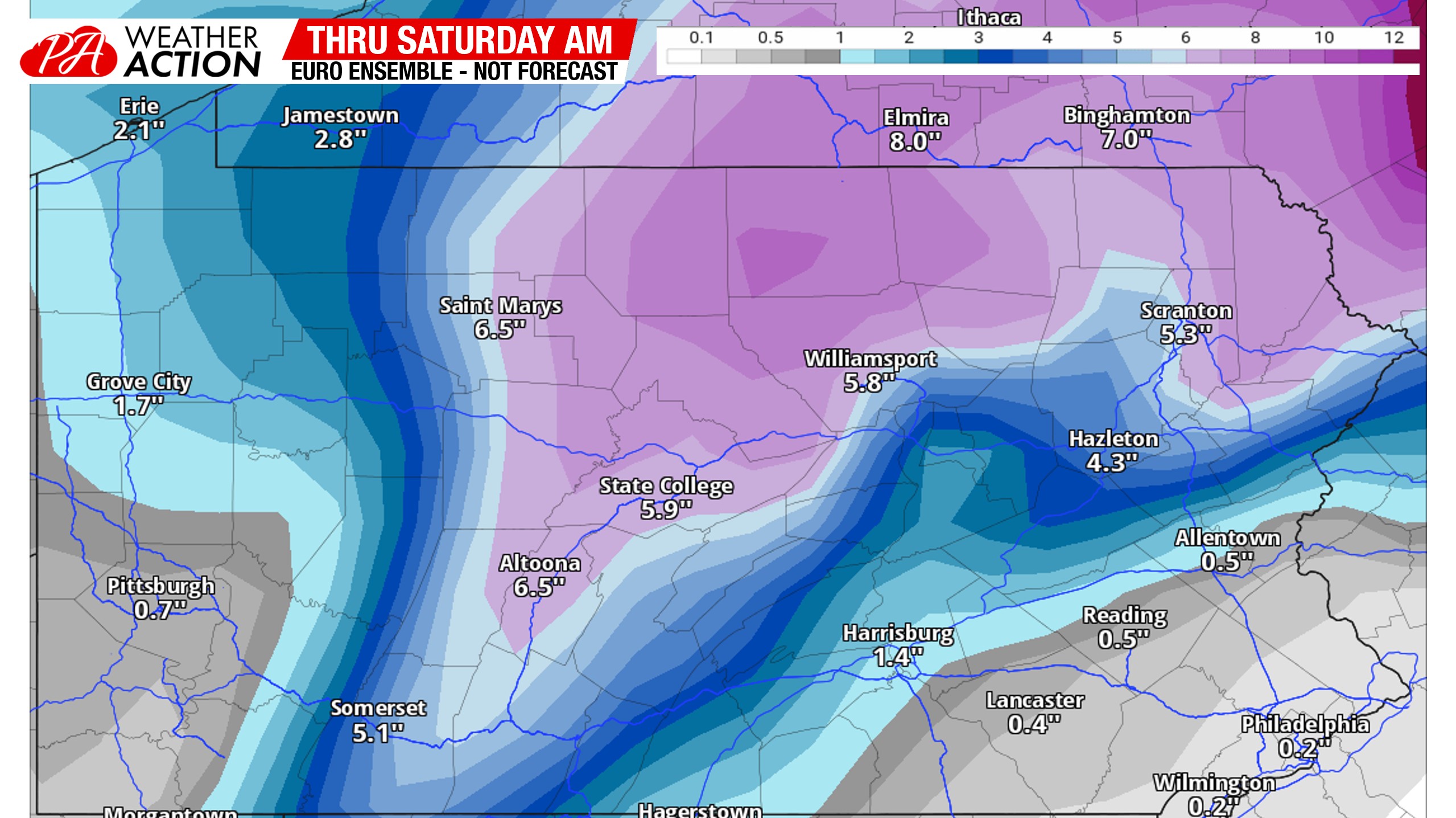
So the result (as of now) is a rainmaker for all of Western PA and all of Eastern PA, south of the Poconos. South Central PA will likely see freezing rain for the first 6-9 hours on Thursday morning and afternoon, and North Central PA will probably start as snow during that period before switching to freezing rain. Maybe parts of Northern PA stay all snow, but nobody south of State College, Williamsport, or Scranton will stay all snow. Here’s the evolution of the system on this morning’s Euro model.
We still have time for things to change, but a solution should begin to lock in by tomorrow. This morning’s Euro Ensembles line up well with my thoughts, which isn’t to say this is my forecast. I’ll leave you with the Euro Ensemble mean snowfall map. More updates potentially today. If not, definitely tomorrow. Our first call will be out Tuesday.
If you enjoyed this brief model breakdown, I recommend you join the Updates Section of our app! I do model updates there two to three times daily ahead of winter storms like this, and keep you in the loop on the latest model trends that you won’t hear about elsewhere. Tap the image below to head to the app!

You must be logged in to post a comment.