
After a week of warmer temperatures and many areas of Pennsylvania reaching 60 to even 70 degrees, it’s understandable that cold air won’t be in place for this storm in 90% of the state. However, the coldest region of the state – the northern mountains, will be seeing snowfall on Sunday.
This storm is so thread the needle in Northern PA, and most towns are in valleys which further complicates things. Elevation and latitude will play a huge role in this event. Mountaintops will receive noticeably more snowfall than surrounding valleys. Also, temperatures will be above freezing as the snow falls in the valleys, but we expect snowfall rates to cause roadway accumulations regardless.
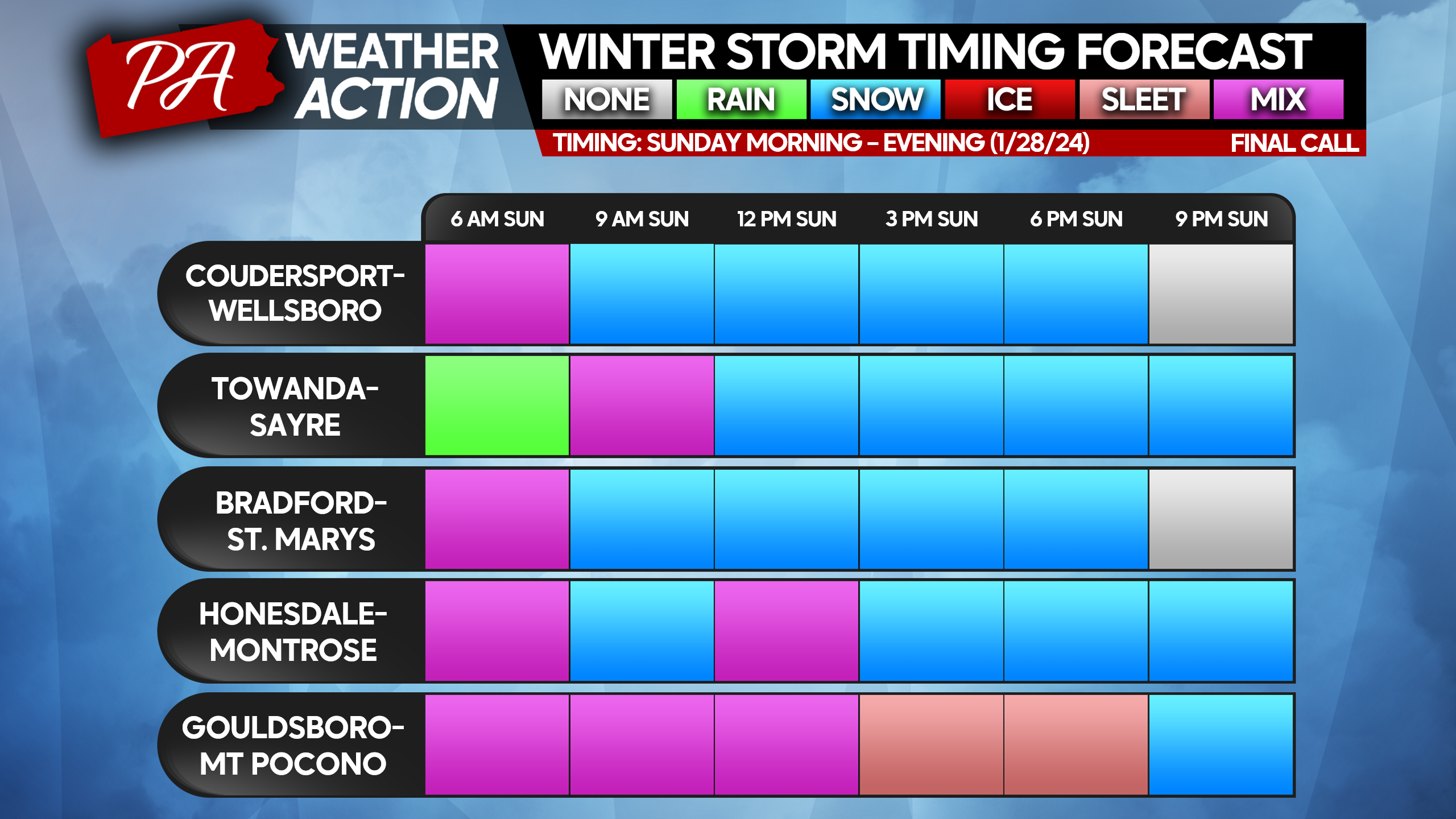
FINAL CALL TIMING FORECAST FOR SUNDAY’S WINTER STORM
We have selected towns that will be seeing snowfall.
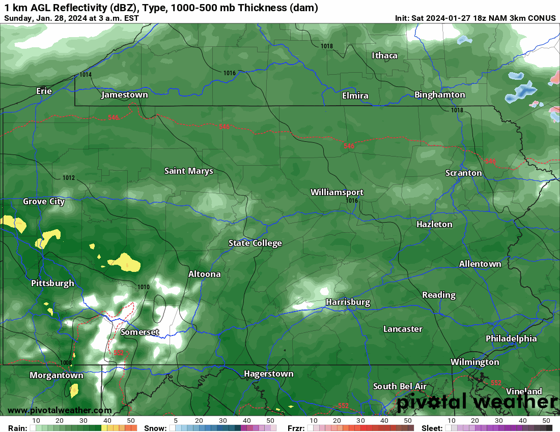
Below is future radar from the latest Hi-Res NAM Model. It’s easy to pick out the ridges and valleys!
FINAL CALL SNOWFALL FORECAST FOR SUNDAY AM – MONDAY AM
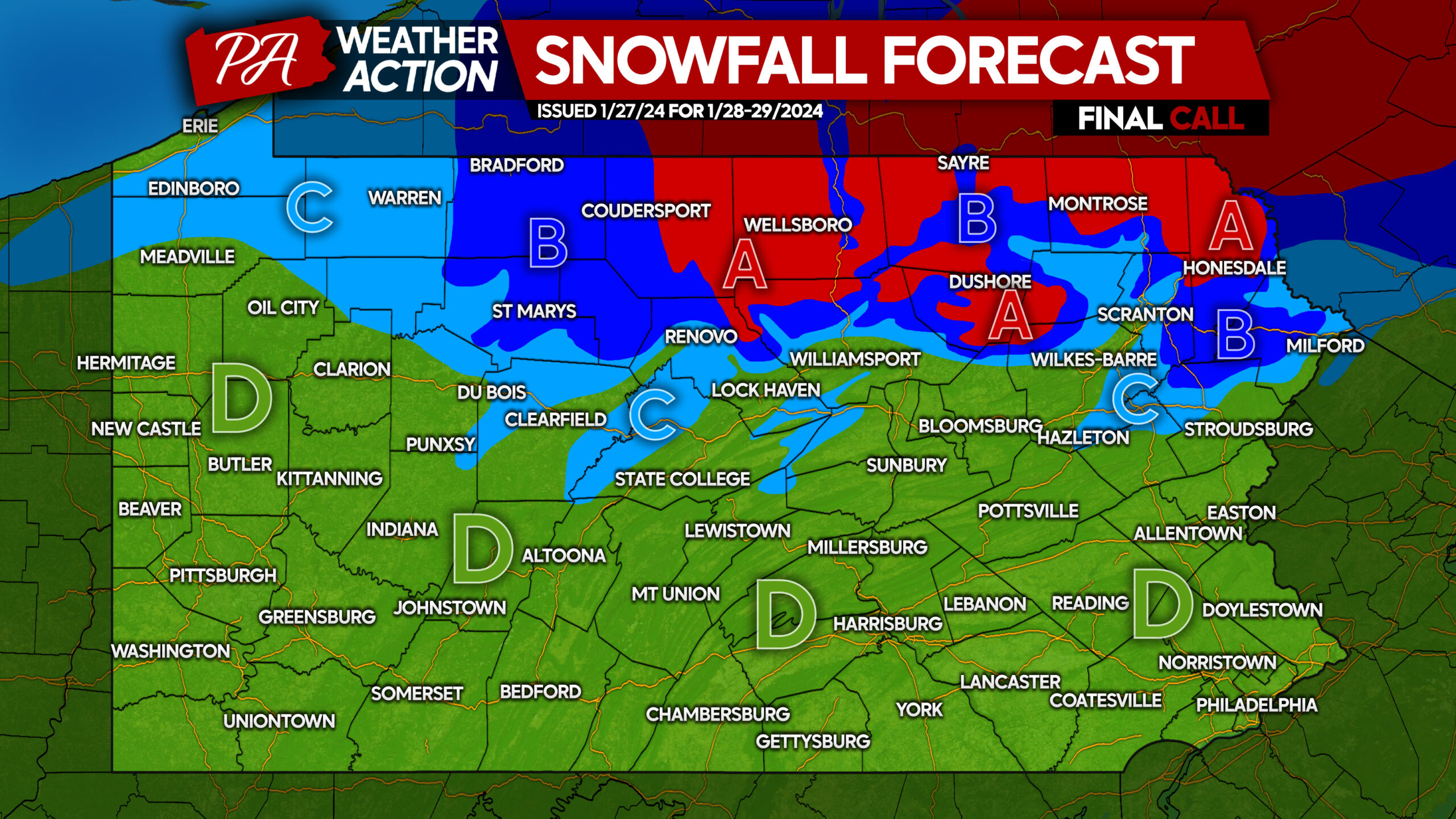
Area A: Snowfall accumulation of 4 – 7” expected. Roadway accumulations likely especially on mountaintops late Sunday morning into the evening.
Area B: Snowfall accumulation of 2 – 4” expected. Roadway accumulations likely especially on mountaintops late Sunday morning into the evening.
Area C: Snowfall accumulation of 1 – 2” expected. Roadway accumulations possible especially on mountaintops late Sunday morning into the evening.
Area D: All rain expected for the duration of the storm. Rainfall accumulation of 0.5 – 1.2” expected.

You must be logged in to post a comment.