
MAJOR CHANGES TO FORECAST, CLICK ARTICLE TO VIEW *REVISED* FINAL CALL:
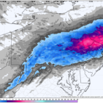
The last 30 hours brought some of the largest run-to-run model changes in the last decade, partially due to weaker than expected thunderstorm activity in the Deep South yesterday. Since that convection did not occur, heights did not increase as much on the East Coast. And higher heights equal a more north storm track, vice versa. So here we sit, about 12 hours away from the onset of precipitation as this forecast is being typed. Timing has changed for changeover times, and snowfall accumulations have drastically shifted southward. Let’s be clear, the boom & bust potential with this storm and this forecast is high.
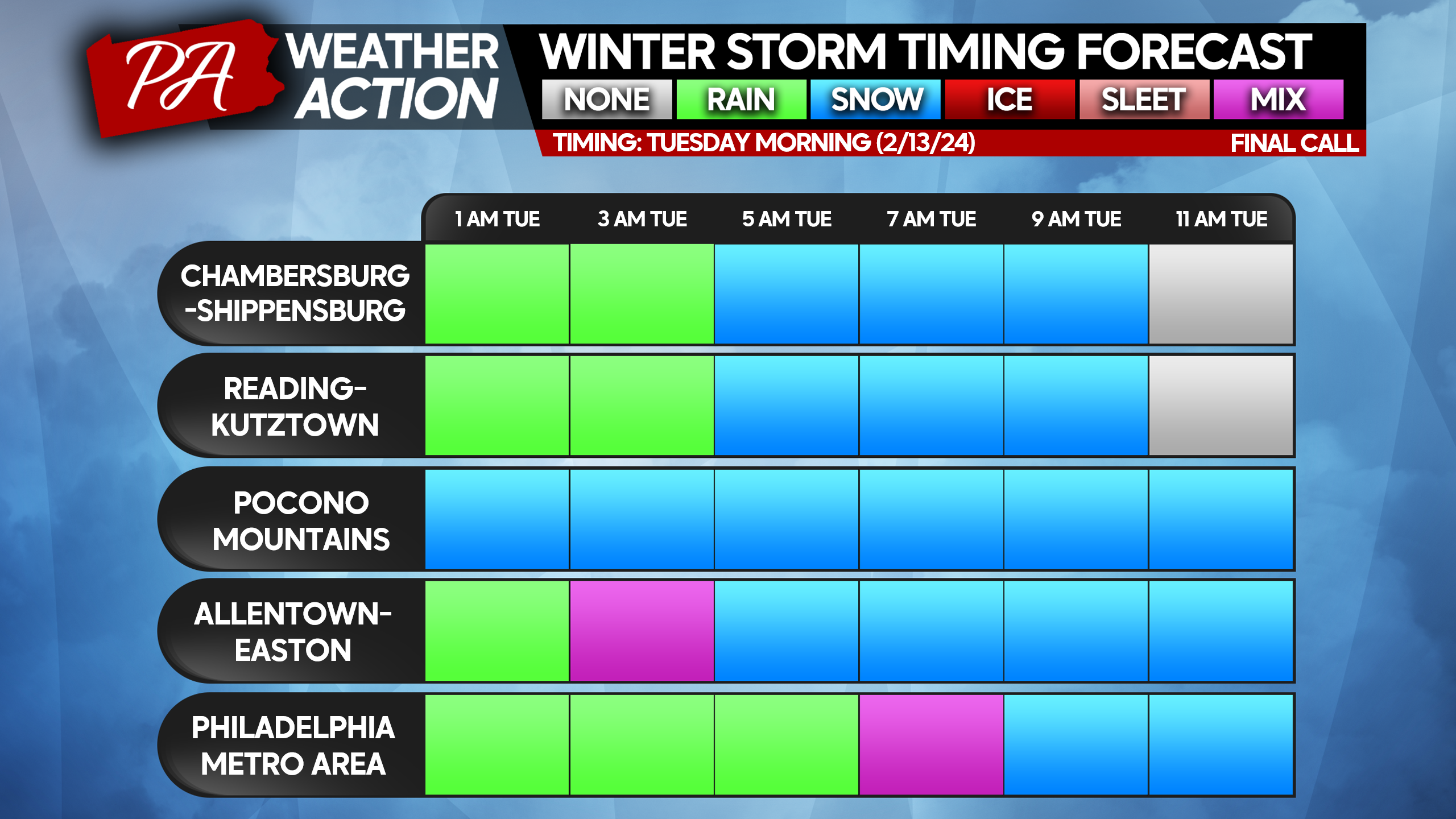
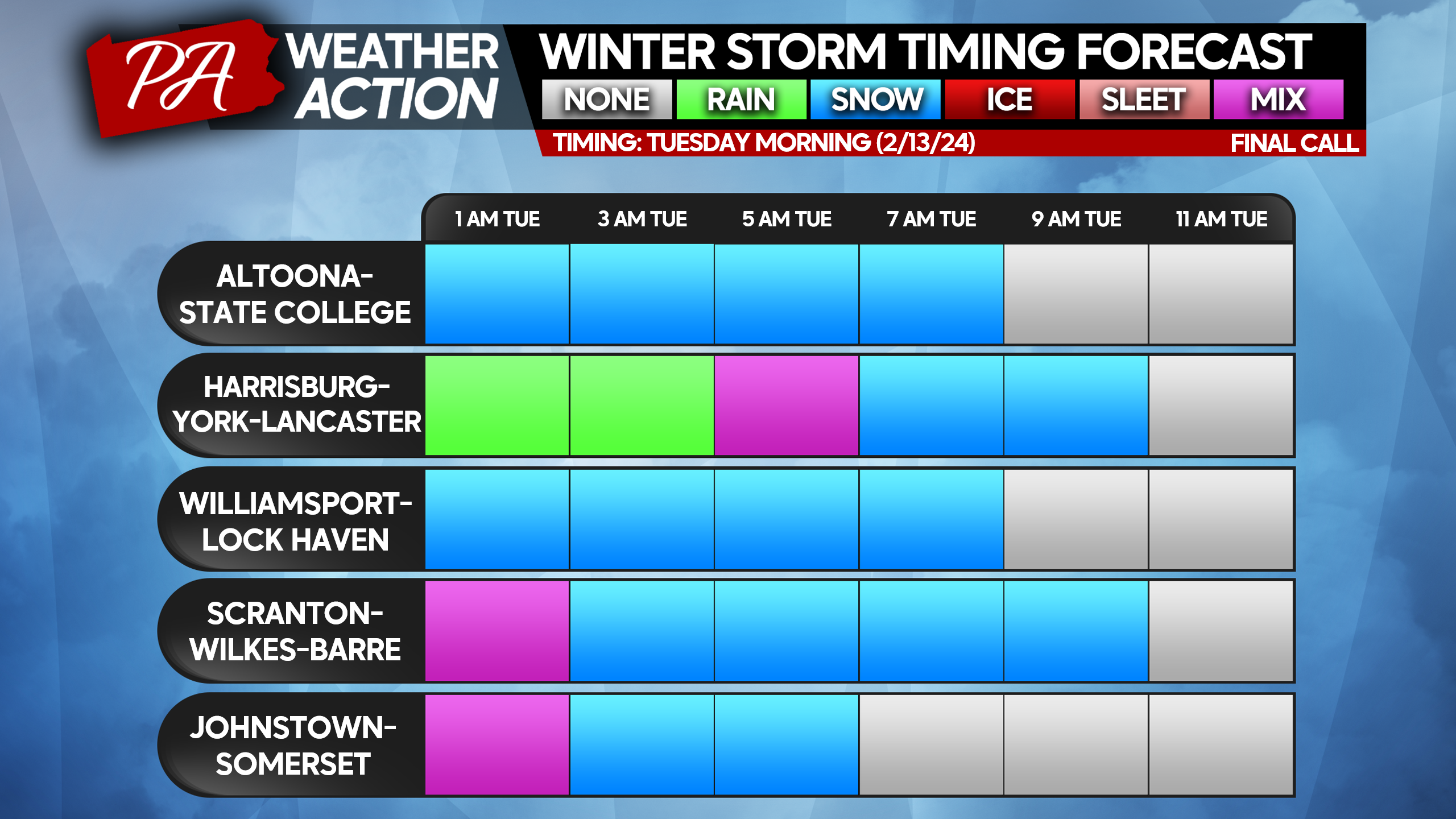
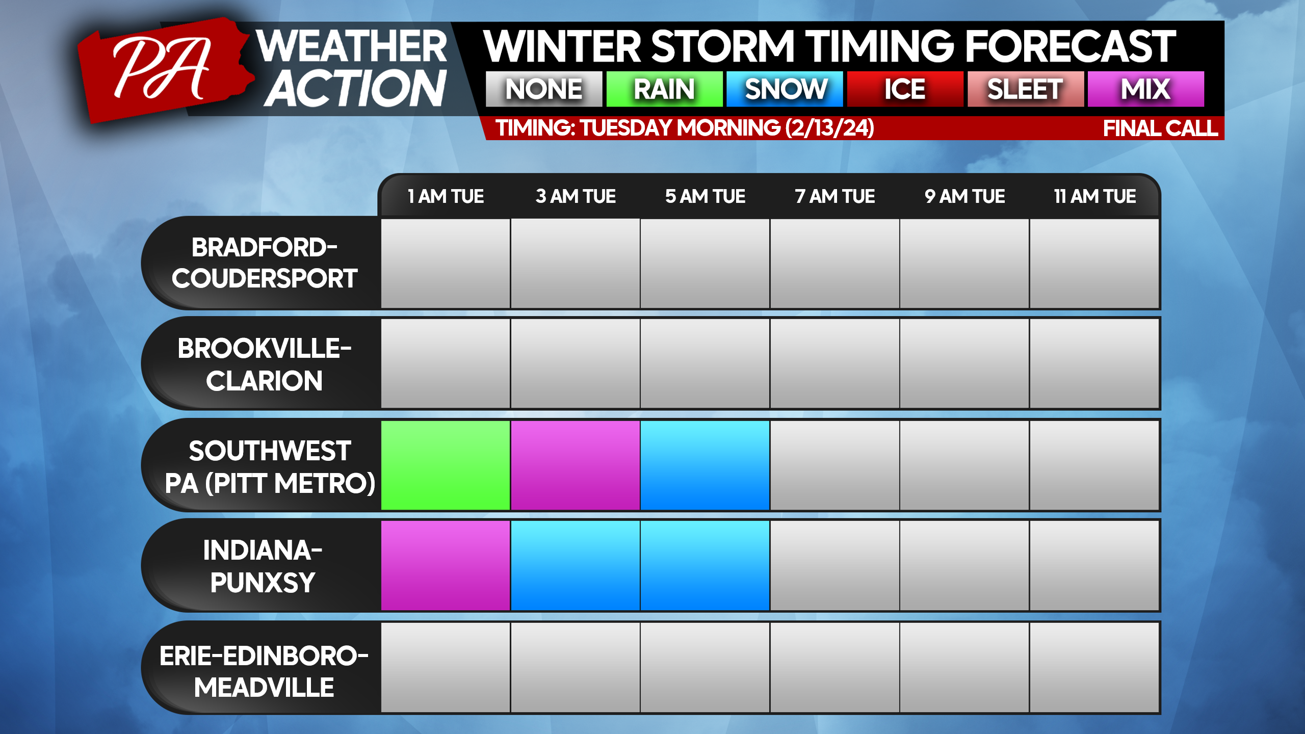
Precipitation will move in late Monday evening as rain everywhere except I-80. Rain will change to snow from north to south in the hours to follow, and heavy snow at that. Snowfall rates of 1 – 2″ per hour will be common, with isolated 3″ per hour rates. Thundersnow is very possible, and we hope Jim Cantore is on a flight to Allentown. On a serious note, this snow will be dense and heavy to shovel. Do not overwork yourself, and stay hydrated! If you see snow on the time tables below for your area, that means travel will be extremely difficult during that period. Snow will move out from west to east mid to late Tuesday morning.
STORM TIME TABLES
FINAL CALL SNOWFALL FORECAST FOR TUESDAY’S SIGNIFICANT SNOWSTORM
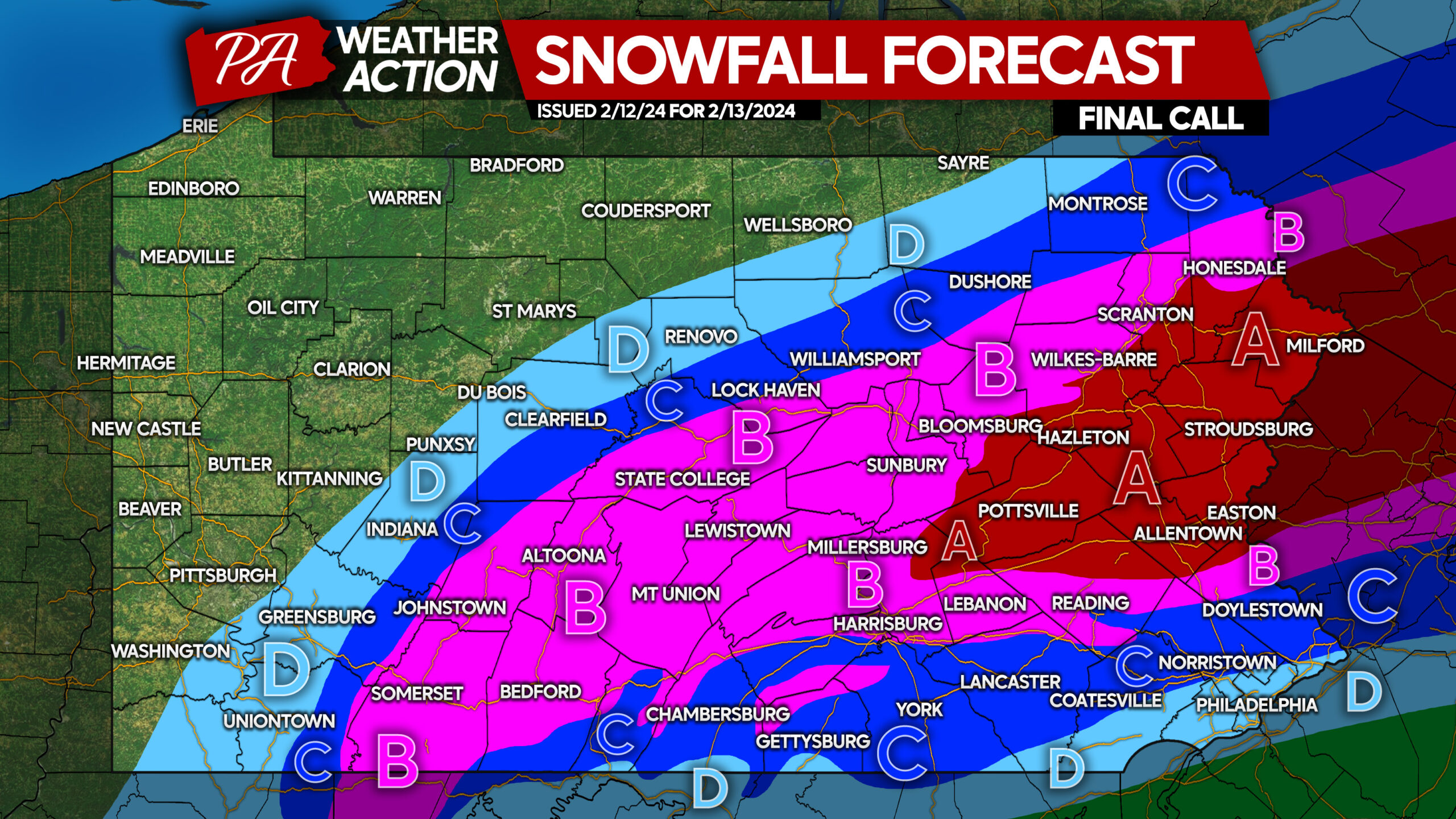
To be transparent, this is a very tough forecast. These amounts are not set in stone, especially on the northern extent of these areas. The potential exists for another southward shift, and we will issue an emergency forecast update if needed late Monday evening.
Area A: Snowfall accumulation of 7 – 11″ expected. Snowfall rates of 1-2″ per hour are likely for 5-7 hours, refer to time tables. Avoid travel completely during that time. Difficult travel also likely for the remainder of Tuesday due to snow-covered roads.
Area B: Snowfall accumulation of 4 – 7″ expected. Snowfall rates of 1-2″ per hour are likely for 3-4 hours, see time tables. Avoid travel completely during that time. Difficult travel also likely for several hours afterwards due to snow-covered roads.
Area C: Snowfall accumulation of 2 – 4″ expected. Snowfall rates of 1-2″ per hour are likely for 2-3 hours, view time tables. Avoid travel completely during that time. Difficult travel also likely for a few hours afterwards due to snow-covered roads.
Area D: Snowfall accumulation 1 – 2″ expected. Snowfall rates of 1/2-1″ per hour are likely for 2-3 hours, see time tables. Road conditions may be slushy during that time.
The moral of the story is that it you should not travel during the heavy snow. Hopefully your employer is intelligent enough to not expect you to!
This is a significant update, so please be sure to share this forecast with friends and family with the button below!
If this is your first or second of fifth time here, but you don’t follow us over on Facebook, consider doing so below!
You must be logged in to post a comment.