FINAL CALL POSTED – SUNDAY AM UPDATE
Many locations in Pennsylvania have not experienced their first official accumulating snowfall this season yet, but that is expected to change in a big way next week. There are two storms currently taking aim to impact our state. The first storm arrives Monday morning, this will be the weaker of the two storms. The second storm will not arrive until Wednesday. That storm has the potential to be a big snow producer for much of the area, we will have more details on that this evening.
A weak area of low pressure will develop to our south Sunday night. The latest trends have suggested that this low pressure will bring enough precipitation north to deliver an accumulating snowfall to some areas of the commonwealth.
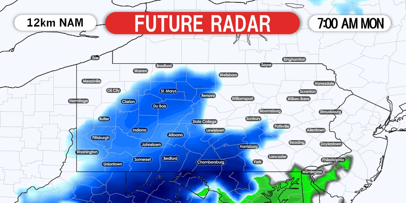
Snowfall will arrive across southern Pennsylvania as early as 4:00 AM Monday morning. The precipitation may start off as a cold rain for some areas. Once the heavier precipitation moves in, this will turn any precipitation over to snowfall. Below is a look at 7:00 AM Monday morning:
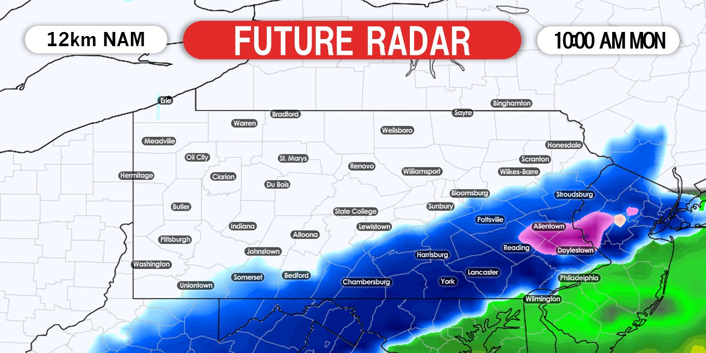
The axis of the snow will move from southwest to northeast. This will cause northern Pennsylvania to miss out on much of the snow this time around. For the southern half of the state, the meat of the storm will occur during the late morning hours and into lunchtime. The snow may fall moderate to heavy at times. Below is a look at 10:00 AM Monday morning:
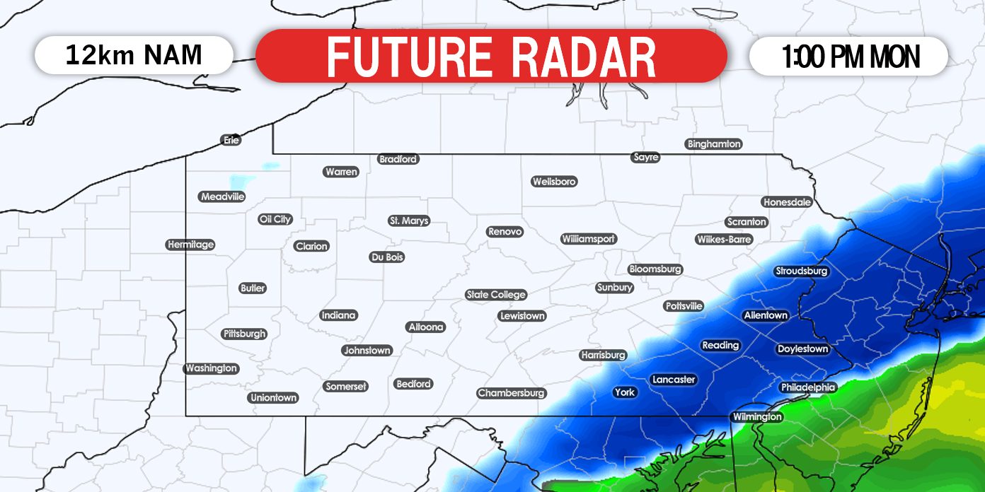
Temperatures will be in the middle 30s during the majority of the storm. This will allow roads to be more wet than white. However, we still expect back roads to receive snow accumulation. The snow will continue through the early parts of the afternoon. After 1:00 PM, the storm system begins to pull away:
It is important to note that we have observed a continuous north trend with model data over the last 24 hours. If this trend continues, this will allow areas further north to get involved in the snow, but for southern areas, mixing issues could be more of a concern. So please stay tuned for updates over the weekend.
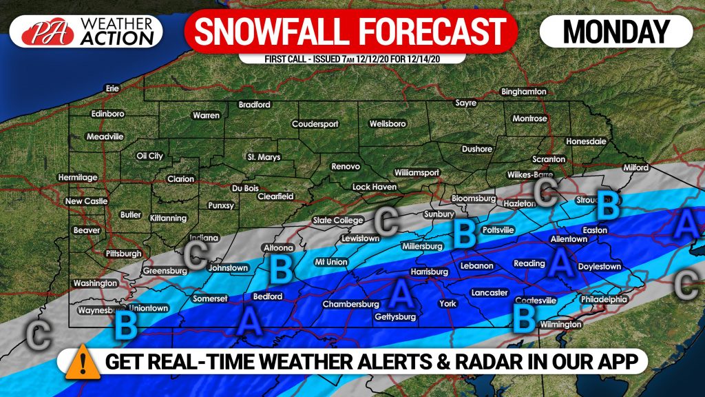
FIRST CALL SNOWFALL FORECAST FOR MONDAY
Area A: Snowfall accumulation of 2 – 4″ expected on grass, with a coating to an inch possible on paved surfaces.
Area B: Snowfall accumulation of 1 – 2″ expected on grass, with a coating possible on paved surfaces.
Area C: Snowfall accumulation of a coating to 1″ expected on grass.
Our Final Call Forecast for Monday’s storm will be posted Sunday afternoon. Scenario maps for Wednesday’s Potential Major Winter Storm will be posted Saturday afternoon, stay tuned.
Be sure to share this forecast with your friends and family. For many, this may just be the appetizer for Wednesday!



You must be logged in to post a comment.