
FINAL CALL POSTED FRIDAY 1/5/24 5:00 PM:
Final Call Snowfall Forecast for Saturday’s Significant Snowstorm in Pennsylvania
It has been an unbelievably long time since many populated areas of Southern and Eastern PA last picked up a half foot of snow in one storm. Even to the point we have seen some people wonder if significant snow events in those areas are a thing of the past. Fortunately for snow lovers, significant snow is not a thing of the past and this storm may be just one of several storms we see over the next couple months. But let’s take it on at a time and address the potential at hand.
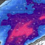
A storm system sweeping across the Southern US will pick up gulf moisture before slamming into cold air right above our heads. And for some areas, we mean literally right above, meaning the threat of some mixing with sleet and/or freezing rain. This will not be a long-duration storm that requires bread and milk and other necessities, but rather about a 9-15 hour storm depending where you are, bringing moderate to heavy snow.
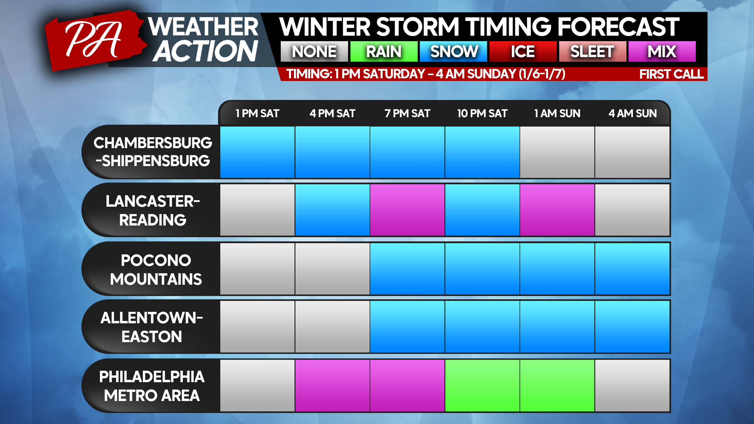
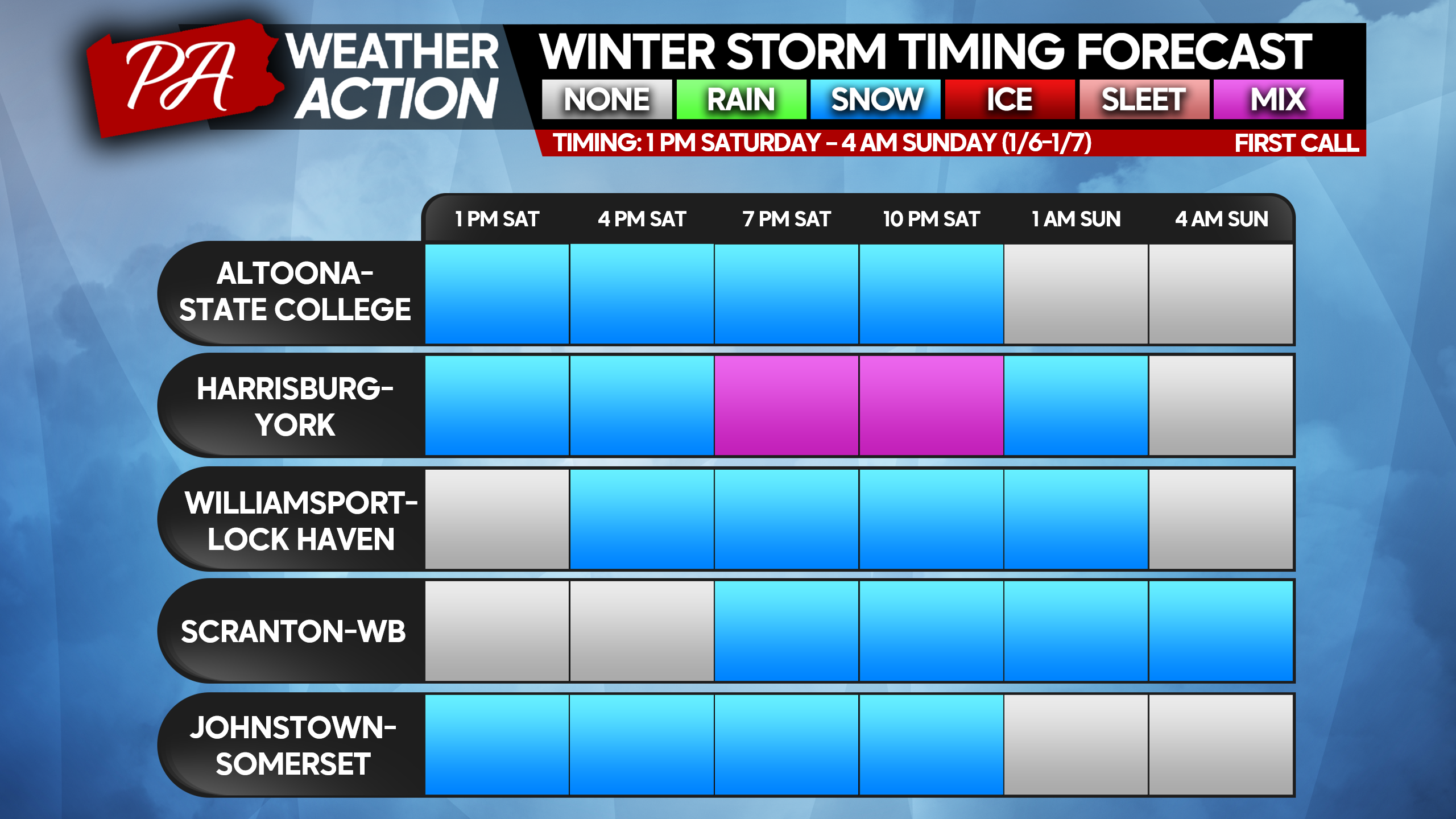
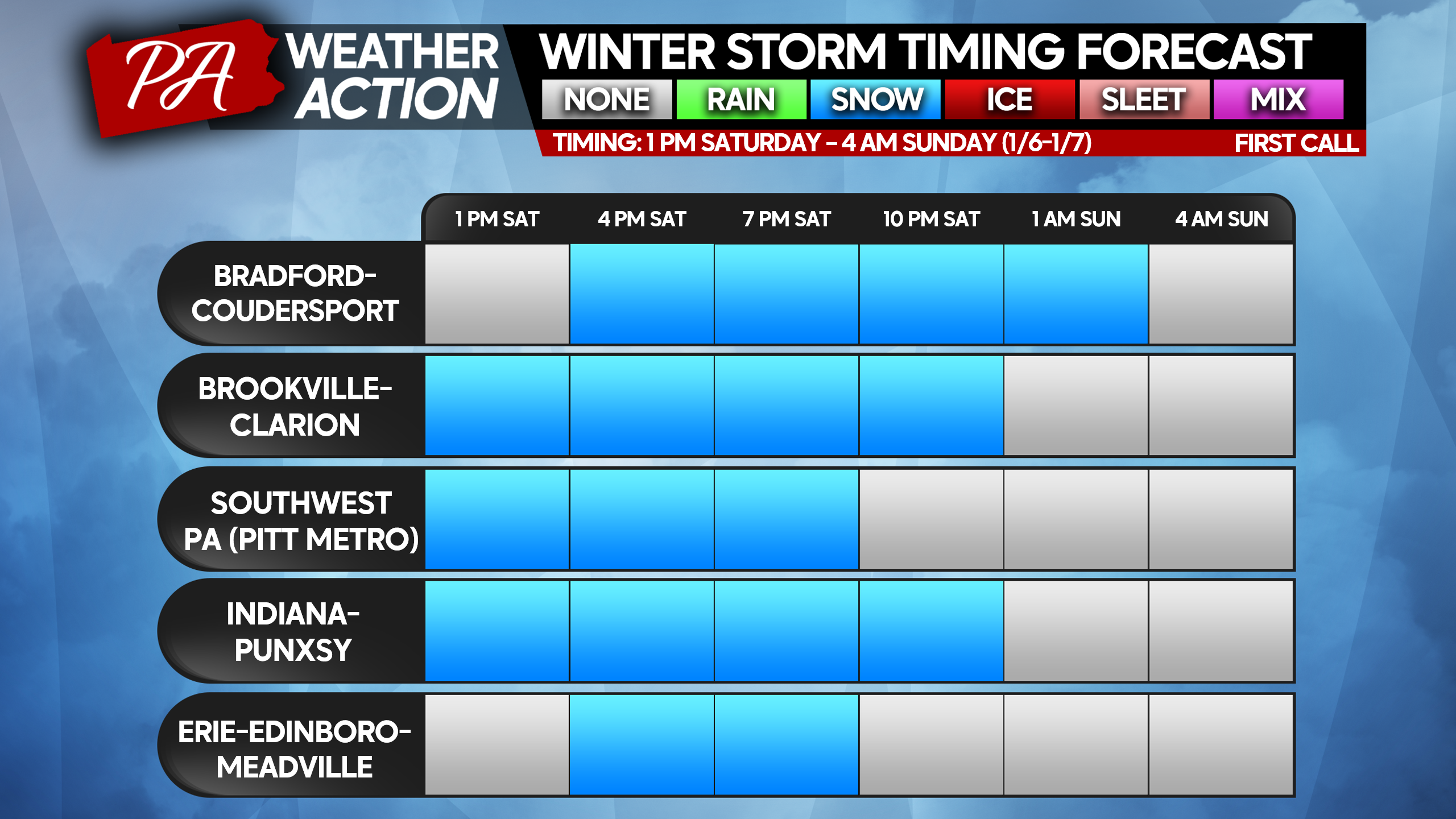
STORM TIMING FORECAST CHARTS
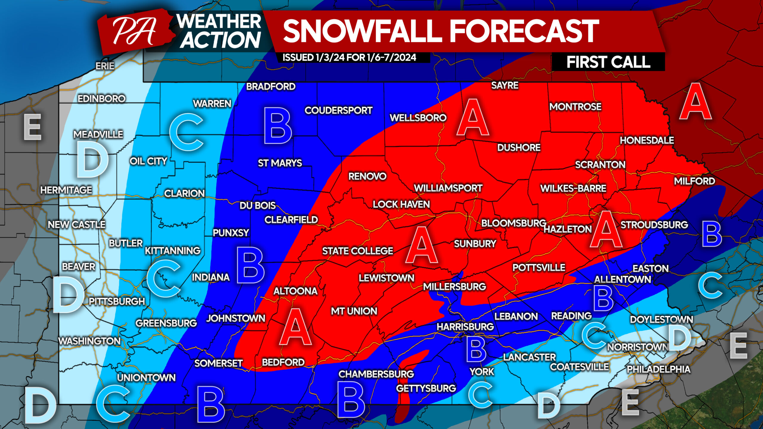
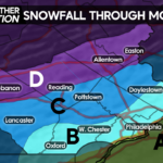
FIRST CALL SNOWFALL FORECAST FOR SATURDAY AFTERNOON – SUNDAY MORNING
Very poor travel conditions expected. View time tables above, find nearest area to you or region of interest.
Area A: Snowfall accumulation of 6 – 10″ expected. The southern extent of this area is most liable to shift north or south in future forecasts.
Area B: Snowfall accumulation of 4 – 6″ expected. Brief mixing with sleet possible near I-81 (south of 78 split) and I-78. The southern extent of this area is most liable to shift north or south in future forecasts.
Area C: Snowfall accumulation of 2 – 4″ expected. Mixing with sleet, freezing rain, and rain is expected in Southeast PA. The southern extent of this area is most liable to shift north or south in future forecasts.
Area D: Snowfall accumulation of 1 – 2″ expected, with a wintry mix in Southeast PA.
Area E: Snowfall accumulation of less than 1″ expected.
It’s the first significant snow in years for some areas. Don’t forget to share this forecast with family and friends below!
You must be logged in to post a comment.