
MAJOR CHANGES TO FORECAST, CLICK ARTICLE PREVIEW TO VIEW FINAL CALL:
After a brief intermission from winter, some parts of the state will be making a strong return in the form of significant snowfall. However, other areas will be seeing primarily rain.
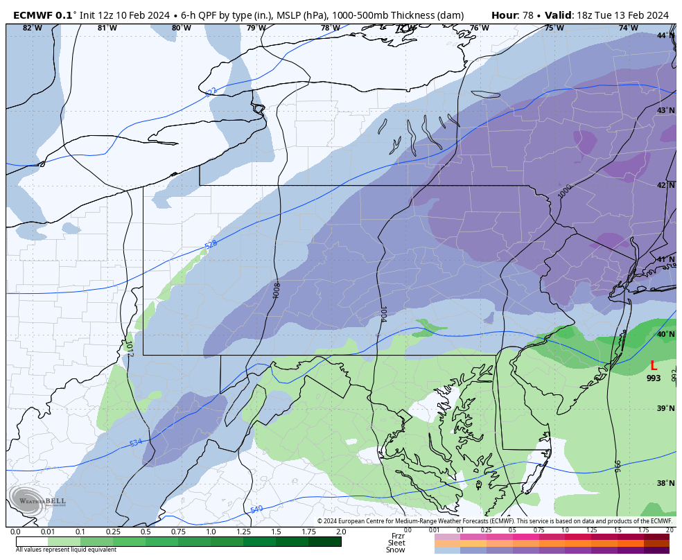
The lack of cold air damming and a high pressure will enable the low pressure system to push near Morgantown, WV before transferring to a coastal low. This will cause the snow axis to be mainly west to east rather than running up the Appalachians.
WINTER STORM TIMING
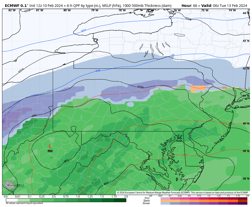
Precipitation will move in late Monday night as snow north generally I-80, and rain south. However as precipitation rates increase, rain will quickly change to snow from north to south as temperatures cool. Below is future radar timing from the European model for 1:00 AM Tuesday.
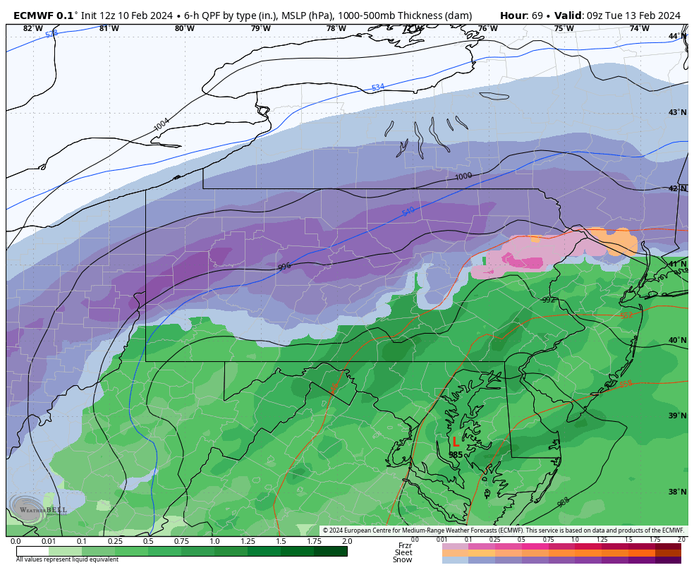
By 4:00 AM Tuesday, the rain/snow line will rapidly drop south to just north of I-76. Future radar for 4:00 AM Tuesday is below.
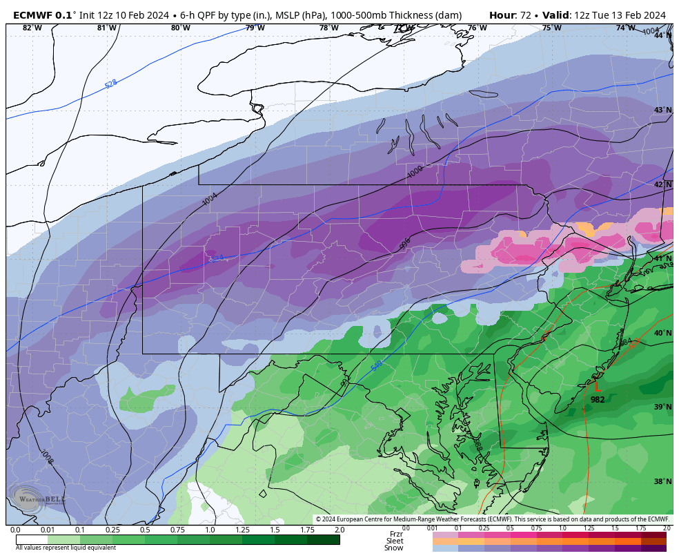
 As the sun rises on Tuesday, snow is expected to be falling heavily in most of the state north of I-76. Here is future radar for 7:00 AM Tuesday.
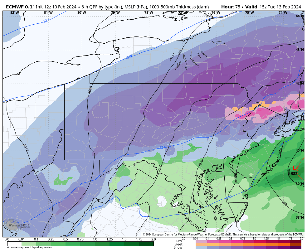 Finally by 1:00 PM Tuesday, snow will be on the way out of Eastern PA as shown here.
FIRST CALL SNOWFALL FORECAST FOR TUESDAY 2/13
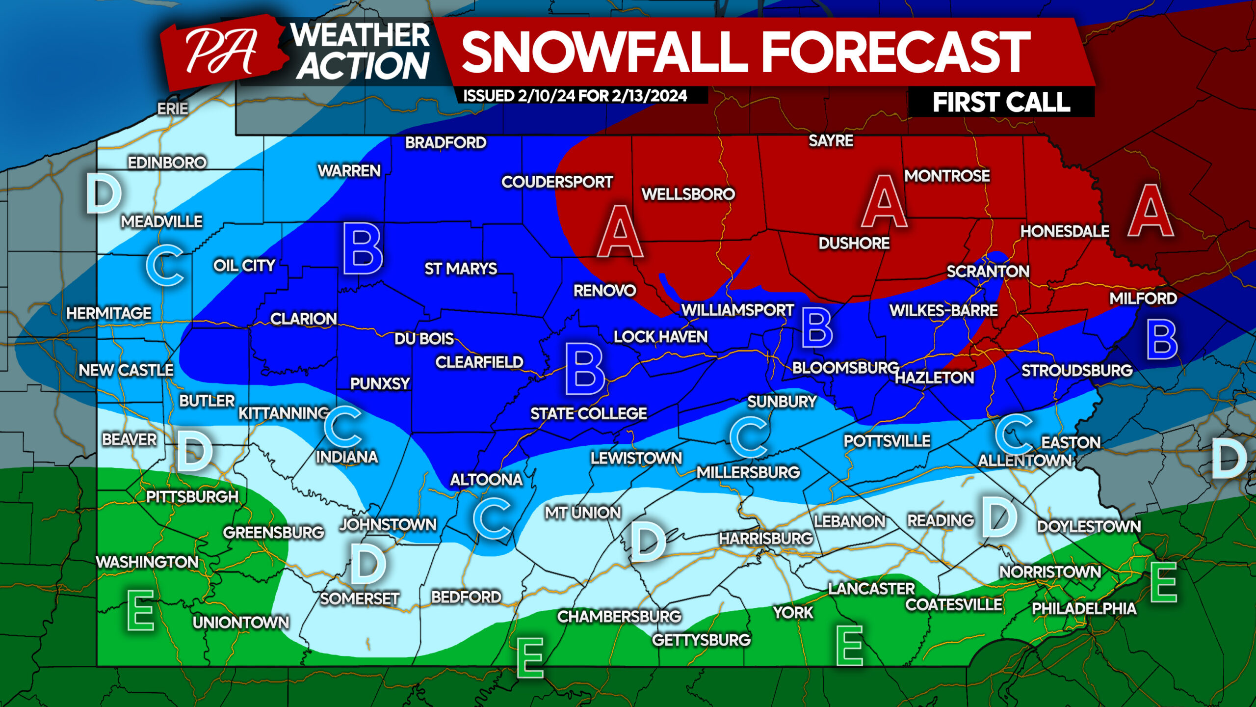
Area A: Snowfall accumulation of 8 – 14” expected. The Tuesday Morning commute will be very difficult to impossible.
Area B: Snowfall accumulation of 4 – 8” expected. The Tuesday Morning commute will be treacherous with snow-covered roads.
Area C: Snowfall accumulation of 2 – 4” expected. The Tuesday Morning commute may include slushy roadways.
Area D: Snowfall accumulation of 1 – 2” expected. Snow may struggle to accumulate on roadways, but slushy spots are certainly possible Tuesday morning.
Area E: Snowfall accumulation of less than 1” expected after a mostly rain event. No roadway impacts expected besides wet roads.
With the Super Bowl and the warm conditions, many people are unaware of this storm! Consider sharing this info with them on Facebook below.
Also, many of you reading this don’t actually follow us! We post worthwhile updates so it’s definitely worth it!
You must be logged in to post a comment.