
FINAL CALL FORECAST POSTED – TUESDAY PM UPDATE:
Final Call Snowfall Forecast for Wednesday’s Historic Winter Storm
As Wednesday slowly approaches, the chances for a widespread major to crippling snowstorm continues to increase as more model data and observations come in. There is the potential for December snowfall records to be broken from this storm for many locations. And if certain model data is correct, all-time snowfall records might be challenged as well.
A large storm system will develop to our south Tuesday and take a direct path at our coverage area and will impact us with heavy snow by Wednesday. Once our storm system transfers into a coastal storm, the exact path the storm takes from there is critical. The closer to the coast, the heavier the precipitation will be, however areas closer to the I-95 in southeast Pennsylvania might experience mixing issues. Meanwhile if the storm takes a slightly east track, this will result in less precipitation, but a colder scenario. Currently right now, the Canadian model is the most “in between” solution so that is what we are going to go with for our future radar images.
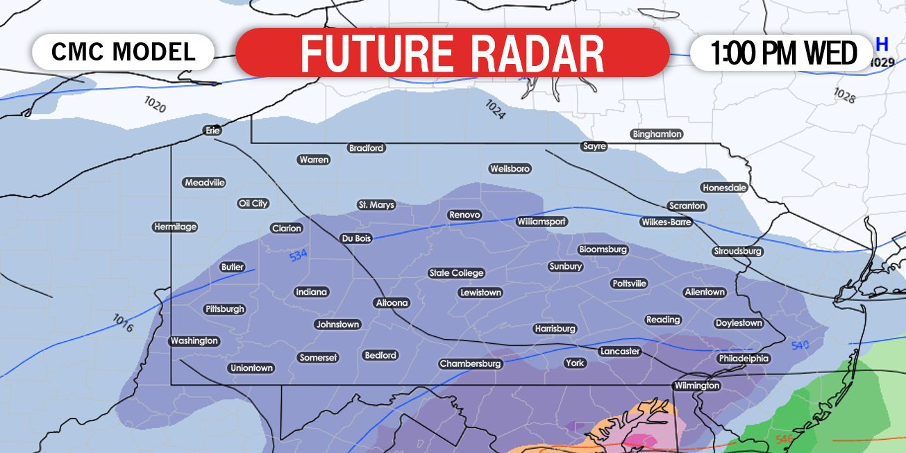
Snow will begin from south to north during the mid-morning hours Wednesday. The snow will begin as a light snow. During the early afternoon hours, steady snow will overspread much of the coverage area. Below is a look at 1:00 PM Wednesday:
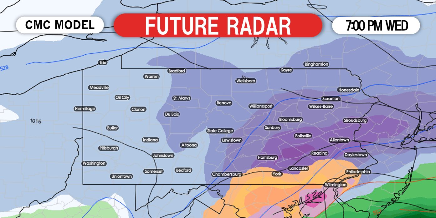
Without a doubt, the evening rush hour will be the most impacted part of the day Wednesday. It is highly recommend to stay home Wednesday if possible. By 4:00 PM, heavy snow has developed across central and eastern Pennsylvania:

It is important to note, that the Canadian model does bring the mix line into extreme southern Pennsylvania and as well as southeast Pennsylvania. This would limit the accumulations for these areas by a tad. Below is a look at 7:00 PM Wednesday evening:
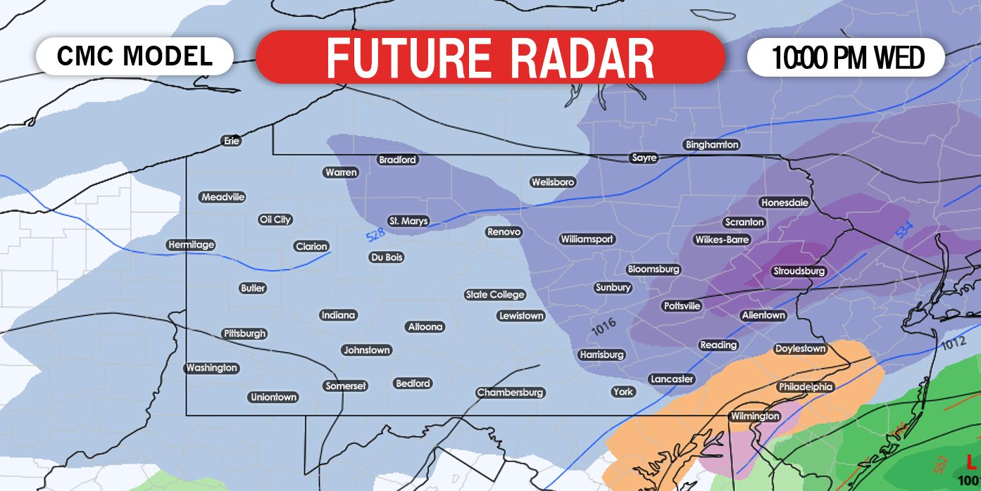
The heaviest of the snowfall will fall Wednesday between 3:00 PM and 10:00 PM Wednesday. After 10:00 PM Wednesday night, the storm will begin to pull away, but snow will continue especially for eastern Pennsylvania through the overnight hours Thursday morning. Below is a look at 10:00 PM Wednesday night:
We are still 72 hours away from the start of this storm. So please stay alert for new updates as we go forward. For now, many of us should begin preparing for a major to even historic snowstorm with accumulations well over a foot of snow in parts of the state.
FIRST CALL FOR WEDNESDAY’S MAJOR TO HISTORIC SNOWSTORM
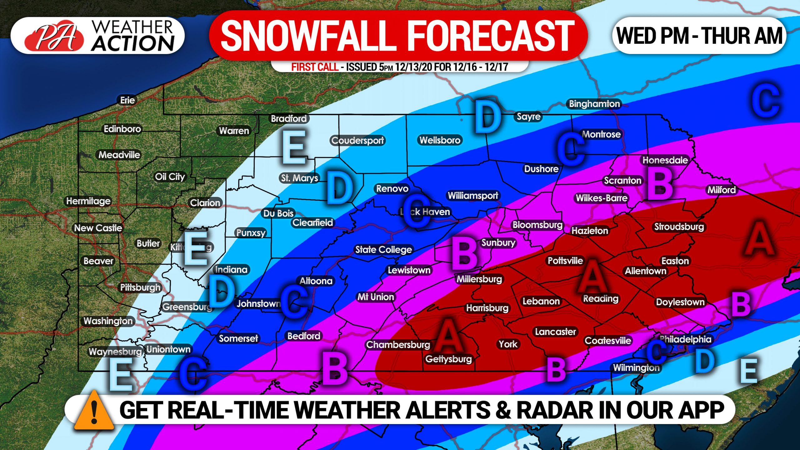
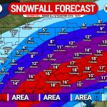
Area A: Snowfall accumulation of 15 – 20″+ expected. Heavy snowfall rates of 1/2″ to as high as 3″ per hour are expected across an 18 hour period, starting Wednesday afternoon through Thursday morning. Travel will be extremely difficult to impossible during and just after the storm. Isolated power outages will be possible.
Area B: Snowfall accumulation of 10 – 15″ expected. Heavy snowfall rates of 1/2″ to as high as 2″ per hour are anticipated over a 15 hour period, from Wednesday afternoon through Thursday morning. Travel will be very difficult to impossible during and just after the storm.
Area C: Snowfall accumulation of 6 – 10″ expected. Snowfall rates of 1/2″ to as high as 1″ per hour are likely across a 15 hour period, starting Wednesday afternoon through Thursday morning. Locations on the southern edge of this zone will likely mix with rain and sleet. Travel will be difficult during and just after the storm.
Area D: Snowfall accumulation of 3 – 6″ expected. Light to moderate snow is expected over a 12 hour period from Wednesday afternoon into early Thursday morning.
Area E: Snowfall accumulation of 1 – 3″ expected. Light snow over a 9 hour period from Wednesday afternoon through the late evening is probable.
Our Second Call Snowfall Forecast will be posted Monday evening. For that and much more, get our new Apple & Android app here! >>> Weather Action App Link
This will likely be a historic December storm for the state. Get the word out to your family and friends so they can plan accordingly, using the blue button below.

You must be logged in to post a comment.