
Fluctuating pressure systems will traverse the region throughout the week, changing weather conditions, wind speeds, and rain potential. Gusty conditions are expected on Tuesday and Wednesday, with the increased potential for rain late Wednesday and most of the day Thursday.
Tuesday
Isolated showers can be expected in the early morning hours as a low pressure system moves out of the area. Mostly sunny but windy conditions can be expected throughout the day on Tuesday. Wind speeds will range between 8-15 mph, with wind gusts above 20 mph. Higher elevations could see wind gusts of 35-40 mph. High temperatures will be in the low to mid 60s, and overnight lows will be in the mid 30s to low 40s.
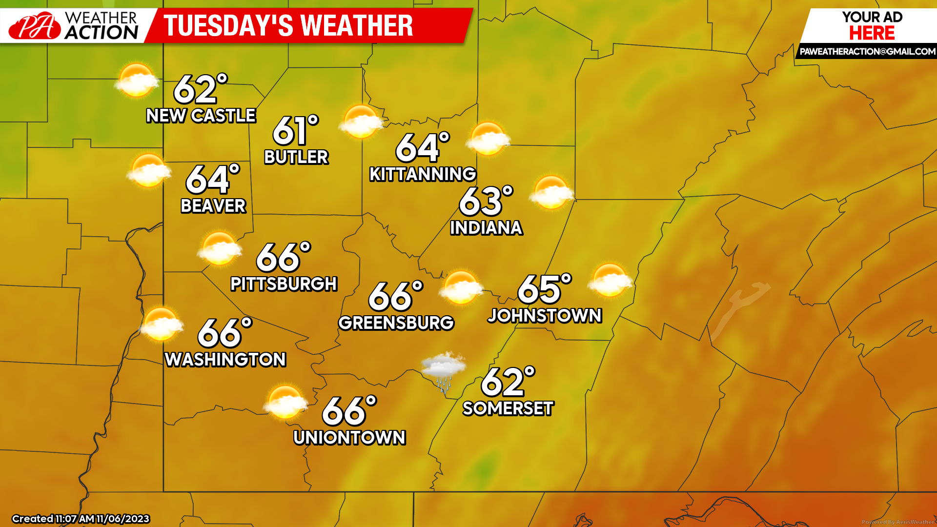
Windy conditions can be expected for most of the day. Wind gusts ranging between 20-40 mph for the regions are expected late Monday and well into Tuesday. Gusty winds should begin to subside in the early evening hours on Tuesday.
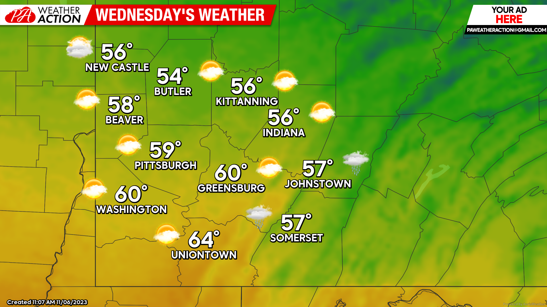
Wednesday
Mostly sunny skies will begin to transition around mid-day leading to rainy evening and overnight conditions. Highs will be in mid 50s to low 60s, and lows will be in the high 40s to mid 50s. Gusty conditions may be accompanied by the rain, wind gusts will range between 15-20 mph, with some gusts in the higher elevations being above 30 mph.
Thursday
Rain and clouds are expected for most of the region. The greatest chance for rain will be in the morning hours, however rain will likely persist throughout the day. Highs will be in the low to mid 60s, and lows will be in the low 50s. The possibility of a rumble of thunder cannot be ruled out.

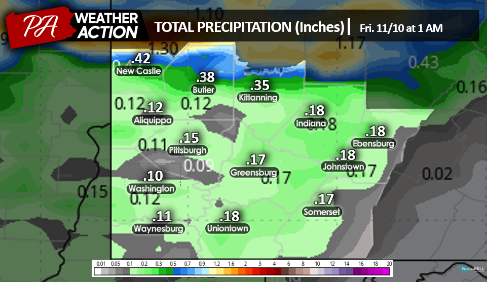
Total anticipated rainfall through Thursday is less than a quarter of an inch for most of the region. Higher rainfall totals could be possible in areas that experience a thunderstorm.
Be sure to follow PA Weather Action on social media platforms to stay up to date on all weather conditions and events.


You must be logged in to post a comment.