

Good evening! I hope you had a pleasant weekend, which ended up being mostly dry for the entire area (with a few isolated showers on Saturday morning that you may have not experienced). Additionally, we had temperatures remain above average this weekend, which is making it feel like early October opposed to early November. If you did not have a chance to soak in the warmth and sunshine, you will have more opportunities this week!
TUESDAY:
Tuesday will be a rather pleasant afternoon with high temperatures climbing into the mid-6os to lower-70s. Expect a mix of sun and clouds, with cloud cover increasing significantly toward sunset and beyond. Despite the higher temperatures, expect a westerly wind to develop in the afternoon hour of 10-15 MPH with occasional gusts of 30+ MPH. It will be a great afternoon to get outdoors!

WEDNESDAY:
Wednesday will allow for slightly unsettled conditions as a moisture-starved cold front moves through the region. Despite the passage of the front, expect generally a mix of sun and clouds with a few very isolated showers early across the northern portion of the viewing area. High temperatures will be cooler, yet still above average, in the mid-50s. Expect to see a break from the wind as well, with a slight easterly wind of 2-5 MPH developing during the afternoon hours.

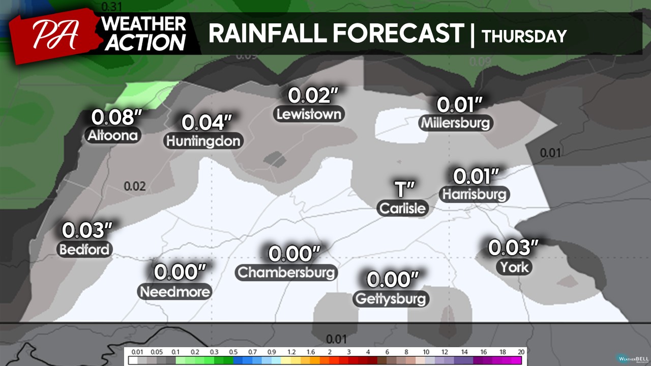
THURSDAY:
A warm front will lift through the region on Thursday, allowing for a rebound in temperatures although a few areas may see rain showers develop, primarily before 2 PM. Expect conditions 2 PM and onward generally to be a mix of sun and clouds. As the warm front lifts north, expect high temperatures to climb into the low-to-upper 60s across the region, with a few spots hitting the 70-degree mark in the far southern counties. We will also see a westerly wind to develop in the afternoon hour of 6-12 MPH with gusts occasionally up to 20 MPH. It will yet be another overall great afternoon and evening!
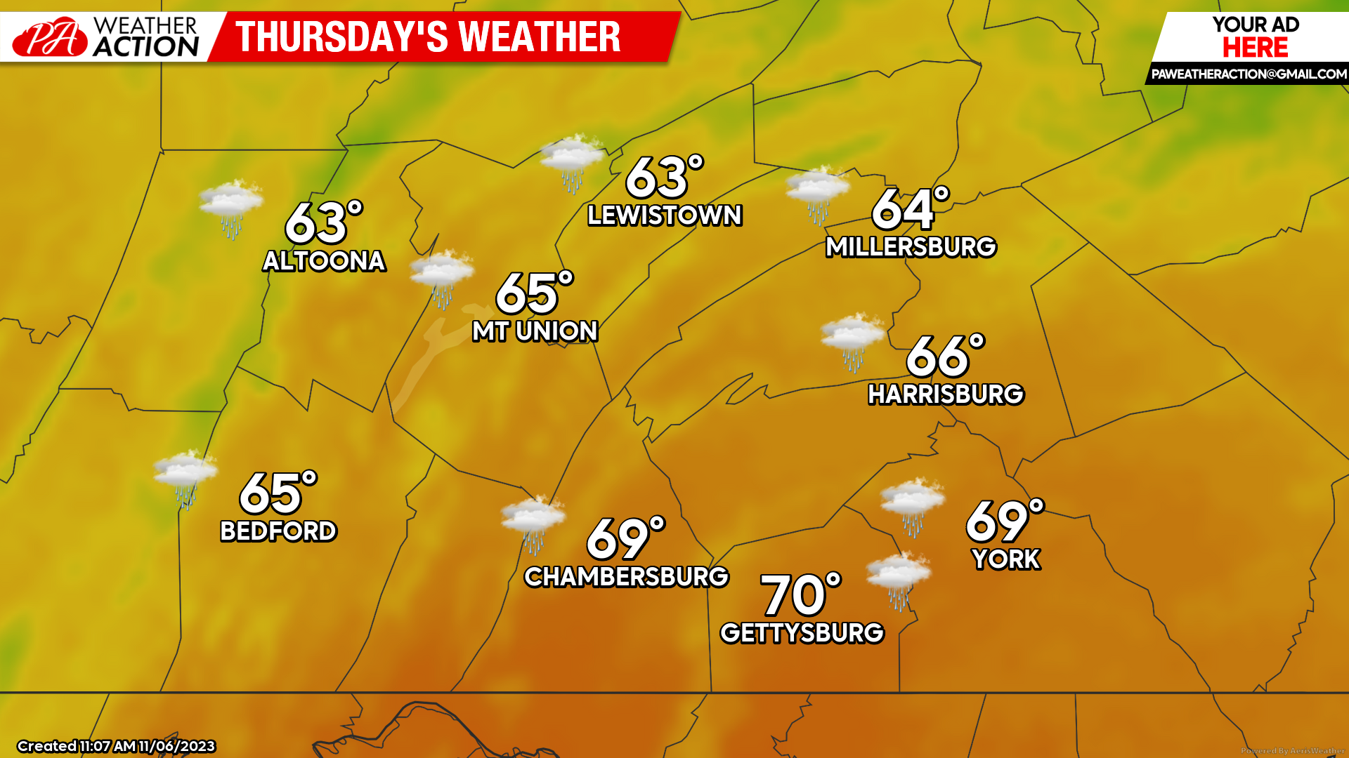 With the showers expected on Thursday, expect these showers to be rather light and sporadic, mainly across the northern areas with overall expected amounts less than at tenth of an inch. Overall, the rain should be an issue Thursday afternoon.
Overall, expect a pretty nice week with high temperatures remaining above average on a day-to-day basis. If you have time this week, make sure to find some time outdoors to soak in the warmth and sunshine. We know it will not be lasting much longer with winter looming around the corner. If you have any questions, feel free to reach out. If you want more updates, download the PA Weather Action app and follow on social media!
Best,
Denys Khrulov

You must be logged in to post a comment.