
After a fairly dry start to Fall, a post-tropical Nicole will bring heavy, wind-blown rain to Pennsylvania early this weekend. The storm will be followed by a cold front that will introduce our new wintry pattern. The warmth was certainly nice while it lasted, and those wishing for more traditional fall weather are about to get a bit more than they wished for. We’re talking about highs in the 30s and 40s with lows in the 20s.
Post-Tropical Nicole
Showers from Nicole will begin to push in from the south by sunrise Friday morning. Heavier periods of rain will stream in by Friday afternoon, and the thick of it comes Friday night into early Saturday morning. Highest rainfall totals will be found where rain is most persistent – in western and northern sections of the state. However, the windier conditions will be felt near and east of the low pressure in central and eastern PA.
Below is future radar for Nicole’s impacts Friday Morning to Saturday Morning.
Rainfall Forecast Map Fri AM – Sat AM
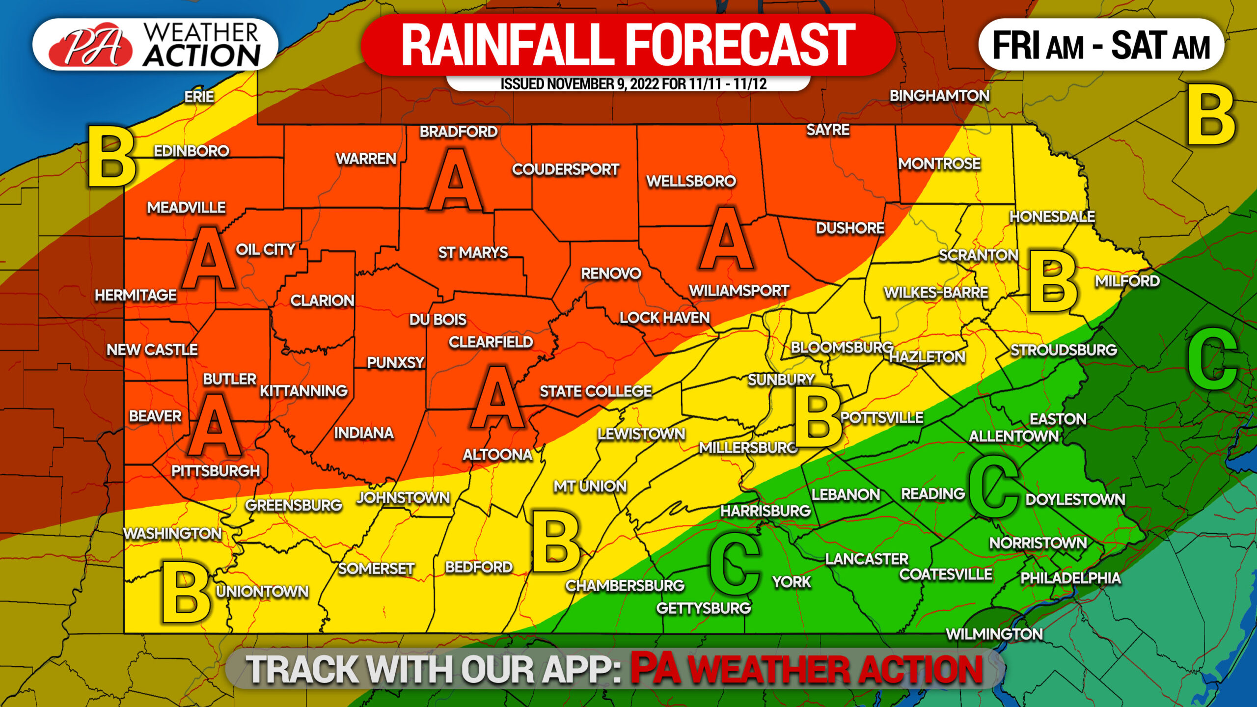
Area A: Total rainfall of 2.0 – 3.0″ expected.
Area B: Total rainfall of 1.5 – 2.0″ expected.
Area C: Total rainfall of 1.0 – 1.5″ expected.
Pattern Change
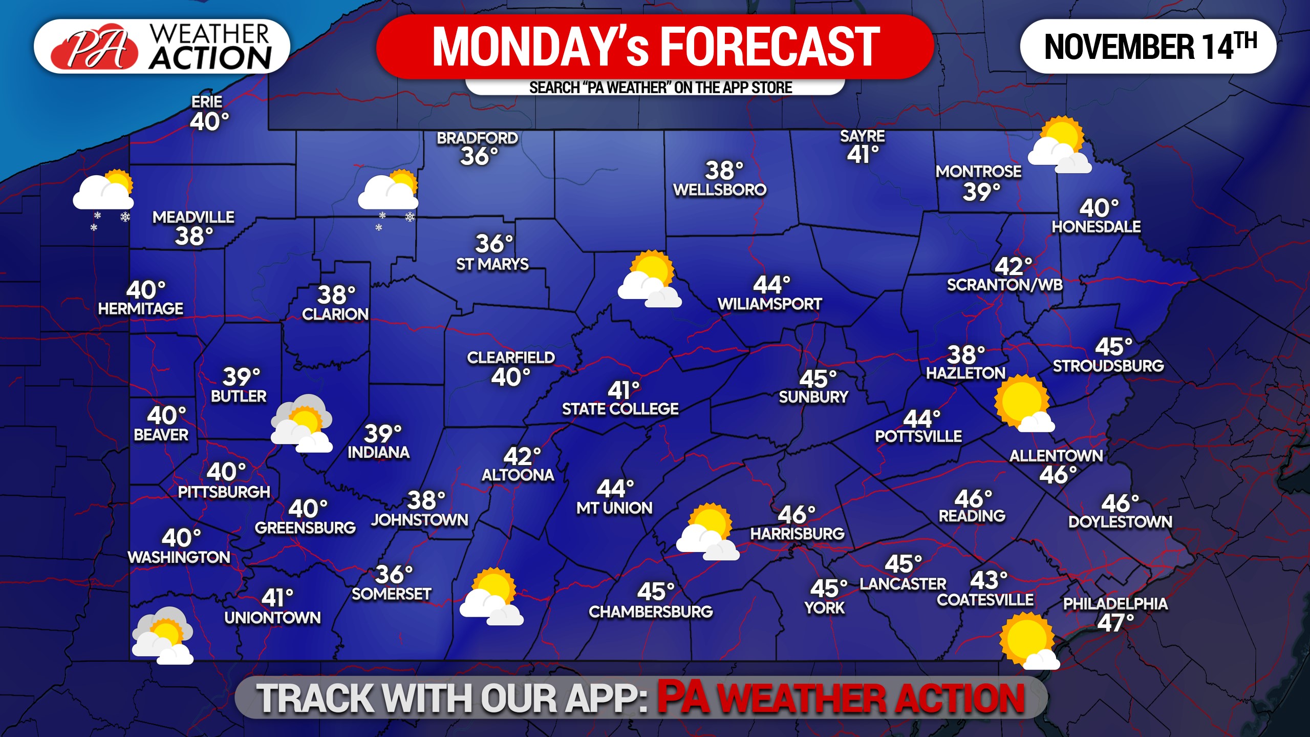
Finally, a pattern change is nearly here. But it’s much more aggressive than most of us wanted, and temperatures will plunge to late February or early March temperatures. Highs in the 30s are expected for higher elevations and 40s elsewhere, and lows in the 20s nearly statewide except near Philadelphia. We don’t expect lake effect to be much of an issue yet.
Sunday will be the slap us in the face day, and Monday will be the settle in day as we get used to this new exciting weather that for some reason many on our page enjoy so much. Here is Monday’s forecast map.
Early Snow?
We mentioned the chance of an early first snow in some areas. Between Wednesday Nov 17 and Monday Nov 21, we see two to three far out opportunities for snow really anywhere in the state. However, by far out, we mean they’re early signals and may easily disappear. But the more chances, the better, unless you dislike snow. But it’s the holiday season and you’re in PA, so cheer up and accept some snow!
That’s all for now, we’ll keep you updated on how things evolve. We also have a models section in our app where you can see what we’re watching in a more raw form (things we don’t post to the masses). Check that our here >>> PA Weather Action APP
Thanks for reading, don’t forget to give this article a share if you think someone else might find some use out of it!
[social_warfare]
You must be logged in to post a comment.