
Today
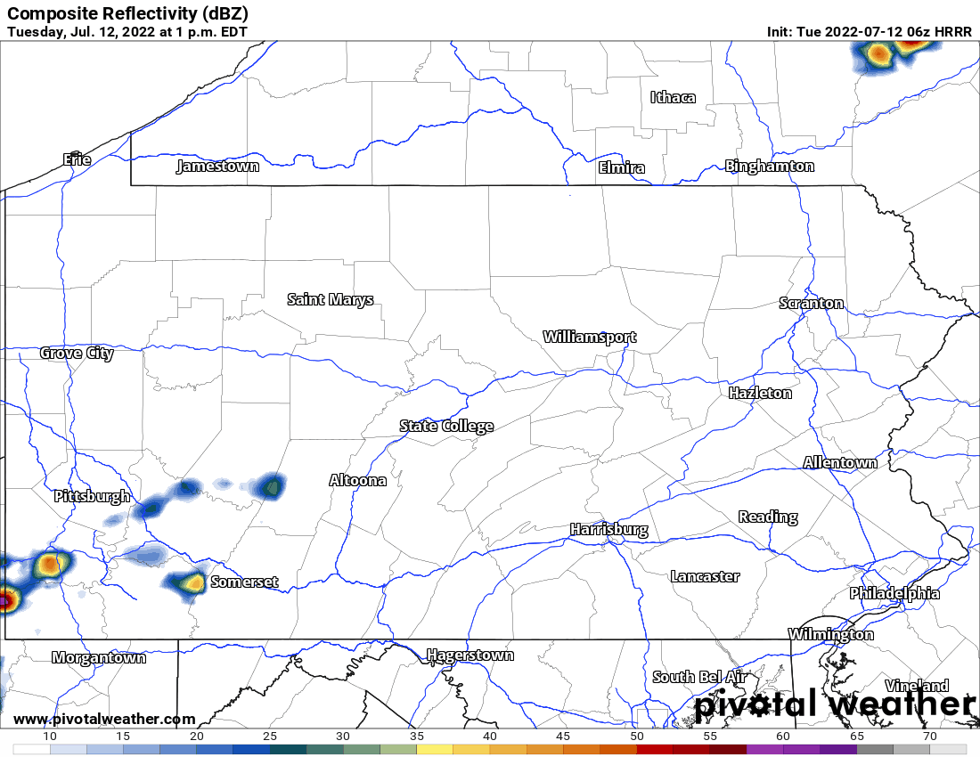
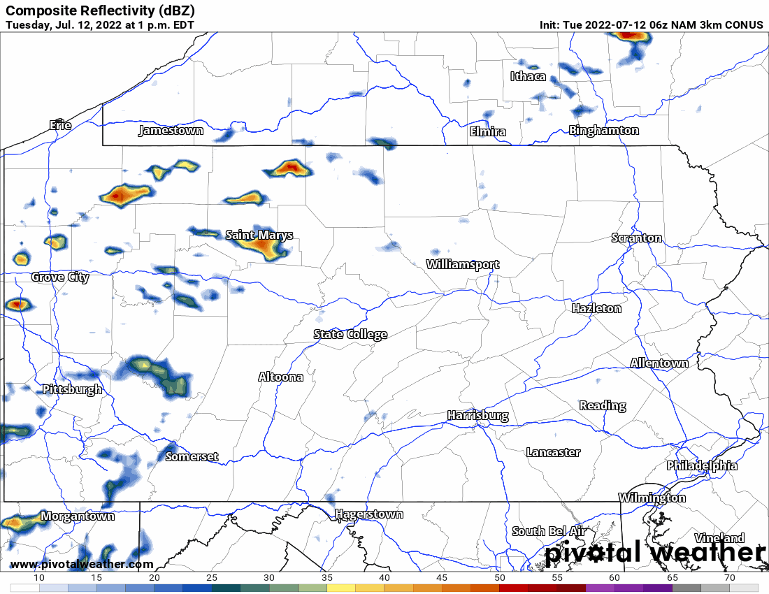
Scattered thunderstorms are possible Today across much of the state, with damaging winds as the main risk. The HRRR & NAM have differing ideas for how Today will play out. Below is the HRRR, followed by the NAM.
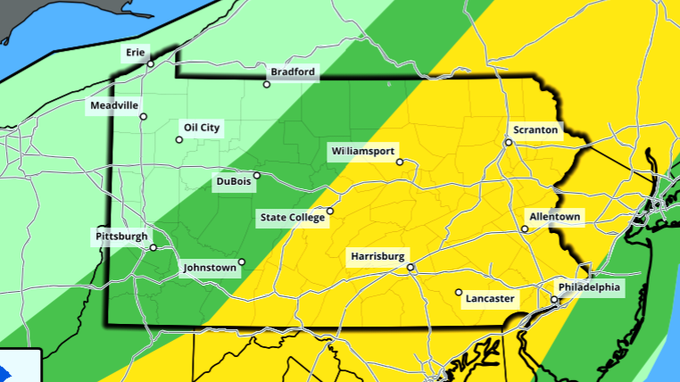
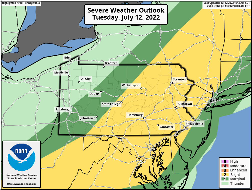
The Storm Prediction Center Outlook depicts a Slight Risk across the eastern half of the state generally.
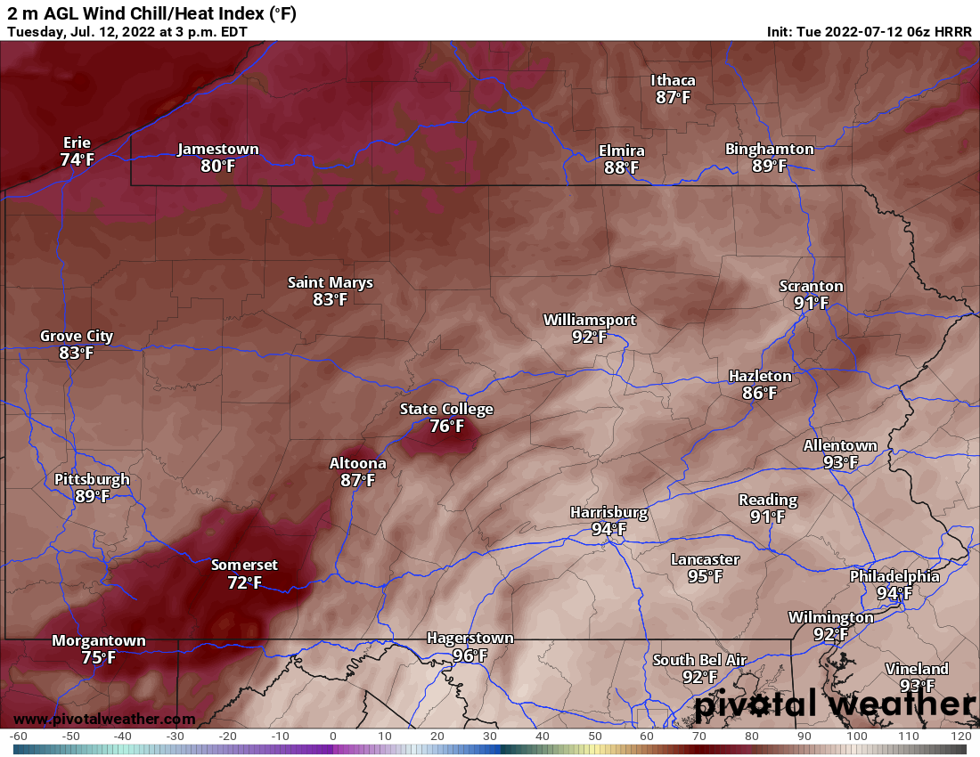
Temperatures today will not be comfortable either, with humid conditions ahead of the front making it feel above 90 degrees in many areas, as shown below.
Wednesday
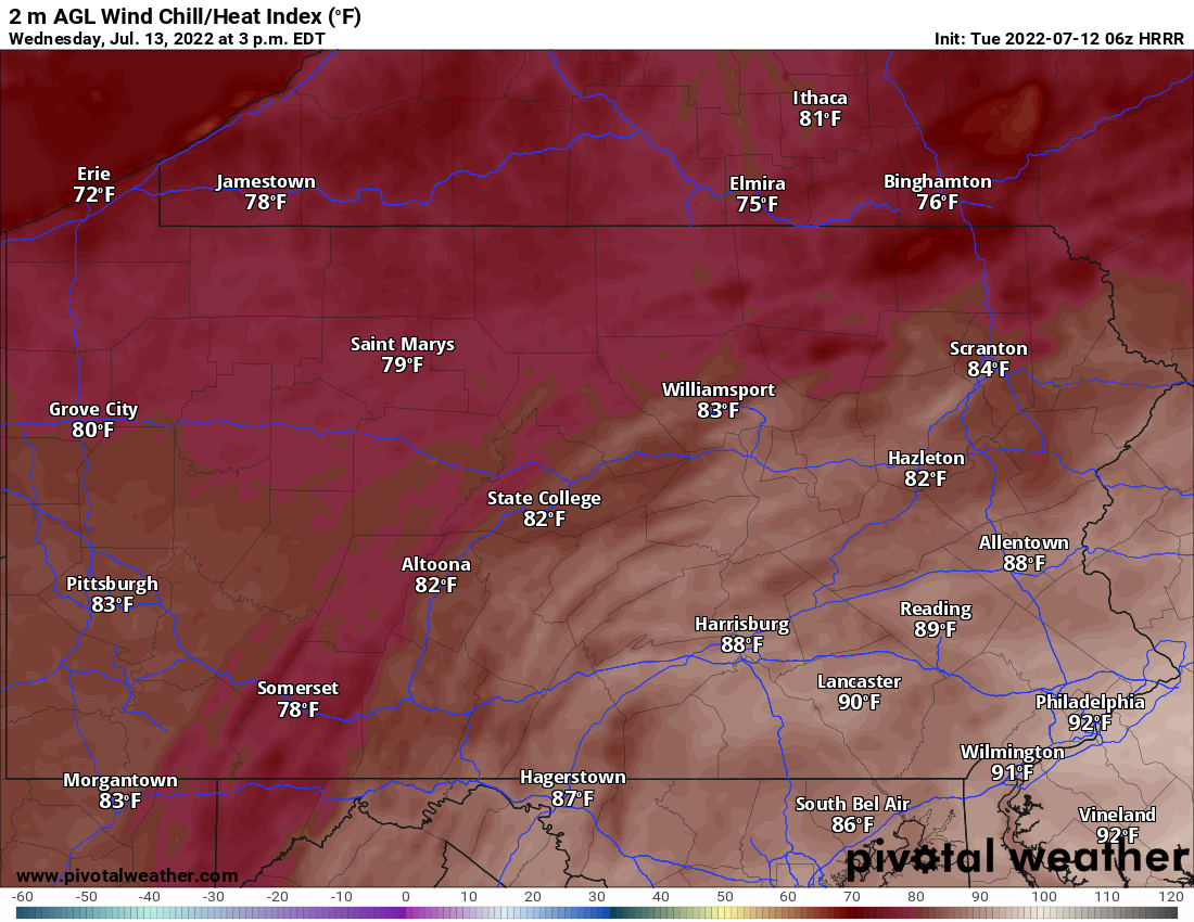
A stretch of mostly dry days begins tomorrow, with high temperatures in the upper 70s to mid 80s and lows in the upper 50s to mid 60s. There may be some isolated showers in Western PA tomorrow. Below are Wednesday’s feels like temperatures at 3pm.
Weekend
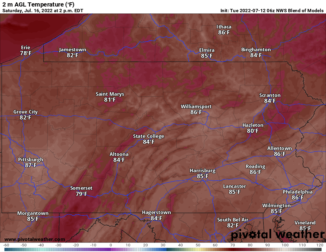
Saturday looks great, with mostly sunny skies. Sunday may bring a chance of showers especially in the eastern half of the state, but they’ll likely be scattered. Below are highs for Saturday.

You must be logged in to post a comment.