
A disturbance will deliver a light snowfall to our area Friday, followed by another blast of arctic air for the weekend. A much-milder pattern of above-normal temperatures will overtake much of the East next week, but not without a small hope for more snow.
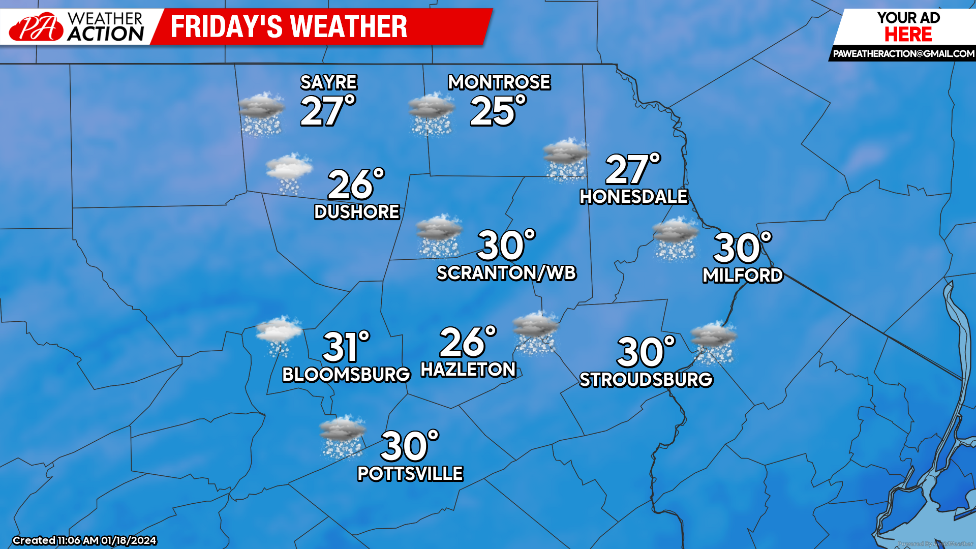
FRIDAY
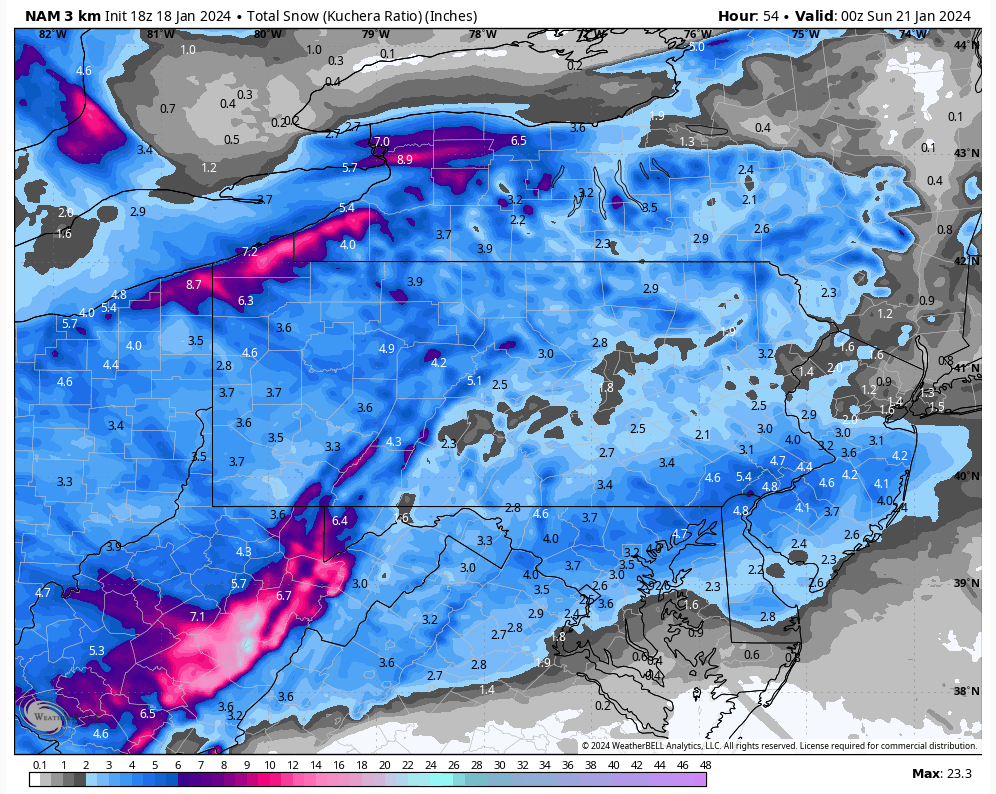
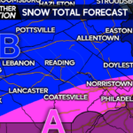
Light snow will overtake the area before sunrise, and last into the evening. A general 1-4″ of low-density shovelable-nuisance snow is anticipated across our area. There will be an inverted trough that will enhance snowfall over New Jersey into southeastern Pennsylvania, where 4-6″ is likely.
Arctic air will spill into our area behind the system Friday night, with NW wind gusting over 30 mph driving temperatures through the teens to near 10 F in the valley locations and single digits in the higher elevations.
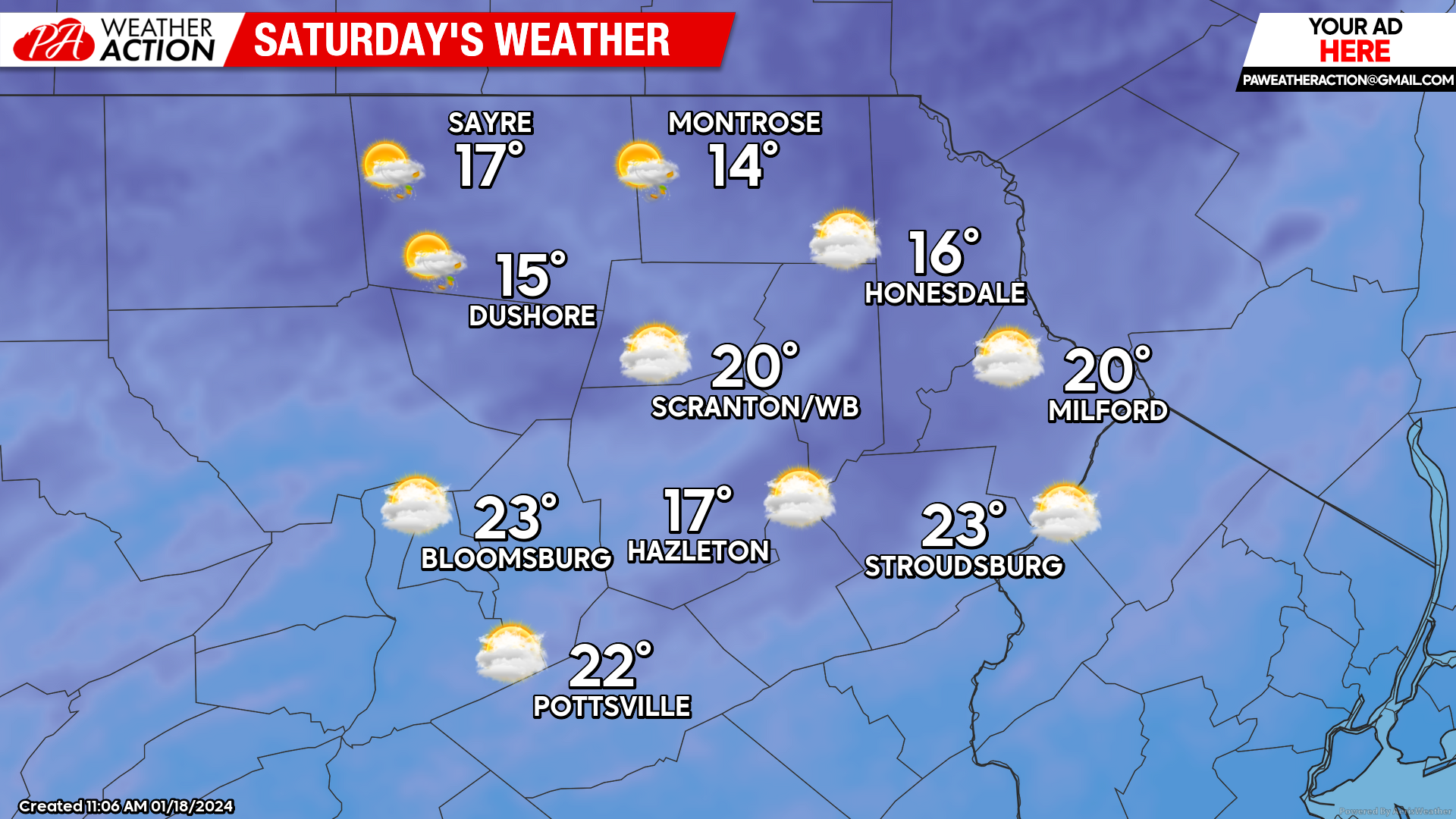
SATURDAY
Northwest wind gusting to 35mph will continue to drive arctic air into the area, with temperatures only recovering a few degrees during the daytime Saturday. There will also be plenty of clouds and snow showers which could provide light accumulations for some areas, especially higher elevations and northern counties. The gusty wind will persist Saturday night, once again driving temperatures down to near 10 for the valleys and single digits in the higher elevations.
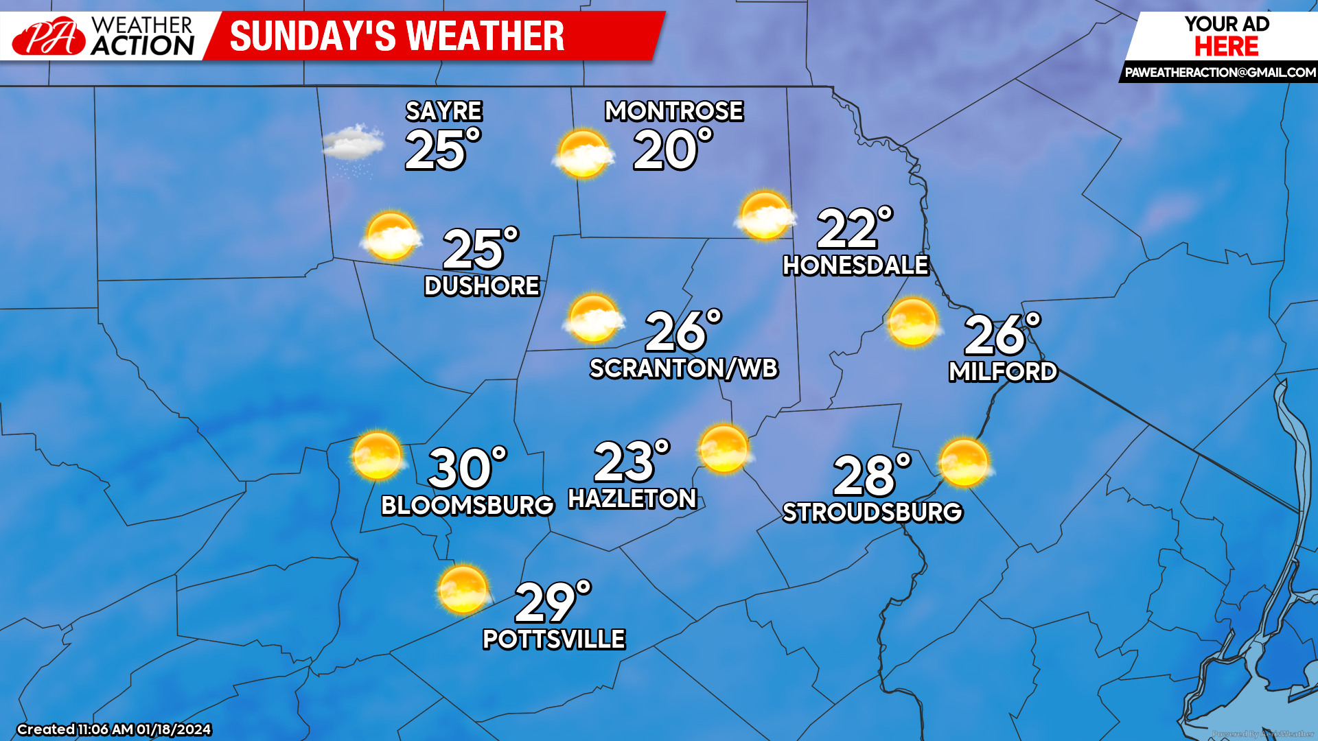
SUNDAY
Blustery conditions will continue, although it will be slightly ‘milder’ than Saturday as temperatures will manage to rise into the 20s along with sunnier conditions.
BEYOND SUNDAY
Next week will provide a respite from the arctic air that has gripped the nation this past week, featuring a return to widespread above-normal temperatures for nearly the entire contiguous US. There will be a couple of disturbances to contend with, most likely on Tuesday and Friday. Despite the lack of arctic air, conditions will be marginal for mixed precipitation, but it is far too early for those details.

You must be logged in to post a comment.