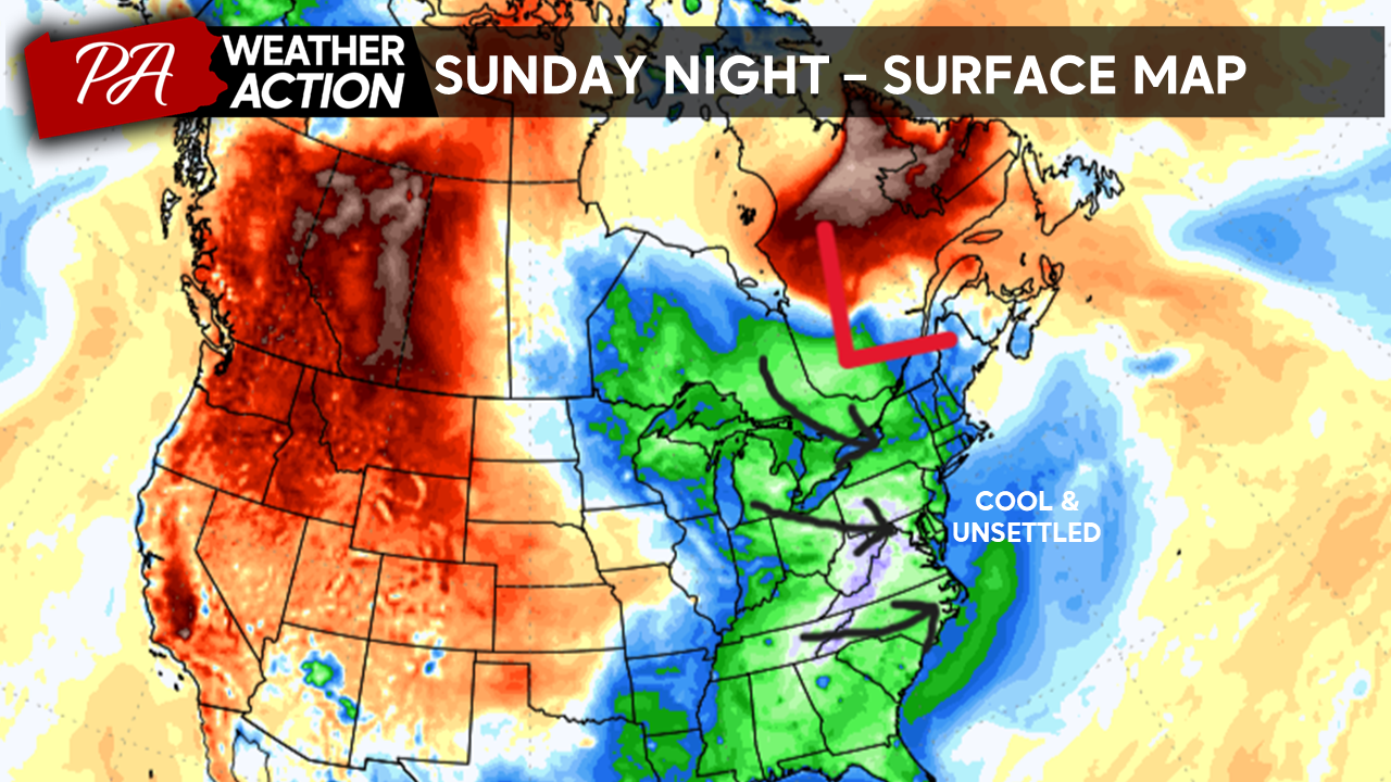
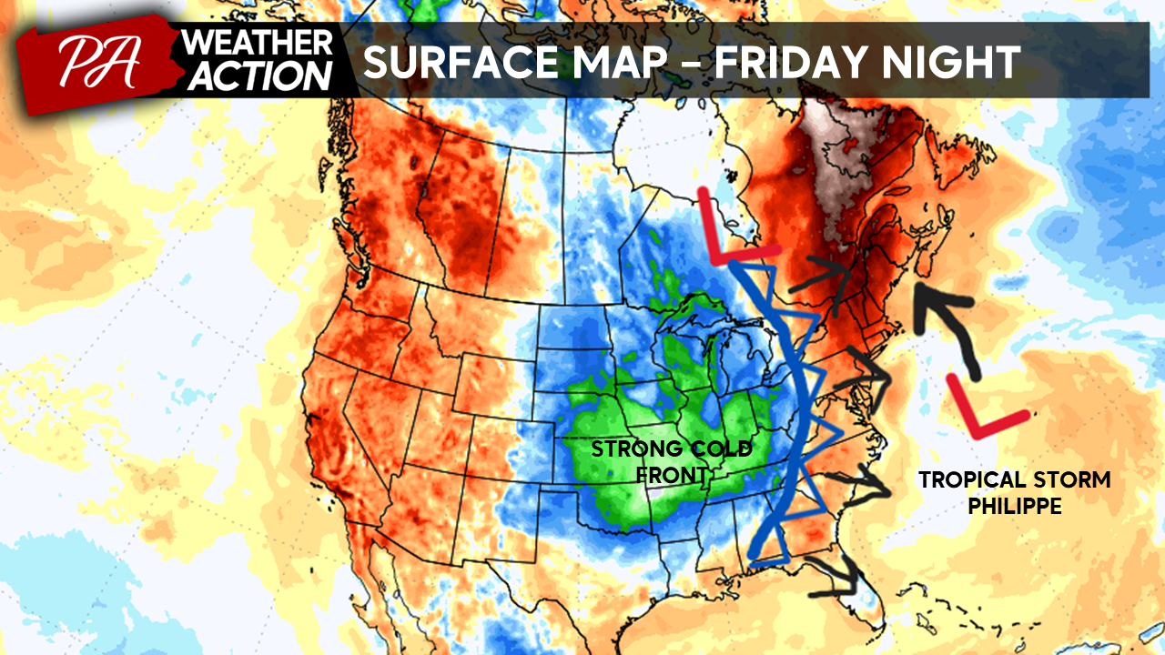
Good afternoon everyone! After a warm and sunny week, major changes are on the way for the weekend. We are tracking two features that are set to impact our weather this weekend and bring a pattern change into early next week. A strong cold front currently moving across the central U.S. will begin to move into our region late in the day on Friday. This front will sweep through the area early Saturday morning bringing showers and thunderstorms and dropping temperatures significantly. The map below indicates the placement and movement of these features while also highlighting temperature anomalies with warm tones indicating above-average temperatures and cool tones indicating below-average temperatures.
Once this front passes through PA, it will combine its energy with Tropical Storm Philippe, which will move up the East Coast. This will initiate the development of a strong extratropical low over Quebec as we head later into the weekend. This low pressure will keep our region under strong northwesterly flow, bringing chilly and unsettled conditions as we head into early next week. The warm summerlike conditions that have characterized this past week will give way to a stretch of unsettled weather. Temperatures will drop dramatically with both daytime highs and lows running 10 – 20 degrees below average as we head into early next week.
Friday
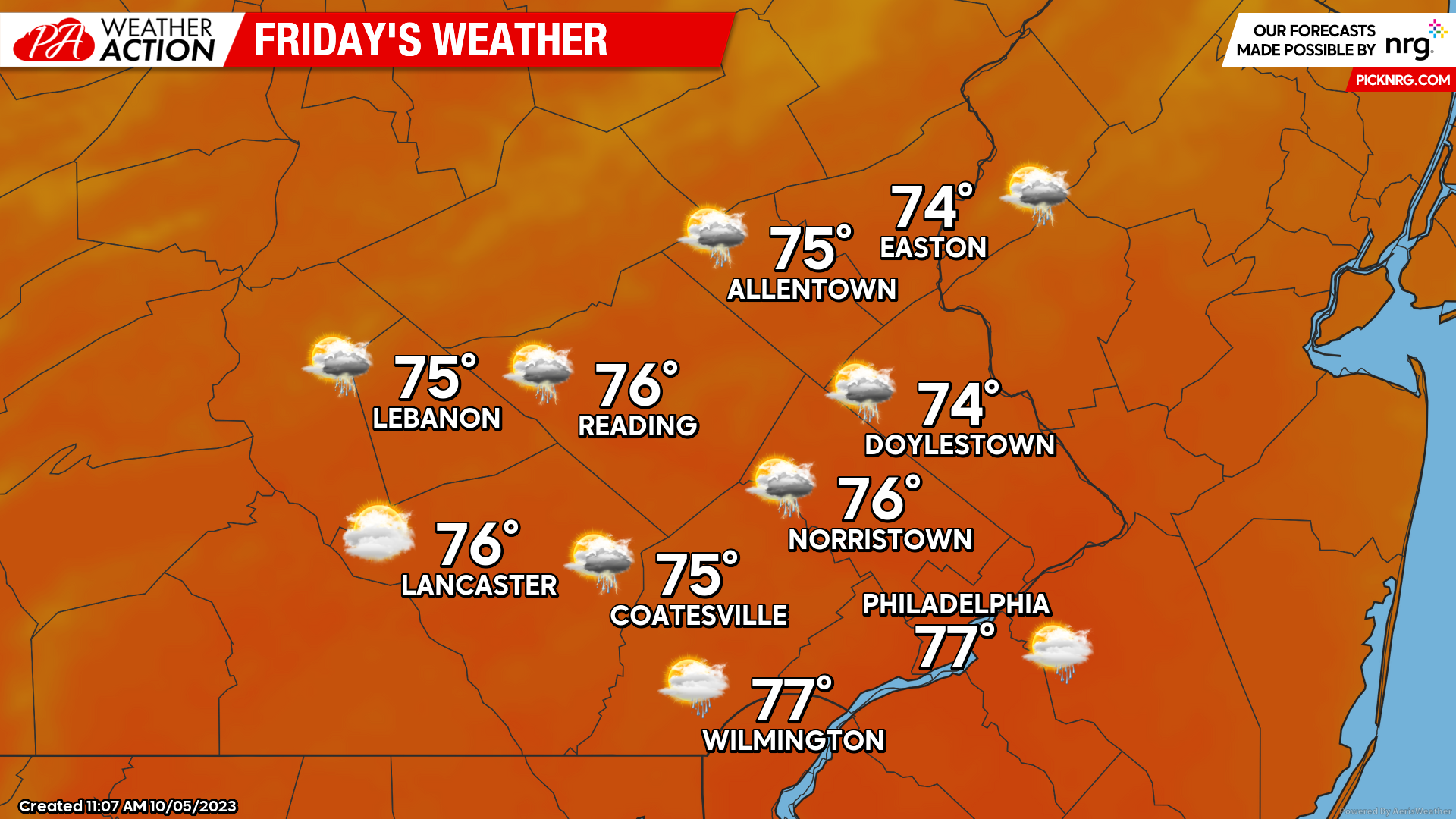
Friday will start off still rather mild and pleasant as the cold front will still be situated to the west of the region. Expect partly cloudy skies to start your day with lows only dipping into the mid-60s for most. Clouds will increase throughout the day on Friday as the front approaches. SE winds off the Atlantic ahead of the front will give the afternoon a muggy feel with mostly cloudy skies, dewpoints in the upper 60s, and highs peaking into the mid-70s. As the front approaches from the west expect scattered showers and thunderstorms to fire throughout the evening. Scattered showers and thunderstorms will continue into the overnight hours.
Saturday
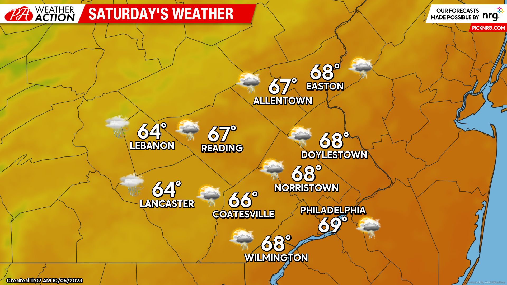
The cold front will move through the region early Saturday morning. High temperatures for the day will occur in the early morning hours just ahead of the front. Expect temperatures Saturday morning to start in the mid-upper 60s. Scattered showers and thunderstorms will continue throughout the morning with the front’s passage. As the cold front slides east winds will shift from out of the SE to out of the NW ushering in cooler temperatures as well. Precipitation should clear the region by the mid-afternoon but temperatures should continue to fall dipping into the mid-50s by the evening. Expect winds to increase as well; out of the NW at 10-20mph.
Sunday
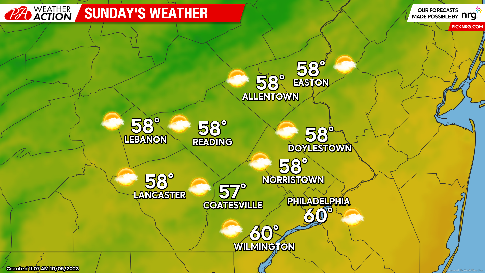
Sunday morning will feature mostly cloudy skies with cool temperatures. Expect lows Sunday to start in the mid-upper 40s. Precipitation should remain North of the region throughout the day, however, NW flow will keep scattered cloud cover in place throughout the day. Expect high temperatures to peak into the upper 50s- near 60 Sunday afternoon. Winds will remain gusty as well out of the NW at 10-15mph with gusts to 25mph, giving the day an overall crisp fall feel.
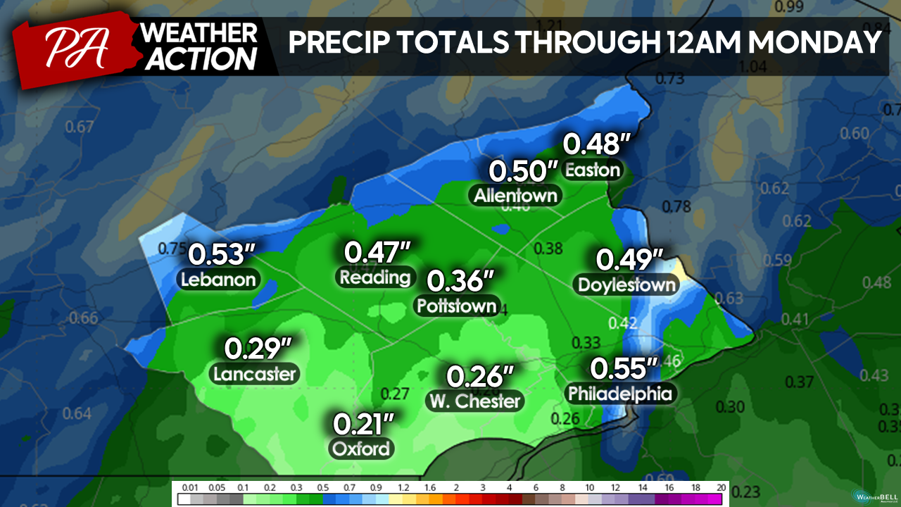
All in all, don’t expect a complete washout of the weekend, however, a dramatic shift in the warm weather of recent days is expected. Precip totals should range between 0.25″- 0.75″ through Sunday night.
Beyond Sunday, this upper-level low is set to remain in place through early next week. With this, we can expect below-average temperatures and occasional shower chances to continue through early next week. If you have any questions are comments regarding the forecast feel free to let me know. Have a great weekend!
-Michael Woytowiez

You must be logged in to post a comment.