
December 13, 2022 Morning Update
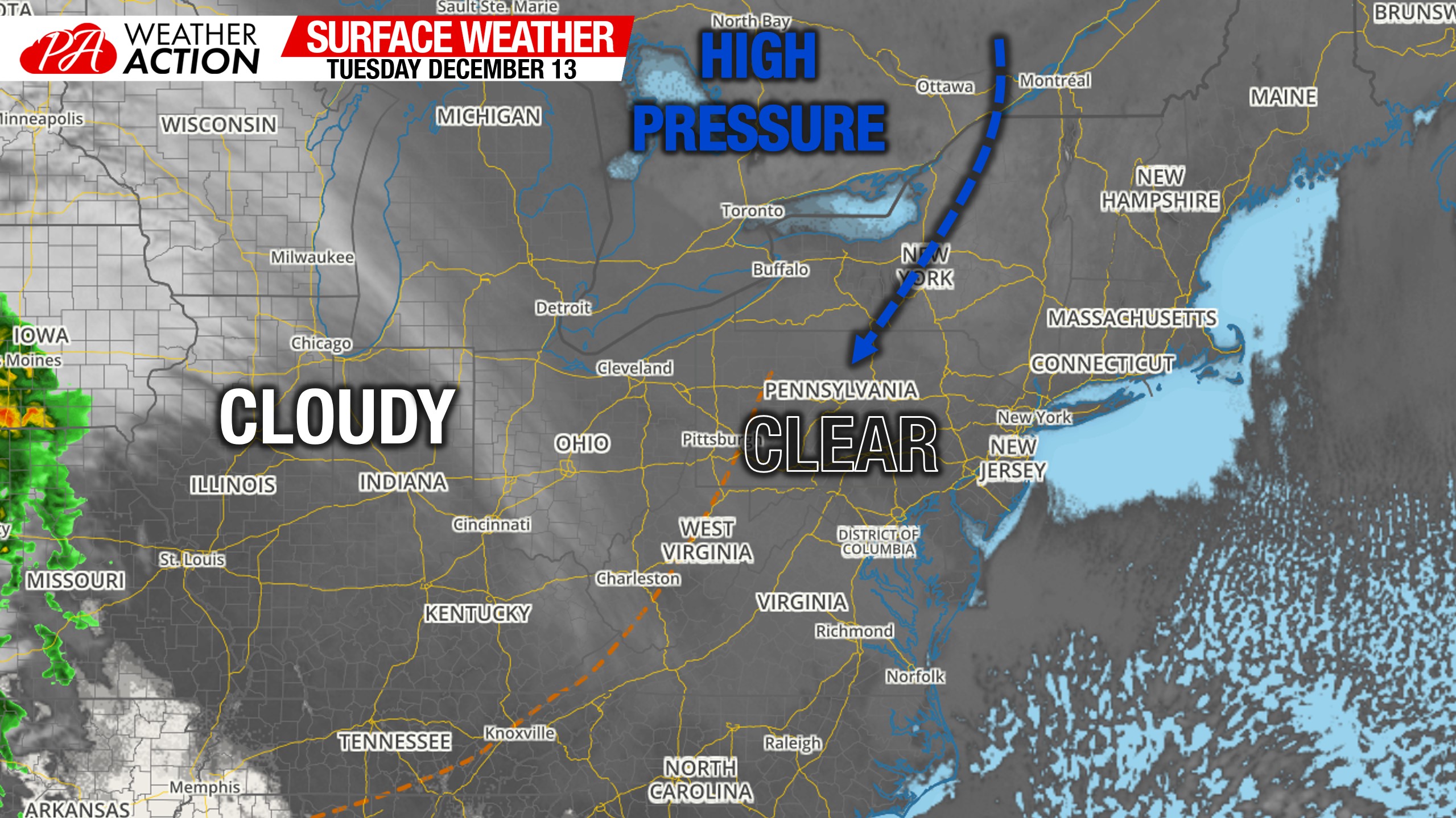
Morning Surface Weather Map
Most of the commonwealth is starting the day with sunny skies except across Western PA, where mostly cloudy skies are overhead. Temperatures very greatly across the state as shown below, followed by the surface map.

Winter Storm Watches Issued in Parts of PA
The National Weather Service has issued Winter Storm Watches for portions of the state ahead of Thursday – Friday’s storm. Currently, the watches are confined to the central mountains but I expect much of Northeast PA to be placed under a watch a bit later today. Below is the alerts map, which updates automatically.

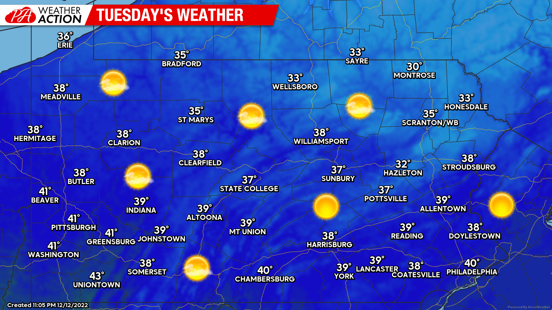
Tuesday’s Weather Map
Another cold December day with temperatures a few degrees below average. Mostly sunny in all area except Western PA where partly to mostly cloudy skies are expected.
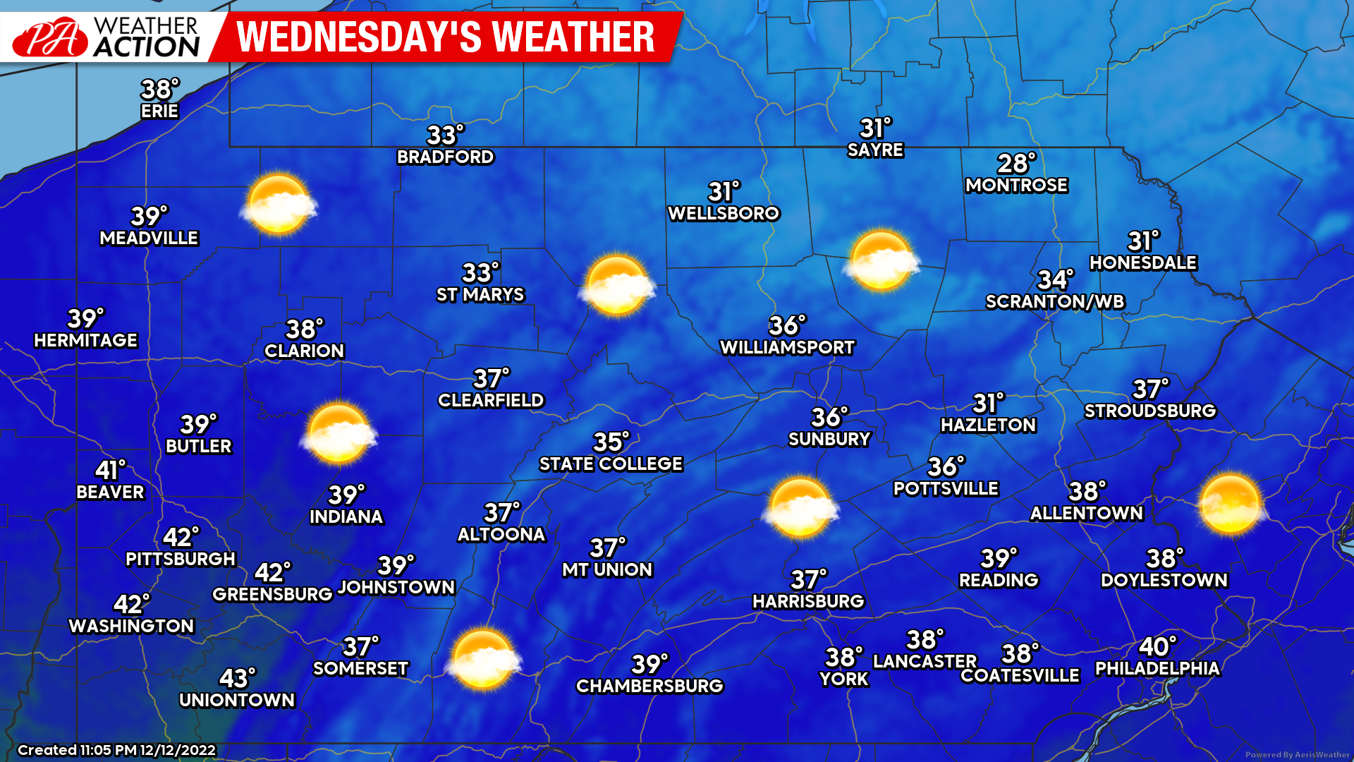
Wednesday’s Weather Map
Tomorrow will be identical today, except we will begin to see clouds move in from west to east in the afternoon ahead of the storm. Highs very similar, in the low 30s to low 40s.
Thursday – Friday Storm Update
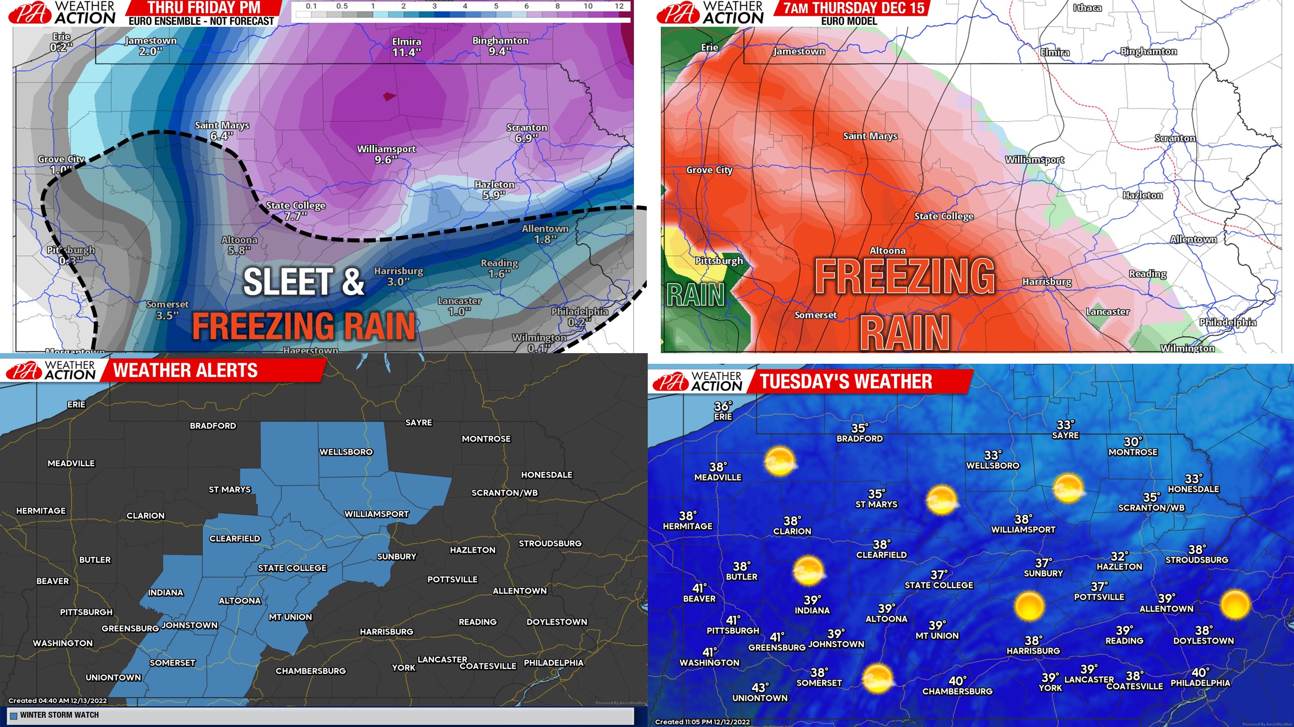
Our first call forecast will be out today at 5pm, and unfortunately it will include two separate maps. One for snow/sleet accumulation and one for ice (freezing rain accumulation). Recent trends have been to bring a 9-15 hour period of ice to parts of Central and Western PA (nearest to the Appalachians). Specifically the Laurel Highlands could significant icing and power outages. The extent of the icing will also depend on the amount of sleet we get first. The longer the upper levels stay cool enough for sleet instead of freezing rain, the lesser the power outage risk from ice. Either way, expect cancellations Thursday in many areas.
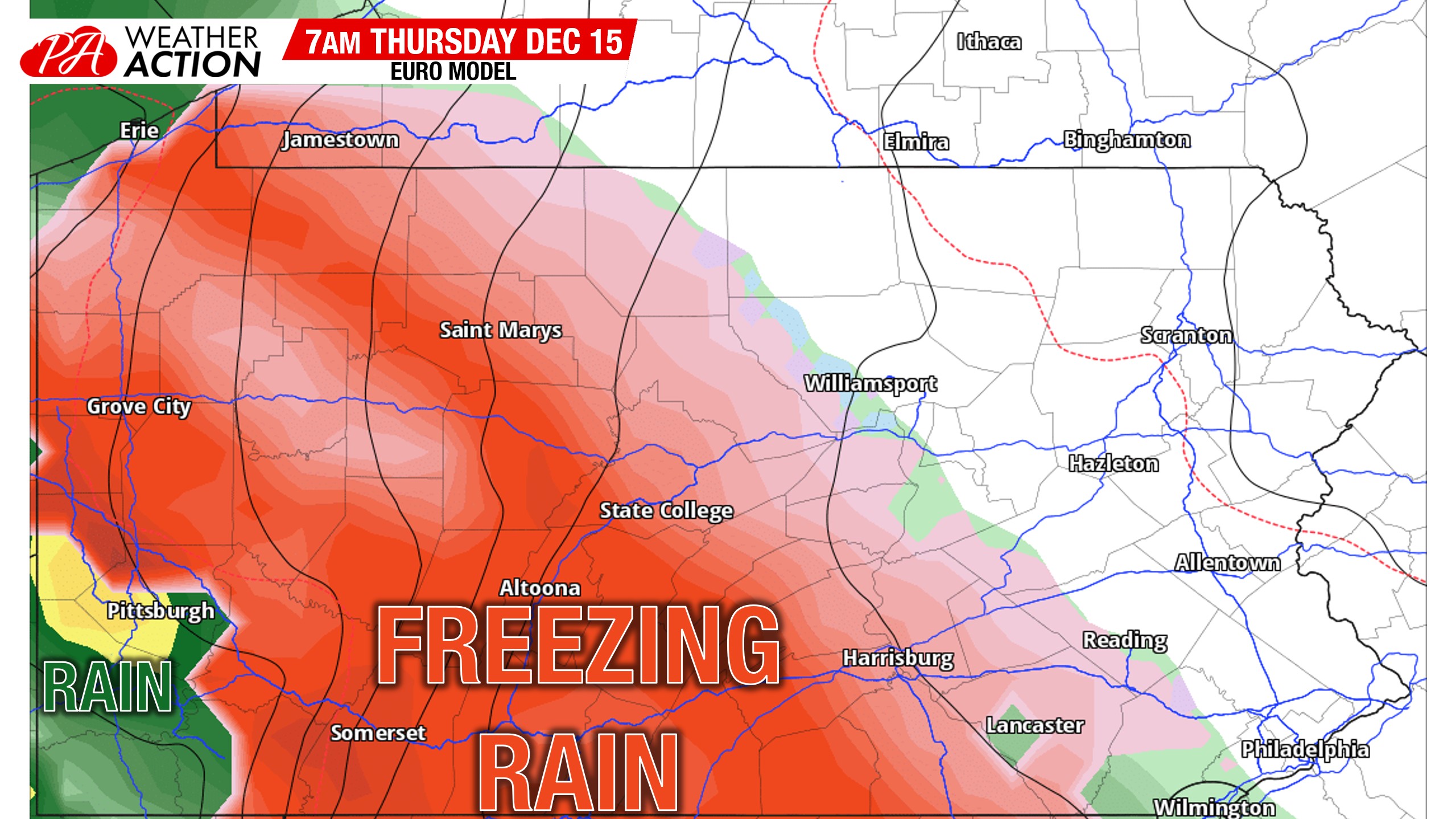
Areas near and north of I-80 are still on track for a moderate to possibly significant snowfall, however there is somewhat of a bust potential. Models are suggesting those regions may start as sleet and changeover to snow when heavy precipitation moves in and cools the upper levels enough. So it’s certainly a delicate situation. Here is an example of that. The Euro actually doesn’t think we will see much sleet, and starts many areas as freezing rain, which would not be good.
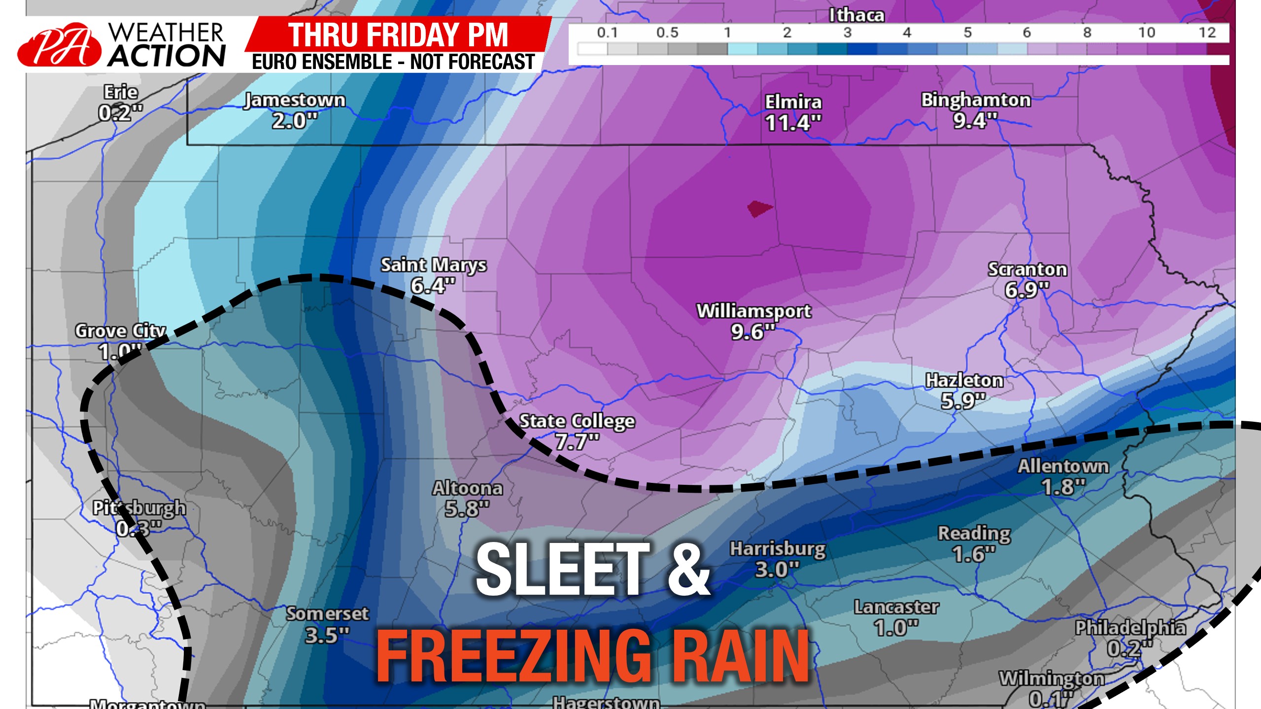
The Euro Ensemble mean has stayed very consistent, but I believe it counts sleet as snow. Areas south of State College, Sunbury, and Hazleton present the biggest challenge. There is certainly the potential those areas don’t see much snow, but a considerable amount of sleet and freezing rain. Outlined below is roughly where I’m referring to on the Euro Ensemble mean.
Models have yet to really fine-tune many of the details with precipitation type amounts. Expect forecasts to waiver slightly as new model data comes out. If you would like to track the latest model runs and my analysis of them ahead of this storm and all the storms to come this winter, subscribe to the Updates section of our app (also includes ad removal) for just over a dollar a month after a free 7 day trial. Tap the banner below if you’re interested in that!
You must be logged in to post a comment.