
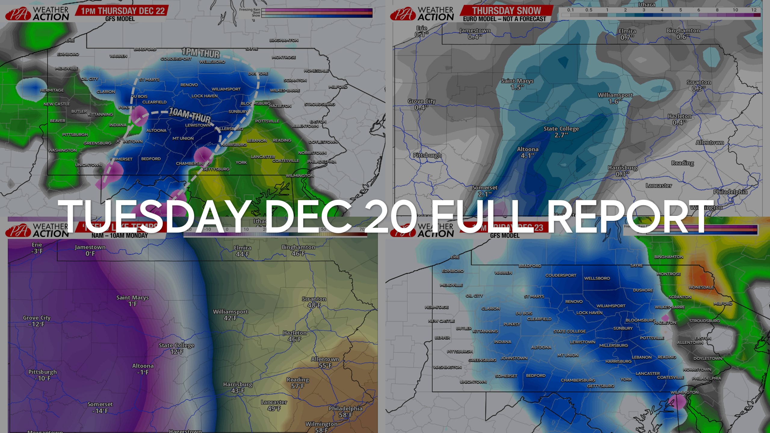
December 20, 2022 Morning Update
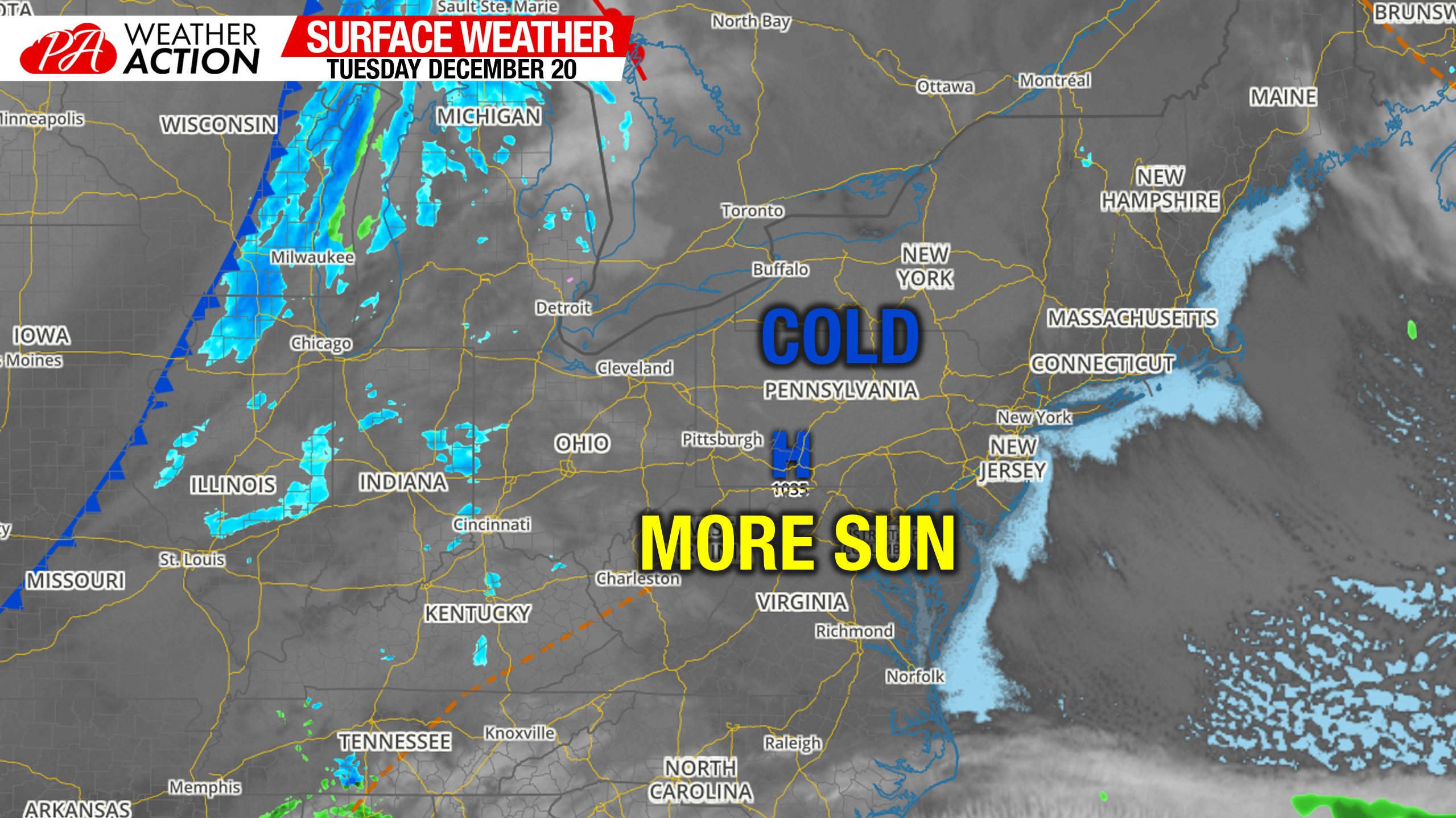
Morning Surface Weather Map
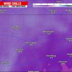
Good morning! It’s another sunny start to the day for nearly all of us. Some clouds as usual up in Northwest PA. We’re starting in the 20s this morning, but very little wind so not as bad as yesterday.
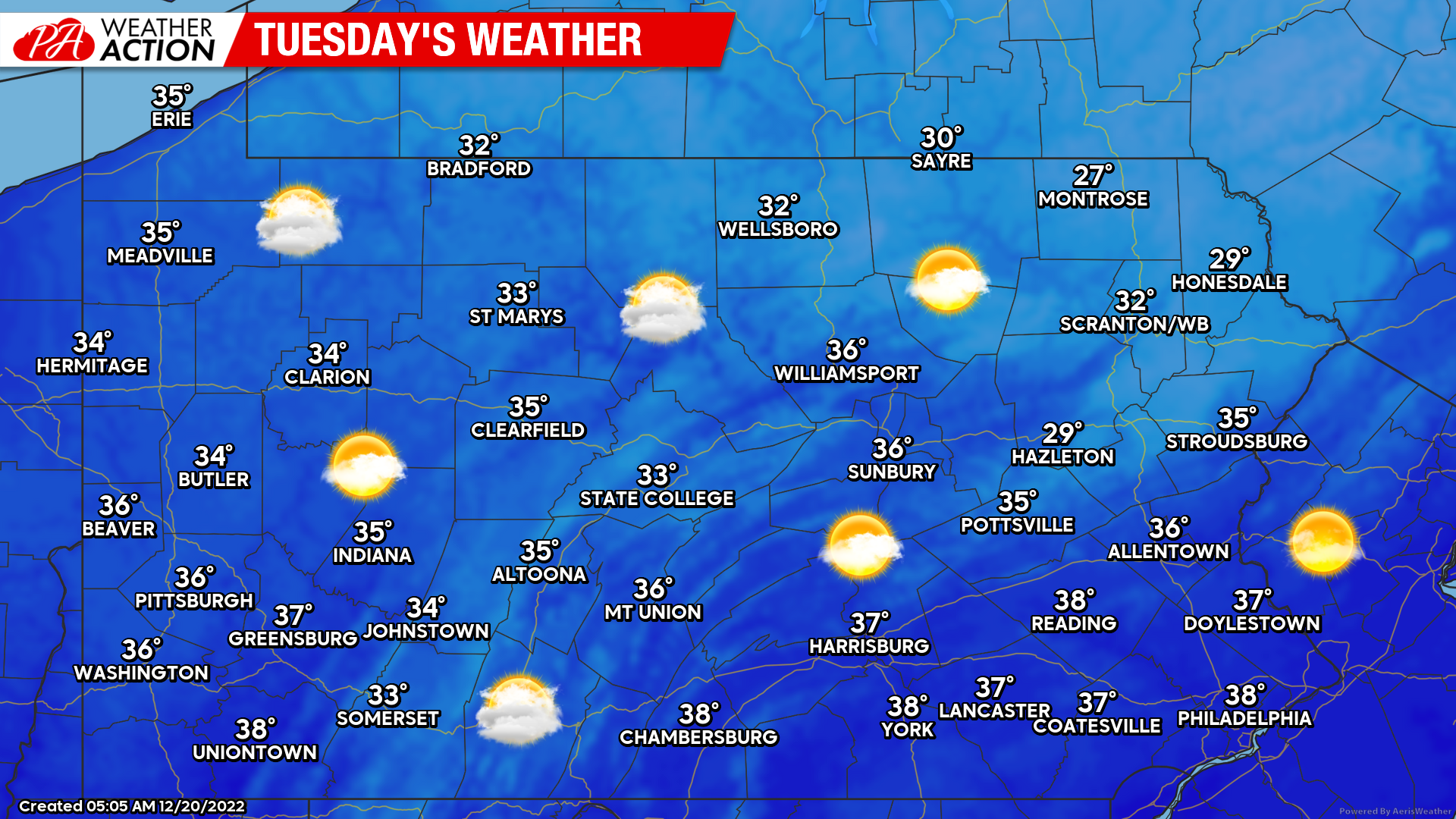
Tuesday’s Weather Map
Partly to mostly sunny skies today with highs in the 30s for 90% of us. It’ll feel coldest in the Poconos where highs will stay below 30 and a light breeze continues.
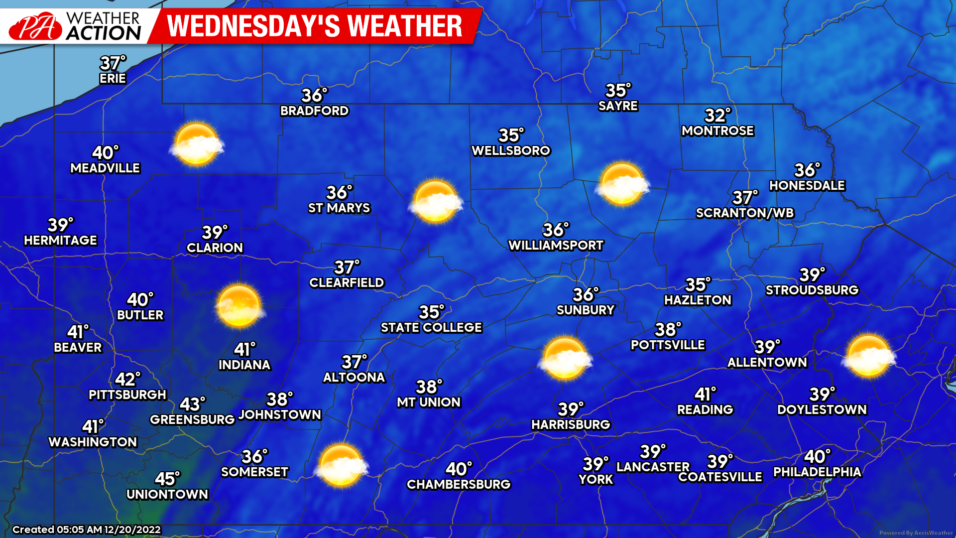
Wednesday’s Weather Map
A few degrees warmer tomorrow but still not warm by any stretch of the imagination. However, it’ll be the last day before our weather goes off the rails for several days. Great travel weather for those very early travelers.
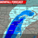
Thursday’s Snow in Central & Northern PA
A four to eight hour period of moderate snow is expected across the Alleghenies and nearby areas Thursday morning, into the afternoon. Snow looks to begin around 8-9am on the Maryland line, west of South Mountain and east of Mount Davis. It will then push north to about State College by 10am and 1pm Thursday near the PA/NY border east of Warren and west of Sayre. If you’re outside of the area outlined below, you can expect plain rain Thursday.
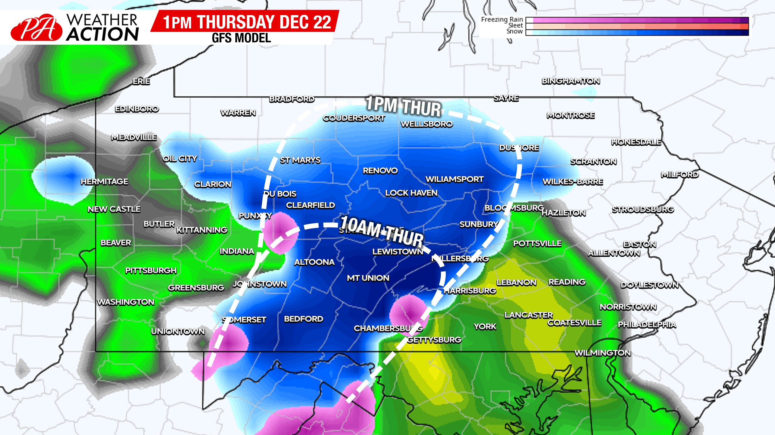
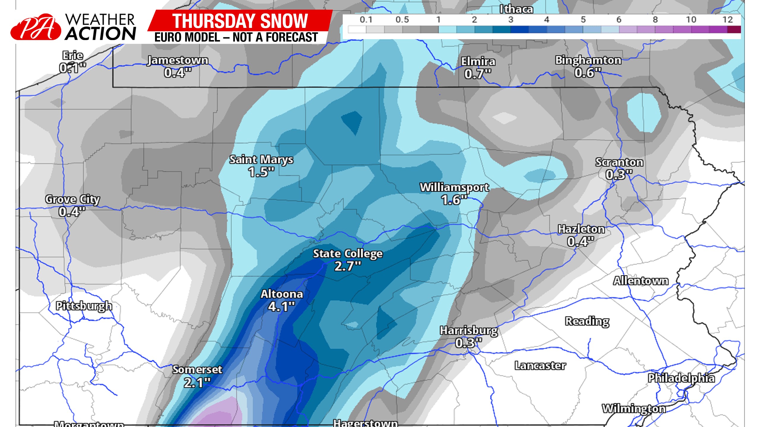
The rain/snow will push north by late Thursday morning into the afternoon. Locations closest to the Allegheny Front (Somerset/Bedford, Cambria/Blair, Clearfield/Centre lines) will hang onto snow the longest, which translates to highest snow totals. We’re not talking about anything major, but what falls will stick to untreated roads easily. We will have a forecast map out later today, but here’s a look at the latest Euro snow totals for this front end stuff. It will be condensed into slush by late Thursday evening.
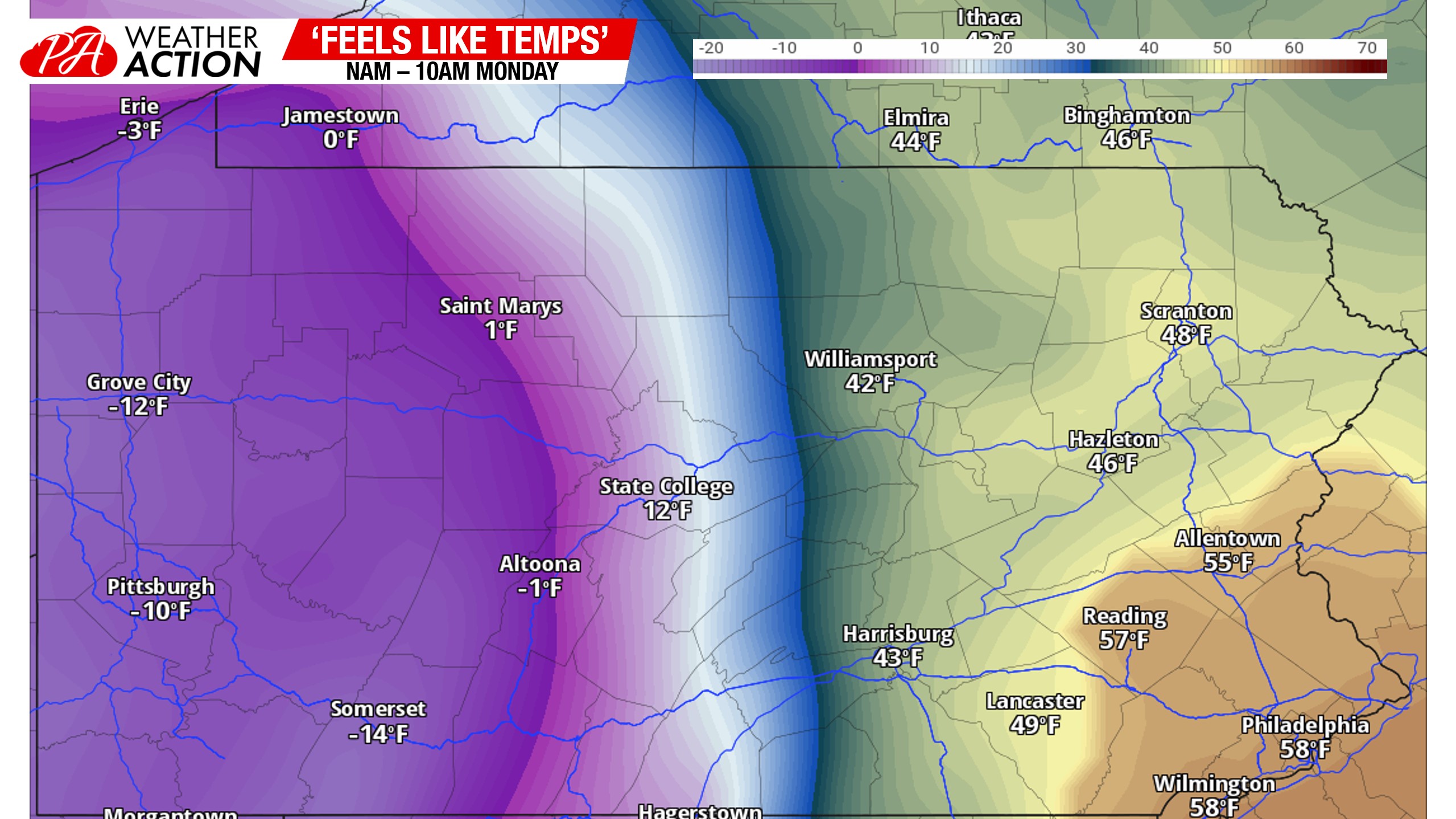
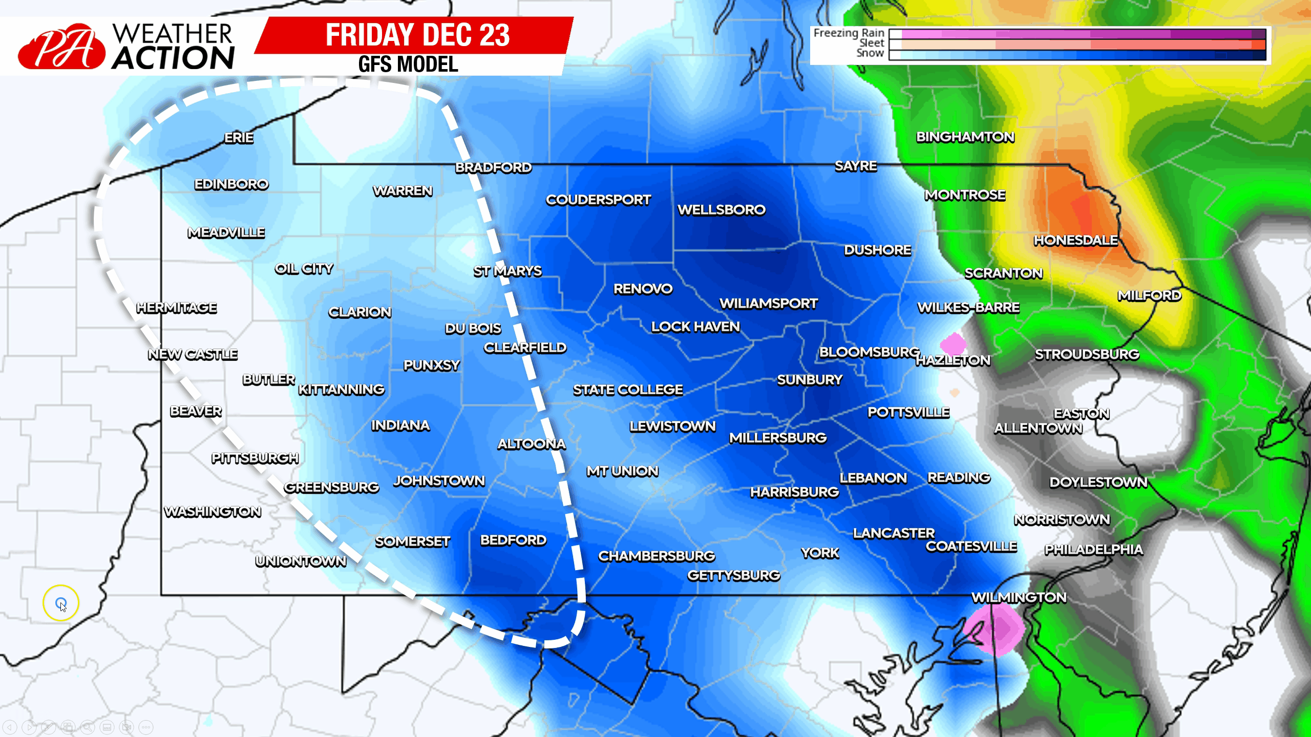
Friday’s Flash Freeze & Backend Snow
This is going to be one of the most impressive flash freezes you will ever see in December in Pennsylvania. We’re looking at feels like temperatures dropping by 40 degrees in three hours. Wind gusts of 40-50mph are expected as the front goes through, with crashing temperatures. Be prepared for some anxious travel during this period.
The backend snow aspect of Friday holds more uncertainty. Most models aren’t too enthused about it anywhere east of the Alleghenies, while the GFS is showing a three (Southern PA) to six (Northern PA) hour period of snow Friday morning – early afternoon. I think it’ll be shorter than that, but it’s too early for precise timing and amounts. Below I’ve outlined what I think the area of snow will look like on radar behind the radar as it moves across the state.
If you found this update informative, view the Updates section of our app! Updates like these that feature content that the daily report doesn’t include are posted twice daily leading up to storms! Tap the banner below!

You must be logged in to post a comment.