
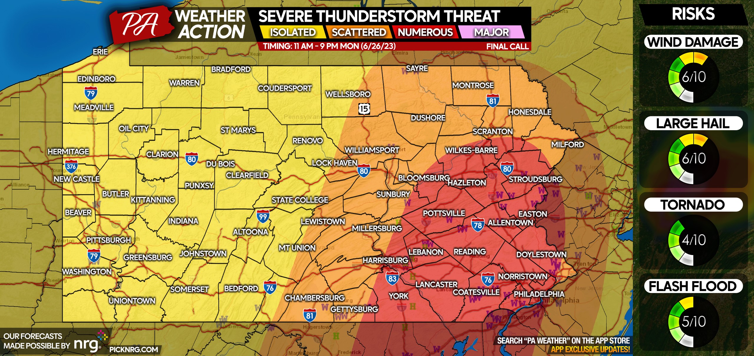
After a rather eventful Monday in many areas, another chance of thunderstorms exists today across the eastern half of Pennsylvania. But first, here’s how our forecast for Monday’s storms did! You’ll notice most of the reports correlate well to the higher threat areas. (This graphic is for verification purposes, not a current forecast)
TIMING FOR TUESDAY’S THUNDERSTORMS
Today’s storms will be pop-up cells, with no clear main line of storms. So the window of opportunity for storms is a bit more broad.
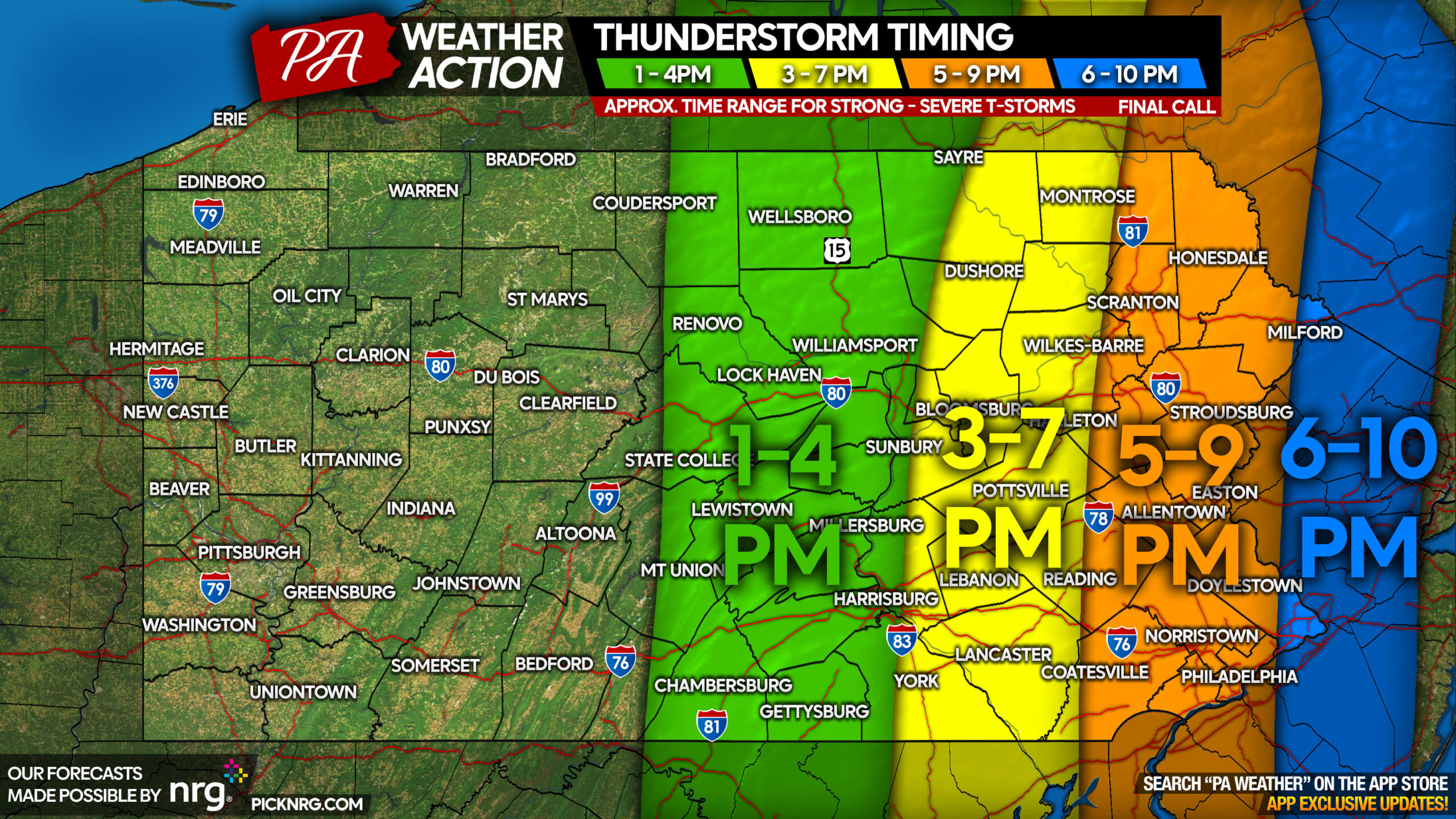
HI-RES NAM FUTURE RADAR
SEVERE THUNDERSTORM THREAT FORECAST FOR TUESDAY (6/27)
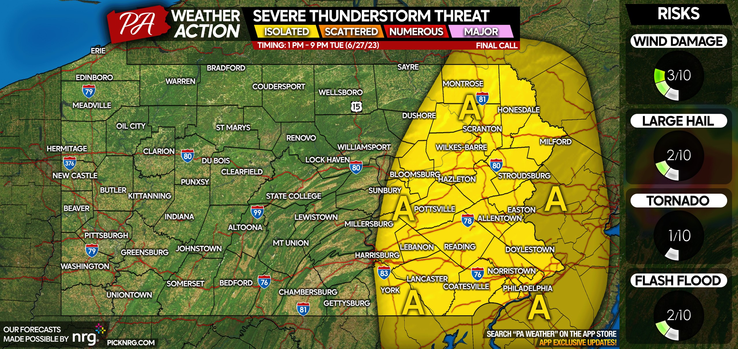
Area A: While scattered showers and thunderstorms are expected, only an a few isolated thunderstorms may turn severe in Eastern PA. The primary risks are wind damage and hail.
You may notice some areas in Central PA shaded in the timing forecast are not in any shade on the threat forecast. This is because only ordinary, non-severe thunderstorms are expected in Central PA.
If in the risk area, consider sharing this article with friends and family using the blue button at the bottom of your screen!


You must be logged in to post a comment.