
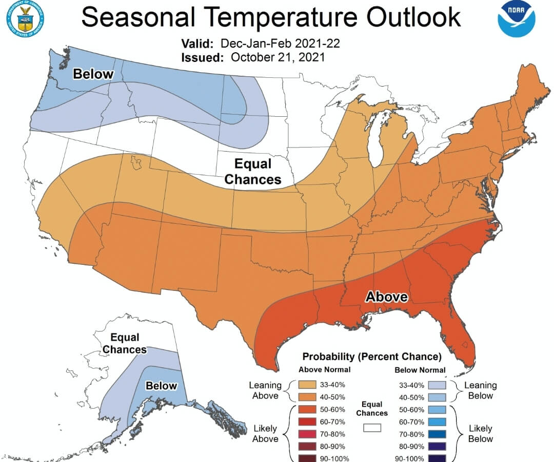
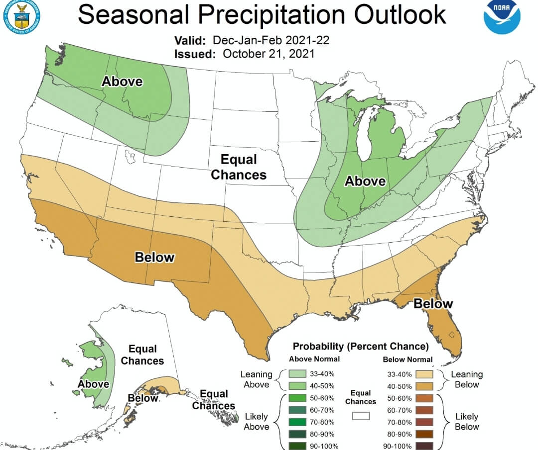
Today NOAA released their winter outlook for the months of December through February, and it’s not good news for snow lovers. Above average temperatures and near to above average precipitation is shown for Pennsylvania.
The outlook has a strong presence of a Southeast Ridge, a phenomenon that is very typical during second-year La Nina winters. In addition, NOAA likely factored in colder than normal ocean temperatures in the Gulf of Alaska and off the West Coast. This may help to bring troughing to the Northwest US, which would result in ridging out East.
NOAA is known for typically taking the average anomalies for any given El Nino Southern Oscillation (ENSO) phase, putting them on the map, and that’s their outlook. There are other teleconnections that can have impacts on our pattern, but they are extremely difficult to predict beyond one month. The closest analog to the upcoming winter is 2011-2012, and that winter produced well below average snowfall.
Below is the NOAA Winter Temperature Outlook.
Below is the NOAA Winter Precipitation Outlook.
You could say, “What about last winter when they had a similar forecast?” The main differences are that this year is a second-year La Nina, which typically brings warmer and drier conditions than a first year La Nina. Also, last year the Gulf of Alaska and Pacific Coast had above average sea surface temperatures, which encouraged ridging in the west and troughing in the east, the opposite of this year’s configuration.
Either way, anything can still happen, but we will need more luck to pull off even an average snowfall season.
Our 2021-2022 Winter Outlook will be posted November 10th.
You can find our new November Forecast by clicking here.
Like warm winters? Feel free to share this article using the blue button below!
[social_warfare]
You must be logged in to post a comment.