

TUESDAY
A storm system currently developing over the Carolinas will crawl northward along the coast tonight, inducing onshore flow and spreading rain into our area for Tuesday, with a general third to half inch falling across the area. The onshore flow will keep temperatures in the 40s for most locations.
That low will depart to our north by Tuesday evening with most of the rain ending around sunset, allowing the wind to shift to the west and a period of dry weather into Wednesday morning.

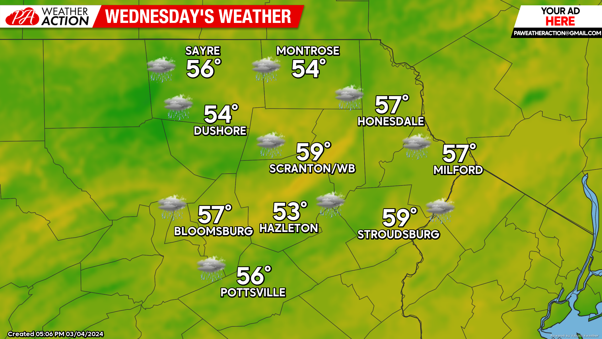
WEDNESDAY
Another storm system will move northward along the coast and spread yet another round of soaking rain across our area for Wednesday, commencing late in the morning and lasting through much of Wednesday night.
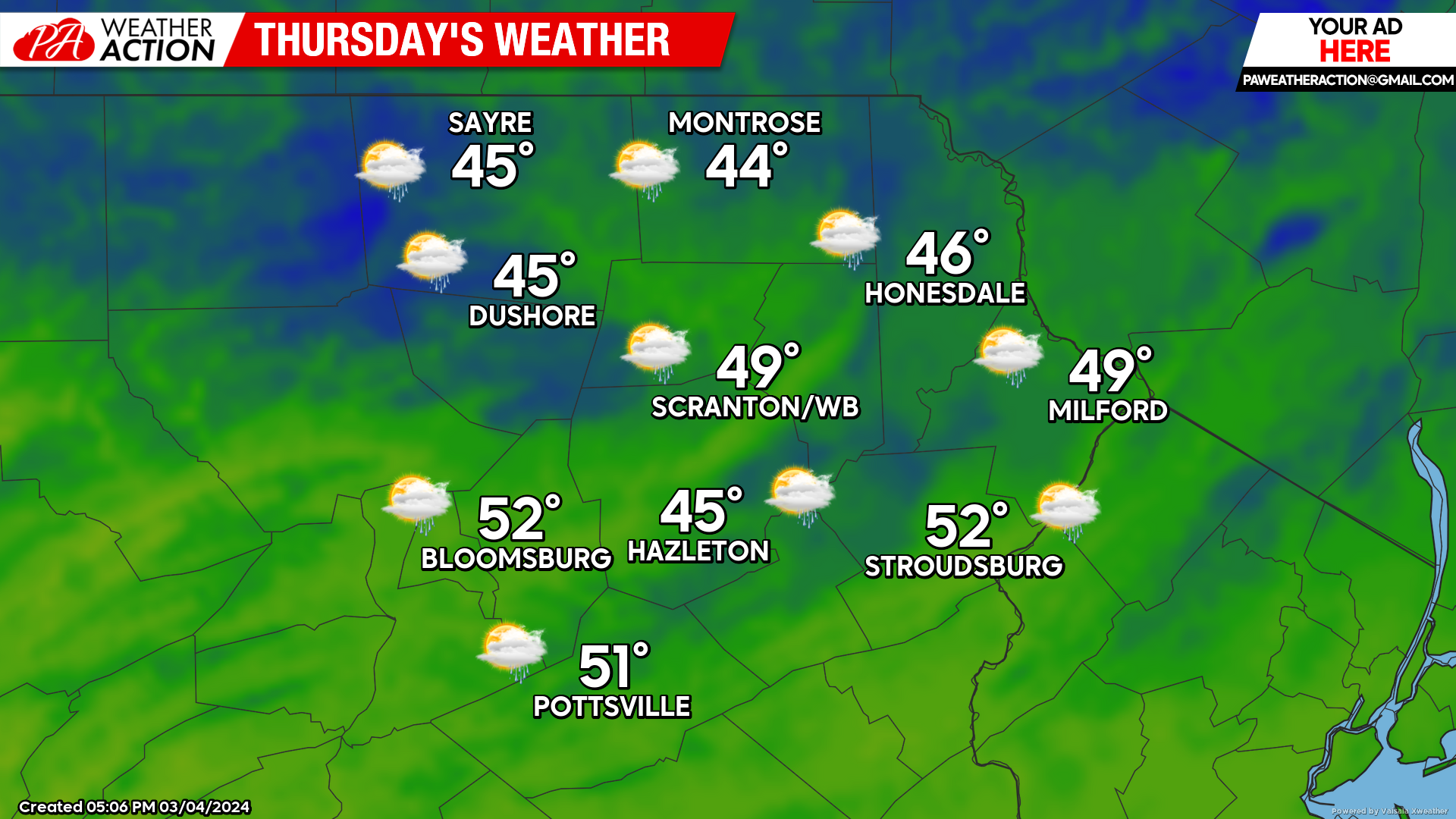
THURSDAY
That storm system will depart to the north, resulting in a breezy north wind and clearing skies. Unable to tap any polar air, temperatures will reach well into the 40s, and even into the 50s in the valleys for yet another much-warmer-than-normal day.
BEYOND THURSDAY:
Friday will be in between systems, featuring mild temperatures and dry conditions.
The next storm will move northeastward into the Great Lakes early Saturday, with secondary development near the Mid-Atlantic coast Saturday evening. This will spread yet another round of drenching rain into our area. This time, the higher elevations could be marginally-cold-enough for a coating of snow, but prospects of anything more than that are slim.
TURN CLOCKS FORWARD ONE HOUR 2AM SUNDAY!
The system will exit to leave slightly-above-normal temperatures in its wake for Sunday into early next week. Some rain and snow showers are likely on Sunday.
Normal highs this time of year are in the low-mid 40s for the valleys, and upper 30s to near 40 for the higher elevations. Normal lows are near 20 to the low 20s.

You must be logged in to post a comment.