
Yet another round of scattered thunderstorms is on tap for today, some of which may be strong to severe. Primary threats include damaging winds in intense cells and isolated hail.
THUNDERSTORM TIMING
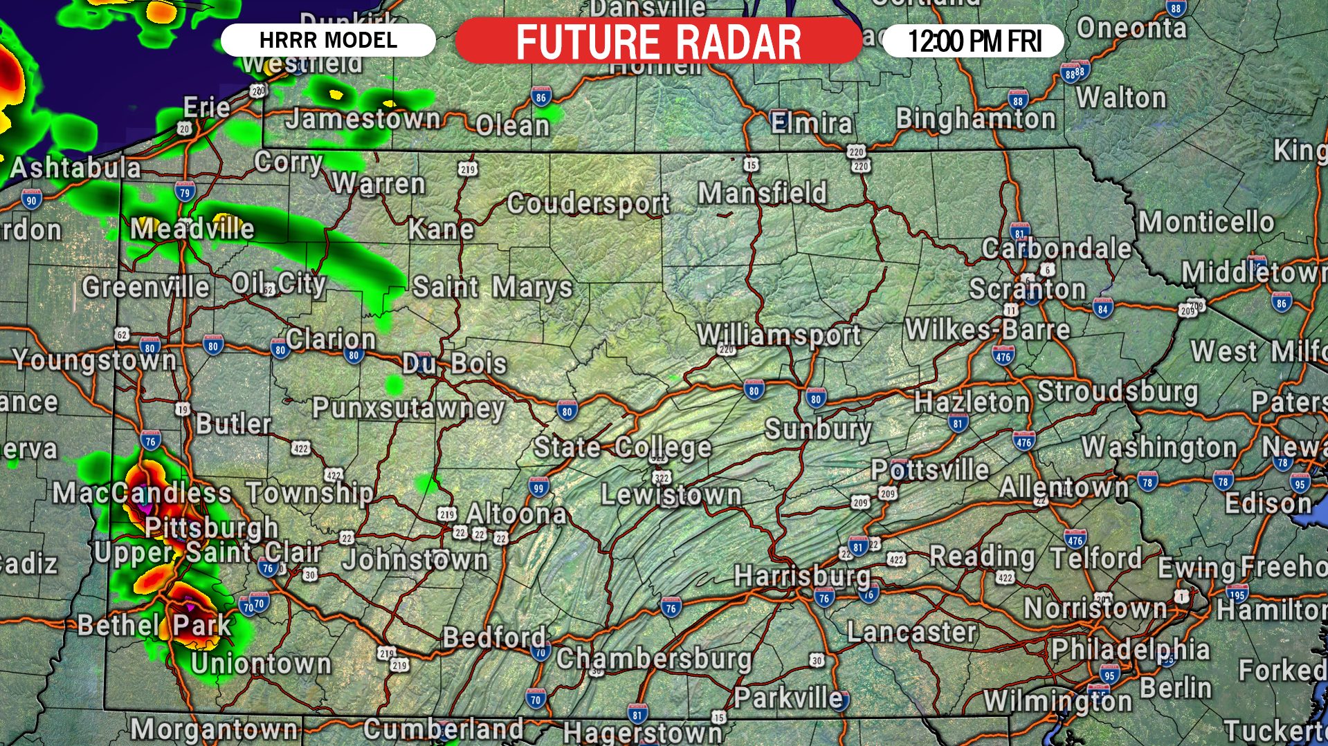
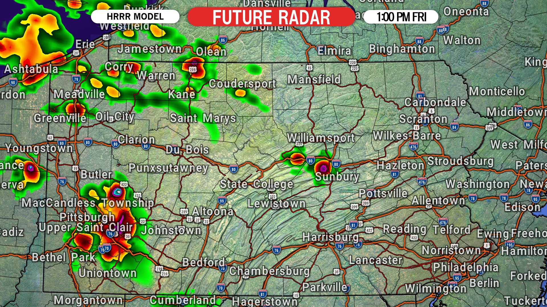
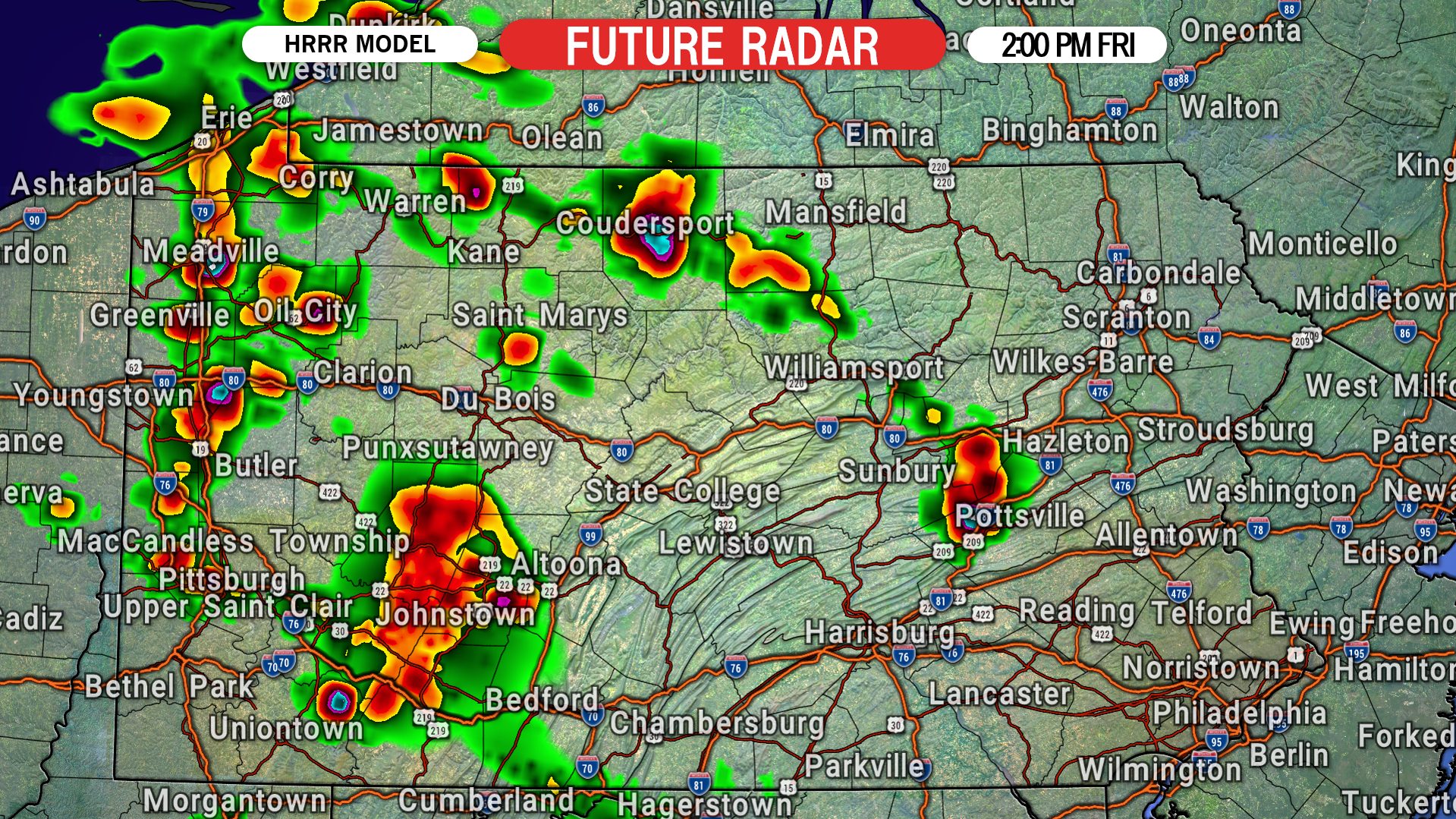
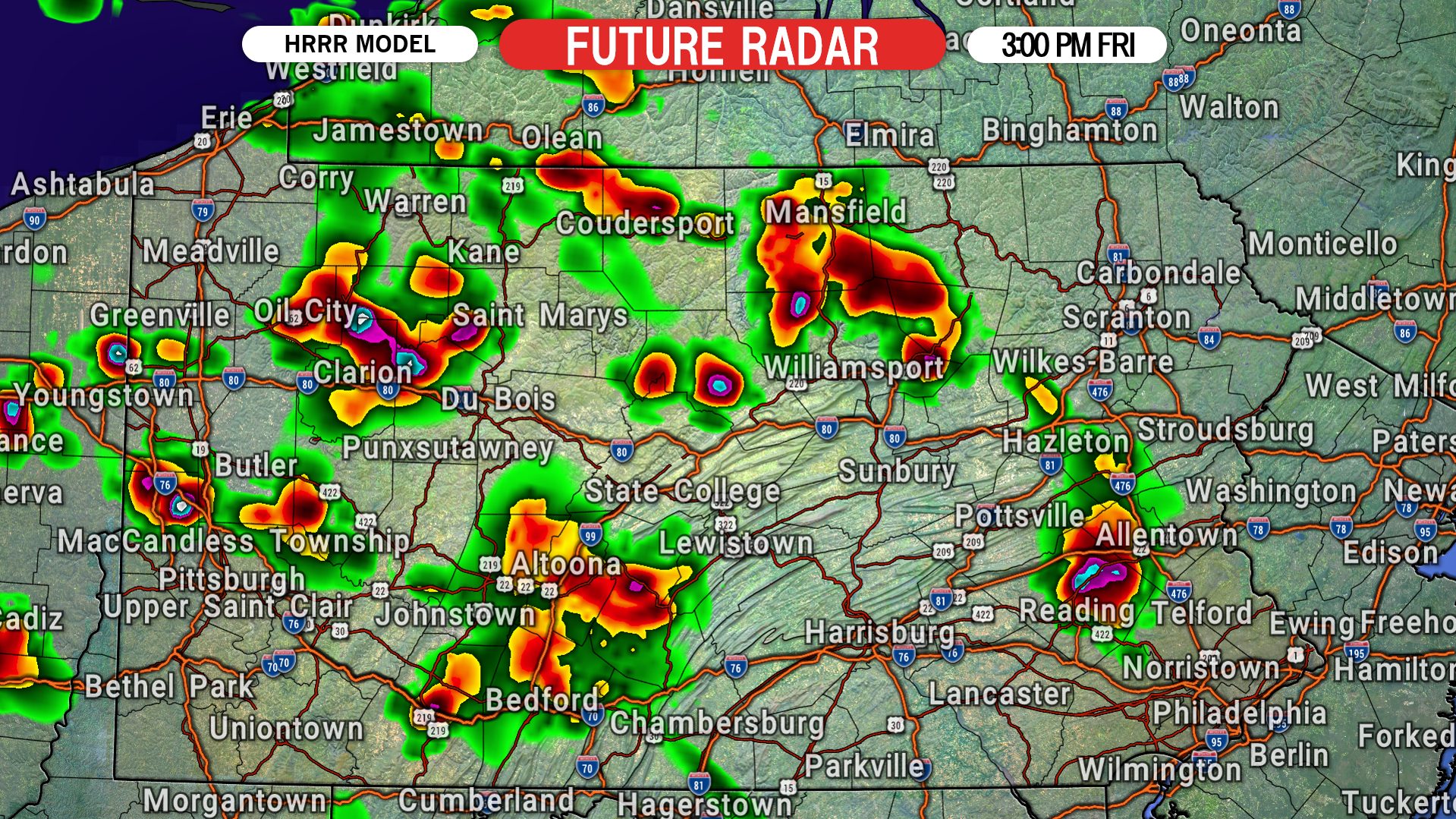
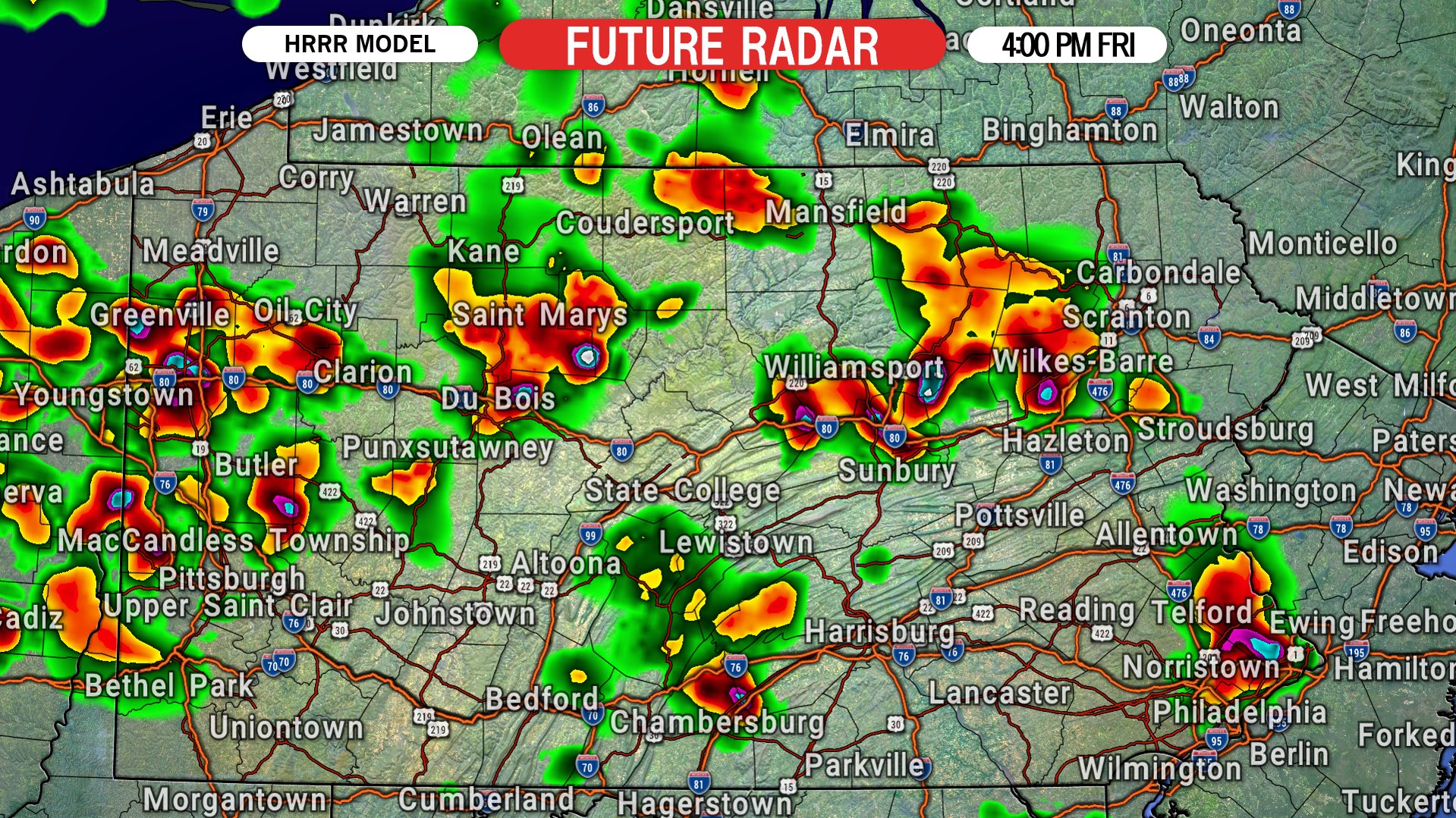
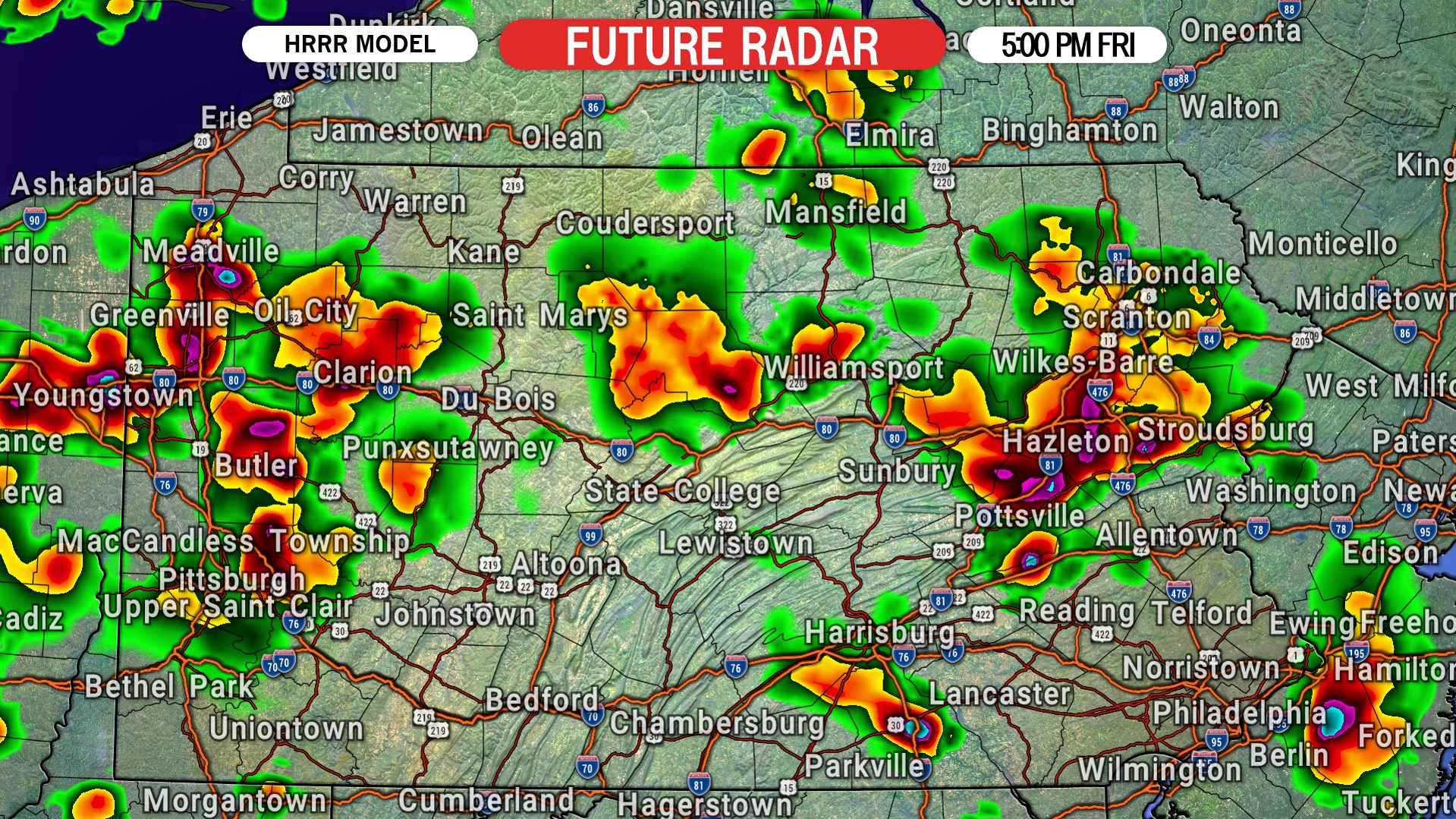
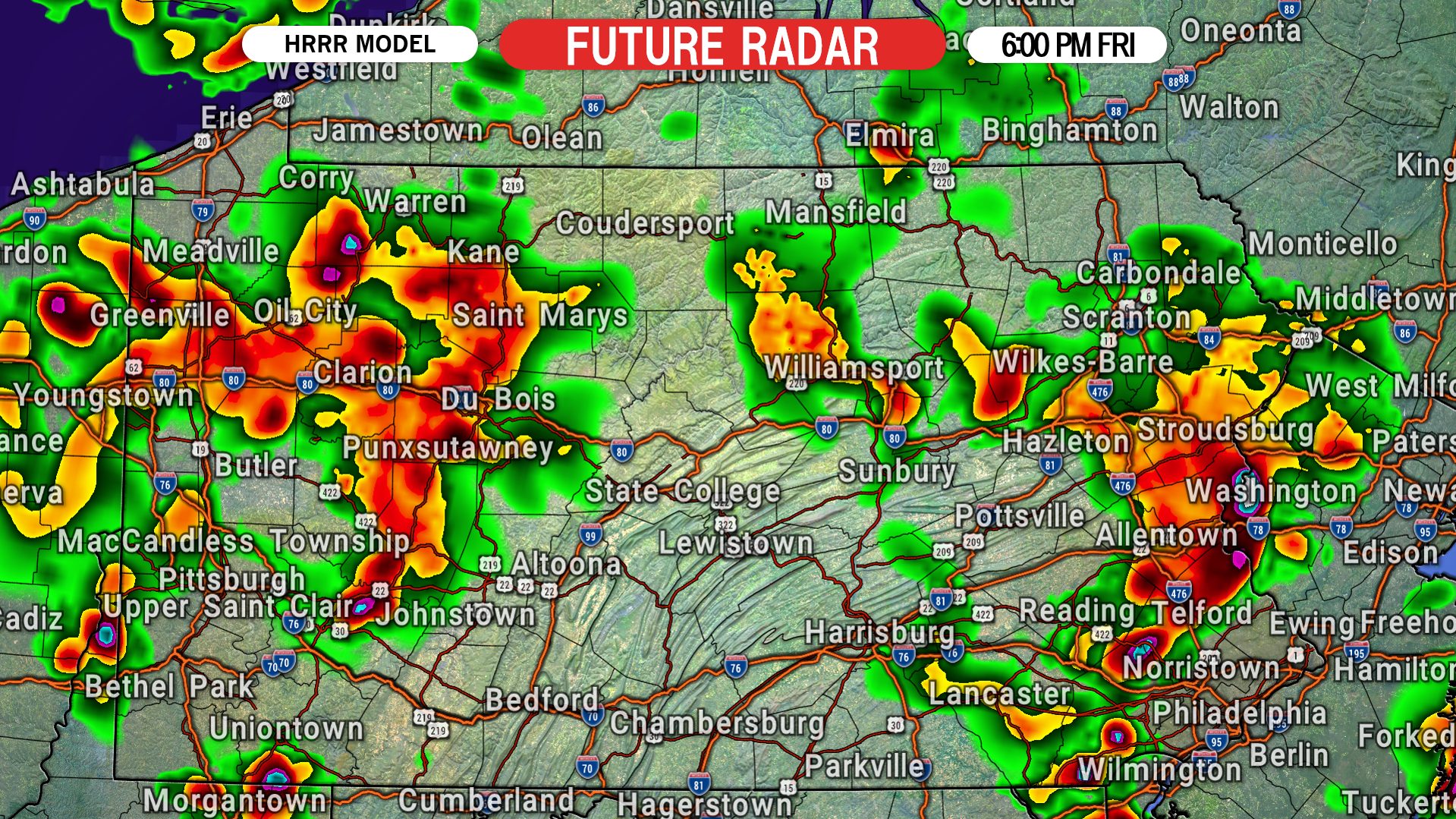
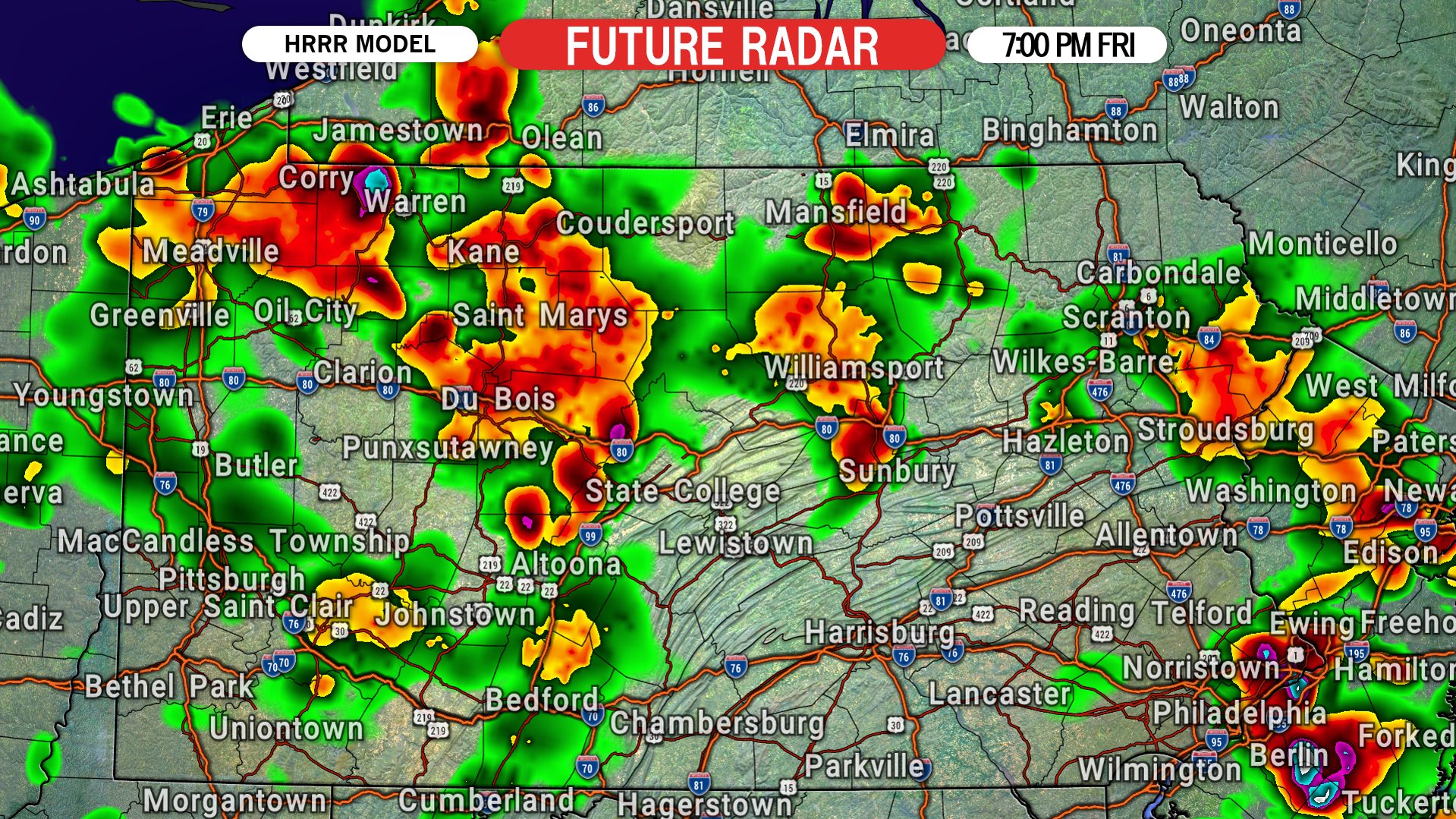
Storms will develop starting just lunchtime, and move east through the state as the afternoon progresses. Below is future radar from the HRRR model.
12:00 PM FRIDAY
1:00 PM FRIDAY
2:00 PM FRIDAY
3:00 PM FRIDAY
4:00 PM FRIDAY
5:00 PM FRIDAY
6:00 PM FRIDAY
7:00 PM THURSDAY
FRIDAY SEVERE THUNDERSTORM THREAT MAP
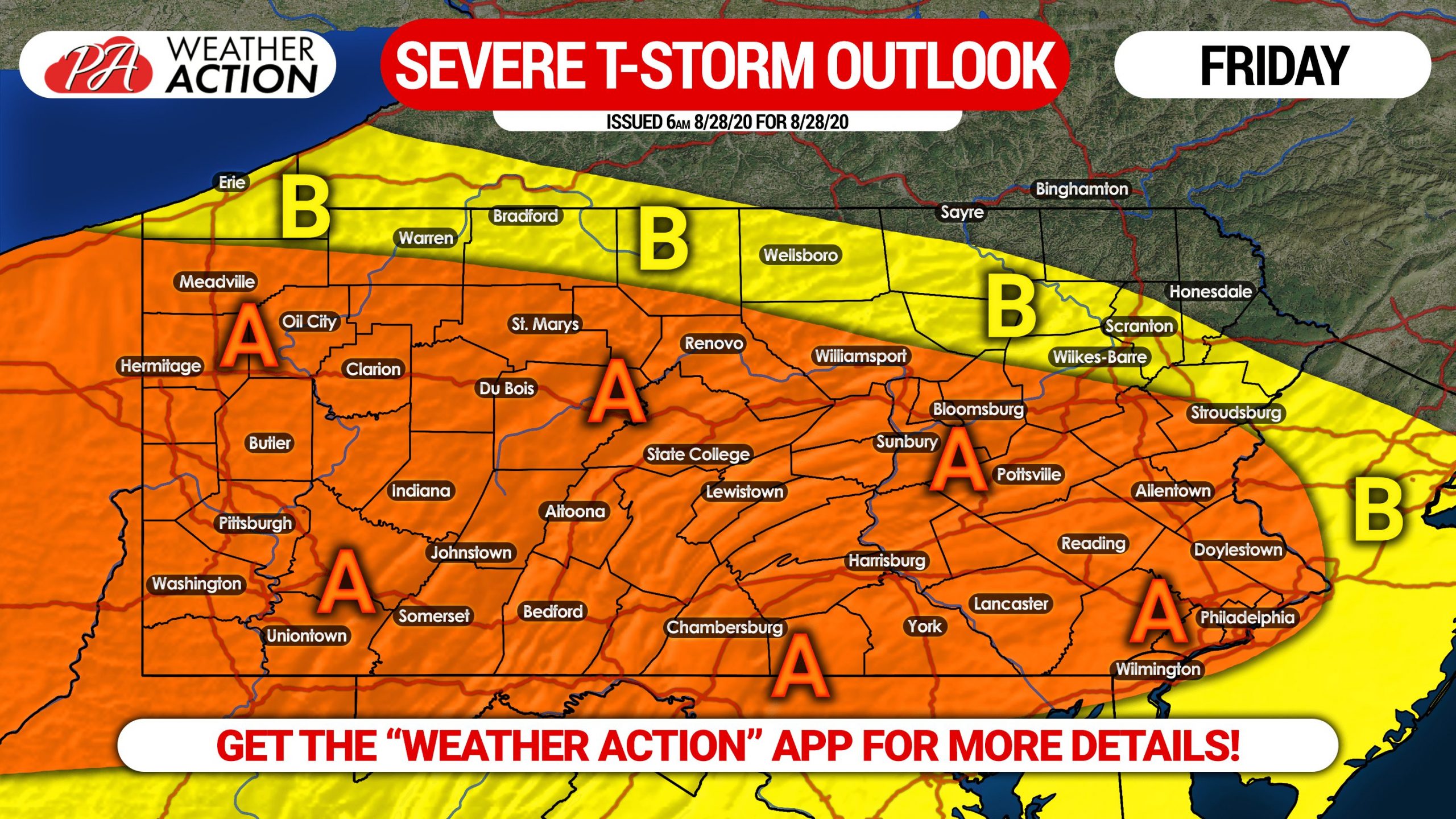
Area A: Scattered strong to severe thunderstorms are expected within this region Friday afternoon and evening, with damaging winds and hail possible in intense storms.
Area B: Isolated strong storms are possible in this region Friday afternoon and evening, with gusty winds possible in stronger storms.
The best way to stay ahead of today’s storms is by using radar. Our app has a great interactive radar and you are also sent weather alerts for your location! Get the Weather Action App here >>> iOS & Android App Link
Be sure to share this forecast with friends and family who may have outdoor plans today using the blue button below!


You must be logged in to post a comment.