
A Colorado Low in the Midwest will transfer its energy to a rapidly intensifying coastal low pressure Monday night. That coastal low will quickly turn into a full-blown Nor’easter by Tuesday, throwing heavy rain and gusty winds back inland. If this were six weeks from now, we would be forecasting a major snowstorm in Eastern PA. Instead, a few inches of rain are likely.
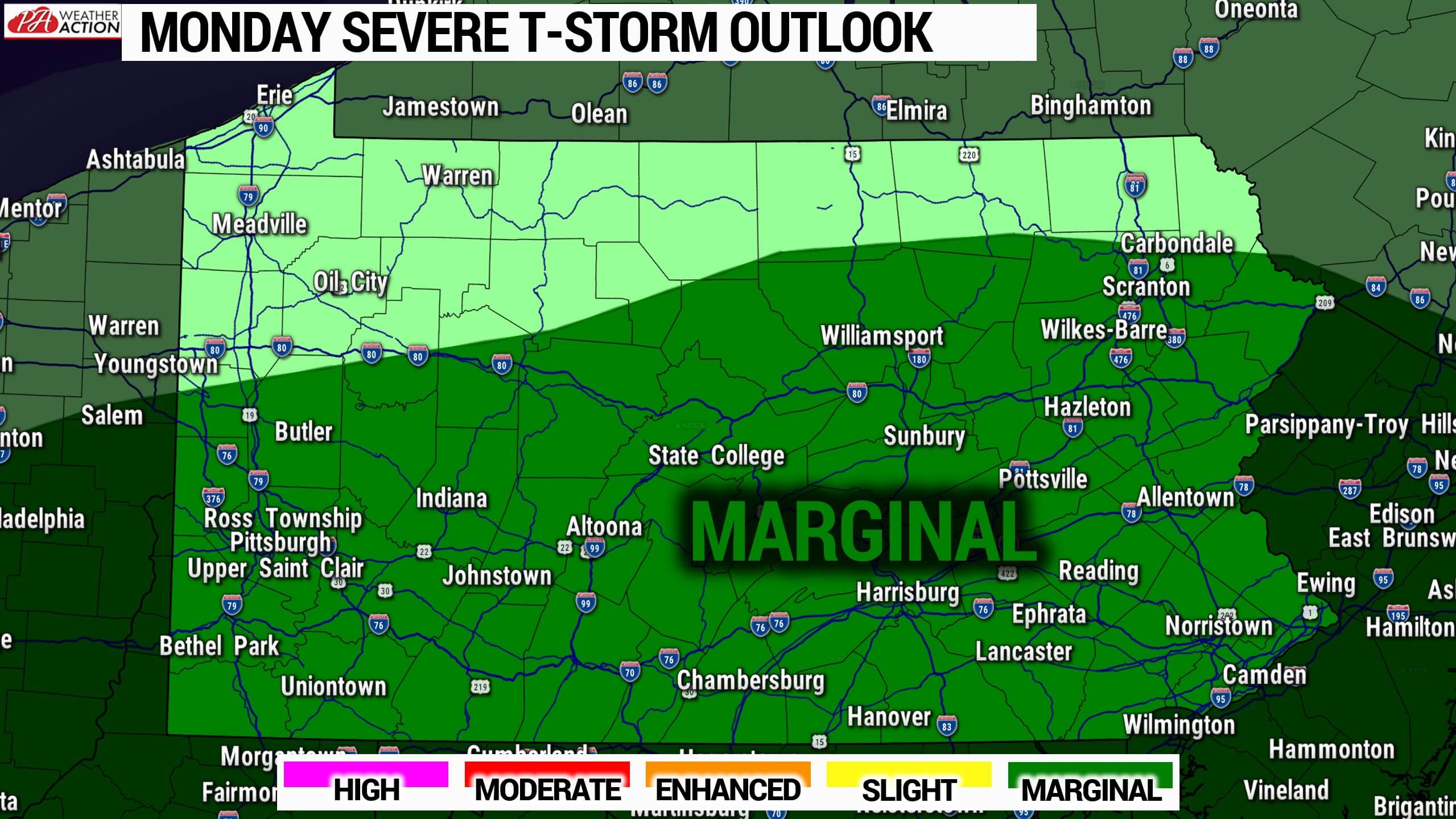
Light to moderate rain will move through Northern PA tonight as that weakening Colorado Low moves to our northwest. Then on Monday, most of the state will see partly to mostly cloudy skies and likely the warmest air left in 2021. Scattered thunderstorms will develop in southern and western Pennsylvania Monday evening and push north. Some storms may produce gusty winds of 40-60 MPH. The Storm Prediction Center has issued a marginal risk for severe storms tomorrow night.
Moderate rain will continue the entirety of Tuesday in Eastern PA, with lighter rain expected in Central PA. Finally, the Nor’easter will move away Tuesday Night.
Below is Hi-Res NAM future-simulated radar through Tuesday night.
RAINFALL FORECAST THRU TUESDAY NIGHT
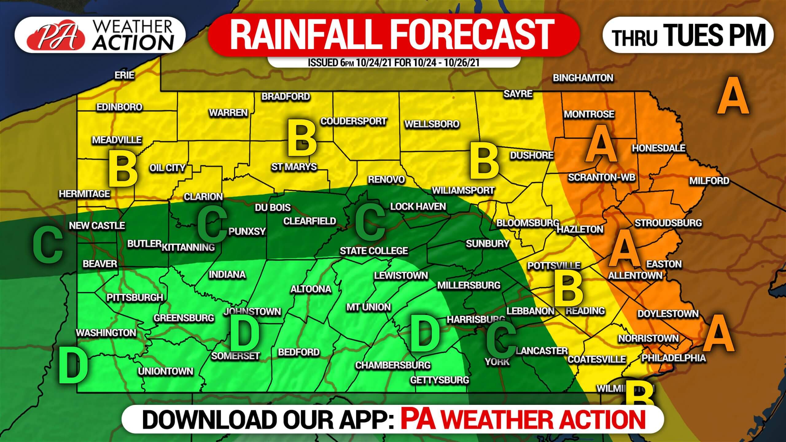
Area A: Rainfall amounts of 2 – 3″ expected. Consistent moderate rain and windy conditions are likely most of Tuesday.
Area B: Rainfall amounts of 1 – 2″ anticipated. This includes tonight’s rain in the Northern PA.
Area C: Rainfall amounts of 1/2″ – 1″ expected.
Area D: Rainfall amounts of 1/4″ – 1/2″ anticipated.
Another storm will affect state late this week. We will have updates on the Halloween Forecast.
Don’t forget to share this article with those who will be impacted using the blue button.
[social_warfare]


You must be logged in to post a comment.