
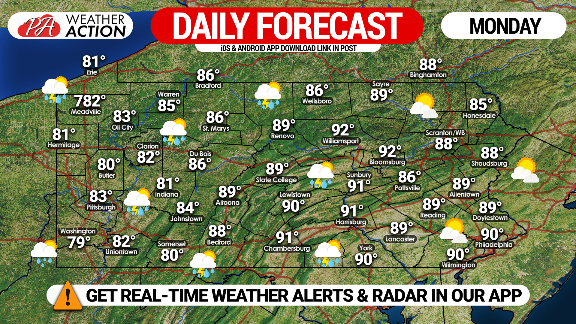
Another hot day is on tap for today, and we finally have a little instability to work with. Unlike previous days, today’s storms have the potential to get strong and possibly severe in scattered areas. Highs today will be in the upper 80s to low 90s in central and eastern PA, and low 80s in western PA.
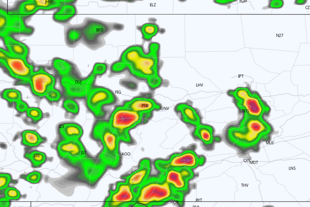
Storms will pop-up in the Laurel Highlands to the northwest PA mountains by mid afternoon, and gradually the activity will work its way northeast. Main threats will be damaging winds and isolated small hail. Here is future radar from the HRRR model for 3:00 PM.

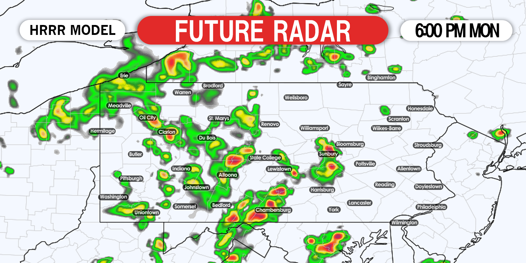
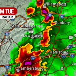
More storms will develop east of the original activity across the Susquehanna Valley later in the afternoon into the early evening. Below is future radar for 6:00 PM Monday.
We will have live radar on our facebook page if there are at least a few warnings. You can also be sure to receive instant weather alerts and latest interactive radar with our free app. Get it here >>> Weather Action App Link for iOS & Android
You must be logged in to post a comment.