December 8, 2022 Morning Update
Morning Surface Weather Map
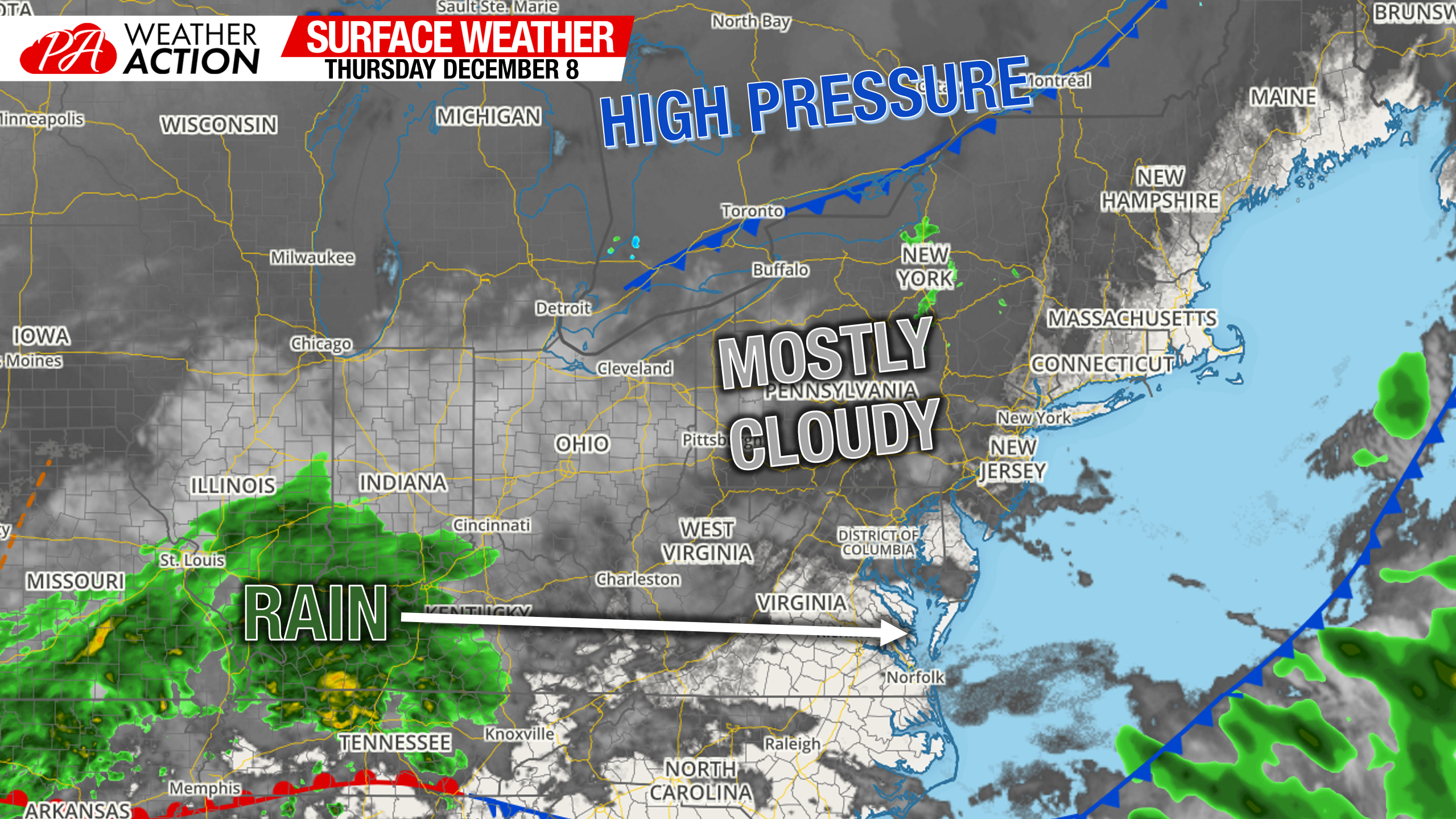
Would you believe it? The fog and rain showers are finally gone, leaving us with mostly cloudy skies this morning. High pressure is stationed well to our north, so temperatures remain very mild this morning in the 40s. Nearest rainfall is down in the Ohio Valley, and will be sliding to our south today. View the current conditions map here.
Thursday’s Weather Map
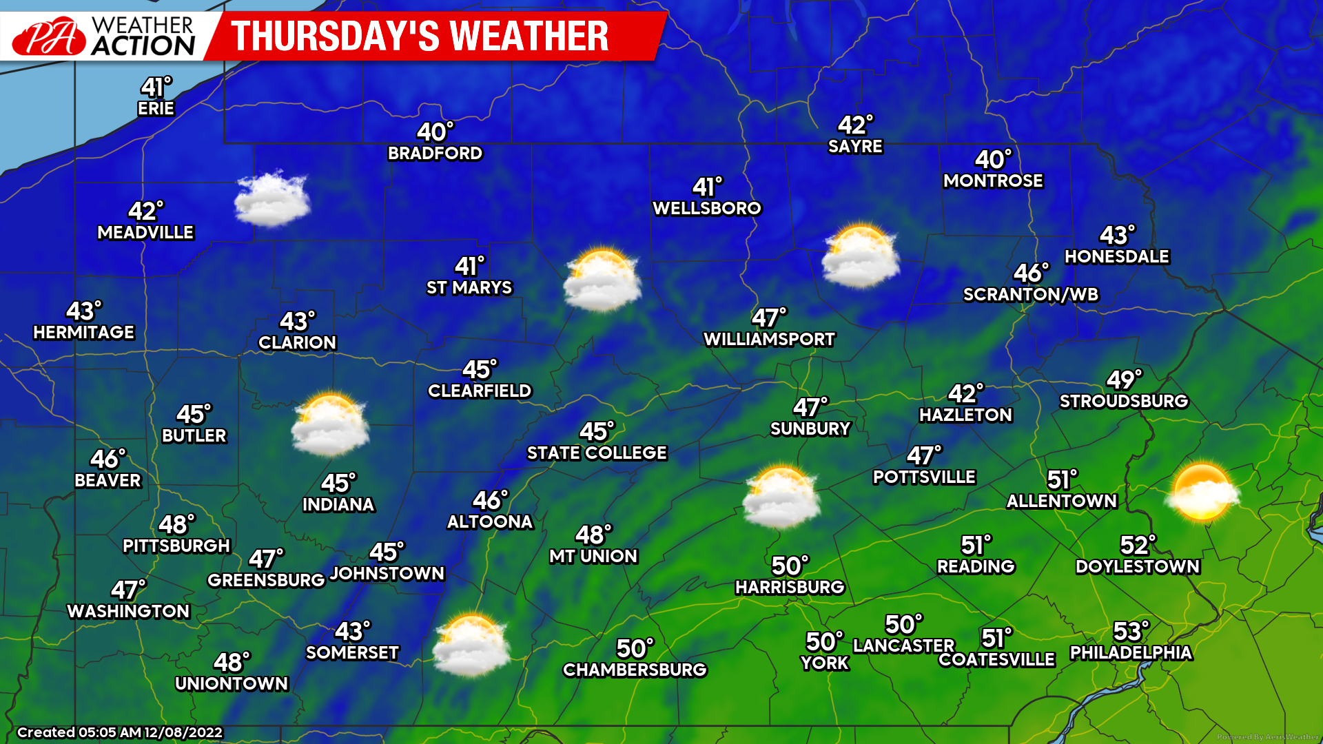
Partly to mostly cloudy skies today – finally some sun! A light northerly breeze won’t be too noticeable, especially with temperatures a few degrees warmer than normal for this time of year. Overall a nice December day!
Friday’s Weather Map
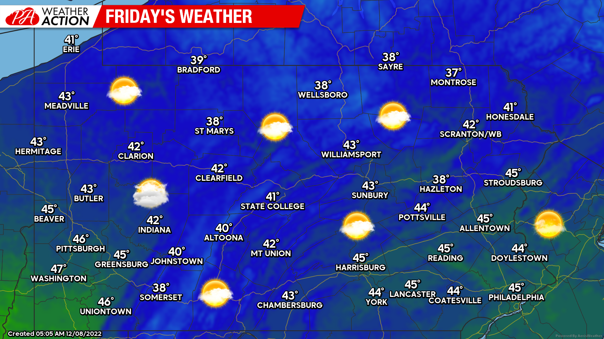
You might just need sunscreen Friday, because it’ll be awfully sunny. All jokes aside – it will be a nice dry start to the weekend with some great conditions for the many outdoor Christmas festivities happening in many of Pennsylvania’s towns. Highs a little colder but nothing too chilly.
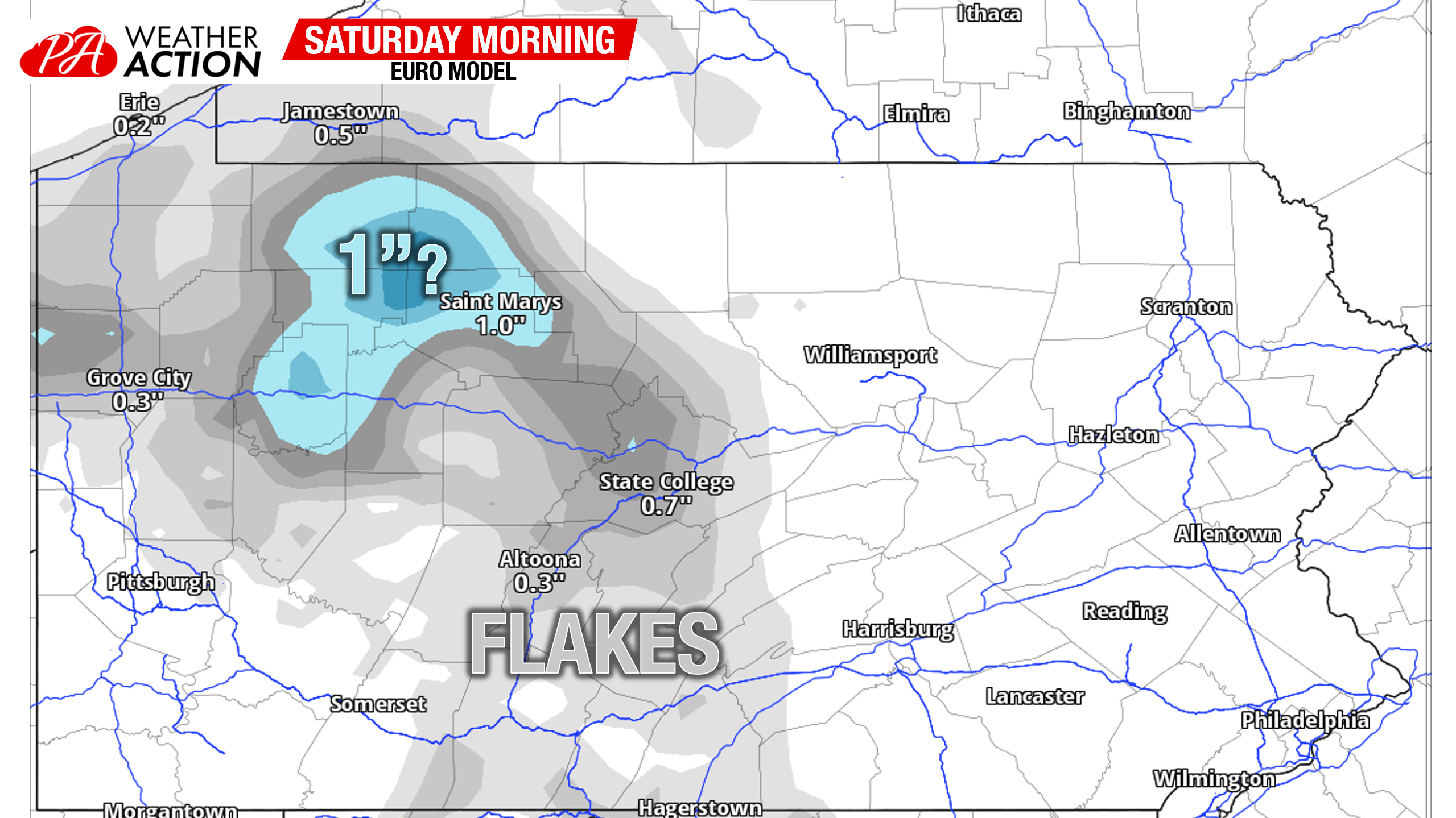
Saturday Morning Light Rain/Snow Showers
The high pressure that will be supplying us our sunshine on Friday will untimely tear the weak low pressure system to the west to shreds. At most, some light rain in Southwest PA and snow showers adding up to maybe a coating from Clarion to Saint Marys to State College. Festive flakes is what I like to call this type of event. You won’t need to change any Saturday plans. Maybe support a small business or two?
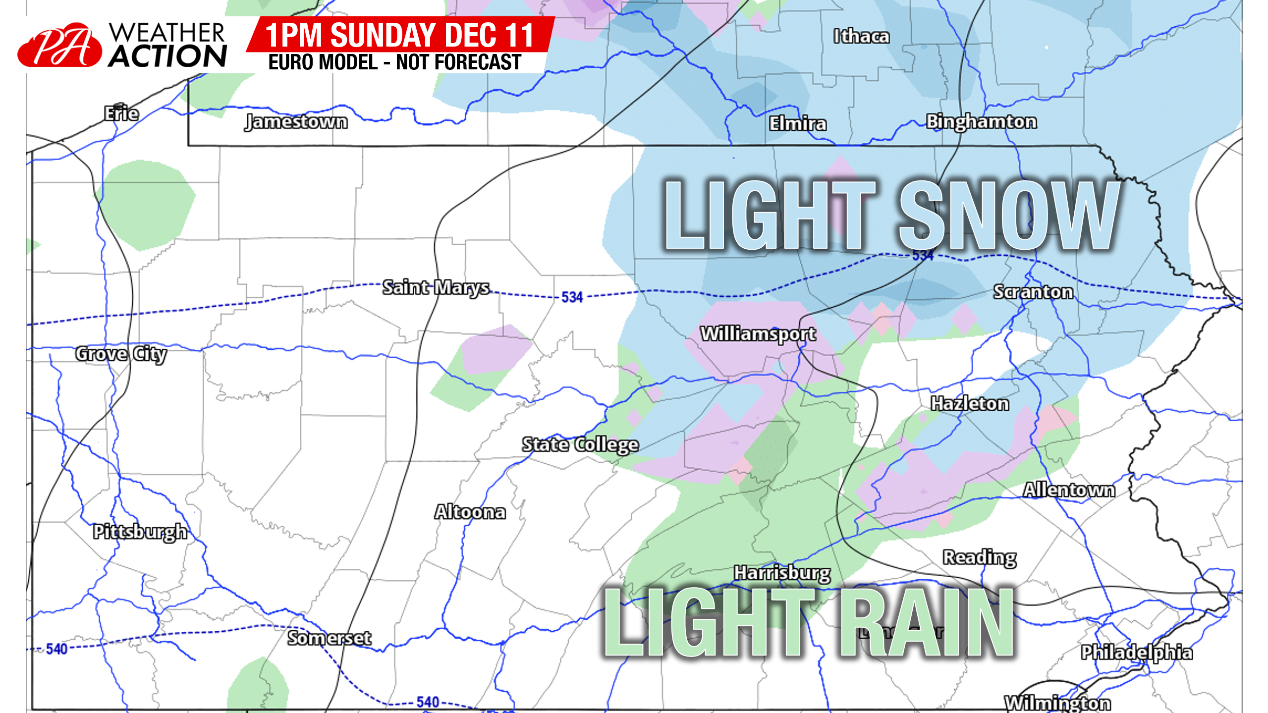
Sunday Rain & Snow System
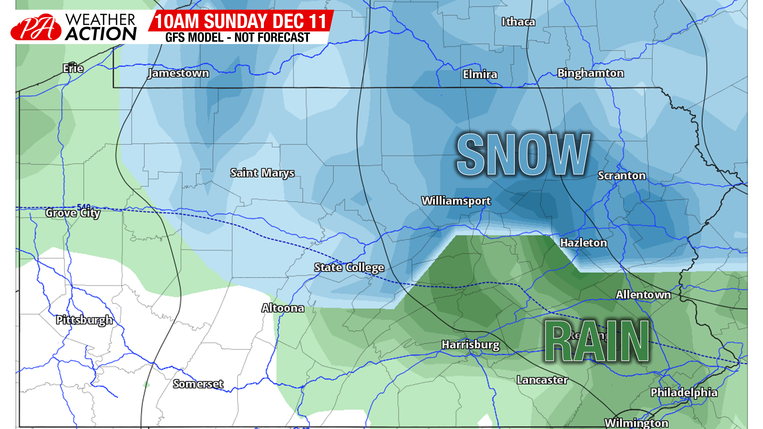
Somewhat similar to Friday’s event, this system will also be a weak low pressure working across the Lower Great Lakes. Models are currently in two camps. The GFS and the Canadian have somewhat of an inverted trough-type setup with moderate snow accumulations (4-7″) in Northern PA, specifically Northeast PA. I would currently give this outcome a 40% chance of happening.
Meanwhile the European model isn’t interested in the inverted trough and is suggesting lighter precipitation. Only Northeast PA and more like the elevated areas of NEPA get in on some light accumulations (2-4″). Based on a few things, just including past experience, I give this solution a 60% chance of occurring. If this happens, only the Poconos will need to worry about road impacts Sunday evening into Monday Morning.
Our next potential for any winter weather may come next Thursday – Friday (December 15-16). That storm will be cutting through the Midwest, so we may see a cold air damming situation with some freezing rain concerns for a period. The pattern change itself is then expected to come after that storm. But how much of a change it’ll be depends on the PNA. Read my thoughts on the pattern change:
When Will We Actually See the Pattern Become Favorable for Cold & Snow?

You must be logged in to post a comment.