
A line of potentially severe storms will track through parts of Ohio and into southwestern PA, the Laurel Highlands, and possibly Southcentral PA.
TIMING
Pittsburgh, Washington, Waynesburg – 3:00 PM
Johnstown, Somerset, Uniontown – 4:00 PM
Bedford, Southern Blair County, McConnellsburg – 5:00 PM
Chambersburg, Gettysburg – 6:00 PM
FUTURE RADAR
Here is the Storm Prediction Center’s risk map:
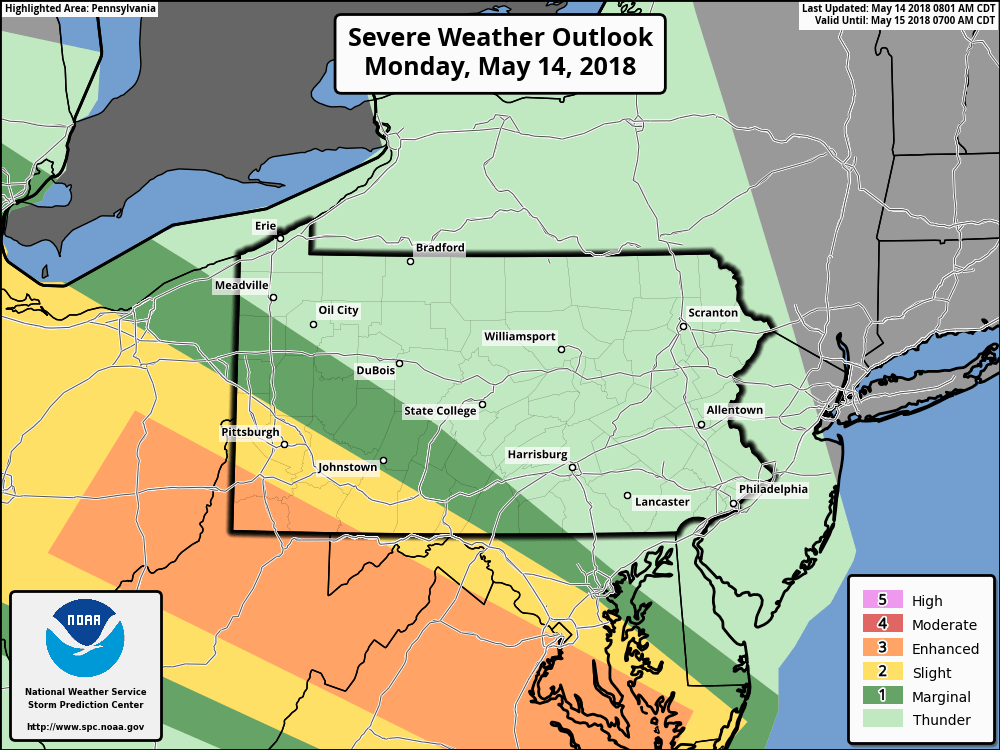
The main threat with this line of storms will be damaging winds. Be sure to keep a close eye on the radar if you are in the path of these storms.
Download our app to view interactive radar, as well as receive notifications for any weather alerts issued for your area >>> Tap Here to Get Our App
Also, watch our Facebook page for any forecast updates!
You must be logged in to post a comment.